The CV season will soon end it's lull as the wave now SE of the CV islands is slowly gaining convection and the GFS at 12z develops it and moves it west towards the islands and then recurve it.I dont have link to GFS because the site is down but if someone has it you may post it here.
http://www.ssd.noaa.gov/PS/TROP/DATA/RT/EATL/IR4/20.jpg
The gates of CV season opening up? 12z GFS develops CV wave
Moderator: S2k Moderators
Forum rules

The posts in this forum are NOT official forecasts and should not be used as such. They are just the opinion of the poster and may or may not be backed by sound meteorological data. They are NOT endorsed by any professional institution or STORM2K. For official information, please refer to products from the National Hurricane Center and National Weather Service.
-
cycloneye

- Admin

- Posts: 149750
- Age: 69
- Joined: Thu Oct 10, 2002 10:54 am
- Location: San Juan, Puerto Rico
The gates of CV season opening up? 12z GFS develops CV wave
Last edited by cycloneye on Thu Aug 14, 2003 1:04 pm, edited 2 times in total.
0 likes
Visit the Caribbean-Central America Weather Thread where you can find at first post web cams,radars
and observations from Caribbean basin members Click Here
and observations from Caribbean basin members Click Here
-
chadtm80
TROPICAL WAVES/ITCZ...
TROPICAL WAVE INTRODUCED ALONG THE W COAST OF AFRICA NEAR 16W
WITH AN 1011 MB LOW NEAR 11N. THERE ARE SOME BANDING FEATURES
AROUND THE LOW AND IN THE ITCZ. THIS WAVE APPEARS TO HAVE SOME
CHANCE FOR DEVELOPMENT GIVEN THE LOW SHEAR FORECAST...
WARMER-THAN-AVERAGE WATERS AND COMPUTER MODEL GENESIS
FORECASTS. CONVECTION IS INCREASING WITH WIDELY SCATTERED
MODERATE FROM 6N-13N BETWEEN 14W-21W.
0 likes


-
cycloneye
- Admin
- Posts: 149750
- Age: 69
- Joined: Thu Oct 10, 2002 10:54 am
- Location: San Juan, Puerto Rico
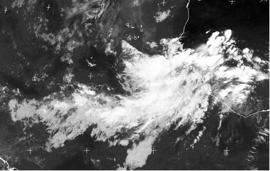
Chad that first pic will change around 2:45 PM EDT and it will show incresed convection.
0 likes
Visit the Caribbean-Central America Weather Thread where you can find at first post web cams,radars
and observations from Caribbean basin members Click Here
and observations from Caribbean basin members Click Here
-
ameriwx2003

- Category 4

- Posts: 980
- Joined: Tue Jul 22, 2003 10:45 am
-
cycloneye
- Admin
- Posts: 149750
- Age: 69
- Joined: Thu Oct 10, 2002 10:54 am
- Location: San Juan, Puerto Rico
Thanks my friend ameriwx2003 I knew someone would bring it. 
0 likes
Visit the Caribbean-Central America Weather Thread where you can find at first post web cams,radars
and observations from Caribbean basin members Click Here
and observations from Caribbean basin members Click Here
-
cycloneye
- Admin
- Posts: 149750
- Age: 69
- Joined: Thu Oct 10, 2002 10:54 am
- Location: San Juan, Puerto Rico
http://www.sat.dundee.ac.uk/pdus/AI/200 ... 0AI1_g.jpg
This is the full disk of africa and shows the organizing wave as well the train behind that looks interesting inside the african conntinent.I think that chad has a password for this pic to all see as you have to register first but FREE in this link below.
http://www.sat.dundee.ac.uk/pdus.html
This is the full disk of africa and shows the organizing wave as well the train behind that looks interesting inside the african conntinent.I think that chad has a password for this pic to all see as you have to register first but FREE in this link below.
http://www.sat.dundee.ac.uk/pdus.html
0 likes
Visit the Caribbean-Central America Weather Thread where you can find at first post web cams,radars
and observations from Caribbean basin members Click Here
and observations from Caribbean basin members Click Here
-
ameriwx2003
- Category 4
- Posts: 980
- Joined: Tue Jul 22, 2003 10:45 am
-
cycloneye
- Admin
- Posts: 149750
- Age: 69
- Joined: Thu Oct 10, 2002 10:54 am
- Location: San Juan, Puerto Rico
Yes I hope if it develops it goes fishing and not threat the islands but of course there is no guarantee that it may do thatso I and all the members from PR that are at storm2k will be watching for sure.
0 likes
Visit the Caribbean-Central America Weather Thread where you can find at first post web cams,radars
and observations from Caribbean basin members Click Here
and observations from Caribbean basin members Click Here

-
cycloneye
- Admin
- Posts: 149750
- Age: 69
- Joined: Thu Oct 10, 2002 10:54 am
- Location: San Juan, Puerto Rico
Yes the first long tracker to follow.
0 likes
Visit the Caribbean-Central America Weather Thread where you can find at first post web cams,radars
and observations from Caribbean basin members Click Here
and observations from Caribbean basin members Click Here
-
chadtm80
-
cycloneye
- Admin
- Posts: 149750
- Age: 69
- Joined: Thu Oct 10, 2002 10:54 am
- Location: San Juan, Puerto Rico
Chad you meant in the east side of africa right?Because there is a very interesting wave there.
0 likes
Visit the Caribbean-Central America Weather Thread where you can find at first post web cams,radars
and observations from Caribbean basin members Click Here
and observations from Caribbean basin members Click Here
-
cycloneye
- Admin
- Posts: 149750
- Age: 69
- Joined: Thu Oct 10, 2002 10:54 am
- Location: San Juan, Puerto Rico
LOL NP chad but seriously that wave at east africa may be the next player after this first one because the global models pick up activity one wave after another in comming weeks.
0 likes
Visit the Caribbean-Central America Weather Thread where you can find at first post web cams,radars
and observations from Caribbean basin members Click Here
and observations from Caribbean basin members Click Here
-
cycloneye
- Admin
- Posts: 149750
- Age: 69
- Joined: Thu Oct 10, 2002 10:54 am
- Location: San Juan, Puerto Rico
http://www.storm2k.org/Weather-Central/ ... lantic.htm
Wow the pressure now at 1009 mbs and look at the wave now at pics.
Wow the pressure now at 1009 mbs and look at the wave now at pics.
0 likes
Visit the Caribbean-Central America Weather Thread where you can find at first post web cams,radars
and observations from Caribbean basin members Click Here
and observations from Caribbean basin members Click Here
-
cycloneye
- Admin
- Posts: 149750
- Age: 69
- Joined: Thu Oct 10, 2002 10:54 am
- Location: San Juan, Puerto Rico
Chad what do you think now looking at the latest pics of the wave?.Looks to me like it is trying to organize.
0 likes
Visit the Caribbean-Central America Weather Thread where you can find at first post web cams,radars
and observations from Caribbean basin members Click Here
and observations from Caribbean basin members Click Here
-
chadtm80
-
cycloneye
- Admin
- Posts: 149750
- Age: 69
- Joined: Thu Oct 10, 2002 10:54 am
- Location: San Juan, Puerto Rico
Yeah those met 7 pics are a tedious waiting but there are 3 hours intervals too in other sources and nasa that has a loop every half an hour.
0 likes
Visit the Caribbean-Central America Weather Thread where you can find at first post web cams,radars
and observations from Caribbean basin members Click Here
and observations from Caribbean basin members Click Here
-
chadtm80
Who is online
Users browsing this forum: No registered users and 151 guests