ATL: EX-Tropical Depression FIVE - Discussion
Moderator: S2k Moderators
-
redfish1
- Tropical Storm

- Posts: 125
- Age: 45
- Joined: Thu Jun 17, 2010 9:24 pm
- Location: Port Arthur, Tx
Re: ATL: INVEST 94L - Discussion
imo i think the models will shift west cause it is a lot further south and west than what was originally forcasted
0 likes
-
Aric Dunn
- Category 5

- Posts: 21238
- Age: 43
- Joined: Sun Sep 19, 2004 9:58 pm
- Location: Ready for the Chase.
- Contact:
yeah radar is becoming increasingly more impressive with convection show some banding features developing.. this is likely due in part to the lack of so many boundaries over florida that were inhibiting the inflow from developing on the east side today.
0 likes
Note: If I make a post that is brief. Please refer back to previous posts for the analysis or reasoning. I do not re-write/qoute what my initial post said each time.
If there is nothing before... then just ask
Space & Atmospheric Physicist, Embry-Riddle Aeronautical University,
I believe the sky is falling...
If there is nothing before... then just ask
Space & Atmospheric Physicist, Embry-Riddle Aeronautical University,
I believe the sky is falling...
-
wxman57

- Moderator-Pro Met

- Posts: 23175
- Age: 68
- Joined: Sat Jun 21, 2003 8:06 pm
- Location: Houston, TX (southwest)
Re: ATL: INVEST 94L - Discussion
redfish1 wrote:imo i think the models will shift west cause it is a lot further south and west than what was originally forecasted
That band of clouds extending NW from the disturbance to SE LA gives a good clue as to the steering currents. I don't think it makes much difference where it forms, the winds seem to be blowing toward SE LA. Would be nice if we could get some rain out of it, but I'm not counting on that.
0 likes
-
Portastorm

- Storm2k Moderator

- Posts: 9955
- Age: 63
- Joined: Fri Jul 11, 2003 9:16 am
- Location: Round Rock, TX
- Contact:
Re: ATL: INVEST 94L - Discussion
redfish1 wrote:imo i think the models will shift west cause it is a lot further south and west than what was originally forcasted
Well, earlier in the day we had some posts from folks who suggested that the more vertical and developed this system becomes, the more apt it would be to move further west than what many of the models were showing due to the strong ridge of high pressure centered over the Deep South.
I still don't understand how this system is going to plow into the ridge ... but it is hard to argue with the current model consensus.
0 likes
-
Aric Dunn
- Category 5
- Posts: 21238
- Age: 43
- Joined: Sun Sep 19, 2004 9:58 pm
- Location: Ready for the Chase.
- Contact:
Re: ATL: INVEST 94L - Discussion
wxman57 wrote:redfish1 wrote:imo i think the models will shift west cause it is a lot further south and west than what was originally forecasted
That band of clouds extending NW from the disturbance to SE LA gives a good clue as to the steering currents. I don't think it makes much difference where it forms, the winds seem to be blowing toward SE LA. Would be nice if we could get some rain out of it, but I'm not counting on that.
this of course is the case atm... but model guidance is becoming slower and slightly more right ... but the general wnw to then NW direction is likely. a weakness in the ridge to the north may become larger as a trough digs south... it all depends on timing.
0 likes
-
Aric Dunn
- Category 5
- Posts: 21238
- Age: 43
- Joined: Sun Sep 19, 2004 9:58 pm
- Location: Ready for the Chase.
- Contact:
Re:
Aric Dunn wrote:yeah radar is becoming increasingly more impressive with convection show some banding features developing.. this is likely due in part to the lack of so many boundaries over florida that were inhibiting the inflow from developing on the east side today.
the basic location as pointed out by wxman57 earlier roughly here ... with radar satellite overlay..

0 likes
Note: If I make a post that is brief. Please refer back to previous posts for the analysis or reasoning. I do not re-write/qoute what my initial post said each time.
If there is nothing before... then just ask
Space & Atmospheric Physicist, Embry-Riddle Aeronautical University,
I believe the sky is falling...
If there is nothing before... then just ask
Space & Atmospheric Physicist, Embry-Riddle Aeronautical University,
I believe the sky is falling...
-
Ivanhater

- Storm2k Moderator
- Posts: 11222
- Age: 39
- Joined: Fri Jul 01, 2005 8:25 am
- Location: Pensacola
Re: ATL: INVEST 94L - Discussion
There is a trough that is coming down..notice the models showing it take off to the NE...ridge will break down


0 likes
Michael
-
amawea

- S2K Supporter

- Posts: 385
- Age: 74
- Joined: Mon Aug 09, 2004 3:36 pm
- Location: Horseshoe Bend, Ar. but from Baytown, Tx
Re: ATL: INVEST 94L - Discussion
This really reminds me of Alicia. She formed on August 15th in the North central Gulf. Actually south of Mobile, Al. This area is much farther south right now but Alicia developed in a similar situation along the west end of a frontal trough.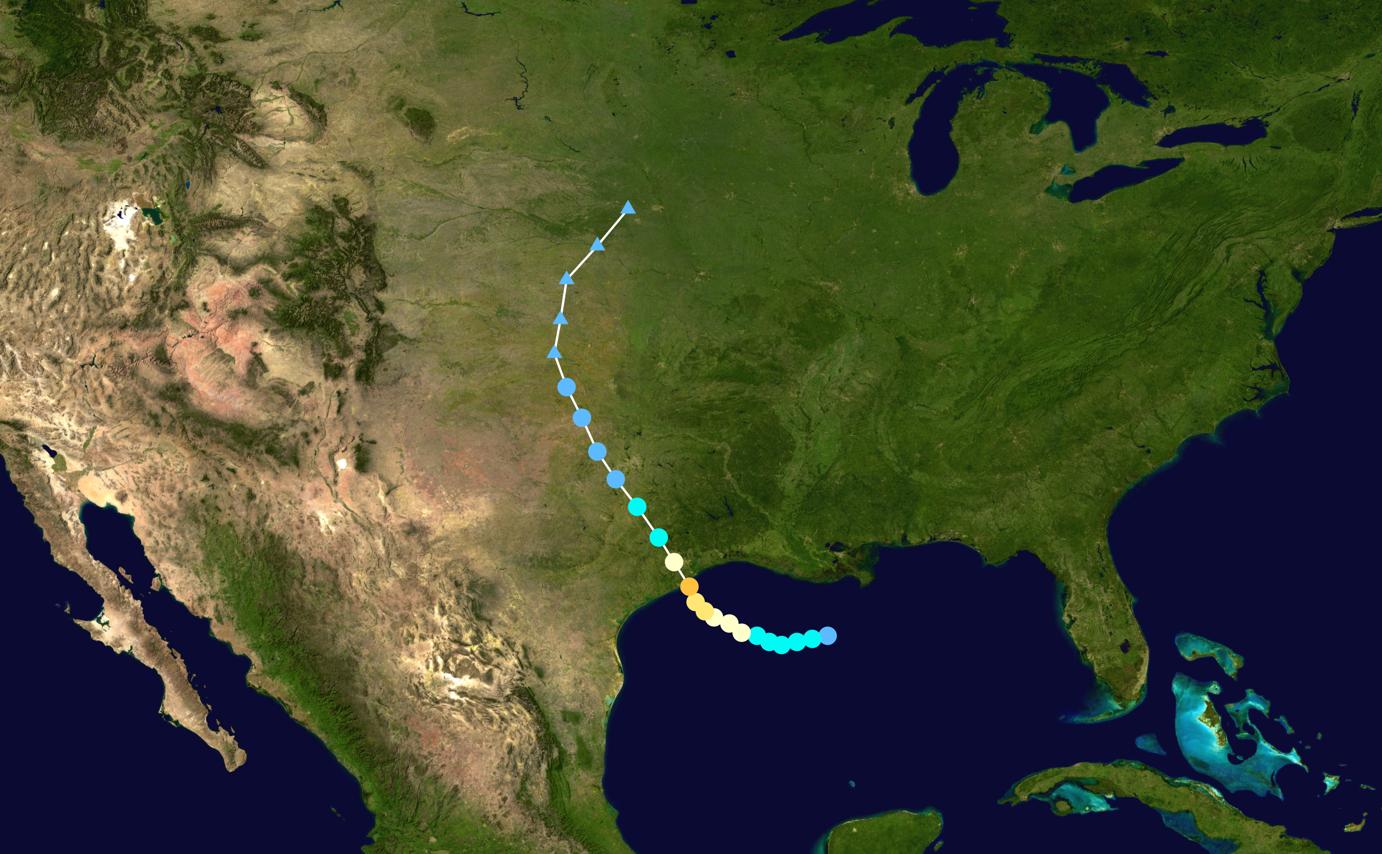
0 likes
-
Stormcenter
- S2K Supporter
- Posts: 6689
- Joined: Wed Sep 03, 2003 11:27 am
- Location: Houston, TX
-
Dean4Storms
- S2K Supporter
- Posts: 6358
- Age: 63
- Joined: Sun Aug 31, 2003 1:01 pm
- Location: Miramar Bch. FL
Notice the extrapolation on this chart, has it currently moving SW right into that convection.
http://raleighwx.easternuswx.com/models ... nvest1.gif
http://raleighwx.easternuswx.com/models ... nvest1.gif
0 likes
-
Portastorm
- Storm2k Moderator
- Posts: 9955
- Age: 63
- Joined: Fri Jul 11, 2003 9:16 am
- Location: Round Rock, TX
- Contact:
Re: ATL: INVEST 94L - Discussion
FWIW, pro met Larry Cosgrove has some interesting thoughts he posted this evening on his blog:
http://www.examiner.com/x-3775-Houston-Weather-Examiner~y2010m8d9-Weather-Forecast-For-Houston-TX-And-Vicinity-Monday-August-9-2010
http://www.examiner.com/x-3775-Houston-Weather-Examiner~y2010m8d9-Weather-Forecast-For-Houston-TX-And-Vicinity-Monday-August-9-2010
0 likes
-
Aric Dunn
- Category 5
- Posts: 21238
- Age: 43
- Joined: Sun Sep 19, 2004 9:58 pm
- Location: Ready for the Chase.
- Contact:
Re: ATL: INVEST 94L - Discussion
Upper level shear is nearly nothing atm but mid level shear which disrupts systems more than upper level is still a tad too strong..
upper level

mid level

upper level
mid level
0 likes
Note: If I make a post that is brief. Please refer back to previous posts for the analysis or reasoning. I do not re-write/qoute what my initial post said each time.
If there is nothing before... then just ask
Space & Atmospheric Physicist, Embry-Riddle Aeronautical University,
I believe the sky is falling...
If there is nothing before... then just ask
Space & Atmospheric Physicist, Embry-Riddle Aeronautical University,
I believe the sky is falling...
-
TeamPlayersBlue

- Category 5
- Posts: 3533
- Joined: Tue Feb 02, 2010 1:44 am
- Location: Denver/Applewood, CO
Yeah Larry has been scaring us along the Gulf Coast for weeks now! He did guess it right, or one of the models brought up the idea of a Low forming east of the GA/FLA border and swinging into the GOM.
I'm still curious how this high wont steer it into texas. If it's near ARK/TENN, and its not going anywhere for a while, why wouldnt it swing towards the Tx coast? Am i missing something? I by no means want this storm but we could use the rain
I'm still curious how this high wont steer it into texas. If it's near ARK/TENN, and its not going anywhere for a while, why wouldnt it swing towards the Tx coast? Am i missing something? I by no means want this storm but we could use the rain
0 likes
Personal Forecast Disclaimer:
The posts in this forum are NOT official forecast and should not be used as such. They are just the opinion of the poster and may or may not be backed by sound meteorological data. They are NOT endorsed by any professional institution or storm2k.org. For official information, please refer to the NHC and NWS products.
The posts in this forum are NOT official forecast and should not be used as such. They are just the opinion of the poster and may or may not be backed by sound meteorological data. They are NOT endorsed by any professional institution or storm2k.org. For official information, please refer to the NHC and NWS products.
-
brunota2003

- S2K Supporter
- Posts: 9476
- Age: 35
- Joined: Sat Jul 30, 2005 9:56 pm
- Location: Stanton, KY...formerly Havelock, NC
- Contact:
-
Aric Dunn
- Category 5
- Posts: 21238
- Age: 43
- Joined: Sun Sep 19, 2004 9:58 pm
- Location: Ready for the Chase.
- Contact:
Re: ATL: INVEST 94L - Discussion
Latest NWS meso analysis.. as of 10 pm... pretty clear where the low is at..

0 likes
Note: If I make a post that is brief. Please refer back to previous posts for the analysis or reasoning. I do not re-write/qoute what my initial post said each time.
If there is nothing before... then just ask
Space & Atmospheric Physicist, Embry-Riddle Aeronautical University,
I believe the sky is falling...
If there is nothing before... then just ask
Space & Atmospheric Physicist, Embry-Riddle Aeronautical University,
I believe the sky is falling...
-
hurricaneCW
- Category 5
- Posts: 1799
- Joined: Wed Mar 03, 2010 6:20 am
- Location: Toms River, NJ
Re: ATL: INVEST 94L - Discussion
It's really starting to pop this evening. One of the most interesting disturbances so far this season. Fun few days ahead of watching and waiting.
0 likes
-
cycloneye

- Admin

- Posts: 149730
- Age: 69
- Joined: Thu Oct 10, 2002 10:54 am
- Location: San Juan, Puerto Rico
Re: ATL: INVEST 94L - Discussion
Low Level Convergence is increasing.

0 likes
Visit the Caribbean-Central America Weather Thread where you can find at first post web cams,radars
and observations from Caribbean basin members Click Here
and observations from Caribbean basin members Click Here
Re: ATL: INVEST 94L - Discussion
Hardly anything here at all. Just some breezy gusts earlier and a few rain showers. Nothing now.
The oil spill operation doesn't need a strengthening system.
The oil spill operation doesn't need a strengthening system.
0 likes
-
cycloneye
- Admin
- Posts: 149730
- Age: 69
- Joined: Thu Oct 10, 2002 10:54 am
- Location: San Juan, Puerto Rico
Re: ATL: INVEST 94L - Discussion
Bingo! ASCAT pass at 11:15 PM EDT got a well defined circulation.

0 likes
Visit the Caribbean-Central America Weather Thread where you can find at first post web cams,radars
and observations from Caribbean basin members Click Here
and observations from Caribbean basin members Click Here
Who is online
Users browsing this forum: No registered users and 32 guests