ATL: Ex COLIN - Discussion
Moderator: S2k Moderators
-
bvigal

- S2K Supporter

- Posts: 2276
- Joined: Sun Jul 24, 2005 8:49 am
- Location: British Virgin Islands
- Contact:
Re: ATL : INVEST 91L - DISCUSSION
:nod: Yessiree, that's right!! And how many times there was a bullish outlook by all data and then fizzled to way less? (pls Father) I'm shutting this computer down and I'll look again bright and early (2am), LOL! Have a great night, everybody!vbhoutex wrote:91L is still moving slowly from what I see and still hasn't consolidated as much as I think it would need to in order to really get going. I'll go out on a limb here and say TD sometime tomorrow.
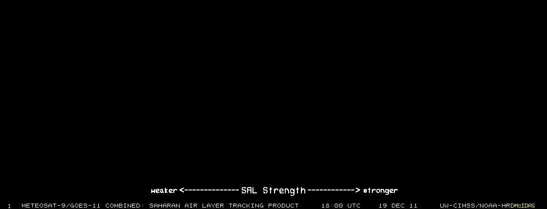
In all seriousness, like I said this system is moving slowly. What I haven't seen discussed lately is the SAL. Is it gone? I don't think so. Is there more coming off of Africa fast enough to impact(catch up with) this system and maybe even slow its' development into a TC past tomorrow? Just some thoughts I have since the SAL has impacted several of the systems significantly.
0 likes


Re: ATL : INVEST 91L - DISCUSSION
I think the system is so large it's going to take some time to reach TD status - perhaps getting to 40W before developing. I don't see any organization now to make it a TD.
http://www.ssd.noaa.gov/goes/east/catl/loop-avn.html
http://www.ssd.noaa.gov/goes/east/catl/loop-avn.html
0 likes

Its always not easy to tell with IR when you've got such deep convection blowing up, it won't get upgraded now till at least tomorrow morning, unless of course a Ship report comes in of course.
0 likes
Personal Forecast Disclaimer:
The posts in this forum are NOT official forecast and should not be used as such. They are just the opinion of the poster and may or may not be backed by sound meteorological data. They are NOT endorsed by any professional institution or storm2k.org. For official information, please refer to the NHC and NWS products
The posts in this forum are NOT official forecast and should not be used as such. They are just the opinion of the poster and may or may not be backed by sound meteorological data. They are NOT endorsed by any professional institution or storm2k.org. For official information, please refer to the NHC and NWS products
-
Cape Verde

- Category 2

- Posts: 564
- Age: 70
- Joined: Tue Aug 31, 2004 5:53 pm
- Location: Houston area

Yeah I agree Macrocane, its got a pretty large precip shield with it and I shouldn't think the SAL will be any issue at all, esp as it gets further west and the SAL weakens.
0 likes
Personal Forecast Disclaimer:
The posts in this forum are NOT official forecast and should not be used as such. They are just the opinion of the poster and may or may not be backed by sound meteorological data. They are NOT endorsed by any professional institution or storm2k.org. For official information, please refer to the NHC and NWS products
The posts in this forum are NOT official forecast and should not be used as such. They are just the opinion of the poster and may or may not be backed by sound meteorological data. They are NOT endorsed by any professional institution or storm2k.org. For official information, please refer to the NHC and NWS products
-
Hurrilurker

- Category 2
- Posts: 738
- Joined: Mon Jun 09, 2003 3:32 pm
- Location: San Francisco, CA
Re: ATL : INVEST 91L - DISCUSSION
I'm no expert, but it looks to me like, at least in terms of convection, the two centers are combining in the latest frame. Actually there were three, two close to each other on the west side, and another separated to the east, but they're all coming together now.
0 likes
-
cycloneye

- Admin

- Posts: 149725
- Age: 69
- Joined: Thu Oct 10, 2002 10:54 am
- Location: San Juan, Puerto Rico
Re: ATL : INVEST 91L - DISCUSSION
Latest microwave image.Between 11n-12n is the center located.

0 likes
Visit the Caribbean-Central America Weather Thread where you can find at first post web cams,radars
and observations from Caribbean basin members Click Here
and observations from Caribbean basin members Click Here
-
MGC

- S2K Supporter
- Posts: 5941
- Joined: Sun Mar 23, 2003 9:05 pm
- Location: Pass Christian MS, or what is left.
Re: ATL : INVEST 91L - DISCUSSION
Where is the big EC trough I ordered?
I would be surprised if 91L is not upgraded by tomorrow morning. Looks like an ULL forming just to the NE of the Leeward Islands which might provide the shear to hold this one down in a few days. Until then, condition look to be condusive for development and futher intensification....would not be surprised if we have Colin sometime tomorrow. Looks like it will pass close to the northern Leewards....MGC
I would be surprised if 91L is not upgraded by tomorrow morning. Looks like an ULL forming just to the NE of the Leeward Islands which might provide the shear to hold this one down in a few days. Until then, condition look to be condusive for development and futher intensification....would not be surprised if we have Colin sometime tomorrow. Looks like it will pass close to the northern Leewards....MGC
0 likes
-
Florida1118
Re: ATL : INVEST 91L - DISCUSSION
Up to 90%
A LARGE AREA OF LOW PRESSURE LOCATED ABOUT 900 MILES WEST-SOUTHWEST
OF THE CAPE VERDE ISLANDS CONTINUES TO SHOW SIGNS OF ORGANIZATION
...BUT DOES NOT APPEAR TO HAVE A WELL-DEFINED SURFACE CENTER.
HOWEVER...CONDITIONS APPEAR FAVORABLE FOR ADDITIONAL DEVELOPMENT
AND A TROPICAL DEPRESSION COULD FORM AT ANY TIME DURING THE NEXT
COUPLE OF DAYS AS THIS SYSTEM MOVES WEST-NORTHWESTWARD AT 10 TO 15
MPH. THERE IS A HIGH CHANCE...90 PERCENT...OF TROPICAL CYCLONE
FORMATION DURING THE NEXT 48 HOURS.
Last edited by Florida1118 on Sun Aug 01, 2010 6:36 pm, edited 2 times in total.
0 likes
-
cycloneye
- Admin
- Posts: 149725
- Age: 69
- Joined: Thu Oct 10, 2002 10:54 am
- Location: San Juan, Puerto Rico
Re: ATL : INVEST 91L - DISCUSSION

0 likes
Visit the Caribbean-Central America Weather Thread where you can find at first post web cams,radars
and observations from Caribbean basin members Click Here
and observations from Caribbean basin members Click Here
Re: ATL : INVEST 91L - DISCUSSION
cycloneye wrote:Here are the past tracks from the 18z best track position of 9.8N-36.3W.Some biggies there.
http://i27.tinypic.com/29ntqir.jpg
Only 4 recurves out to sea (and 2 of those made landfall up north!) from the other storms that have formed over the years where 91L is presently. All of the rest of the storms made it into the gulf, and most of them hit at least one of the islands. Not time for us in the US to be filling our cars just yet, but if I was in the islands, I would be paying very close attention. Lets all hope for a complete fish, because (as it looks right now), 91L will be Colin, and Colin will be big...
0 likes


Looks pretty much ready to upgrade right now IMO, nice blow-up right over the center...
As for the past historical map, I wonder if there are any more fishes/recurvers if you raise the location upto 11N instead of 9.8...but possibly not I suppose.
Given we have a likely upper trough I do slightly have to favour the storms that hit Newfoundland...so even they weren't total fishes really!
0 likes
Personal Forecast Disclaimer:
The posts in this forum are NOT official forecast and should not be used as such. They are just the opinion of the poster and may or may not be backed by sound meteorological data. They are NOT endorsed by any professional institution or storm2k.org. For official information, please refer to the NHC and NWS products
The posts in this forum are NOT official forecast and should not be used as such. They are just the opinion of the poster and may or may not be backed by sound meteorological data. They are NOT endorsed by any professional institution or storm2k.org. For official information, please refer to the NHC and NWS products
-
SeminoleWind

- Category 1

- Posts: 359
- Age: 51
- Joined: Wed Jun 02, 2010 8:37 pm
- Location: Lake County Florida
90%? Really?
i can understand them waiting for it to separate from the itcz, but but i dont think i have ever seen one over 80%.
come on Collin get with the program already.
i can understand them waiting for it to separate from the itcz, but but i dont think i have ever seen one over 80%.
come on Collin get with the program already.
0 likes
This post is NOT an official forecast and should not be used as such. It is just the opinion of the poster and may or may not be backed by sound meteorological data. It is NOT endorsed by any professional institution including storm2k.org For Official Information please refer to the NHC and NWS products.

There is SAL ahead but its much less than a few weeks. This will become TS Colin. Its a large system and I hope he will be fish.
0 likes
The following post is NOT an official forecast and should not be used as such. It is just the opinion of the poster and may or may not be backed by sound meteorological data. It is NOT endorsed by any professional institution including storm2k.org For Official Information please refer to the NHC and NWS products.
SeminoleWind, Ts Blas in the EPAC got to 100% before it was upgraded to a TD!
The best thing we hope for now is a sort of Hurricane Karen evolution in 2007, otherwise we obviously take a big risk with hoping the upper trough does do the job.
The best thing we hope for now is a sort of Hurricane Karen evolution in 2007, otherwise we obviously take a big risk with hoping the upper trough does do the job.
0 likes
Personal Forecast Disclaimer:
The posts in this forum are NOT official forecast and should not be used as such. They are just the opinion of the poster and may or may not be backed by sound meteorological data. They are NOT endorsed by any professional institution or storm2k.org. For official information, please refer to the NHC and NWS products
The posts in this forum are NOT official forecast and should not be used as such. They are just the opinion of the poster and may or may not be backed by sound meteorological data. They are NOT endorsed by any professional institution or storm2k.org. For official information, please refer to the NHC and NWS products
-
cycloneye
- Admin
- Posts: 149725
- Age: 69
- Joined: Thu Oct 10, 2002 10:54 am
- Location: San Juan, Puerto Rico
Re: ATL : INVEST 91L - DISCUSSION
The big question trackwise in a short to medium range is if it crosses the NE Caribbean islands or moves by them to the NE. IMO,the key to that may be how much westward movement it takes before turning more wnw to nw.

0 likes
Visit the Caribbean-Central America Weather Thread where you can find at first post web cams,radars
and observations from Caribbean basin members Click Here
and observations from Caribbean basin members Click Here

Who is online
Users browsing this forum: No registered users and 43 guests