ATL: TROPICAL DEPRESSION BONNIE - DISCUSSION

Moderator: S2k Moderators

Message
Author
User avatar
x-y-no
Category 5
Category 5
Posts: 8359
Age: 65
Joined: Wed Aug 11, 2004 12:14 pm
Location: Fort Lauderdale, FL

Re: Re:

#2961 Postby x-y-no » Fri Jul 23, 2010 8:09 pm

RL3AO wrote:
x-y-no wrote:
exactly one reading that can pass for west wind ... pretty poor


They didn't pass though the south side of the circulation. Thats why there are so few west winds.


Well ... they headed SW from the center, and practically every wind measurement on that leg is east of north. One would expect at least a short series of NW winds at the beginning of that leg if there's any meaningful circulation.
0 likes   

User avatar
wxman57
Moderator-Pro Met
Moderator-Pro Met
Posts: 22978
Age: 67
Joined: Sat Jun 21, 2003 8:06 pm
Location: Houston, TX (southwest)

Re: Re:

#2962 Postby wxman57 » Fri Jul 23, 2010 8:17 pm

x-y-no wrote:
RL3AO wrote:
x-y-no wrote:
exactly one reading that can pass for west wind ... pretty poor


They didn't pass though the south side of the circulation. Thats why there are so few west winds.


Well ... they headed SW from the center, and practically every wind measurement on that leg is east of north. One would expect at least a short series of NW winds at the beginning of that leg if there's any meaningful circulation.


The did pass through a small center. You can see WNW-NW winds right where they made the small loop around the center:
http://i28.tinypic.com/29ffart.jpg

That's all there is, a small diameter swirl just south of that convection.
0 likes   

Vortmax1
Category 1
Category 1
Posts: 360
Joined: Wed Jul 07, 2010 11:35 pm
Location: Port Salerno, FL
Contact:

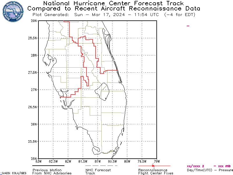
#2963 Postby Vortmax1 » Fri Jul 23, 2010 8:17 pm

Seems to be a little left of the official tracking:


Image
0 likes   

User avatar
wxman57
Moderator-Pro Met
Moderator-Pro Met
Posts: 22978
Age: 67
Joined: Sat Jun 21, 2003 8:06 pm
Location: Houston, TX (southwest)

Re:

#2964 Postby wxman57 » Fri Jul 23, 2010 8:20 pm

Vortmax1 wrote:Seems to be a little left of the official tracking:

https://my.sfwmd.gov/sfwmd/common/image ... ortex1.gif


As a remnant low in a moderate-shear environment it'll tend to move with the lower-level flow - more westward than NW. Most of the models will be focusing in the mid-level steering currents and they may be too far right. Not too worried about this system. Would rather work the weekend for a real storm, though. This one's just a pain.
0 likes   

redfish1
Tropical Storm
Tropical Storm
Posts: 125
Age: 44
Joined: Thu Jun 17, 2010 9:24 pm
Location: Port Arthur, Tx

Re:

#2965 Postby redfish1 » Fri Jul 23, 2010 8:20 pm

[quote="Vortmax1"]Seems to be a little left of the official tracking:

if this is the case would that change the models
0 likes   

Vortmax1
Category 1
Category 1
Posts: 360
Joined: Wed Jul 07, 2010 11:35 pm
Location: Port Salerno, FL
Contact:

#2966 Postby Vortmax1 » Fri Jul 23, 2010 8:22 pm

would that change the models


No...Wxman57 is exactly right with his explanation.
I just wanted to point out how it was looking right now.
0 likes   

User avatar
wxman57
Moderator-Pro Met
Moderator-Pro Met
Posts: 22978
Age: 67
Joined: Sat Jun 21, 2003 8:06 pm
Location: Houston, TX (southwest)

Re: Re:

#2967 Postby wxman57 » Fri Jul 23, 2010 8:22 pm

redfish1 wrote:
Vortmax1 wrote:Seems to be a little left of the official tracking:

if this is the case would that change the models


Might mean SE Louisiana vs. near the MS border. That's about it.
0 likes   

CYCLONE MIKE
Category 5
Category 5
Posts: 2183
Joined: Tue Aug 31, 2004 6:04 pm
Location: Gonzales, LA

Re: ATL: TROPICAL DEPRESSION BONNIE - DISCUSSION

#2968 Postby CYCLONE MIKE » Fri Jul 23, 2010 8:26 pm

As wxman stated wouldn't worry much. A slight shift west in the models wouldn't amount to much either. Whoever is on the east side of this might get a couple of inches of rain and gusty winds, nothing more than a typical summertime afternoon thunderstorm around here.
0 likes   

User avatar
TwisterFanatic
Category 5
Category 5
Posts: 1041
Joined: Mon Jun 28, 2010 12:43 pm
Location: Sallisaw, Oklahoma

Re: ATL: TROPICAL DEPRESSION BONNIE - DISCUSSION

#2969 Postby TwisterFanatic » Fri Jul 23, 2010 8:27 pm

I am happy Bonnie might bring us some relief from the 115 heat index temps up here in Oklahoma... Or at least they said it should. :D
0 likes   
Personal Forecast Disclaimer:
The posts in this forum are NOT official forecast and should not be used as such. They are just the opinion of the poster and may or may not be backed by sound meteorological data. They are NOT endorsed by any professional institution or storm2k.org. For official information, please refer to the NHC and NWS products.

CrazyC83
Professional-Met
Professional-Met
Posts: 34002
Joined: Tue Mar 07, 2006 11:57 pm
Location: Deep South, for the first time!

#2970 Postby CrazyC83 » Fri Jul 23, 2010 8:28 pm

That ULL could try to develop itself...
0 likes   

Chris_in_Tampa
Category 5
Category 5
Posts: 5075
Age: 41
Joined: Thu Jun 21, 2007 11:06 pm
Location: Tampa, Florida, USA
Contact:

Re:

#2971 Postby Chris_in_Tampa » Fri Jul 23, 2010 8:32 pm

lester88 wrote:did the atcf deactivate bonnie? sorry if it's off-topic
They really need to fix the errors in the ATCF database. First, there never has been a renumbering file to make 97L into 03L. (That is why NRL still has both.) Then, they deactivate Bonnie accidentally with a file date of 2009. They have been late on other renumbering files as well this year.
0 likes   

User avatar
Steve
S2K Supporter
S2K Supporter
Posts: 9620
Joined: Sat Apr 05, 2003 11:41 pm
Location: Not a state-caster

Re: ATL: TROPICAL DEPRESSION BONNIE - DISCUSSION

#2972 Postby Steve » Fri Jul 23, 2010 8:39 pm

crimi481 wrote:Take look at this folks. Remember the movie -"The day after tomorrow"?

The ULL center is over gulf water/air that is filled with huge amounts of Methane gas (Global Warming anyone?)
Its drawing in all surface weather =from all sides -from thousands of miles away.
With little imagination -youi can see how the surface storm remnants are going up in hright -forming what appears to be a CDO - around cold core ULL. You tell me...have you ever? (hope link works)
Once loop loads - on the "pick enhancement tab -choose 5th one down (in drop down) "cool season B&W CURVE"
http://www.ssec.wisc.edu/data/geo/index ... thod=flash


Yeah, that's pretty insane man. Even parts of 98L are are getting sucked back around. Good thing the pattern appears to be repeating because this low basically will open up the central and eastern gulf from influences south and east. And right now, those may just be a more tropical airmass/regime over the next few days rather than ushering in a storm.

First stripped-from-storm moisture band is about an hour east or so. I'm looking forward to that just to get a few raindrops from the system regardless of what else happens.

http://radar.weather.gov/radar.php?rid= ... 1&loop=yes

I'm also happy that NWS has decided to go with the impact charts. There's been a debate brewing for years on how to categorize storms and hurricanes. You see a Cat 4/3 like Katrina with a Cat 5 Surge, Cat 2 Ike with a Cat 4-5 surge, etc. Some have argued it should be based on more than windspeed factoring in size, pressure, surge, whatever. TWC has been using a graph of effects for the last several years, but it was on the low-budget side. Storm impact ratings give you a good picture of what you're dealing with. A lot of people dis on the government at every opportunity (and often rightly so). But they're the best when it comes to this kind of thing. For anyone who hasn't seen these charts yet this year, click on this link: http://www.weather.gov/ghls/php/ghls_index.php?sid=LIX and you'll get the idea of what they're classifying and what the ratings mean.
0 likes   

supercane
S2K Supporter
S2K Supporter
Posts: 2858
Joined: Wed Sep 16, 2009 8:27 pm

Re: ATL: TROPICAL DEPRESSION BONNIE - DISCUSSION

#2973 Postby supercane » Fri Jul 23, 2010 8:43 pm

MGC wrote:Sitting on pins and needles here...the anxiety is killing me. I hope the eye passes right over me. I have not been this nerveous since Ivan made that turn towards Gulf Shores that fateful September afternoon....Ooops did I forget Katrina? Anyway, now that Bonnie is back over water......as the depression pulls away from Florida, I expect the sytem to become a bit more organized. Bonnie will be moving with the shear somewhat so it might not be totally ripped to shreads....remember Wilma did kinda sorta the same thing....Rumors of Bonnies demise have been greatly exeragated.......MGC


I'm a long time mostly lurker and have enjoyed your posts in the past, so please take this in the supportive vein in which it is intended. While I empathize with what you've been through in the past, I urge you to take a deep breath and have some perspective. If you look at the situation objectively, struggling Bonnie simply does compare to an Ivan or a Katrina in terms of strength, organization, upper level support, or central pressure. Wilma was not ever like Bonnie, with winds of 85 kt and pressure of 962 mb at its nadir prior to heading toward Florida. Bonnie's decline is certainly not only rumored; it is actual with a central pressure of 1010 mb, very little convection, and a weak circulation with recon barely finding west winds. It still faces a hostile environment with a ULL relentlessly impinging on its outflow. Even if it manages to rebuild convection, it has at most 24 hr prior to landfall and therefore will have difficulty being more than a tropical storm. It definitely has no eyewall to pass over you.

Your angst will be better spent channeled into something positive, especially given the forecast for an active season and the apparent penchant for Gulf landings.

Stay safe, and hang in there. You will make it through this.
0 likes   

User avatar
Sean in New Orleans
Category 5
Category 5
Posts: 1794
Joined: Thu Aug 28, 2003 7:26 pm
Location: New Orleans, LA 30.0N 90.0W
Contact:

Re: Re:

#2974 Postby Sean in New Orleans » Fri Jul 23, 2010 8:56 pm

wxman57 wrote:
redfish1 wrote:
Vortmax1 wrote:Seems to be a little left of the official tracking:

if this is the case would that change the models


Might mean SE Louisiana vs. near the MS border. That's about it.


We could use the rain....I'm having to put the sprinkler on tonight. We need some relief from this heat. I'm hoping we'll get at least a couple of inches. Really, no worries, whatsoever about this one. We could have some wind for a couple of hours, but, we get worse with daily storms than what this system is packing.
0 likes   

StormClouds63
Category 2
Category 2
Posts: 583
Age: 62
Joined: Tue May 13, 2008 11:56 am
Location: Southwest Louisiana

Re: ATL: TROPICAL DEPRESSION BONNIE - DISCUSSION

#2975 Postby StormClouds63 » Fri Jul 23, 2010 8:58 pm

If there were a Hall of Fame for ULLs, that one in the central GOM would be a no-brainer. Looks to be taking the shape of a figure "9" this evening with dry air to the south and southeast as well.

Graphic w/comparison to Ike very interesting indeed.
0 likes   

Vortmax1
Category 1
Category 1
Posts: 360
Joined: Wed Jul 07, 2010 11:35 pm
Location: Port Salerno, FL
Contact:

#2976 Postby Vortmax1 » Fri Jul 23, 2010 9:01 pm

0 likes   

User avatar
HURAKAN
Professional-Met
Professional-Met
Posts: 46086
Age: 38
Joined: Thu May 20, 2004 4:34 pm
Location: Key West, FL
Contact:

#2977 Postby HURAKAN » Fri Jul 23, 2010 9:04 pm

Image

battle of sizes!!
0 likes   

Vortmax1
Category 1
Category 1
Posts: 360
Joined: Wed Jul 07, 2010 11:35 pm
Location: Port Salerno, FL
Contact:

#2978 Postby Vortmax1 » Fri Jul 23, 2010 9:09 pm

Hard to choose Hurakan...nice images!
LOL

See y'all tomorrow.
0 likes   

Vortmax1
Category 1
Category 1
Posts: 360
Joined: Wed Jul 07, 2010 11:35 pm
Location: Port Salerno, FL
Contact:

#2979 Postby Vortmax1 » Fri Jul 23, 2010 9:11 pm

Whoops!
Did they relocate the center this time?
That's almost a due West move this time Wxman...if you're still here.


Image
Last edited by Vortmax1 on Fri Jul 23, 2010 9:23 pm, edited 1 time in total.
0 likes   

redfish1
Tropical Storm
Tropical Storm
Posts: 125
Age: 44
Joined: Thu Jun 17, 2010 9:24 pm
Location: Port Arthur, Tx

Re:

#2980 Postby redfish1 » Fri Jul 23, 2010 9:12 pm

Vortmax1 wrote:Seems to be a little left of the official tracking:
https://my.sfwmd.gov/sfwmd/common/image ... ortex1.gif

looking at that it looks to be going west if not a little south of west
0 likes   


Return to “2010”

Who is online

Users browsing this forum: No registered users and 0 guests