ATL: TROPICAL DEPRESSION BONNIE - DISCUSSION

Moderator: S2k Moderators

Message
Author
miamijaaz
Tropical Storm
Tropical Storm
Posts: 172
Joined: Thu Sep 09, 2004 3:40 pm

Re: ATL: INVEST 97L - DISCUSSION

#1221 Postby miamijaaz » Wed Jul 21, 2010 5:38 pm

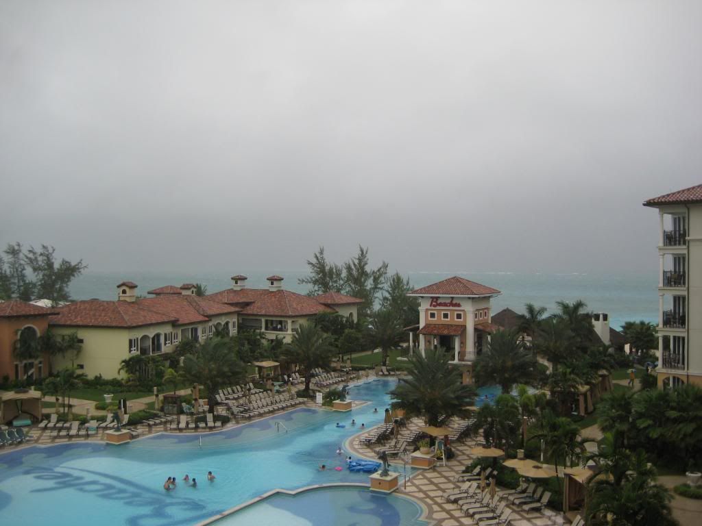
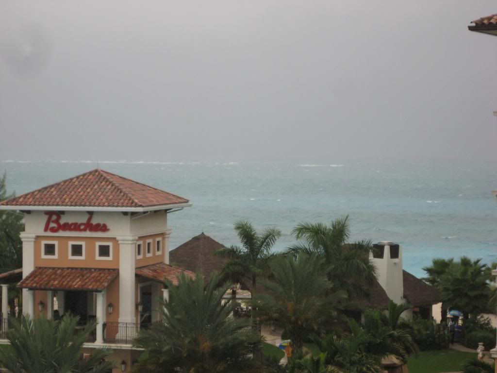
Greetings from Beaches in the Turks and Caicos!


Image

Image
0 likes   

Florida1118

Re: ATL: INVEST 97L - DISCUSSION

#1222 Postby Florida1118 » Wed Jul 21, 2010 5:41 pm

:uarrow: Looks like a great day for a vacation. :P I still think a 45mph Bonnie is possible. shes getting together...Again.
0 likes   

User avatar
tailgater
S2K Supporter
S2K Supporter
Posts: 3339
Joined: Sun Jul 11, 2004 9:13 pm
Location: St. Amant La.

Re: ATL: INVEST 97L - DISCUSSION

#1223 Postby tailgater » Wed Jul 21, 2010 5:43 pm

Looks like T-storms very near the center, I would think it gets a little higher percentage this time around.
Image
0 likes   
The following post is NOT an official forecast and should not be used as such. It is just the opinion of the poster and may or may not be backed by sound meteorological data. It is NOT endorsed by any professional institution including storm2k.org For Official Information please refer to the NHC and NWS products.

User avatar
chzzdekr81
S2K Supporter
S2K Supporter
Posts: 189
Joined: Sun Aug 30, 2009 7:54 pm
Location: Orange, Texas (SETX)
Contact:

Re: ATL: INVEST 97L - DISCUSSION

#1224 Postby chzzdekr81 » Wed Jul 21, 2010 5:46 pm

Florida1118 wrote::uarrow: Looks like a great day for a vacation. :P I still think a 45mph Bonnie is possible. shes getting together...Again.

Could be a Colin 8-)
0 likes   
I survived Rita, Humberto, Edouard, and Ike.

rockyman
Category 5
Category 5
Posts: 1967
Joined: Thu Jun 26, 2003 12:24 pm
Location: Dauphin Island, AL

Re: ATL: INVEST 97L - DISCUSSION

#1225 Postby rockyman » Wed Jul 21, 2010 5:46 pm

Work on oil leak stopped by developing storm; cap may have to be opened
http://mobile.al.com/advmobile/db_96557 ... ue#display
0 likes   

User avatar
ConvergenceZone
Category 5
Category 5
Posts: 5194
Joined: Fri Jul 29, 2005 1:40 am
Location: Northern California

#1226 Postby ConvergenceZone » Wed Jul 21, 2010 5:48 pm

So far the waves this year have been very frustrating. Hopefully will have some normal ones where we will actually know what they are or aren't going to do...

Very frustrating season so far.
0 likes   

AFWeather
Professional-Met
Professional-Met
Posts: 84
Joined: Mon Jun 14, 2010 6:27 pm
Location: Dayton, OH

Re: ATL: INVEST 97L - DISCUSSION

#1227 Postby AFWeather » Wed Jul 21, 2010 5:57 pm

tailgater wrote:Looks like T-storms very near the center, I would think it gets a little higher percentage this time around.
Image


Convection is firing up again, but I think NHC sticks with 50% for the 8PM TWO. Remember, politics play a role in what the NHC does and they don't want to keep jumping between different categories every update (low/medium/high) unless they have to.
0 likes   

User avatar
KWT
Category 5
Category 5
Posts: 31415
Joined: Tue Aug 17, 2004 11:02 am
Location: UK!!!

#1228 Postby KWT » Wed Jul 21, 2010 5:58 pm

Remember CZ its only July, plus this wave is really having fun interacting with the ULL.

Watch the ULL in the next 6-12hrs, if it can get sdpace between itself and 97L shear will decrease slowly in that period and given the current presentation we may not need 'that' low shear levels to get the job done, esp with some turning to the west of the convection.
0 likes   
Personal Forecast Disclaimer:
The posts in this forum are NOT official forecast and should not be used as such. They are just the opinion of the poster and may or may not be backed by sound meteorological data. They are NOT endorsed by any professional institution or storm2k.org. For official information, please refer to the NHC and NWS products

User avatar
TexasF6
S2K Supporter
S2K Supporter
Posts: 816
Joined: Mon Aug 09, 2004 9:33 pm
Location: Austin, TX

Re: ATL: INVEST 97L - DISCUSSION

#1229 Postby TexasF6 » Wed Jul 21, 2010 6:01 pm

Master Yoda: There is another, Sky--walker....invest 98L!!! just a suprise Aside, I still think once shear lessons over this (97L) one, it will get more organized, perhaps slowly as wxman57 sees things unfolding in time... :flag:
0 likes   

StormClouds63
Category 2
Category 2
Posts: 583
Age: 62
Joined: Tue May 13, 2008 11:56 am
Location: Southwest Louisiana

Re:

#1230 Postby StormClouds63 » Wed Jul 21, 2010 6:07 pm

ConvergenceZone wrote:So far the waves this year have been very frustrating. Hopefully will have some normal ones where we will actually know what they are or aren't going to do...

Very frustrating season so far.


Yes, very frustrating. Bonnie, where are you? Might have to wait until August until she finally decides to show up.
0 likes   

User avatar
TeamPlayersBlue
Category 5
Category 5
Posts: 3445
Joined: Tue Feb 02, 2010 1:44 am
Location: Denver/Applewood, CO

#1231 Postby TeamPlayersBlue » Wed Jul 21, 2010 6:12 pm

The waves are taking a long time to get their act together but im not complaining at all. Giving us a better chance for a weak min hurricane
0 likes   
Personal Forecast Disclaimer:
The posts in this forum are NOT official forecast and should not be used as such. They are just the opinion of the poster and may or may not be backed by sound meteorological data. They are NOT endorsed by any professional institution or storm2k.org. For official information, please refer to the NHC and NWS products.

User avatar
thetruesms
Professional-Met
Professional-Met
Posts: 844
Age: 41
Joined: Thu Aug 16, 2007 1:14 pm
Location: Tallahasee, FL
Contact:

#1232 Postby thetruesms » Wed Jul 21, 2010 6:13 pm

I was kind of wrestling with what I was seeing earlier this afternoon, but the last several vis frames have me pretty well convinced that we don't yet have an LLC. However, it has certainly made quite a bit of progress since this morning. Also, in addition to the ULL now starting to move westward somewhat faster than 97L, there's definitely been a moistening of the area ahead of 97 to go along with it. It's starting to look like a path is open for some development. I don't feel it's going to be quick, and I don't expect it to be smooth, but it's at least a more conducive looking situation than earlier.
0 likes   

User avatar
artist
Category 5
Category 5
Posts: 9792
Joined: Mon Jun 06, 2005 3:26 pm
Location: West Palm

Re:

#1233 Postby artist » Wed Jul 21, 2010 6:16 pm

thetruesms wrote:I was kind of wrestling with what I was seeing earlier this afternoon, but the last several vis frames have me pretty well convinced that we don't yet have an LLC. However, it has certainly made quite a bit of progress since this morning. Also, in addition to the ULL now starting to move westward somewhat faster than 97L, there's definitely been a moistening of the area ahead of 97 to go along with it. It's starting to look like a path is open for some development. I don't feel it's going to be quick, and I don't expect it to be smooth, but it's at least a more conducive looking situation than earlier.


I keep looking a little further east of where the supposed llc was this morning and really think I might see something there. Am I completely out of my mind? :cheesy:
0 likes   

Aric Dunn
Category 5
Category 5
Posts: 21238
Age: 42
Joined: Sun Sep 19, 2004 9:58 pm
Location: Ready for the Chase.
Contact:

Re: ATL: INVEST 97L - DISCUSSION

#1234 Postby Aric Dunn » Wed Jul 21, 2010 6:16 pm

run 20 images and speed it up... you will see what is likely at tight eddy but has a well defined structure... its very close to being at TD... http://weather.msfc.nasa.gov/GOES/goeseastconus.html


you will see the eddy shoot out from under the convection the image below just shows where too look.
Image
0 likes   

User avatar
TexasF6
S2K Supporter
S2K Supporter
Posts: 816
Joined: Mon Aug 09, 2004 9:33 pm
Location: Austin, TX

Re: ATL: INVEST 97L - DISCUSSION

#1235 Postby TexasF6 » Wed Jul 21, 2010 6:25 pm

can someone please post some reliable satelite movie links? NHC's are old or not working for me....very strange...thanks! :double:
0 likes   

User avatar
KWT
Category 5
Category 5
Posts: 31415
Joined: Tue Aug 17, 2004 11:02 am
Location: UK!!!

#1236 Postby KWT » Wed Jul 21, 2010 6:27 pm

I'm not sure you can tell Aric, the only signs of it is when the sun starts to go down so it could jsut as easily be an optical illusion.

That being said its certainly possible as it would fit the general area any LLC is likely to form and fits the location of that eddy we had earlier.
0 likes   
Personal Forecast Disclaimer:
The posts in this forum are NOT official forecast and should not be used as such. They are just the opinion of the poster and may or may not be backed by sound meteorological data. They are NOT endorsed by any professional institution or storm2k.org. For official information, please refer to the NHC and NWS products

User avatar
thetruesms
Professional-Met
Professional-Met
Posts: 844
Age: 41
Joined: Thu Aug 16, 2007 1:14 pm
Location: Tallahasee, FL
Contact:

Re: ATL: INVEST 97L - DISCUSSION

#1237 Postby thetruesms » Wed Jul 21, 2010 6:27 pm

Aric Dunn wrote:run 20 images and speed it up... you will see what is likely at tight eddy but has a well defined structure... its very close to being at TD... http://weather.msfc.nasa.gov/GOES/goeseastconus.html


you will see the eddy shoot out from under the convection the image below just shows where too look.
[img]http://img811.imageshack.us/img811/5057/goes22252010202hxzska.jpg[img]
I see what I think it is you're getting at, but I can see below that feature clouds that are more indicative of being along a wave axis.

Structurally better than last night, that's for sure. Now if it had some of that nice looking convection it had yesterday. The last few frames do look like the tops aren't getting blown off like they have been all day, though. At least, for now - that convection is pretty new. Too bad the sun is going down on it.
0 likes   

User avatar
Blown Away
S2K Supporter
S2K Supporter
Posts: 10147
Joined: Wed May 26, 2004 6:17 am

Re: ATL: INVEST 97L - DISCUSSION

#1238 Postby Blown Away » Wed Jul 21, 2010 6:32 pm

Convection is really starting to converge on the "LLC". Better structure than 18z so they have to go Code Red 00z?? IMO, IF the rate of organization continues we should have a TD by tomorrow morning!
0 likes   
Hurricane Eye Experience: David 79, Irene 99, Frances 04, Jeanne 04, Wilma 05... EYE COMING MY WAY IN 2024…
Hurricane Brush Experience: Andrew 92, Erin 95, Floyd 99, Matthew 16, Irma 17, Ian 22, Nicole 22…

User avatar
Aquawind
Category 5
Category 5
Posts: 6714
Age: 62
Joined: Mon Jun 16, 2003 10:41 pm
Location: Salisbury, NC
Contact:

#1239 Postby Aquawind » Wed Jul 21, 2010 6:34 pm

Atlantic Tropical Weather Outlook
--------------------------------------------------------------------------------


000
ABNT20 KNHC 212331
TWOAT
TROPICAL WEATHER OUTLOOK
NWS TPC/NATIONAL HURRICANE CENTER MIAMI FL
800 PM EDT WED JUL 21 2010

FOR THE NORTH ATLANTIC...CARIBBEAN SEA AND THE GULF OF MEXICO...

A TROUGH OF LOW PRESSURE ASSOCIATED WITH A TROPICAL WAVE IS LOCATED
NEAR THE SOUTHEASTERN BAHAMAS. THIS SYSTEM CONTINUES TO PRODUCE
DISORGANIZED CLOUDINESS...SHOWERS...AND THUNDERSTORMS MAINLY TO THE
EAST OF THE TROUGH. DATA FROM THE NOAA G-IV JET INDICATE THAT
UPPER-LEVEL WINDS ARE NOT CONDUCIVE FOR DEVELOPMENT AT THIS
TIME...ALTHOUGH THEY COULD BECOME MARGINALLY FAVORABLE IN A DAY OR
TWO. LOCALLY HEAVY SHOWERS AND GUSTY WINDS ASSOCIATED WITH THIS
DISTURBANCE WILL SPREAD OVER THE BAHAMAS...PORTIONS OF CUBA AND
SOUTHERN FLORIDA DURING THE NEXT COUPLE OF DAYS AS THE SYSTEM MOVES
WESTWARD OR WEST-NORTHWESTWARD AT 10 TO 15 MPH. THERE IS A MEDIUM
CHANCE...40 PERCENT...OF THIS SYSTEM BECOMING A TROPICAL CYCLONE
DURING THE NEXT 48 HOURS.

SHOWER AND THUNDERSTORM ACTIVITY ASSOCIATED WITH A BROAD AREA OF LOW
PRESSURE OVER THE BAY OF CAMPECHE HAS BECOME A LITTLE BETTER
ORGANIZED TODAY. THIS SYSTEM IS EXPECTED TO MOVE WESTWARD OR
WEST-NORTHWESTWARD AT 10 TO 15 MPH. ENVIRONMENTAL CONDITIONS
APPEAR TO BE FAVORABLE FOR SOME DEVELOPMENT OF THE LOW BEFORE IT
REACHES THE NORTHEAST COAST OF MEXICO IN A COUPLE OF DAYS. THERE
IS A MEDIUM CHANCE...30 PERCENT...OF THIS SYSTEM BECOMING A
TROPICAL CYCLONE DURING THE NEXT 48 HOURS.

ELSEWHERE...TROPICAL CYCLONE FORMATION IS NOT EXPECTED DURING THE
NEXT 48 HOURS.

$$
FORECASTER KIMBERLAIN/PASCH
0 likes   

shortwave
S2K Supporter
S2K Supporter
Posts: 156
Age: 53
Joined: Mon May 24, 2004 5:56 pm
Location: palm bay, fl.

Re: ATL: INVEST 97L - DISCUSSION

#1240 Postby shortwave » Wed Jul 21, 2010 6:34 pm

thetruesms wrote:
Aric Dunn wrote:run 20 images and speed it up... you will see what is likely at tight eddy but has a well defined structure... its very close to being at TD... http://weather.msfc.nasa.gov/GOES/goeseastconus.html


you will see the eddy shoot out from under the convection the image below just shows where too look.
[img]http://img811.imageshack.us/img811/5057/goes22252010202hxzska.jpg[img]
I see what I think it is you're getting at, but I can see below that feature clouds that are more indicative of being along a wave axis.

Structurally better than last night, that's for sure. Now if it had some of that nice looking convection it had yesterday. The last few frames do look like the tops aren't getting blown off like they have been all day, though. At least, for now - that convection is pretty new. Too bad the sun is going down on it.

for us non-pros...what in the cloud structure show more of a wave axis rather than something else?
0 likes   
Personal Forecast Disclaimer:
The posts in this forum are NOT official forecast and should not be used as such. They are just the opinion of the poster and may or may not be backed by sound meteorological data. They are NOT endorsed by any professional institution or storm2k.org. For official information, please refer to the NHC and NWS products.


Return to “2010”

Who is online

Users browsing this forum: No registered users and 3 guests