ATL: TROPICAL DEPRESSION BONNIE - DISCUSSION
Moderator: S2k Moderators
-
wzrgirl1

- S2K Supporter

- Posts: 1360
- Joined: Sat Sep 04, 2004 6:44 am
- Location: Pembroke Pines, Florida
Re: ATL: INVEST 97L - DISCUSSION
I think we may wake up to a little surprise on our hands IMO. I am going with the trend that I am seeing and I think the NHC is being conservative with their numbers....which is a good thing. If anything....this would be a good time to just check your supplies and make sure all is good. I know I just called my hubby and told him to pick up some more water just in case. That will never go to waste and is usually the first thing to go in my Wal Mart. Just a little precaution is all.
0 likes
-
Blown Away

- S2K Supporter
- Posts: 10253
- Joined: Wed May 26, 2004 6:17 am
Re: ATL: INVEST 97L - DISCUSSION
Does the PR or DR radar see this center? I would be paying attention in the SE Bahamas & Keys right now.
0 likes
Hurricane Eye Experience: David 79, Irene 99, Frances 04, Jeanne 04, Wilma 05… Hurricane Brush Experience: Andrew 92, Erin 95, Floyd 99, Matthew 16, Irma 17, Ian 22, Nicole 22…
-
ocala
- Tropical Depression

- Posts: 88
- Joined: Sat Apr 08, 2006 8:48 am
- Location: Candler,Florida
- Contact:
Re: ATL: INVEST 97L - DISCUSSION
Blown Away wrote:Does the PR or DR radar see this center? I would be paying attention in the SE Bahamas & Keys right now.
Looks like 19.4 68.1 on radar.
0 likes

Re: ATL: INVEST 97L - DISCUSSION
The system to be slow to develop because it is a very broad and has had several mid-level circulations. I see Bonnie on this system in the next 48 hours.
0 likes
-
Bocadude85

- Category 5

- Posts: 2991
- Age: 39
- Joined: Mon Apr 18, 2005 2:20 pm
- Location: Honolulu,Hi
Re:
gatorcane wrote:I think that means all of the models can be thrown out right now, as they initialize it much further east near the Eastern tip of Puerto Rico. If that is truly where it forms then I would expect most of the models to shift more south maybe even south of FL entirely
Why? the system continues off to the wnw as expected...
0 likes
-
Aric Dunn
- Category 5
- Posts: 21238
- Age: 43
- Joined: Sun Sep 19, 2004 9:58 pm
- Location: Ready for the Chase.
- Contact:
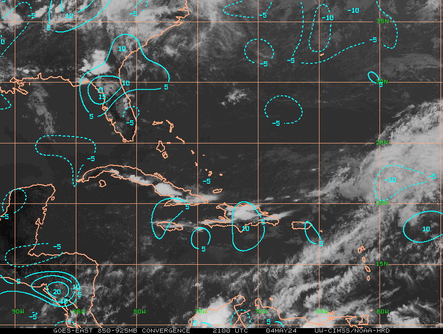
well just as expected( and mentioned before) the area just NE of Hispaniola where earlier the winds were light we have some deep convection and clearly improved convergence.. still no center to speak of but some much improved curvature to the low level structure. the 60% is pretty good i say as it has been trending towards a faster organization then what was seen yesterday.
0 likes
-
TCmet
- Professional-Met

- Posts: 106
- Age: 45
- Joined: Sat Jul 14, 2007 4:00 pm
- Location: New York, NY
- Contact:
Re: ATL: INVEST 97L - DISCUSSION
The government of Haiti has just upped its alert stage to orange, in advance of NHC's designation of 97L at code red.
The ironic thing is that the civil/military/UN cooperation in the city of Gonaives in northern Haiti (which was seriously impacted by Jeanne in 2004 and again in 2008) is as we speak carrying out a "hurricane simulation" (http://bit.ly/coTqrR)..... which may be delayed by the storm. Thus the complexities of humanitarian response in Haiti.
Also just heard a few rumbles of thunder here in Port au Prince.... an ominous feeling.
0 likes

Obviously if it did hit Florida, where it hit would be important (duh). If he hit Central Florida or further north it would weaken quicker and have little or no time over the GOM, if it hit further south, it would impact Miami and if it tracked over the Everglades it wouldn't weaken much and then would have more time over the GOM (ala Katrina).
Last edited by RL3AO on Tue Jul 20, 2010 2:11 pm, edited 1 time in total.
0 likes
-
HURAKAN

- Professional-Met
- Posts: 46084
- Age: 39
- Joined: Thu May 20, 2004 4:34 pm
- Location: Key West, FL
- Contact:
Re: ATL: INVEST 97L - DISCUSSION
Jeff Masters - http://www.wunderground.com/blog/JeffMa ... rynum=1548
A tropical wave (Invest 97L) between Puerto Rico and the Dominican Republic has continued to become more organized today, and is a threat to develop into a tropical depression as early as Wednesday morning. The disturbance has brought heavy rains of 8+ inches to Culebra and Vieques islands over the past day, and all of Puerto Rico and the Virgin Islands are under flash flood watches today. The storm could bring an additional 3 - 6 inches of rain to the islands over the next two days. The upper level low centered a few hundred miles north of the Dominican Republic is no longer bringing high levels of wind shear to 97L; wind shear has fallen to the moderate range, 10 - 15 knots, which should allow 97L to continue to develop today. Satellite images of 97L show a moderate area of steadily organizing thunderstorms, with curved bands developing to the north and east of the center. There are no signs of a surface circulation on satellite imagery or on the 10:38am EDT ASCAT pass. Surface observations show only light winds over Puerto Rico and the Dominican Republic, but the surface winds at Punta Cana on the eastern tip of the Dominican Republic have shifted to the west this afternoon, indicating that a surface circulation may be forming just north of that location. Long-range radar loops from San Juan do not show any evidence of a surface circulation. The Hurricane Hunter mission scheduled for today was canceled, but is scheduled to fly Wednesday afternoon.
Track Forecast for 97L
The storm is in a fairly straightforward steering current environment, and 97L should progress steadily to the west-northwest through Saturday. The rains from 97L's thunderstorms will bring the threat of isolated flooding to the Dominican Republic today and Wednesday, and to Haiti on Wednesday and Thursday. Heavy rains from 97L will begin moving into eastern Cuba, the Turks and Caicos Islands, and the eastern Bahamas on Wednesday, and South Florida can expect heavy rains to arrive as early as Thursday night. The latest suite of model runs from 8am EDT this morning (12Z) foresee a more northerly track for 97L into Central Florida. Several models develop 97L into a tropical storm, with both the GFDL and HWRF models predicting 97L will hit South or Central Florida as a tropical storm on Friday. Most of the models have 97L entering the Gulf of Mexico on Saturday, but the amount of time 97L has over the Gulf may be limited to a day or less if the storm ends up exiting into the Gulf near Tampa Bay. The NOGAPS model predicts a more southerly path across South Florida and into Louisiana.
Intensity Forecast for 97L
One factor potentially aiding development of 97L will be the Madden-Julian oscillation, which currently favors upward motion over the Gulf of Mexico and Caribbean. The Madden-Julian oscillation is a pattern of enhanced rainfall that travels along the Equator from west to east. The pattern has a wet phase with large-scale rising air and enhanced thunderstorm activity, followed by a dry phase with large-scale sinking air and suppressed thunderstorm activity. Each cycle lasts approximately 30 - 60 days. When the Madden-Julian oscillation is in its wet phase over a hurricane-prone region, the chances for tropical storm activity are greatly increased. Also in favor of development are the warm ocean temperatures of 29°C. The SHIPS model predicts shear will stay in the moderate range, 10 - 20 knots, over the next five days. The primary detriment to development of 97L over the next three days will probably be the presence of dry, stable air in its path over the Bahamas, thanks to the upper-level low to the north of the Dominican Republic. If the center forms close to the coast of the Dominican Republic, the high mountains of Hispaniola may also be a problem for the storm. NHC is giving 97L a 60% chance of developing into a tropical depression by Thursday, which is a reasonable forecast. I think there is a 70% chance 97L will eventually become Tropical Storm Bonnie, sometime in the next five days. Sudden rapid development today or on Wednesday is unlikely, due to the dry air over the Bahamas. I put the odds of 97L making it to hurricane strength before reaching Florida at 30%, and I give a 20% chance it will be a hurricane in the Gulf of Mexico. The probability of 97L being a hurricane in the Gulf of Mexico will depend heavily upon how long the storm spends over land or interacting with land over the next four days, which is very uncertain.
0 likes
-
mascpa
- S2K Supporter
- Posts: 500
- Age: 70
- Joined: Tue Sep 30, 2003 10:43 am
- Location: Jupiter, FL
- Contact:
Re: ATL: INVEST 97L - DISCUSSION
Just my luck - leaving Saturday afternoon on a cruise out of Miami - to Bahamas, San Juan, St. Thomas and Grand Turk. Maybe it will be past by then???
0 likes

-
jlauderdal
- S2K Supporter
- Posts: 7240
- Joined: Wed May 19, 2004 5:46 am
- Location: NE Fort Lauderdale
- Contact:
Re: ATL: INVEST 97L - DISCUSSION
Hugo1989 wrote:The system to be slow to develop because it is a very broad and has had several mid-level circulations. I see Bonnie on this system in the next 48 hours.
why people using CAPS on this board, you aren't the only offender either
0 likes

Re: ATL: INVEST 97L - DISCUSSION
Dr. Masters newest update seems to confirm what the vorticity charts are saying about the beginnings of a COC developing just off of DR.
A tropical wave (Invest 97L) between Puerto Rico and the Dominican Republic has continued to become more organized today, and is a threat to develop into a tropical depression as early as Wednesday morning. The disturbance has brought heavy rains of 8+ inches to Culebra and Vieques islands over the past day, and all of Puerto Rico and the Virgin Islands are under flash flood watches today. The storm could bring an additional 3 - 6 inches of rain to the islands over the next two days. The upper level low centered a few hundred miles north of the Dominican Republic is no longer bringing high levels of wind shear to 97L; wind shear has fallen to the moderate range, 10 - 15 knots, which should allow 97L to continue to develop today. Satellite images of 97L show a moderate area of steadily organizing thunderstorms, with curved bands developing to the north and east of the center. There are no signs of a surface circulation on satellite imagery or on the 10:38am EDT ASCAT pass. Surface observations show only light winds over Puerto Rico and the Dominican Republic, but the surface winds at Punta Cana on the eastern tip of the Dominican Republic have shifted to the west this afternoon, indicating that a surface circulation may be forming just north of that location. Long-range radar loops from San Juan do not show any evidence of a surface circulation. The Hurricane Hunter mission scheduled for today was canceled, but is scheduled to fly Wednesday afternoon.
0 likes
-
Blown Away
- S2K Supporter
- Posts: 10253
- Joined: Wed May 26, 2004 6:17 am
Re: ATL: INVEST 97L - DISCUSSION
Excerpt from Jeff Master's:
Surface observations show only light winds over Puerto Rico and the Dominican Republic, but the surface winds at Punta Cana on the eastern tip of the Dominican Republic have shifted to the west this afternoon, indicating that a surface circulation may be forming just north of that location.
I hate that, what does he consider "just north"?? Leaving me hanging again!!
0 likes
Hurricane Eye Experience: David 79, Irene 99, Frances 04, Jeanne 04, Wilma 05… Hurricane Brush Experience: Andrew 92, Erin 95, Floyd 99, Matthew 16, Irma 17, Ian 22, Nicole 22…

-
jlauderdal
- S2K Supporter
- Posts: 7240
- Joined: Wed May 19, 2004 5:46 am
- Location: NE Fort Lauderdale
- Contact:
Re: ATL: INVEST 97L - DISCUSSION
Blown Away wrote:Excerpt from Jeff Master's:
Surface observations show only light winds over Puerto Rico and the Dominican Republic, but the surface winds at Punta Cana on the eastern tip of the Dominican Republic have shifted to the west this afternoon, indicating that a surface circulation may be forming just north of that location.
I hate that, what does he consider "just north"?? Leaving me hanging again!!
he usually has all the bases covered, be nice if he would pick a spot and run with it
0 likes
-
Weatherboy1

- Category 5
- Posts: 1190
- Age: 50
- Joined: Mon Jul 05, 2004 1:50 pm
- Location: Jupiter/Sarasota, FL
Who is online
Users browsing this forum: No registered users and 33 guests