
ATL: TROPICAL DEPRESSION BONNIE - DISCUSSION
Moderator: S2k Moderators


-
Blown Away

- S2K Supporter

- Posts: 10253
- Joined: Wed May 26, 2004 6:17 am
Re: ATL: INVEST 97L - DISCUSSION
I said yesterday this reminded me of Erin.

0 likes
Hurricane Eye Experience: David 79, Irene 99, Frances 04, Jeanne 04, Wilma 05… Hurricane Brush Experience: Andrew 92, Erin 95, Floyd 99, Matthew 16, Irma 17, Ian 22, Nicole 22…
-
MiamiHurricanes10

- S2K Supporter
- Posts: 260
- Joined: Mon Jul 19, 2010 7:56 pm
- Location: Miami, Florida


Re: ATL: INVEST 97L - DISCUSSION
Here we go!!
It took longer than I thought to develop, that ULL was the cause for the delay. It appears to becoming better organized this morning.
FLA and GOM'ers need to watch this one carefully.
Call me crazy, but I still believe this has the potential down the road to become our first major.
It took longer than I thought to develop, that ULL was the cause for the delay. It appears to becoming better organized this morning.
FLA and GOM'ers need to watch this one carefully.
Call me crazy, but I still believe this has the potential down the road to become our first major.
0 likes
-
gatorcane

- S2K Supporter
- Posts: 23708
- Age: 48
- Joined: Sun Mar 13, 2005 3:54 pm
- Location: Boca Raton, FL
Anybody thinks NHC will give this a code red by the end of the day today? If not when?
I think it is on the way to code RED folks....
I think it is on the way to code RED folks....
Last edited by gatorcane on Tue Jul 20, 2010 8:24 am, edited 2 times in total.
0 likes

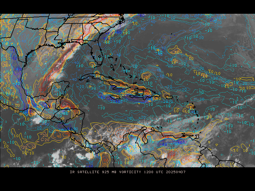
Watching the visible loops, the strongest spin DOES appear to be near the NE coast of Dominican Republic (consistent with vorticity maps just posted).
Last edited by rockyman on Tue Jul 20, 2010 8:26 am, edited 1 time in total.
0 likes
-
wzrgirl1

- S2K Supporter
- Posts: 1360
- Joined: Sat Sep 04, 2004 6:44 am
- Location: Pembroke Pines, Florida
Re:
gatorcane wrote:Anybody thinks NHC will give this a code red by the end of the day today? If not when?
Yes gator I do. Seems as if a lot of factors are coming into play as far as development goes. Don't think they want to raise the percentage too quick to frighten people, but there is plenty of ocean for the center to go through, and man are those waters warm.
0 likes
-
MiamiHurricanes10
- S2K Supporter
- Posts: 260
- Joined: Mon Jul 19, 2010 7:56 pm
- Location: Miami, Florida
Re:
gatorcane wrote:Anybody thinks NHC will give this a code red by the end of the day today? If not when?
I think it is on the way to code RED folks....
If it can develop an area of low pressure the NHC may give it red shading at 8PM EDT the earliest. Tomorrow if Recon does investigate we might, just might have TD #3. Of course, just my opinion.
0 likes
-
Comanche

- Category 1

- Posts: 381
- Age: 54
- Joined: Wed Jul 06, 2005 9:33 am
- Location: Clear Lake City Texas
Re: ATL: INVEST 97L - DISCUSSION
For everyone that was so bullish the euro models over the GFS, not one of the 50 member euro ensemble develops it. Does this mean everyone is going to become GFS lubbers?
0 likes
-
cycloneye

- Admin

- Posts: 149719
- Age: 69
- Joined: Thu Oct 10, 2002 10:54 am
- Location: San Juan, Puerto Rico
Re: ATL: INVEST 97L - DISCUSSION
IMO,at 2 PM they may raise the % to 50 and by 8 PM to 60%. But it all depends on how the system evolves during the day.
0 likes
Visit the Caribbean-Central America Weather Thread where you can find at first post web cams,radars
and observations from Caribbean basin members Click Here
and observations from Caribbean basin members Click Here
I think the availability of Puerto Rico radar data (and the lack of radar from Hispaniola, and the lack until recently of visible loops) has skewed perceptions, making some of us think the center might be to the southeast or northeast of Puerto Rico. As the day wears on, I think it'll become clear that the center is forming closer to the wave axis near Hispaniola. What do y'all think?
0 likes
-
MiamiHurricanes10
- S2K Supporter
- Posts: 260
- Joined: Mon Jul 19, 2010 7:56 pm
- Location: Miami, Florida
Re: ATL: INVEST 97L - DISCUSSION
cycloneye wrote:IMO,at 2 PM they may raise the % to 50 and by 8 PM to 60%. But it all depends on how the system evolves during the day.
Yep, same here.
0 likes

-
hurricaneCW
- Category 5

- Posts: 1799
- Joined: Wed Mar 03, 2010 6:20 am
- Location: Toms River, NJ
Re: ATL: INVEST 97L - DISCUSSION
Comanche wrote:For everyone that was so bullish the euro models over the GFS, not one of the 50 member euro ensemble develops it. Does this mean everyone is going to become GFS lubbers?
Why does everyone think the Euro is god. It can be wrong sometimes. Other models can be right. I don't think the EURO has a clue and the only systems it does develop are distinctly strong systems that are guaranteed to form.
0 likes
-
cycloneye
- Admin
- Posts: 149719
- Age: 69
- Joined: Thu Oct 10, 2002 10:54 am
- Location: San Juan, Puerto Rico
Re: ATL: INVEST 97L - DISCUSSION
This is the 12z sounding from San Juan that shows the circulation between 600-700mbs. See right side for the barb turnings at those heights.

0 likes
Visit the Caribbean-Central America Weather Thread where you can find at first post web cams,radars
and observations from Caribbean basin members Click Here
and observations from Caribbean basin members Click Here
-
hurricaneCW
- Category 5
- Posts: 1799
- Joined: Wed Mar 03, 2010 6:20 am
- Location: Toms River, NJ
Re: ATL: INVEST 97L - DISCUSSION
I won't bother with 97L until Thursday. Right now there is nearly 30 knots of wind shear by it due to that stationary TUTT/ULL that's been there for over a month.
0 likes
Who is online
Users browsing this forum: No registered users and 67 guests