ATL: TROPICAL DEPRESSION BONNIE - DISCUSSION
Moderator: S2k Moderators


Re: ATL : INVEST 97L - DISCUSSION
Could we possibly be looking at "Bonnie" out of this in 3-4 days? Just wondering ~
0 likes

Re: ATL : INVEST 97L - DISCUSSION
defintely has a MLC with it with some new convection near it. still though shear is still there but decreasing.....orange tonight if convection doesnt wane after sunset.
0 likes
-
jlauderdal
- S2K Supporter

- Posts: 7240
- Joined: Wed May 19, 2004 5:46 am
- Location: NE Fort Lauderdale
- Contact:
Re: Re:
abajan wrote:That seems more likely than code orange at 8:00 pm to me.chzzdekr81 wrote:I'm thinking they are going to raise the percentage up to 30%.
well we dont have long to wait for the official color from NHC, shows how desperate we are for something that an upgrade from lemon to orange can get so much debate
0 likes
-
cycloneye

- Admin

- Posts: 149720
- Age: 69
- Joined: Thu Oct 10, 2002 10:54 am
- Location: San Juan, Puerto Rico
Re: ATL : INVEST 97L - DISCUSSION
Mantains at 20%
TROPICAL WEATHER OUTLOOK
NWS TPC/NATIONAL HURRICANE CENTER MIAMI FL
800 PM EDT MON JUL 19 2010
FOR THE NORTH ATLANTIC...CARIBBEAN SEA AND THE GULF OF MEXICO...
A TROPICAL WAVE LOCATED NEAR PUERTO RICO CONTINUES TO PRODUCE
DISORGANIZED SHOWERS AND THUNDERSTORMS. SURFACE PRESSURES ARE NOT
FALLING SIGNIFICANTLY OVER THE AREA...AND UPPER-LEVEL WINDS ARE
EXPECTED TO BE ONLY MARGINALLY FAVORABLE FOR DEVELOPMENT AS THE
DISTURBANCE MOVES WEST-NORTHWESTWARD AT 10 TO 15 MPH. THERE IS A
LOW CHANCE...20 PERCENT...OF THIS SYSTEM BECOMING A TROPICAL CYCLONE
DURING THE NEXT 48 HOURS...ALTHOUGH CONDITIONS COULD BECOME MORE
FAVORABLE FOR DEVELOPMENT AFTER THAT TIME. REGARDLESS OF
DEVELOPMENT...GUSTY WINDS AND LOCALLY HEAVY RAINFALL COULD AFFECT
THE NORTHERN LEEWARD ISLANDS...THE VIRGIN ISLANDS...PUERTO
RICO...THE DOMINICAN REPUBLIC...HAITI...EASTERN CUBA...THE TURKS
AND CAICOS ISLANDS...AND THE SOUTHEASTERN BAHAMAS DURING THE NEXT
COUPLE OF DAYS.
ELSEWHERE...TROPICAL CYCLONE FORMATION IS NOT EXPECTED DURING THE
NEXT 48 HOURS.
$$
FORECASTER PASCH
0 likes
Visit the Caribbean-Central America Weather Thread where you can find at first post web cams,radars
and observations from Caribbean basin members Click Here
and observations from Caribbean basin members Click Here
-
alienstorm

- Category 1

- Posts: 496
- Joined: Tue Jul 31, 2007 1:29 pm
- Location: Miami Fla western suburb
This is actually a complex weather system, we have two waves merging together and what is clear a MLC north of San Juan.
The question is will this consolidate and drop to the surface. All seems to point to yes, it may happen in the next 24 - 48 hours as the entire system moves WNW slowly.
The question is will this consolidate and drop to the surface. All seems to point to yes, it may happen in the next 24 - 48 hours as the entire system moves WNW slowly.
0 likes
Personal Forecast Disclaimer:The posts in this forum are NOT official forecast and should not be used as such. They are just the opinion of the poster and may or may not be backed by sound meteorological data. They are NOT endorsed by any professional institution or storm2k.org. For official information, please refer to the NHC and NWS products.

Looks like the surface pressures are the clincher for the NHC to up it to 30% which is fair enough, as Wxman57s image shows the surface obs are going to be very good to use in this sort of set-up given the obs nearby.
That being said shear really isn't that much of an issue right now, but it takes some time after several days of very high shear values to sort itself out.
That being said shear really isn't that much of an issue right now, but it takes some time after several days of very high shear values to sort itself out.
0 likes
Personal Forecast Disclaimer:
The posts in this forum are NOT official forecast and should not be used as such. They are just the opinion of the poster and may or may not be backed by sound meteorological data. They are NOT endorsed by any professional institution or storm2k.org. For official information, please refer to the NHC and NWS products
The posts in this forum are NOT official forecast and should not be used as such. They are just the opinion of the poster and may or may not be backed by sound meteorological data. They are NOT endorsed by any professional institution or storm2k.org. For official information, please refer to the NHC and NWS products
-
jlauderdal
- S2K Supporter
- Posts: 7240
- Joined: Wed May 19, 2004 5:46 am
- Location: NE Fort Lauderdale
- Contact:
Re: ATL : INVEST 97L - DISCUSSION
cycloneye wrote:Mantains at 20%
TROPICAL WEATHER OUTLOOK
NWS TPC/NATIONAL HURRICANE CENTER MIAMI FL
800 PM EDT MON JUL 19 2010
FOR THE NORTH ATLANTIC...CARIBBEAN SEA AND THE GULF OF MEXICO...
A TROPICAL WAVE LOCATED NEAR PUERTO RICO CONTINUES TO PRODUCE
DISORGANIZED SHOWERS AND THUNDERSTORMS. SURFACE PRESSURES ARE NOT
FALLING SIGNIFICANTLY OVER THE AREA...AND UPPER-LEVEL WINDS ARE
EXPECTED TO BE ONLY MARGINALLY FAVORABLE FOR DEVELOPMENT AS THE
DISTURBANCE MOVES WEST-NORTHWESTWARD AT 10 TO 15 MPH. THERE IS A
LOW CHANCE...20 PERCENT...OF THIS SYSTEM BECOMING A TROPICAL CYCLONE
DURING THE NEXT 48 HOURS...ALTHOUGH CONDITIONS COULD BECOME MORE
FAVORABLE FOR DEVELOPMENT AFTER THAT TIME. REGARDLESS OF
DEVELOPMENT...GUSTY WINDS AND LOCALLY HEAVY RAINFALL COULD AFFECT
THE NORTHERN LEEWARD ISLANDS...THE VIRGIN ISLANDS...PUERTO
RICO...THE DOMINICAN REPUBLIC...HAITI...EASTERN CUBA...THE TURKS
AND CAICOS ISLANDS...AND THE SOUTHEASTERN BAHAMAS DURING THE NEXT
COUPLE OF DAYS.
ELSEWHERE...TROPICAL CYCLONE FORMATION IS NOT EXPECTED DURING THE
NEXT 48 HOURS.
$$
FORECASTER PASCH
as predicted by myself and wxman57, be interesting too watch but dont expect too much except for frustration between now and Thursday, happy hurricane hunting, real season starts aug. 1 and anything before then is a bonus for those that like them
0 likes


-
lrak

- S2K Supporter
- Posts: 1770
- Age: 59
- Joined: Thu Jun 21, 2007 2:48 pm
- Location: Corpus Christi, TX
Re: ATL : INVEST 97L - DISCUSSION
0 likes
AKA karl
Also
Personal Forecast Disclaimer:
My posts on this forum are NOT official forecast and should not be used as such. My posts are my basic observations and are definitely not backed by any "well some" meteorological knowledge. For official information, please refer to the NHC and NWS products.
Also
Personal Forecast Disclaimer:
My posts on this forum are NOT official forecast and should not be used as such. My posts are my basic observations and are definitely not backed by any "well some" meteorological knowledge. For official information, please refer to the NHC and NWS products.
-
Blown Away

- S2K Supporter
- Posts: 10253
- Joined: Wed May 26, 2004 6:17 am
Re: ATL : INVEST 97L - DISCUSSION
Ivanhater, we need to keep bumping that radar because, IMO it's showing a developing system. Clearly a MLC/LLC is developing by the minute and we can see deep convection blowing up near this area on the IR loop. I think this will be a SFL/NE GOM storm if this develops because this system has slowed way down and will be feeling the ridge breaking down as it approaches SFL, JMHO.
0 likes
Hurricane Eye Experience: David 79, Irene 99, Frances 04, Jeanne 04, Wilma 05… Hurricane Brush Experience: Andrew 92, Erin 95, Floyd 99, Matthew 16, Irma 17, Ian 22, Nicole 22…

Re: ATL : INVEST 97L - DISCUSSION
Does it reach Florida? I know it's not yet and may not become an "it", but does the disturbance make it in this direction or get driven farther north?
0 likes
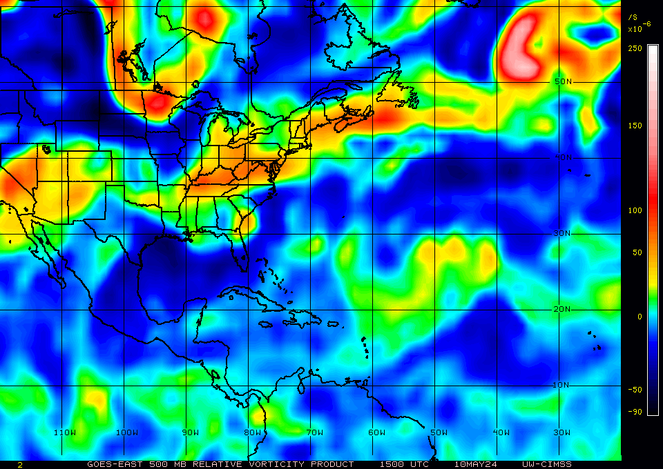
Thats certainly a decent looking radar presentation I've gotta admit, the MLC is more then evident there thats for sure!
The fact the Vorticity has become concentrated near where convection is as well which is another sign of things getting going. That being said the rest of the convection doesn't look quite so good as it did earlier on.
BA, I agree with that but I think the only reason its slowed down is the upper high hasn't really gotten going yet, the system should start to speed up as the high forms over the next 24-36hrs and IMO bend near due west for a time before the upper high starts to erode again.
0 likes
Personal Forecast Disclaimer:
The posts in this forum are NOT official forecast and should not be used as such. They are just the opinion of the poster and may or may not be backed by sound meteorological data. They are NOT endorsed by any professional institution or storm2k.org. For official information, please refer to the NHC and NWS products
The posts in this forum are NOT official forecast and should not be used as such. They are just the opinion of the poster and may or may not be backed by sound meteorological data. They are NOT endorsed by any professional institution or storm2k.org. For official information, please refer to the NHC and NWS products
-
jlauderdal
- S2K Supporter
- Posts: 7240
- Joined: Wed May 19, 2004 5:46 am
- Location: NE Fort Lauderdale
- Contact:
Re:
KWT wrote:Thats certainly a decent looking radar presentation I've gotta admit, the MLC is more then evident there thats for sure!
The fact the Vorticity has become concentrated near where convection is as well which is another sign of things getting going. That being said the rest of the convection doesn't look quite so good as it did earlier on.
BA, I agree with that but I think the only reason its slowed down is the upper high hasn't really gotten going yet, the system should start to speed up as the high forms over the next 24-36hrs and IMO bend near due west for a time before the upper high starts to erode again.
that radar shot is rather impressive and its over water so none of this land BS we usually get around PR, so now if we can just put together a decent sat presentation with that radar than we have something
0 likes

-
gatorcane

- S2K Supporter
- Posts: 23708
- Age: 48
- Joined: Sun Mar 13, 2005 3:54 pm
- Location: Boca Raton, FL
The ULL to the N of 97L is drifting SW and should weaken as a ridge builds in over Florida, Northern Bahamas, and Western Atlantic over the next couple of days. Assuming we have convection left and some rotation, would be interesting to see how it responds to the better upper-level conditions. How many times have we seen a pathetic looking system fighting a ULL in this part of the Atlantic only to hang in there long enough to take advantage of much better upper-level conditions from a building high? That said, we just don't see models coming on board, so the chances are this remains a strong tropical wave heading towards the SE Bahamas. Still, have to pay attention because of where it is headed and the fact upper-level conditions may become favorable in the SE Bahamas / FL straits area where some of the warmest SSTs in the basin exist.
Last edited by gatorcane on Mon Jul 19, 2010 7:34 pm, edited 2 times in total.
0 likes
-
cycloneye
- Admin
- Posts: 149720
- Age: 69
- Joined: Thu Oct 10, 2002 10:54 am
- Location: San Juan, Puerto Rico
Re: ATL : INVEST 97L - DISCUSSION
BULLETIN - IMMEDIATE BROADCAST REQUESTED
SPECIAL MARINE WARNING
NATIONAL WEATHER SERVICE SAN JUAN PR
749 PM AST MON JUL 19 2010
THE NATIONAL WEATHER SERVICE IN SAN JUAN HAS REISSUED A
* SPECIAL MARINE WARNING FOR...
ATLANTIC WATERS OF PUERTO RICO AND USVI FROM 10 NM TO 19.5N...
COASTAL WATERS OF NORTHERN USVI AND CULEBRA OUT 10 NM...
* UNTIL 945 PM AST
* AT 745 PM AST...NATIONAL WEATHER SERVICE DOPPLER RADAR INDICATED A
THUNDERSTORM...PRODUCING SEVERE WINDS IN EXCESS OF 40 KNOTS OVER
ATLANTIC WATERS OF PUERTO RICO AND USVI FROM 10 NM TO 19.5N...OR
ABOUT 24 NM NORTH OF CULEBRA...MOVING WEST AT 5 KNOTS.
PRECAUTIONARY/PREPAREDNESS ACTIONS...
MARINERS CAN EXPECT GUSTY WINDS...HIGH WAVES...DANGEROUS LIGHTNING...
AND HEAVY RAINS. BOATERS SHOULD SEEK SAFE HARBOR IMMEDIATELY...UNTIL
THIS STORM PASSES. IF CAUGHT ON THE OPEN WATER STAY BELOW DECK IF
POSSIBLE...KEEP AWAY FROM UNGROUNDED METAL OBJECTS.
THUNDERSTORMS CAN PRODUCE SUDDEN WATERSPOUTS. WATERSPOUTS CAN EASILY
OVERTURN BOATS AND CREATE LOCALLY HAZARDOUS SEAS. SEEK SAFE HARBOR
IMMEDIATELY.
0 likes
Visit the Caribbean-Central America Weather Thread where you can find at first post web cams,radars
and observations from Caribbean basin members Click Here
and observations from Caribbean basin members Click Here
-
dolebot_Broward_NW
- Category 2

- Posts: 529
- Joined: Fri Sep 10, 2004 6:38 am
Re: ATL : INVEST 97L - DISCUSSION
http://radar.weather.gov/radar.php?product=NCR&rid=JUA&loop=yes
Definitely something going on. See the composite NWS doppler out of Puerto Rico. That far away from radar you are looking at least a few thousand feet up. THe composite combines returns from a number of different radar elevations. Any doppler nerds care to say what the radar return elevation is of that apparent "center"?
Definitely something going on. See the composite NWS doppler out of Puerto Rico. That far away from radar you are looking at least a few thousand feet up. THe composite combines returns from a number of different radar elevations. Any doppler nerds care to say what the radar return elevation is of that apparent "center"?
0 likes
Who is online
Users browsing this forum: No registered users and 42 guests