
ATL: TROPICAL DEPRESSION TWO - DISCUSSION
Moderator: S2k Moderators
-
Nederlander
- S2K Supporter

- Posts: 1259
- Joined: Sat Jul 19, 2008 4:28 pm
- Location: Conroe, TX
-
HouTXmetro

- Category 5

- Posts: 3949
- Joined: Sun Jun 13, 2004 6:00 pm
- Location: District of Columbia, USA


Re: ATL: INVEST 96L - DISCUSSION
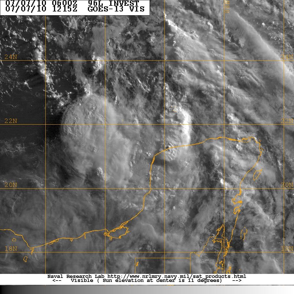
I was expecting more convection than this but there is some convection start to pop around 96L.
0 likes

Convection developing on the western side of the circulation but its still devoid of much deep convection over the system. It has got a chance but it does have to really develop its convecrion soon if it is to develop before its inland.
0 likes
Personal Forecast Disclaimer:
The posts in this forum are NOT official forecast and should not be used as such. They are just the opinion of the poster and may or may not be backed by sound meteorological data. They are NOT endorsed by any professional institution or storm2k.org. For official information, please refer to the NHC and NWS products
The posts in this forum are NOT official forecast and should not be used as such. They are just the opinion of the poster and may or may not be backed by sound meteorological data. They are NOT endorsed by any professional institution or storm2k.org. For official information, please refer to the NHC and NWS products
-
cycloneye

- Admin

- Posts: 149735
- Age: 69
- Joined: Thu Oct 10, 2002 10:54 am
- Location: San Juan, Puerto Rico
Re: ATL: INVEST 96L - DISCUSSION
Time is running out for this to develop. If convection does not flare in the next 6 hours, I think recon will be canceled.
0 likes
Visit the Caribbean-Central America Weather Thread where you can find at first post web cams,radars
and observations from Caribbean basin members Click Here
and observations from Caribbean basin members Click Here
-
Frank P
- S2K Supporter
- Posts: 2779
- Joined: Fri Aug 29, 2003 10:52 am
- Location: Biloxi Beach, Ms
- Contact:
Re: ATL: INVEST 96L - DISCUSSION
cycloneye wrote:Time is running out for this to develop. If convection does not flare in the next 6 hours, I think recon will be canceled.
Yep, it started falling apart early last night as far as convection... and has not recovered as of yet.. good bet recon will be cancelled unless something drastic happens.. we've gotten a ton of rain on the coast in MS the past three days... still don't think this thing will amount to anything but....
0 likes

-
HouTXmetro
- Category 5
- Posts: 3949
- Joined: Sun Jun 13, 2004 6:00 pm
- Location: District of Columbia, USA
-
cycloneye
- Admin
- Posts: 149735
- Age: 69
- Joined: Thu Oct 10, 2002 10:54 am
- Location: San Juan, Puerto Rico
Re: ATL: INVEST 96L - DISCUSSION
TROPICAL WEATHER OUTLOOK
NWS TPC/NATIONAL HURRICANE CENTER MIAMI FL
800 AM EDT WED JUL 7 2010
FOR THE NORTH ATLANTIC...CARIBBEAN SEA AND THE GULF OF MEXICO...
SHOWERS AND THUNDERSTORMS ASSOCIATED WITH A BROAD AREA OF LOW
PRESSURE LOCATED OFF THE NORTHWESTERN COAST OF THE YUCATAN
PENINSULA REMAIN DISORGANIZED. ENVIRONMENTAL CONDITIONS APPEAR
MARGINALLY CONDUCIVE FOR SOME DEVELOPMENT OF THIS DISTURBANCE AS
IT MOVES WEST-NORTHWESTWARD AT 10 TO 15 MPH. THERE IS A MEDIUM
CHANCE...40 PERCENT...OF THIS SYSTEM BECOMING A TROPICAL CYCLONE
BEFORE IT MOVES INLAND OVER MEXICO OR SOUTHERN TEXAS IN A DAY OR
SO.
ELSEWHERE...TROPICAL CYCLONE FORMATION IS NOT EXPECTED DURING THE
NEXT 48 HOURS.
$$
FORECASTER BROWN
0 likes
Visit the Caribbean-Central America Weather Thread where you can find at first post web cams,radars
and observations from Caribbean basin members Click Here
and observations from Caribbean basin members Click Here


Re: ATL: INVEST 96L - DISCUSSION
HurrMark wrote:Calling Bones...
Wouldn't write it off yet. New convection is firing near the center.
0 likes
-
Air Force Met
- Military Met

- Posts: 4372
- Age: 57
- Joined: Tue Jul 08, 2003 9:30 am
- Location: Roan Mountain, TN
Re: ATL: INVEST 96L - DISCUSSION
HurrMark wrote:Calling Bones...
I wouldn't call Bones just yet. There is a sfc low down there...albeit very broad. 42055 is reporting a NW wind around the circulation...and there are strong winds to the NE of the broad center...sustained at around 30...due to the pressure gradient.
With convection starting to fire now that its moving away from the Yucatan...I think it actually has a good chance of being upgraded before it moves inland south of Brownsville. Does it get a name?
That's more uncertain. Maybe as some sort of hybrid system where the strongest winds are 100-200 miles NE of the center. If the MLC hadn't collapsed last night...I think it would have certainly been named later today...but as it stands...it has to totally rebuild a core and it doesn't have time for that.
0 likes
-
srainhoutx

- S2K Supporter
- Posts: 6919
- Age: 68
- Joined: Sun Jan 14, 2007 11:34 am
- Location: Haywood County, NC
- Contact:
Re: ATL: INVEST 96L - DISCUSSION
0 likes
Carla/Alicia/Jerry(In The Eye)/Michelle/Charley/Ivan/Dennis/Katrina/Rita/Wilma/Ike/Harvey
Member: National Weather Association
Wx Infinity Forums
http://wxinfinity.com/index.php
Facebook.com/WeatherInfinity
Twitter @WeatherInfinity
Member: National Weather Association
Wx Infinity Forums
http://wxinfinity.com/index.php
Facebook.com/WeatherInfinity
Twitter @WeatherInfinity
-
tolakram
- Admin
- Posts: 20186
- Age: 62
- Joined: Sun Aug 27, 2006 8:23 pm
- Location: Florence, KY (name is Mark)
Re: ATL: INVEST 96L - DISCUSSION
Loop: http://wwwghcc.msfc.nasa.gov/cgi-bin/ge ... mframes=10
Looks like the center of a broad ... turning ... is half way to Tex/Mex already.
Looks like the center of a broad ... turning ... is half way to Tex/Mex already.
0 likes
M a r k
- - - - -
Join us in chat: Storm2K Chatroom Invite. Android and IOS apps also available.
The posts in this forum are NOT official forecasts and should not be used as such. Posts are NOT endorsed by any professional institution or STORM2K.org. For official information and forecasts, please refer to NHC and NWS products.
-
StormClouds63
- Category 2

- Posts: 583
- Age: 62
- Joined: Tue May 13, 2008 11:56 am
- Location: Southwest Louisiana
Re: ATL: INVEST 96L - DISCUSSION
We'll have to wait a bit longer for Bonnie, because 96L looks even worse this morning than yesterday. A hybrid, semi-tropical system is an outside possibility, but it's running out of real estate, and there appears to be plenty of dry air ahead of its projected path.
Dr. McCoy may be needed ... later today or (more likely) tomorrow. I'm fairly certain 96L will not be a Bonnie-type storm from 1986.
Dr. McCoy may be needed ... later today or (more likely) tomorrow. I'm fairly certain 96L will not be a Bonnie-type storm from 1986.
0 likes
-
latitude_20

- Tropical Storm

- Posts: 196
- Joined: Wed Jun 30, 2010 6:46 am
- Location: Tulum, Mexico
- Contact:
Re: ATL: INVEST 96L - DISCUSSION
Yep, looks like it may have already been interacting with that dry air already which probably explains the way it looks this morning.
0 likes


Who is online
Users browsing this forum: No registered users and 43 guests