
cycloneye wrote:In case anyone missed it,here is the video that Joe Bastardi made this afternoon about 92L.
http://hurricane.accuweather.com/hurricane/index.asp
Thank you for that video, Cycloneye!
Moderator: S2k Moderators
cycloneye wrote:In case anyone missed it,here is the video that Joe Bastardi made this afternoon about 92L.
http://hurricane.accuweather.com/hurricane/index.asp


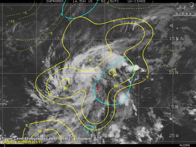
gatorcane wrote:I took another really close look a the models. I basically see that the CMC and UKMET are the two models that show shear out ahead of 92L the lightest (relatively-speaking) around 50W and westwards to the Leewards. The ECMWF, GFDL, HWRF, GFS, and NOGAPS show some strong shear ahead and really lose 92L. Given the time of year, that is pretty expected. Usually when you have this good of a consensus with a system in the medium forecasting range, it happens.
That's telling me that there is a better-than-not chance that should it develop, it will become an open wave again before it could really threaten any land areas (such as the Leewards). As far as what happens past the shear zone where it appears some more favorable conditions exist, well it could be so disrupted going through that it really may not be able to recover that quickly if at all.
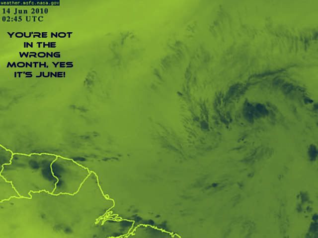
That said, pretty cool to be tracking a potential Cape Verde system so early in the season.


NOLA2010 wrote:So what is the National Hurricane Center going to do at the 2AM EST advisory? Just keep it at a 60% of development?


Users browsing this forum: No registered users and 49 guests