AdamFirst wrote:Looks like it's breaking down a bit.
It will redevelop in the evening, thats what TC's do.
Moderator: S2k Moderators


AdamFirst wrote:Looks like it's breaking down a bit.


Hurricane Andrew wrote:I think TD at 8PM TS at 2AM


Blown Away wrote:Interesting the NHC says WNW or NW, anxious to see the 18z models!!

Weatherfreak000 wrote:I disagree with some posts i've been seeing regarding intensity.
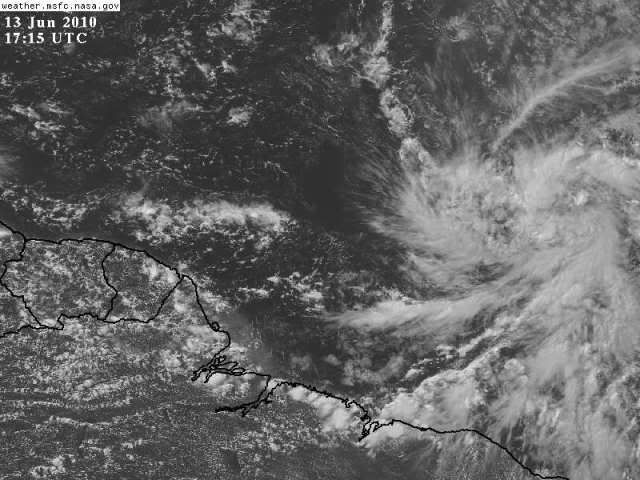
I think it's clear that not only is 92L not developing quickly, I would say it's weakening. There is really no further need to worry about daily convective waning and waxing if the system has a LLC. That would mean to imply it is now capable of sustaining itself, and therefore should be doing so. But I think it is safe to say that is not the case.
Why? It is uncertain to me. Wxman claims there is shear and I completely agree. I see what I believe to be direct shear impacting the storm from the NW and it has completely destroyed the convective structure. I am now looking for the shear to persist and eventually destroy the LLC.
Bumping my odds down to 30%.

KWT wrote:Blown Away wrote:Interesting the NHC says WNW or NW, anxious to see the 18z models!!
I suspect the fact they make reference to the NW is probably because the hurricane models both take this system instantly to the NW.
I'd have thought we will keep a WNW motion once the system develops and possibly a bend back westwards, with probably the system getting severely sheared once it gets to between 50-60W.
I suspect we maybe watching this system for quite some time yet, whilst I think it'll not have a long first life, you can never rule out regeneration like we saw with Ana last year.

Hurricane Andrew wrote:I think TD at 8PM TS at 2AM

The posts in this forum are NOT official forecast and should not be used as such. They are just the opinion of the poster and may or may not be backed by sound meteorological data. They are NOT endorsed by any professional institution or storm2k.org. For official information, please refer to the NHC and NWS products.

Blown Away wrote:
If 92L maintains a general WNW track it will be 4 days before the shear gets bad based on current conditions. I don't put high confidence in shear maps 4 days out
minter45 wrote:Hi all I am new to this sight and have very much enjoyed reading your insight. The link below is a intesity forcast I found for invest 92 I thought looked a little high with winds going to 80 knts in 72 hours? This is the ships forecast, any input would be appreciated.
Matt
http://www.wunderground.com/tropical/tr ... ml#a_topad
Users browsing this forum: No registered users and 34 guests