Texas winter wx thread (2009-2010)
Moderator: S2k Moderators
Forum rules
 The posts in this forum are NOT official forecast and should not be used as such. They are just the opinion of the poster and may or may not be backed by sound meteorological data. They are NOT endorsed by any professional institution or STORM2K.

The posts in this forum are NOT official forecast and should not be used as such. They are just the opinion of the poster and may or may not be backed by sound meteorological data. They are NOT endorsed by any professional institution or STORM2K.
-
Storm Tracker SA-CS
- Tropical Depression

- Posts: 97
- Joined: Fri Feb 19, 2010 2:01 pm
- Location: College Station, TX
Re: Texas winter wx thread (2009-2010)
is the ecmwf the only model showing snow for central and SE texas?
0 likes

Re: Texas winter wx thread (2009-2010)
Storm Tracker SA-CS wrote:is the ecmwf the only model showing snow for central and SE texas?
Canadian moves the moisture out just before the cold air settles in place but has some snow in northern regions of S\E Texas and central Texas. Very close call, but the idea is there.
Last edited by Ntxw on Wed Feb 24, 2010 2:22 pm, edited 1 time in total.
0 likes
The above post and any post by Ntxw is NOT an official forecast and should not be used as such. It is just the opinion of the poster and may or may not be backed by sound meteorological data. It is NOT endorsed by any professional institution including Storm2k. For official information, please refer to NWS products.
Help support Storm2K!
-
msstateguy83

Re: Texas winter wx thread (2009-2010)
wxman57 wrote:Precip would be long-gone by the time the ECMWF shows cold enough air overhead in SE TX.
Not on that run...look at the precip plots at 12z Tue (6 hour precip)..still snowing in East TX.
0 likes
“If you thought that science was certain - well, that is just an error on your part.”
-
srainhoutx

- S2K Supporter

- Posts: 6919
- Age: 68
- Joined: Sun Jan 14, 2007 11:34 am
- Location: Haywood County, NC
- Contact:
Re: Re:
wxman57 wrote:txagwxman wrote:Ntxw wrote::uarrow: Euro maintains that storm as a cutoff low throughout. Pointing out snow all the way possibly down to Houston area.
Cold core lows could do the trick for N. Houston...I have seen it snow in Atlanta in April underneath a cold core low.
Or December of 2008's event. This one doesn't look as cold as the low passes us, but it's still a ways out.
We won't forget that one will we wxman57.
0 likes
Carla/Alicia/Jerry(In The Eye)/Michelle/Charley/Ivan/Dennis/Katrina/Rita/Wilma/Ike/Harvey
Member: National Weather Association
Wx Infinity Forums
http://wxinfinity.com/index.php
Facebook.com/WeatherInfinity
Twitter @WeatherInfinity
Member: National Weather Association
Wx Infinity Forums
http://wxinfinity.com/index.php
Facebook.com/WeatherInfinity
Twitter @WeatherInfinity
-
srainhoutx
- S2K Supporter
- Posts: 6919
- Age: 68
- Joined: Sun Jan 14, 2007 11:34 am
- Location: Haywood County, NC
- Contact:
Re: Texas winter wx thread (2009-2010)
The HPC Final Extended will raise an eyebrow...
EXTENDED FORECAST DISCUSSION
NWS HYDROMETEOROLOGICAL PREDICTION CENTER CAMP SPRINGS MD
152 PM EST WED FEB 24 2010
VALID 12Z SAT FEB 27 2010 - 12Z WED MAR 03 2010
...SIGNIFICANT WINTER WEATHER THREAT FOR THE SW/SRN/SE US AND
POSSIBLY MID-ATLC NEXT WEEK...
THE MODELS CONTINUE TO ADVERTISE A RETROGRADING POSITIVE MID-UPPER
LEVEL HEIGHT ANOMALY FROM EASTERN INTO W-CENTRAL CANADA. THIS
SHOULD ALLOW AN AMBIENT CLOSED NORTHEAST VORTEX TO EXIT STAGE
RIGHT OVER THE WEEKEND...YET TRAP SOME MID-LEVEL ENERGY BACK
ACROSS THE MIDWEST NEXT WEEK. REPERCUSSIONS ARE MANY FOR ITS
INTERACTION WITH A NEARLY CLOSED CYCLONE ALOFT/STRONG SHORTWAVE
WHICH SPLITS OUT OF THE EASTERN PACIFIC TROUGH IN A POTENT SRN
STREAM TO NEAR 4 CORNERS BY SUN. THIS ENERGETIC FLOW/SYSTEM THEN
PROGRESSES BODILY/STEADILY EASTWARD OVER THE SOUTHERN TIER OF THE
COUNTRY...WITH QUESTION MARKS WITH RESPECT TO WHETHER OR NOT
DIGGING MIDWEST NRN STREAM ENERGY IS STRONG ENOUGH TO LURE THE
SOUTHERN SYSTEM NORTHWARD OR MERGE WITH IT...AND IF SO HOW FAR
NORTH THE COMBINED SYSTEM COULD MOVE. WITH A TWO DAY TREND
SOMEWHAT TO THE SOUTH NOTED AMONGST THE MULTI-MODEL ENSEMBLE
MEMBERS...FELT THE BEST COURSE OF ACTION WAS TO GO IN THE MIDDLE
OF THE ENSEMBLE CLUSTERING RATHER THAN THE NORTHERN SIDE
CONSIDERING CONTINUITY. THIS SOLUTION ADVERTISES A SNOWSTORM
THREAT ACROSS THE SRN ROCKY STATES SUN OUT ACROSS THE SRN THEN
SERN US/LOWER MID-ATLANTIC MONDAY INTO WEDNESDAY NEXT WEEK AS A
DECENT CLUSTER OF ECMWF ENSEMBLE MEMBERS CLOSE OFF A VORTEX AT 500
HPA WITH HEIGHTS BELOW 5400 METERS INTO THE SOUTH. HOWEVER...A
CLUSTER OF GEFS/CANADIAN MEMBERS ARE LOCATED MORE NORTHWARD OVER
THE MID-ATLANTIC STATES. NEEDLESS TO SAY...SOME UNCERTAINTY
REMAINS CONCERNING THESE IMPORTANT SMALLER SCALE DETAILS AND
INTERACTIONS OF THIS FORECAST. THE FINAL HPC SURFACE
FRONTS/PRESSURE AND 500 MB PROGS MAINTAIN CLOSE HPC CONTINUITY AS
PRIMARILY DERIVED FROM 50-50 BLEND OF SIMILAR 00 UTC
GFS/ECMWF...ALBEIT ADJUSTED SLIGHTLY CLOSER TO THE SE US COAST
INTO NEXT MIDWEEK BASED ON POTENTIAL BEST SHOWN BY ECMWF ENSEMBLE
CLUSTERING. DESPITE UNCERTAINTIES WITH EMBEDDED SYSTEM
DETAILS...LARGER SCALE FLOW DEPICTION FROM THE MODELS AND
ENSEMBLES ARE ACTUALLY QUITE SIMILAR...WITH BELOW NORMAL FORECAST
SPREAD LEADING TO ABOVE AVERAGE FORECASTER CONFIDENCE. THIS
INCLUDES AMPLIFIED NRN STREAM FLOW POTENTIAL...LEAD SRN STREAM
ENERGY OUT FROM SW US THROUGH THE US SRN TIER/GULF OF MEX...AND
SUBSEQUENT RELOADING OF AMPLIFIED ERN PACIFIC TROUGH ENERGY AND
ASSOCIATED RENEWED US W COAST ORGANIZED PCPN POTENTIAL AGAIN BY
DAYS 6/7. ACCORDINGLY...THE MAIN WEATHER SYSTEMS HAVE A HIGHER
THAN NORMAL CHANCE OF DEVELOPING IN A VEIN SIMILAR TO
GUIDANCE...EVEN THOUGH THE FOCUS FOR SIGNIFICANT SENSIBLE WEATHER
IS MORE UNCERTAIN.
WE SEE MINIMAL COMPELLING REASON TO ALTER HPC CONTINUITY
SIGNIFICANTLY AFTER CONSIDERATION OF 12 UTC MODEL AND ENSEMBLE
GUIDANCE. OVERALL...12 UTC GUIDANCE CONTINUED TO SUPPORT A
SIMILAR LARGER SCALE PATTERN DEVELOPMENT FOR MUCH OF THE
PERIOD...BUT FORECAST SPREAD DID INCREASE SUBSTANTIALLY BY DAYS
6/7 WITH SYSTEM DEEPENING/TRACK OUT FROM THE SRN/SERN US/GULF OF
MEX TO THE WRN ATLANTIC. THE 12 UTC GFS/UKMET SEEM OUTLIERS WITH A
FAR SOUTHWARD SUPPRESSED OFFSHORE TRACK NOT SUPPORTED BY
CONTINUITY...12 UTC GFS ENSEMBLES...12 UTC CANADIAN...OR
ESPECIALLY THE 12 UTC ECMWF THAT STILL SUPPORTS DEEP COASTAL STORM
POTENTIAL.
0 likes
Carla/Alicia/Jerry(In The Eye)/Michelle/Charley/Ivan/Dennis/Katrina/Rita/Wilma/Ike/Harvey
Member: National Weather Association
Wx Infinity Forums
http://wxinfinity.com/index.php
Facebook.com/WeatherInfinity
Twitter @WeatherInfinity
Member: National Weather Association
Wx Infinity Forums
http://wxinfinity.com/index.php
Facebook.com/WeatherInfinity
Twitter @WeatherInfinity
-
Portastorm

- Storm2k Moderator

- Posts: 9954
- Age: 63
- Joined: Fri Jul 11, 2003 9:16 am
- Location: Round Rock, TX
- Contact:
Re: Texas winter wx thread (2009-2010)
Neither will I! I was in Houston that day/night for work and had the privilege of enjoying the event. In fact, that is the last time I saw a decent snowfall until ... yesterday!
0 likes
-
orangeblood
- S2K Supporter
- Posts: 3895
- Joined: Tue Dec 15, 2009 6:14 pm
- Location: Fort Worth, TX
Re: Re:
Actually, most of the other global models out were consistent about a significant snowfall several days out however they chose to stick to the two that did not agree with the rest, outliers. Of course forecasting a record snowfall in these parts is nearly impossible, but to disregard such is not a wise decision. The models have shown the possibility the past few days they could be swapping now or simply going through hiccups it's too early to tell. So really what they say now is mostly based on climatology and the recent few runs of models saying it won't happen.[/
Ntxw - Do you think that snow should at least be mentioned in the forecast with the way this winter has been going (2nd highest snowfall in a season, El Nino peaking in the middle of winter during a cold PDO, etc.)? The NWS forecast in my area for Monday shows a high of 50 F with a 20% chance of showers. The conservative approach to forecasting in a winter like this doesn't really make a whole lot of sense.
0 likes
Last edited by Ntxw on Wed Feb 24, 2010 2:37 pm, edited 1 time in total.
0 likes
The above post and any post by Ntxw is NOT an official forecast and should not be used as such. It is just the opinion of the poster and may or may not be backed by sound meteorological data. It is NOT endorsed by any professional institution including Storm2k. For official information, please refer to NWS products.
Help support Storm2K!
Help support Storm2K!
-
msstateguy83
-
Weatherdude20
Re: Texas winter wx thread (2009-2010)
Yeah, I think the NWS should atleast issue a special weather statement for the possibility of a winter weather disturbance to warn public that as far as models have depicted so far, a Winter Storm that could potentially cause widespread impacts across the region may occur.
But to totally write off the event is not right... Least I can say.
But to totally write off the event is not right... Least I can say.
Last edited by Weatherdude20 on Wed Feb 24, 2010 2:50 pm, edited 1 time in total.
0 likes

Re: Texas winter wx thread (2009-2010)
TXAGWXMAN,i got a question to ask you.I live up in memphis,tn.I know a little bit about weather,but not as much as you obviously.I know the ridge in eastern canada has been really strong and it has suppressed the barclinic zone well down in the gulf as of late.IF the ridge weakens enough before monday and the ridge retrogrades into west-central canada,as advertised by the HPC,could that allow the storm for next week to shift further north? Just wanted to know your take on that scenario.Thanks kevin
0 likes
-
Portastorm
- Storm2k Moderator
- Posts: 9954
- Age: 63
- Joined: Fri Jul 11, 2003 9:16 am
- Location: Round Rock, TX
- Contact:
Re:
msstateguy83 wrote:i swear i will scream so damn loud you folks in austin, houston might hear me if we get a big snow again up here in w.fallsits nice for a little bit then it just gets damn old VERY quick!
Dude, you actually live in a place that gets a great variety of weather: blizzards, ice, severe thunderstorms, tornadoes, flash floods. I don't see how that could ever get old, at least for a weather enthusiast.
0 likes
-
msstateguy83
-
srainhoutx
- S2K Supporter
- Posts: 6919
- Age: 68
- Joined: Sun Jan 14, 2007 11:34 am
- Location: Haywood County, NC
- Contact:
Re: Texas winter wx thread (2009-2010)
Well, the G-IV is certainly getting a good workout this Winter Season...
000
NOUS42 KNHC 241745
WEATHER RECONNAISSANCE FLIGHTS
CARCAH, NATIONAL HURRICANE CENTER, MIAMI, FL.
1245 PM EST WED 24 FEBRUARY 2010
SUBJECT: WINTER STORM PLAN OF THE DAY (WSPOD)
VALID 25/1100Z TO 26/1100Z FEBRUARY 2010
WSPOD NUMBER.....09-086
I. ATLANTIC REQUIREMENTS
1. FLIGHT ONE -- TEAL 70
A. A61/ ACK/ 25/1300Z
B. AFXXX 09WSA TRACK61
C. 25/0900Z
D. DROPS EVERY 20 MINUTES OVER WATER
E. AS HIGH AS POSSIBLE/ 25/1500Z
F. COUNTERCLOCKWISE
2. SUCCEEDING DAY OUTLOOK.....NEGATIVE
II. PACIFIC REQUIREMENTS
1. FLIGHT ONE -- NOAA 49
A. P54/ 45.40N 166.0W/ 26/1200Z
B. NOAA9 38WSC TRACK54
C. 26/0800Z
D. 17 DROPS ON TRACK
E. 39,000 TO 45,000 FT/ 26/1800Z
2. OUTLOOK FOR SUCCEEDING DAY:
FLIGHT ONE -- NOAA 49
A. P56/ 44.9N 150.9W/ 27/1200Z
JWP
0 likes
Carla/Alicia/Jerry(In The Eye)/Michelle/Charley/Ivan/Dennis/Katrina/Rita/Wilma/Ike/Harvey
Member: National Weather Association
Wx Infinity Forums
http://wxinfinity.com/index.php
Facebook.com/WeatherInfinity
Twitter @WeatherInfinity
Member: National Weather Association
Wx Infinity Forums
http://wxinfinity.com/index.php
Facebook.com/WeatherInfinity
Twitter @WeatherInfinity
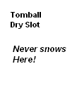
Re: Texas winter wx thread (2009-2010)
For instance, this is something wise. San Angelo putting up something stating such.

0 likes
The above post and any post by Ntxw is NOT an official forecast and should not be used as such. It is just the opinion of the poster and may or may not be backed by sound meteorological data. It is NOT endorsed by any professional institution including Storm2k. For official information, please refer to NWS products.
Help support Storm2K!
Help support Storm2K!
-
msstateguy83
-
msstateguy83
-
msstateguy83
Who is online
Users browsing this forum: No registered users and 164 guests