

850 - 2C, < 540 thickness...boundary layer temps are kinda warm though...going to be close.
Moderator: S2k Moderators
 The posts in this forum are NOT official forecast and should not be used as such. They are just the opinion of the poster and may or may not be backed by sound meteorological data. They are NOT endorsed by any professional institution or STORM2K.


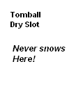
Portastorm wrote:Nope. Winter's over south of a San Angelo-Waco-College Station line.
Or at least that is what Lucy is telling me!
txagwxman wrote:Portastorm wrote:Nope. Winter's over south of a San Angelo-Waco-College Station line.
Or at least that is what Lucy is telling me!
Baloney...it snowed in Houston in March 1963---the day my parents moved to Canada.
wxman57 wrote:GFS doesn't see anything significant for Wichita Falls or the Dallas-Ft. Worth Metroplex. The UKMET looks "iffy" as well. The precip seems to end before temps get cold enough based on flipping through the maps. Euro has a more significant storm. Big question is what airmass will be overhead as it moves by? GFS did fairly well with yesterday's system.
Looking at the meteograms, below, I see nothing significant. Just quite "warm" air in both places. Sounding for Wichita Falls (GFS-based) does show sub-freezing air about 2000 feet above the warmer layer at the surface, but VERY LITTLE moisture once the air cools enough for snow aloft.
Wichita Falls:
Dallas-Ft. Worth:
srainhoutx wrote:txagwxman wrote:Portastorm wrote:Nope. Winter's over south of a San Angelo-Waco-College Station line.
Or at least that is what Lucy is telling me!
Baloney...it snowed in Houston in March 1963---the day my parents moved to Canada.
I have pictures at my Mom's house to prove it too.
jasons wrote:Texas Snowman wrote:msstateguy83 wrote:yes.. another thing this is well known for ANYONE into meteorology and iam NOT trying to be a basher
of the ft worth nws office BUT you do not have to have a REAL SOLID COLD AIRMASS in place
for snow YES you have to have a source of cold air and cold air there but it does not have to be
like other cold masses we have had prev this winter. i can remember some of the heaviest
snowfalls being w/border line temps and at that point it does not matter if the temp is 32, 33
or 23 if its coming down hard enough it will stick!
Remember, this is the same office that NEVER got the forecast right on the Snowmageddon event. So I wouldn't put much stock into what they're saying at this point in time...
I would give them some credit though. Yes, they missed the Snowmageddon, as did most any public-facing forecaster. As some of the TV mets said in the DMN article a few pages back, you just don't go on-camera and forecast the biggest snowfall in history - especially when none of the models supported it.
Most of the time, they do a great job, as do our pro-mets, and I would trust their guidance.
There doesn't appear to be anything like that in the cards with these next two systems.
To be quite blunt, if some are forecasting a 'major event' or 'massive system' for the Metroplex out of this, based on what we see now, I would quickly write it off as hype. There is just nothing credible that points to that right now.

Ntxw wrote::uarrow: Euro maintains that storm as a cutoff low throughout. Pointing out snow all the way possibly down to Houston area.


txagwxman wrote:Ntxw wrote::uarrow: Euro maintains that storm as a cutoff low throughout. Pointing out snow all the way possibly down to Houston area.
Cold core lows could do the trick for N. Houston...I have seen it snow in Atlanta in April underneath a cold core low.
msstateguy83 wrote:we could be talking BIG time storm then nwtx??!
Users browsing this forum: No registered users and 223 guests


