The posts in this forum are NOT official forecast and should not be used as such. They are just the opinion of the poster and may or may not be backed by sound meteorological data. They are NOT endorsed by any professional institution or

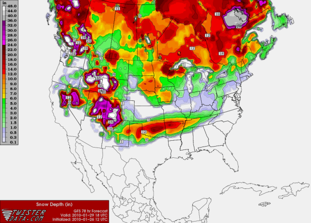
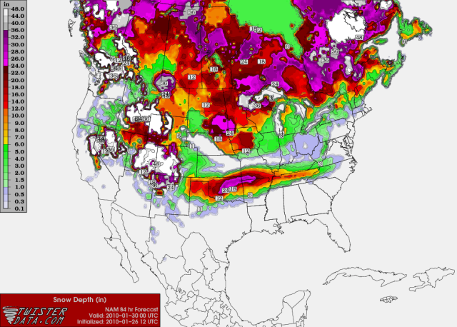
Extremeweatherguy wrote:The GFS is just now running, so no map for that quite yet. The NAM should have a new map up by about now, but I am not 100% sure where to get one like msstateguy83 posted earlier (which looked like this: http://wxcaster4.com/nam/CONUS1_MESO-ET ... A_84HR.gif). Hopefully he'll post one again later.BlueIce wrote:Extremeweatherguy wrote:The 00z NAM is impressive to say the least. It drops a good 3-4" of liquid equivalent precipitation across central Oklahoma Thursday into Friday, with 1.5-2.0" of that falling in the form of some kind of wintry precipitation type over Oklahoma City. Either way you slice it (freezing rain..sleet..or snow), IF the 00z NAM verifies, this would be a major storm.
sounds like you may have not missed your oppurtunity to see record snow in Oklahoma city. Is there an updated snow totals maps from the gfs. I don't have any good links for that.
I would like to see another one of those maps as well