WOW!!
If tonight's 00z GFS run plays out, then we will be experiencing a major winter storm across Oklahoma in less than a week!
This is definitely the most impressive run yet..
SURFACE
126hrs - http://www.nco.ncep.noaa.gov/pmb/nwprod ... n_126l.gif
132hrs - http://www.nco.ncep.noaa.gov/pmb/nwprod ... n_132l.gif
138hrs - http://www.nco.ncep.noaa.gov/pmb/nwprod ... n_138l.gif
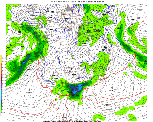
144hrs - http://www.nco.ncep.noaa.gov/pmb/nwprod ... n_144l.gif
150hrs - http://www.nco.ncep.noaa.gov/pmb/nwprod ... n_150l.gif
156hrs - http://www.nco.ncep.noaa.gov/pmb/nwprod ... n_156l.gif
850MB
126hrs - http://www.nco.ncep.noaa.gov/pmb/nwprod ... p_126l.gif
132hrs - http://www.nco.ncep.noaa.gov/pmb/nwprod ... p_132l.gif
138hrs - http://www.nco.ncep.noaa.gov/pmb/nwprod ... p_138l.gif
144hrs - http://www.nco.ncep.noaa.gov/pmb/nwprod ... p_144l.gif
150hrs - http://www.nco.ncep.noaa.gov/pmb/nwprod ... p_150l.gif
156hrs - http://www.nco.ncep.noaa.gov/pmb/nwprod ... p_156l.gif
ALSO, here is a look at the latest 00z GFS MOS numbers for OKC later this week...
WEDNESDAY
Daytime High: 48F
Overnight Low: 34F
-52% chance of precip-
THURSDAY
Daytime High: 37F
Overnight Low: 20F
-52% chance of precip-
FRIDAY
Daytime High: 37F
Overnight Low: 19F
-29% chance of precip-
Southern Plains winter wx thread (2009-2010)
Moderator: S2k Moderators
Forum rules
 The posts in this forum are NOT official forecast and should not be used as such. They are just the opinion of the poster and may or may not be backed by sound meteorological data. They are NOT endorsed by any professional institution or STORM2K.

The posts in this forum are NOT official forecast and should not be used as such. They are just the opinion of the poster and may or may not be backed by sound meteorological data. They are NOT endorsed by any professional institution or STORM2K.
-
Extremeweatherguy

- Category 5

- Posts: 11095
- Joined: Mon Oct 10, 2005 8:13 pm
- Location: Florida

0 likes
The above post and any post by Ntxw is NOT an official forecast and should not be used as such. It is just the opinion of the poster and may or may not be backed by sound meteorological data. It is NOT endorsed by any professional institution including Storm2k. For official information, please refer to NWS products.
Help support Storm2K!
-
Extremeweatherguy
- Category 5
- Posts: 11095
- Joined: Mon Oct 10, 2005 8:13 pm
- Location: Florida
The 12z GFS continues to advertise a winter storm threat next week, and now that we are within the 114-138 hour range, it is becoming more and more likely to actually play out.
UPDATE: 12z ECMWF seems to be onboard now too.
UPDATE: 12z ECMWF seems to be onboard now too.
Last edited by Extremeweatherguy on Sat Jan 23, 2010 1:35 pm, edited 1 time in total.
0 likes
With a few differences the setup looks similar to the Christmas storm (by no means am I saying anyone is going to see that kind of record snow) but nonetheless interesting...
0 likes
The above post and any post by Ntxw is NOT an official forecast and should not be used as such. It is just the opinion of the poster and may or may not be backed by sound meteorological data. It is NOT endorsed by any professional institution including Storm2k. For official information, please refer to NWS products.
Help support Storm2K!
Help support Storm2K!
-
vbhoutex

- Storm2k Executive

- Posts: 29150
- Age: 74
- Joined: Wed Oct 09, 2002 11:31 pm
- Location: Cypress, TX
- Contact:
Re: Southern Plains winter wx thread (2009-2010)
0 likes
Skywarn, C.E.R.T.
Please click below to donate to STORM2K to help with the expenses of keeping the site going:

Please click below to donate to STORM2K to help with the expenses of keeping the site going:
-
Extremeweatherguy
- Category 5
- Posts: 11095
- Joined: Mon Oct 10, 2005 8:13 pm
- Location: Florida
The NWS in Norman is still not very bullish on this system just yet. The wording in their afternoon AFD makes it seem like this will be a minor storm with snow mainly in northern Oklahoma and only moderately cold air. If the models are correct though, then this will not be the case. The GFS, ECMWF and CMC all hint at a much more widespread winter event with solidly below normal cold air moving in behind. It will be interesting to see how the NWS wording changes in the days to come if the models continue to stick to their guns.
AREA FORECAST DISCUSSION
NATIONAL WEATHER SERVICE NORMAN OK
106 PM CST SAT JAN 23 2010
.DISCUSSION...
LIGHT RAIN MAY LINGER UNTIL MID-EVENING WHEN IT SHOULD CLEAR EAST
OF SOUTHEAST OKLAHOMA; HOWEVER, OTHER SHOWERS AND MAYBE A FEW
THUNDERSTORMS ARE POSSIBLE FROM WICHITA FALLS TOWARDS ARDMORE AND
ADA EARLY THIS EVENING WHEN COOLER AIR ALOFT IN THE BASE OF AN
UPPER TROUGH MOVES ACROSS THIS AREA. A WEAK COLD FRONT WILL BRING
LITTLE CHANGE TO TEMPERATURES LATER TODAY AND SUNDAY; IN FACT THE
ABOVE NORMAL TEMPERATURES WILL PERSIST UNTIL TUESDAY. THE NEXT
UPPER LEVEL TROUGH IS EXPECTED TO ROTATE QUICKLY FROM NORTHWEST TO
SOUTHEAST ACROSS OKLAHOMA MONDAY. THIS WILL BRING A WEAK COLD
FRONT TUESDAY. A STRONGER SYSTEM ON WEDNESDAY, THIS ONE
APPROACHING FROM THE SOUTHWEST WILL BRING THE BEST CHANCE FOR
WIDESPREAD PRECIPITATION. WITH ITS ASSOCIATED COLD FRONT, IT
BRINGS A CHANCE FOR SNOW IN NORTHERN OKLAHOMA AND RAIN SOUTH. THIS
COLD FRONT WILL BE ASSOCIATED WITH A CONTINENTAL POLAR AIR MASS AND
WINDY CONDITIONS THURSDAY, ALTHOUGH TEMPERATURES ARE FORECAST TO
BE NEAR OR ONLY SLIGHTLY BELOW MID-WINTER NORMALS.
0 likes
0 likes
The above post and any post by Ntxw is NOT an official forecast and should not be used as such. It is just the opinion of the poster and may or may not be backed by sound meteorological data. It is NOT endorsed by any professional institution including Storm2k. For official information, please refer to NWS products.
Help support Storm2K!
Help support Storm2K!
-
Extremeweatherguy
- Category 5
- Posts: 11095
- Joined: Mon Oct 10, 2005 8:13 pm
- Location: Florida
The 00z GFS has shifted a little further south with next weeks storm, but still looks to show a possible big-ticket event for portions of Oklahoma and perhaps even north Texas.
If this run played out 100%, then Oklahoma City would experience over 0.50" of liquid equivalent precipitation while surface temperatures were near/below freezing. If that fell as freezing rain it would mean a major ice storm, and if it fell as snow it would mean 5+ inches. Either way you slice it, this would definitely become a significant event for the region if tonight's model run played out exactly.

UPDATE: 00z ECMWF and CMC also continue to look quite impressive.
If this run played out 100%, then Oklahoma City would experience over 0.50" of liquid equivalent precipitation while surface temperatures were near/below freezing. If that fell as freezing rain it would mean a major ice storm, and if it fell as snow it would mean 5+ inches. Either way you slice it, this would definitely become a significant event for the region if tonight's model run played out exactly.
UPDATE: 00z ECMWF and CMC also continue to look quite impressive.
0 likes
Re: Southern Plains winter wx thread (2009-2010)
0z EC is still trending colder. A lot of details to work out in the days to come. Has potential to be a big ticket item for the southern plains.
http://www.meteo.psu.edu/ewall/ECMWF_0z/ecmwfloop.html
Edit: The Canadian is also advertising another similar storm behind the first one.
http://www.meteo.psu.edu/ewall/CMC_0z/cmcloop.html
http://www.meteo.psu.edu/ewall/ECMWF_0z/ecmwfloop.html
Edit: The Canadian is also advertising another similar storm behind the first one.
http://www.meteo.psu.edu/ewall/CMC_0z/cmcloop.html
0 likes
The above post and any post by Ntxw is NOT an official forecast and should not be used as such. It is just the opinion of the poster and may or may not be backed by sound meteorological data. It is NOT endorsed by any professional institution including Storm2k. For official information, please refer to NWS products.
Help support Storm2K!
Help support Storm2K!
-
Extremeweatherguy
- Category 5
- Posts: 11095
- Joined: Mon Oct 10, 2005 8:13 pm
- Location: Florida
The ECMWF looks to be showing that second system too:
http://www.ecmwf.int/products/forecasts ... !chart.gif
http://www.ecmwf.int/products/forecasts ... !chart.gif
http://www.ecmwf.int/products/forecasts ... !chart.gif
http://www.ecmwf.int/products/forecasts ... !chart.gif
As well as the GFS:
http://www.nco.ncep.noaa.gov/pmb/nwprod ... p_204l.gif
http://www.nco.ncep.noaa.gov/pmb/nwprod ... p_216l.gif
http://www.nco.ncep.noaa.gov/pmb/nwprod ... p_228l.gif
It would be crazy if we saw two back-to-back winter storms within just a few days of each other!
http://www.ecmwf.int/products/forecasts ... !chart.gif
http://www.ecmwf.int/products/forecasts ... !chart.gif
http://www.ecmwf.int/products/forecasts ... !chart.gif
http://www.ecmwf.int/products/forecasts ... !chart.gif
As well as the GFS:
http://www.nco.ncep.noaa.gov/pmb/nwprod ... p_204l.gif
http://www.nco.ncep.noaa.gov/pmb/nwprod ... p_216l.gif
http://www.nco.ncep.noaa.gov/pmb/nwprod ... p_228l.gif
It would be crazy if we saw two back-to-back winter storms within just a few days of each other!
0 likes
-
Extremeweatherguy
- Category 5
- Posts: 11095
- Joined: Mon Oct 10, 2005 8:13 pm
- Location: Florida
I am just stunned at how much better this is looking with each new model run. The latest 12z GFS has ramped up even more, and now shows an event that could possibly rival what happened back on December 24th! I don't know if the winds would be quite the same, but precipitation amounts might be. The latest run is showing 1.43" of liquid equivalent precipitation falling on OKC in an environment capable of winter precipitation types. If that were to all fall as snow, then we would be talking about 14+ inches, and even if only half of that fell as snow then we would still be looking at 7+ inches! Could you imagine if OKC were to see another storm of this magnitude within the same winter season!? That would be crazy! Of course, we are still a few days out and the models are sure to change a little bit between now and then, so this is by no means set in stone just yet. Stay tuned!
BTW: This run of the GFS also brings some crazy cold air to the region after the winter weather. It is showing a low of -1.5F in OKC on Saturday morning!
0 likes
Re: Southern Plains winter wx thread (2009-2010)
0 likes
The above post and any post by Ntxw is NOT an official forecast and should not be used as such. It is just the opinion of the poster and may or may not be backed by sound meteorological data. It is NOT endorsed by any professional institution including Storm2k. For official information, please refer to NWS products.
Help support Storm2K!
Help support Storm2K!

Re: Southern Plains winter wx thread (2009-2010)
Lol I'll be PISSED if southern Oklahoma sees 16 inches of snow, and we see nothing.
0 likes
-
Portastorm

- Storm2k Moderator

- Posts: 9955
- Age: 63
- Joined: Fri Jul 11, 2003 9:16 am
- Location: Round Rock, TX
- Contact:
Re: Southern Plains winter wx thread (2009-2010)
Hey EWG ... good luck to ya! I know it probably just about killed you to watch the Christmas Eve blizzard in OKC on your computer instead of out your door!! 
Let's spin up a nice system for you and then send it south to us!
Let's spin up a nice system for you and then send it south to us!
0 likes
-
Extremeweatherguy
- Category 5
- Posts: 11095
- Joined: Mon Oct 10, 2005 8:13 pm
- Location: Florida
Re: Southern Plains winter wx thread (2009-2010)
Thanks portastorm! Hopefully this storm plays out like the models are showing and I can make up for that miss on Christmas Eve. That would be nice.Portastorm wrote:Hey EWG ... good luck to ya! I know it probably just about killed you to watch the Christmas Eve blizzard in OKC on your computer instead of out your door!!
Let's spin up a nice system for you and then send it south to us!
I'll try to send some south to you too. I don't know if i'll be able to make happen with this event, but it might be a different story in the weeks to come.
0 likes
-
Extremeweatherguy
- Category 5
- Posts: 11095
- Joined: Mon Oct 10, 2005 8:13 pm
- Location: Florida
The 18z GFS continues the impressive trend, and is now showing over 1.5" of liquid equivalent precipitation falling while the temperature is near/below freezing! Amazing! It also now shows us getting down to near -4F in Oklahoma City on Saturday morning..which would be the coldest temperature i've ever experienced if that verified (my current personal coldest is -2F)!

0 likes
We'll be getting into the NAM's realm soon which should give a better picture. Colder and colder trends  west and central Oklahoma should prepare so we avoid problems like last time.
0 likes
The above post and any post by Ntxw is NOT an official forecast and should not be used as such. It is just the opinion of the poster and may or may not be backed by sound meteorological data. It is NOT endorsed by any professional institution including Storm2k. For official information, please refer to NWS products.
Help support Storm2K!
Help support Storm2K!
Re: Southern Plains winter wx thread (2009-2010)
Latest snippet out of Tulsa.
AS SURFACE LOW TRACKS OVER NORTH TEXAS ON THURSDAY AND BEGINS TO
DEEPEN...OVERRUNNING PRECIPITATION WILL LIKELY INCREASE IN
COVERAGE WITH THE POTENTIAL FOR SIGNIFICANT ICE/SNOW ACCUMULATIONS
ACROSS MUCH OF THE AREA. PRECIPITATION WILL TRANSITION TO FREEZING
RAIN/SLEET ACROSS NORTHEAST OKLAHOMA/NORTHWEST ARKANSAS THEN
SWITCH TO SLEET THEN SNOW AS 850 MB LOW TRACKS EAST NEAR THE RED
RIVER INTO SOUTHERN ARKANSAS THURSDAY EVENING. IT WILL REMAIN
DIFFICULT TO PIN DOWN THE EXACT TIMING...PRECIP AMOUNTS/TYPES THIS
FAR OUT AND FORECAST WILL CONTINUE TO BE REFINED AS THE EVENT
APPROACHES. DID ADD 4 INCH SNOW TOTAL ACCUMULATIONS ACROSS
NORTHEAST OKLAHOMA AND NORTHWEST ARKANSAS WITH A QUARTER INCH OF
ICE SOUTH OF THE INTERSTATE 44 CORRIDOR AND GENERALLY NORTH OF A
MCALESTER...FORT SMITH LINE. GIVEN THE AMOUNT OF QPF IN THE
MODELS...THESE AMOUNTS COULD BE SIGNIFICANTLY HIGHER IN SOME AREAS
INCLUDING SLEET ACCUMULATIONS. SNOW SHOULD BEGIN TO END THURSDAY
NIGHT WITH ONLY A FEW FLURRIES POSSIBLE ACROSS NORTHWEST ARKANSAS
DURING THE DAY FRIDAY.
0 likes
The above post and any post by Ntxw is NOT an official forecast and should not be used as such. It is just the opinion of the poster and may or may not be backed by sound meteorological data. It is NOT endorsed by any professional institution including Storm2k. For official information, please refer to NWS products.
Help support Storm2K!
Help support Storm2K!
-
BlueIce
- S2K Supporter

- Posts: 194
- Age: 37
- Joined: Mon Sep 01, 2008 10:05 pm
- Location: Oklahoma City, Oklahoma
Re: Southern Plains winter wx thread (2009-2010)
I am ready for round two!! Bring on blizzard 2010 haha
0 likes
The models have been considerably further south with this storm this far out compared to the similar setup of the Christmas eve storm. There's also blustery winds associated with the cold front and jet again similar to the predecessor. Personally I think areas just to the south of OKC will be under the gun for heaviest precip.
0 likes
The above post and any post by Ntxw is NOT an official forecast and should not be used as such. It is just the opinion of the poster and may or may not be backed by sound meteorological data. It is NOT endorsed by any professional institution including Storm2k. For official information, please refer to NWS products.
Help support Storm2K!
Help support Storm2K!
Who is online
Users browsing this forum: No registered users and 64 guests