Derek Ortt wrote:SFMR winds look suspect. I do not believe those cane winds are valid
Agree.
Moderator: S2k Moderators


Derek Ortt wrote:SFMR winds look suspect. I do not believe those cane winds are valid

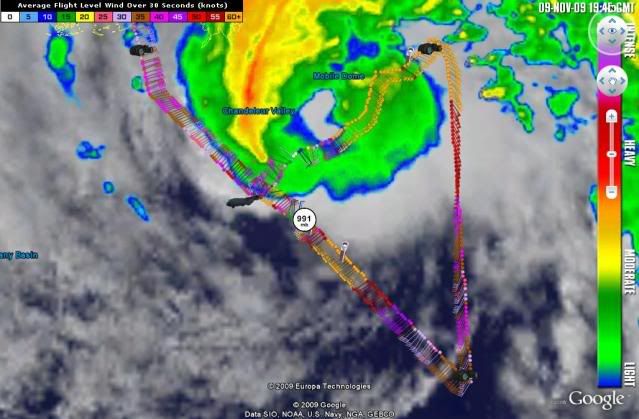
wxman57 wrote:jconsor wrote:A ship at 28.0N 88.1W (near the NW eyewall) reported ESE winds of 58 mph and a pressure of 29.41" (996 mb) at 12 PM CST (18z).
http://www.wunderground.com/weatherstat ... ?ID=MV7HC8
That wind would be blowing away from the center. Certainly suspect. I see the Shell Mars platform near 28.2N/89.2N reporting 55kt winds. But that instrument is several hundred feet above the surface (maybe over 300 feet up).

jconsor wrote:Notice the eye temperature is 22C and the temp/dewpoint spreads show very moist air around the storm. Ida is still very much a tropical entity.

Users browsing this forum: No registered users and 43 guests