drdavisjr wrote:Ok, I see this now. Thanks for pointing it out.
You're welcome!
Since we're already getting a much clearer picture of things to come, I wonder whether tomorrow's forecast would be much stable and reliable than today?
Moderator: S2k Moderators

drdavisjr wrote:Ok, I see this now. Thanks for pointing it out.

JTE50 wrote:metenthusiast wrote:drdavisjr wrote:
Interesting, they have the ridge weakening on day 4 to allow for a west nothwest movement and miss Metro Manila.
Good evening guys! (Good morning to our friends in the west!). I think it wouldn't matter much whether it would hit Metro Manila directly or not. Based on what I read, this system would intensify into a 115-knot storm before it hits land due to the favorable condition the Philippine Sea would give it. By the time it makes it westward march across the island of Luzon, it has already gained strength that I'm sure won't dissipate that quickly. And the rest I'm leaving to your imagination.
No. I think it's not a question of where and when exactly it would hit anymore. The real question would be as to how we would weather it out.
I agree, it's looking more and more likely a Philippine hit - especially if it's moves south of west. The only good part about the track is it won't be crawling along and dumping a lot more rain - well, that's the way it looks right now. I suppose it's impossible to get to the eastern coast with that mountain range in the way correct?

JTE50 wrote:metenthusiast wrote:drdavisjr wrote:
Interesting, they have the ridge weakening on day 4 to allow for a west nothwest movement and miss Metro Manila.
Good evening guys! (Good morning to our friends in the west!
No. I think it's not a question of where and when exactly it would hit anymore. The real question would be as to how we would weather it out.
I agree, it's looking more and more likely a Philippine hit - especially if it's moves south of west. The only good part about the track is it won't be crawling along and dumping a lot more rain - well, that's the way it looks right now. I suppose it's impossible to get to the eastern coast with that mountain range in the way correct?
drdavisjr wrote:
What about Polillo Island?

Frank2 wrote:The WPAC is having an Atlantic basin 2005 type of season - very bad...
Frank


dexterlabio wrote:i will consider the forecast track tomorrow. more or less, they are already certain about mirinae's movement by tomorrow, especially that it is moving fast and nothing can cause it to slow down as of now.
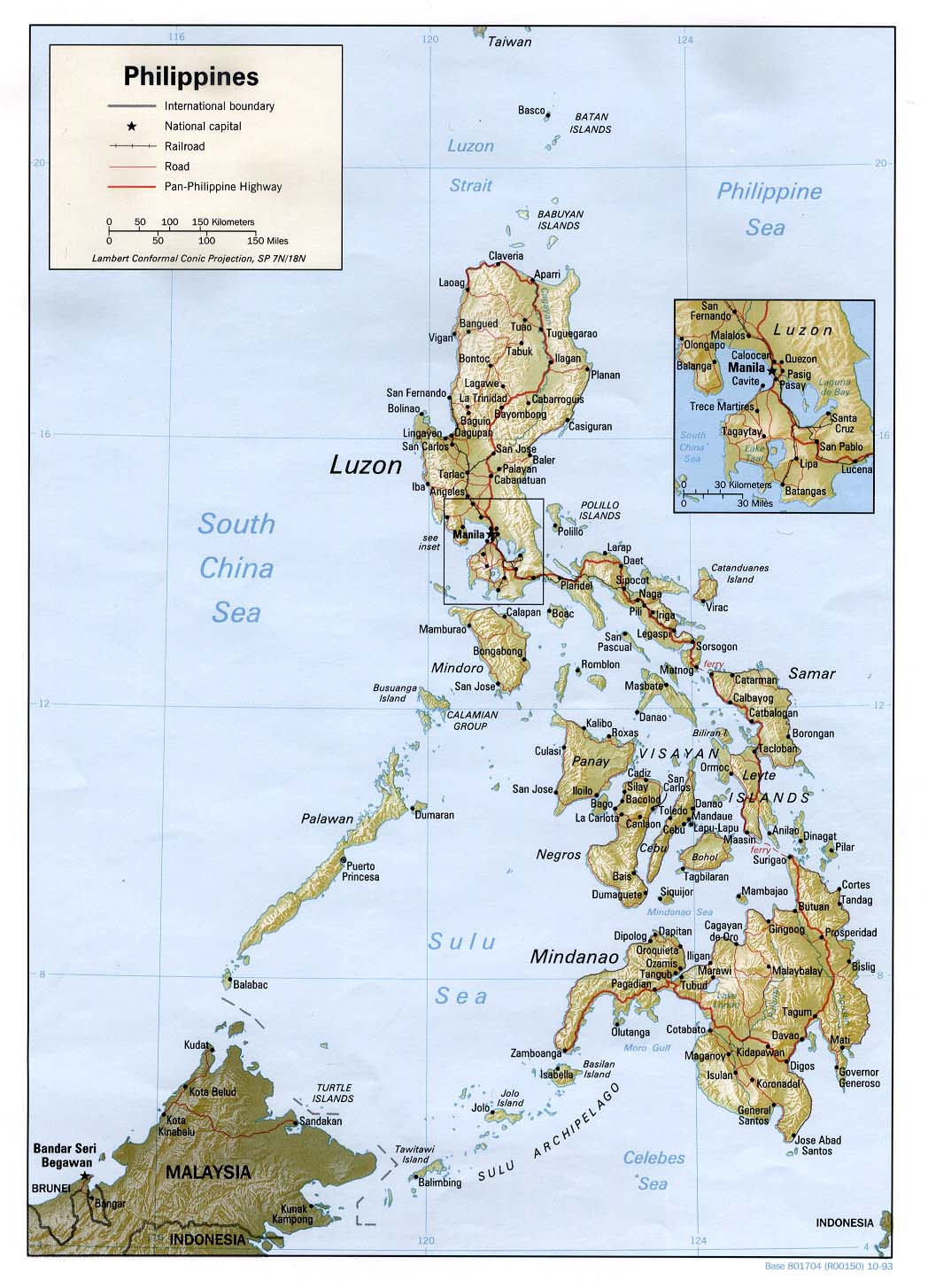
cycloneye wrote:For those members who dont know where Manila and the other cities are located,here is a great graphic.
Click symbol at the upper left to have a big closeup.
metenthusiast wrote:cycloneye wrote:For those members who dont know where Manila and the other cities are located,here is a great graphic.
Click symbol at the upper left to have a big closeup.
Very nice cycloneye, and thanks for posting this. Based on forecast models, it would enter in the Aurora Province area (Baler, Casiguran region) and traverse westward.

dexterlabio wrote:^ Hahabut jtwc still reports a 45kts intensity. for a system to have an eye-like feature, it has to reach almost typhoon intensity, maybe 55kts or more. Maybe it still appears to be weaker because of its size and soon-to-be-develop circulation.
ozonepete wrote:dexterlabio wrote:^ Haha
When a storm is developing rapidly, as this now appears to be doing, the agencies can't keep up with it sometimes. Remember JTWC reports every 6 hours with intermediate every 3 hours. A eye can form within an hour or two in some cases. So it could be that Mirinae got to 55 knots or even higher since the JTWC issued that last advisory.
Users browsing this forum: No registered users and 93 guests


