

Anyone ordered a bigger eye?!?!?
Moderator: S2k Moderators

HURAKAN wrote:
Anyone ordered a bigger eye?!?!?
starlight wrote:Hello, I'm new here. I am a weather nerd, but this time I am very worried as I have relative living near Tokyo. I am almost experiencing panic attacks here. What preparation should be done? I'm not handling this very well. It is a very big system to my mind
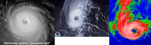
ozonepete wrote::uarrow:
Yeah, I'm really suspecting we may get an annular tropical cyclone now...
Macrocane wrote:ozonepete wrote::uarrow:
Yeah, I'm really suspecting we may get an annular tropical cyclone now...
In that case it won't weak that fast when it reaches Japan, Vamco earlier this year became annular and was a rather strong typhoon despite of the cool waters and increasing wind shear.
Derek Ortt wrote:where is the mysterious shear that JTWC mentioned?
starlight wrote:Hello Infdidoll, I can sure share your fear. I am not in Japan, but a dear relative is. What are you doing to prepare?


ozonepete wrote:Derek Ortt wrote:where is the mysterious shear that JTWC mentioned?
lol they've been saying some "interesting" things lately. Are you talking about this one (in red), or did I miss something?
WDPN34 PGTW 051500
MSGID/GENADMIN/NAVMARFCSTCEN PEARL HARBOR HI/JTWC//
SUBJ/PROGNOSTIC REASONING FOR SUPER TYPHOON 20W (MELOR) WARNING NR 26//
RMKS/
1. FOR METEOROLOGISTS. ... skipped some stuff here...
B. STY 20W WILL CONTINUE TO TRACK ALONG THE SOUTHWESTERN
PERIPHERY OF THE SUBTROPICAL STEERING RIDGE BEFORE ENCOUNTERING
STRONG UPPER LEVEL WESTERLIES ASSOCIATED WITH A DEEP UPPER LEVEL
TROUGH NEAR OKINAWA. THE SYSTEM IS POSITIONED TO VENT AHEAD OF
THIS FEATURE AND MAY ACCOUNT FOR SHORT TERM INTENSIFICATION.
HOWEVER, SHORTLY THEREAFTER, THE TYPHOON WILL BEGIN TO WEAKEN
DUE TO EXCESSIVE VERTICAL WIND SHEAR AND DECREASED OCEAN HEAT
CONTENT. THE PREVIOUSLY MENTIONED TROUGH WILL ALSO ERODE THE
STEERING RIDGE AND INITIATE RECURVATURE INTO THE MID-LATITUDES.
INTERACTION WITH A STRONG BAROCLINIC BOUNDARY (NEAR 30N) WILL
PROMPT EXTRATROPICAL TRANSITION, JUST TO THE SOUTH OF TOKYO.
THE FORECAST REMAINS CONSISTENT WITH THE PREVIOUS FORECASTS AND
CALLS FOR PASSAGE OF MELOR AS A TRANSITIONING CYCLONE ALONG THE
EAST COAST OF JAPAN. THE TYPHOON WILL BE FULLY EXTRATROPICAL BY
TAU 72.//

Users browsing this forum: No registered users and 29 guests


