

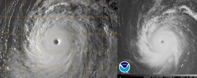
CrazyC83 wrote:Macrocane wrote:IMO it looks better than Choi-wan in visible imagery, very symmetrical and with excellent outflow in all quadrants, certainly a beautiful storm.
http://www.nrlmry.navy.mil/tc-bin/tc_ho ... egreeticks - No signs of an ERC either...definitely looks even better than Choi-wan did. Strongest storm in the world this year probably.
No, Super Typhoon Choi-wan on September 16 at 0730z looked better than what Melor looks like currently.
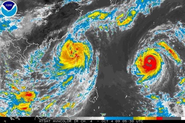
The floater imagery page isn't loading right now on the NHC's site. I want some of these Melor images other then from the NRL and Typhoon2000 websites.


