ATL: TROPICAL LOW ex-FRED (ex-07L)

Moderator: S2k Moderators

Message
Author
User avatar
HURAKAN
Professional-Met
Professional-Met
Posts: 46086
Age: 38
Joined: Thu May 20, 2004 4:34 pm
Location: Key West, FL
Contact:

Re: ATL: TROPICAL LOW ex-FRED (ex-07L)

#1661 Postby HURAKAN » Mon Sep 21, 2009 9:35 am

Code: Select all

2009 Storms
All
   
Active
   
Year

Atlantic

East Pacific

Central Pacific

West Pacific

Indian Ocean

Southern Hem.
Season: 10
91S.INVEST

The entire northern hemisphere is dead at the moment.
0 likes   

Aric Dunn
Category 5
Category 5
Posts: 21238
Age: 42
Joined: Sun Sep 19, 2004 9:58 pm
Location: Ready for the Chase.
Contact:

Re: ATL: TROPICAL LOW ex-FRED (ex-07L)

#1662 Postby Aric Dunn » Mon Sep 21, 2009 9:39 am

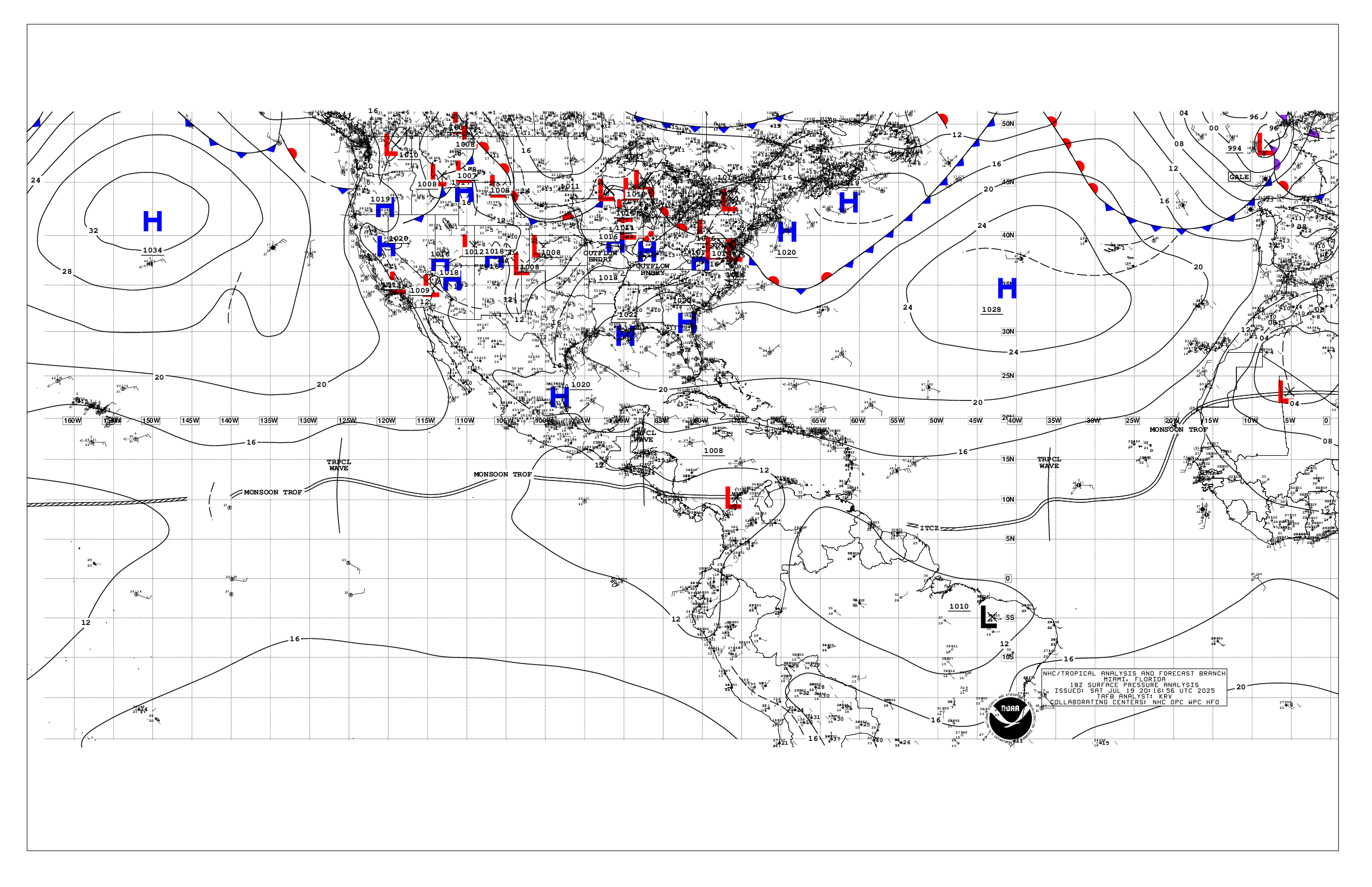
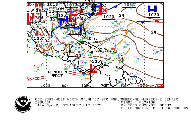
latest surface analysis ..
1017 Low at 30N and about 73 - 74 W

Image

Image
0 likes   

User avatar
HURAKAN
Professional-Met
Professional-Met
Posts: 46086
Age: 38
Joined: Thu May 20, 2004 4:34 pm
Location: Key West, FL
Contact:

#1663 Postby HURAKAN » Mon Sep 21, 2009 9:45 am

:uarrow: If that a "low pressure," then it has serious pressure problem!!! :lol: :lol: :lol: :lol:
0 likes   

tolakram
Admin
Admin
Posts: 20009
Age: 62
Joined: Sun Aug 27, 2006 8:23 pm
Location: Florence, KY (name is Mark)

Re: ATL: TROPICAL LOW ex-FRED (ex-07L)

#1664 Postby tolakram » Mon Sep 21, 2009 9:46 am

Almost looks like there's another upper level feature near Fred.

Image

I think we're seeing another temporary blow up.
0 likes   

Aric Dunn
Category 5
Category 5
Posts: 21238
Age: 42
Joined: Sun Sep 19, 2004 9:58 pm
Location: Ready for the Chase.
Contact:

Re:

#1665 Postby Aric Dunn » Mon Sep 21, 2009 9:48 am

HURAKAN wrote::uarrow: If that a "low pressure," then it has serious pressure problem!!! :lol: :lol: :lol: :lol:


hehe.. that sounds funny.. lol

but its all about background pressure. i had seen TD's with 1016mb before..
0 likes   

jaxfladude
Category 5
Category 5
Posts: 1249
Joined: Wed Aug 24, 2005 9:36 pm
Location: Jacksonville, Fla

#1666 Postby jaxfladude » Mon Sep 21, 2009 9:50 am

:uarrow:
WE WANT(Tropical Cyclones and Pesky Invest)RAID!
0 likes   

User avatar
storms NC
Tropical Storm
Tropical Storm
Posts: 247
Age: 69
Joined: Tue Sep 14, 2004 2:41 pm
Location: Coast of NC & southwest coast of Fla

#1667 Postby storms NC » Mon Sep 21, 2009 9:50 am

Well If it wasn't to late in the season I would say when the Pacific slows down the
Atlantic picks up. But maybe to late now.

See what this thing will do this X fred. Don't think it would be more than a rain maker to where ever it goes. More like SC-NC line then pushed back out to sea.
Last edited by storms NC on Mon Sep 21, 2009 9:53 am, edited 1 time in total.
0 likes   

Aric Dunn
Category 5
Category 5
Posts: 21238
Age: 42
Joined: Sun Sep 19, 2004 9:58 pm
Location: Ready for the Chase.
Contact:

Re: ATL: TROPICAL LOW ex-FRED (ex-07L)

#1668 Postby Aric Dunn » Mon Sep 21, 2009 9:50 am

tolakram wrote:Almost looks like there's another upper level feature near Fred.

Image

I think we're seeing another temporary blow up.


its possible .. but that little feature is one of the reason the shear is dropping fast and a small upper ridge is developing.
as that feature drops south a upper high will build in north of it.
0 likes   

User avatar
wxman57
Moderator-Pro Met
Moderator-Pro Met
Posts: 22978
Age: 67
Joined: Sat Jun 21, 2003 8:06 pm
Location: Houston, TX (southwest)

Re: ATL: TROPICAL LOW ex-FRED (ex-07L)

#1669 Postby wxman57 » Mon Sep 21, 2009 9:50 am

Air Force Met wrote:
I would put the center of the broad low near 30/74. There is low level inflow headed ENE at 29/74. I would not call it way NW of the convection as the westerly inflow is under the cirrus shield. Looks like an elongated e-w low with the eastern part of the low being near the convection.


But I also see low cloud elements moving WNW well to the NW of the convection. Could be a very large, weak, elliptical LLC about 150 miles across with the the southeast lobe near 30N/74.5W.
0 likes   

jaxfladude
Category 5
Category 5
Posts: 1249
Joined: Wed Aug 24, 2005 9:36 pm
Location: Jacksonville, Fla

Re: ATL: TROPICAL LOW ex-FRED (ex-07L)

#1670 Postby jaxfladude » Mon Sep 21, 2009 9:51 am

HURAKAN wrote:

Code: Select all

2009 Storms
All
   
Active
   
Year

Atlantic

East Pacific

Central Pacific

West Pacific

Indian Ocean

Southern Hem.
Season: 10
91S.INVEST

The entire northern hemisphere is dead at the moment.


Good!!!
0 likes   

User avatar
Emmett_Brown
Category 5
Category 5
Posts: 1432
Joined: Wed Aug 24, 2005 9:10 pm
Location: Sarasota FL

Re: ATL: TROPICAL LOW ex-FRED (ex-07L)

#1671 Postby Emmett_Brown » Mon Sep 21, 2009 9:51 am

tolakram wrote:Almost looks like there's another upper level feature near Fred.

Image

I think we're seeing another temporary blow up.


This small ULL may be what helps Fred to develop. Appears to be aiding outflow, and sheltering him from shear.
0 likes   

Aric Dunn
Category 5
Category 5
Posts: 21238
Age: 42
Joined: Sun Sep 19, 2004 9:58 pm
Location: Ready for the Chase.
Contact:

Re:

#1672 Postby Aric Dunn » Mon Sep 21, 2009 9:51 am

jaxfladude wrote::uarrow:
WE WANT(Tropical Cyclones and Pesky Invest)RAID!


hehe .. i want to go play in the rain .. lol and fly a kite.. :P
0 likes   

User avatar
Emmett_Brown
Category 5
Category 5
Posts: 1432
Joined: Wed Aug 24, 2005 9:10 pm
Location: Sarasota FL

Re: Re:

#1673 Postby Emmett_Brown » Mon Sep 21, 2009 9:53 am

Aric Dunn wrote:
HURAKAN wrote::uarrow: If that a "low pressure," then it has serious pressure problem!!! :lol: :lol: :lol: :lol:


hehe.. that sounds funny.. lol

but its all about background pressure. i had seen TD's with 1016mb before..


If memory serves, Andrew was a 1016 mb TS just before he exploded (under great conditions)
0 likes   

User avatar
HURAKAN
Professional-Met
Professional-Met
Posts: 46086
Age: 38
Joined: Thu May 20, 2004 4:34 pm
Location: Key West, FL
Contact:

Re: Re:

#1674 Postby HURAKAN » Mon Sep 21, 2009 9:53 am

Aric Dunn wrote:but its all about background pressure. i had seen TD's with 1016mb before..


I know. I remember Josephine in 2002 had a very high pressure as a depression. But I was just making fun of the fact that the barrier between low and high pressure is 1013.25 mb. To have a low at 1017 mb is kind of ironic!!!

Josephine 2002:
REPEATING THE 5 PM EDT POSITION...33.5 N... 52.7 W. MOVEMENT
TOWARD...NORTH NEAR 8 MPH. MAXIMUM SUSTAINED
WINDS... 35 MPH. MINIMUM CENTRAL PRESSURE...1015 MB.

Danny 2003:
REPEATING THE 11 AM AST POSITION...31.5 N... 54.5 W. MOVEMENT
TOWARD...NORTHWEST NEAR 13 MPH. MAXIMUM SUSTAINED WINDS... 30 MPH.
MINIMUM CENTRAL PRESSURE...1015 MB.
0 likes   

Aric Dunn
Category 5
Category 5
Posts: 21238
Age: 42
Joined: Sun Sep 19, 2004 9:58 pm
Location: Ready for the Chase.
Contact:

Re:

#1675 Postby Aric Dunn » Mon Sep 21, 2009 9:54 am

storms NC wrote:Well If it wasn't to late in the season I would say when the Pacific slows down the
Atlantic picks up. But maybe to late now.

See what this thing will do this X fred. Don't think it would be more than a rain maker to where ever it goes. More like SC-NC line then pushed back out to sea.


you do know we just past the peak of the season 9 days ago right :)
0 likes   

User avatar
HURAKAN
Professional-Met
Professional-Met
Posts: 46086
Age: 38
Joined: Thu May 20, 2004 4:34 pm
Location: Key West, FL
Contact:

Re: Re:

#1676 Postby HURAKAN » Mon Sep 21, 2009 9:55 am

Emmett_Brown wrote:If memory serves, Andrew was a 1016 mb TS just before he exploded (under great conditions)


In the best track it appears as 1015 mb,

1200 21.7 60.7 1015 40 " "

Link: http://www.nhc.noaa.gov/1992andrew.html
0 likes   

User avatar
Emmett_Brown
Category 5
Category 5
Posts: 1432
Joined: Wed Aug 24, 2005 9:10 pm
Location: Sarasota FL

#1677 Postby Emmett_Brown » Mon Sep 21, 2009 9:57 am

Still maintaining cold tops:

Image
0 likes   

User avatar
ronjon
Category 5
Category 5
Posts: 4822
Joined: Fri Aug 19, 2005 5:17 pm
Location: Hernando Beach, FL

Re: ATL: TROPICAL LOW ex-FRED (ex-07L)

#1678 Postby ronjon » Mon Sep 21, 2009 10:01 am

I'm now starting to wonder if the broad center will tighten up somewhere under the deep convection - shear is practically non-existent and SSTs increase as the system moves west.
0 likes   

User avatar
hurricanetrack
HurricaneTrack.com
HurricaneTrack.com
Posts: 1781
Joined: Tue Dec 02, 2003 10:46 pm
Location: Wilmington, NC
Contact:

#1679 Postby hurricanetrack » Mon Sep 21, 2009 10:04 am

It looks like it has about 48-60 hours tops to get going before very strong northerly shear comes in. Of course, it depends too on where Zombie Fred is. A lot can happen in this time frame, do not kid yourselves in to thinking it does not have time to ramp up. We should all know better than that, not saying this will or has to, but it does have time.

http://www.nco.ncep.noaa.gov/pmb/nwprod ... 0_060l.gif
0 likes   

Aric Dunn
Category 5
Category 5
Posts: 21238
Age: 42
Joined: Sun Sep 19, 2004 9:58 pm
Location: Ready for the Chase.
Contact:

#1680 Postby Aric Dunn » Mon Sep 21, 2009 10:08 am

For some reason I see a little kid with a on and off switch hiding behind something pointing his little finger and laughing at us, as he turns Fred on and off.. lol :double:
0 likes   


Return to “2009”

Who is online

Users browsing this forum: No registered users and 6 guests