ATL: TROPICAL LOW ex-FRED (ex-07L)

Moderator: S2k Moderators

Message
Author
User avatar
deltadog03
Professional-Met
Professional-Met
Posts: 3580
Joined: Tue Jul 05, 2005 6:16 pm
Location: Macon, GA

Re: ATL: TROPICAL LOW ex-FRED (ex-07L) - Computer Models

#1461 Postby deltadog03 » Sat Sep 19, 2009 4:40 pm

12z gfdl and hwrf actually show something. Not great, but better than the last runs.

Image


Image


Image


Image
0 likes   

User avatar
Nimbus
Category 5
Category 5
Posts: 5300
Joined: Mon Jul 19, 2004 10:54 am

#1462 Postby Nimbus » Sat Sep 19, 2009 4:40 pm

The elongated circulation is a bit of a relief since that should mean no real fast development. The convection looks about the same as before dawn, but I gather from all the posts today that ex Fred did not look very healthy much of the day. You wouldn't expect this to open up into just a wave if the convection persists would you?
0 likes   

Shewtinstar
Tropical Low
Tropical Low
Posts: 32
Joined: Wed Aug 26, 2009 10:01 am

#1463 Postby Shewtinstar » Sat Sep 19, 2009 4:41 pm

I think there was a song about Fred. Dizzy, I'm so dizzy my head is spinning.
0 likes   

Aric Dunn
Category 5
Category 5
Posts: 21238
Age: 42
Joined: Sun Sep 19, 2004 9:58 pm
Location: Ready for the Chase.
Contact:

Re:

#1464 Postby Aric Dunn » Sat Sep 19, 2009 4:43 pm

Nimbus wrote:The elongated circulation is a bit of a relief since that should mean no real fast development. The convection looks about the same as before dawn, but I gather from all the posts today that ex Fred did not look very healthy much of the day. You wouldn't expect this to open up into just a wave if the convection persists would you?


yeah it wont open up.. the dynamics are still there at the surface.

and the circ is become more circular again as the trough is finally lifting out.
0 likes   

User avatar
Emmett_Brown
Category 5
Category 5
Posts: 1432
Joined: Wed Aug 24, 2005 9:10 pm
Location: Sarasota FL

Re: ATL: TROPICAL LOW ex-FRED (ex-07L)

#1465 Postby Emmett_Brown » Sat Sep 19, 2009 4:43 pm

Anyone know if they are still running models on Fred?
0 likes   

User avatar
deltadog03
Professional-Met
Professional-Met
Posts: 3580
Joined: Tue Jul 05, 2005 6:16 pm
Location: Macon, GA

#1466 Postby deltadog03 » Sat Sep 19, 2009 4:45 pm

yes...EB i posted the hwrf and gfdl from 12z runs in model thread. I do notice that the gfs is starting to build a weak 300mb upper ridge over the bahamas.
0 likes   

ozonepete
Professional-Met
Professional-Met
Posts: 4743
Joined: Mon Sep 07, 2009 3:23 pm
Location: From Ozone Park, NYC / Now in Brooklyn, NY

Re: Re:

#1467 Postby ozonepete » Sat Sep 19, 2009 4:46 pm

gatorcane wrote:
Aric Dunn wrote:I do have one prediction.. lol once the sun goes down.. a lot of people are going to say there is no llc or anything and its dead .. but please don't start that tell visible comes back as no matter how good you are at analyzing infrared and shortwave you will not be able to tell exactly where if any a llc of such size is at unless its completely naked.. especially with the cloud debris. one more prediction it takes along time for a vorticity to disperse so at the least the vorticity WILL be around for a couple days yet.


I think we'll see a large blow-up of convection tonight again, and I'm a bit surprised we are seeing blow-up during the peak of diurnal minimum. There is also a noticable twist still in the low-levels. I think ex-Fred has more tricks left. Shear will keep decreasing from here on out based on CIMSS shear tendency charts.

Use this link and you will see the very distinct low-level twist here:
http://metofis.rsmas.miami.edu/~dortt/s ... 1_loop.gif


Thanks for that loop, gatorcane. Yeah, you can see it quite easily. The funny part is that the center appears to be between the two "centers" we saw today, roughly 27.5N, 70W. Just the latest trick from Fred... :wink:
0 likes   

User avatar
BigA
Professional-Met
Professional-Met
Posts: 1317
Joined: Sun Jul 24, 2005 10:56 pm

Re: ATL: TROPICAL LOW ex-FRED (ex-07L)

#1468 Postby BigA » Sat Sep 19, 2009 4:47 pm

Aric Dunn wrote:A motion west wsw should occur here very shortly.


Forgive me if you have already explained this, but what factors do you think will cause the above motion? I agree with your assessment of WSW motion, as the models concur with your statement, but what has led you to this conclusion?

Thank you.
0 likes   

User avatar
Blown Away
S2K Supporter
S2K Supporter
Posts: 10145
Joined: Wed May 26, 2004 6:17 am

Re: ATL: TROPICAL LOW ex-FRED (ex-07L)

#1469 Postby Blown Away » Sat Sep 19, 2009 4:51 pm

Amazing almost the same convection formation for the third time, can't kill the cockroach.
0 likes   

User avatar
deltadog03
Professional-Met
Professional-Met
Posts: 3580
Joined: Tue Jul 05, 2005 6:16 pm
Location: Macon, GA

#1470 Postby deltadog03 » Sat Sep 19, 2009 4:54 pm

0 likes   

User avatar
BigA
Professional-Met
Professional-Met
Posts: 1317
Joined: Sun Jul 24, 2005 10:56 pm

Re: ATL: TROPICAL LOW ex-FRED (ex-07L)

#1471 Postby BigA » Sat Sep 19, 2009 4:54 pm

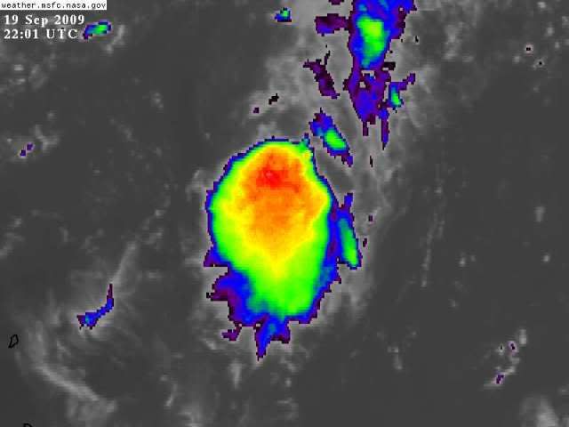
Blown_away wrote:Amazing almost the same convection formation for the third time, can't kill the cockroach.


The reason this time might be different is that it is happening near D-min, and because if the system begins its West/WSW motion as Aric and the models indicate, it will for the first time in over 2000 miles be moving into an area of low shear.
0 likes   

User avatar
HURAKAN
Professional-Met
Professional-Met
Posts: 46086
Age: 38
Joined: Thu May 20, 2004 4:34 pm
Location: Key West, FL
Contact:

#1472 Postby HURAKAN » Sat Sep 19, 2009 4:56 pm

Image

Not much movement today
0 likes   

Aric Dunn
Category 5
Category 5
Posts: 21238
Age: 42
Joined: Sun Sep 19, 2004 9:58 pm
Location: Ready for the Chase.
Contact:

Re: ATL: TROPICAL LOW ex-FRED (ex-07L)

#1473 Postby Aric Dunn » Sat Sep 19, 2009 4:58 pm

BigA wrote:
Aric Dunn wrote:A motion west wsw should occur here very shortly.


Forgive me if you have already explained this, but what factors do you think will cause the above motion? I agree with your assessment of WSW motion, as the models concur with your statement, but what has led you to this conclusion?

Thank you.


one of my other posts explain it. but in general the exiting trough will be replaced by a build ridge to the south of the east coast which is already occurring and last couple hours a westerly motion seems to be taking place. Also the orientation of the ridge and where our system is such that a west to wsw motion will be likely since Fred is on the SE side of the ridge.
0 likes   

Steve H.
Category 5
Category 5
Posts: 2146
Joined: Sat Oct 19, 2002 9:06 am
Location: Palm Bay, Florida

Re: ATL: TROPICAL LOW ex-FRED (ex-07L)

#1474 Postby Steve H. » Sat Sep 19, 2009 5:19 pm

Only issue here being that the ridge is causing shear across central Florida currently if you look at the latest visible. I expect this should abate over the next 24 hours.
0 likes   

User avatar
wxman57
Moderator-Pro Met
Moderator-Pro Met
Posts: 22978
Age: 67
Joined: Sat Jun 21, 2003 8:06 pm
Location: Houston, TX (southwest)

Re: ATL: TROPICAL LOW ex-FRED (ex-07L)

#1475 Postby wxman57 » Sat Sep 19, 2009 5:20 pm

That Raid seems to have opened up and dissipated the LLC of old Fred. A very broad, elongated area of low pressure not. Take a look at a WV loop. The NE shear is about to end, but SW shear is right in its path. Could see the convection shift to the north of the low pressure area tonight.

By the way, we won't have to guess TOO much about an LLC tonight. There are a number of surface obs in and around Fred. Central pressure looks to be about 1015mb.

I'll keep my big can of Raid handy.
0 likes   

User avatar
HURAKAN
Professional-Met
Professional-Met
Posts: 46086
Age: 38
Joined: Thu May 20, 2004 4:34 pm
Location: Key West, FL
Contact:

#1476 Postby HURAKAN » Sat Sep 19, 2009 5:25 pm

Image

Latest
0 likes   

ozonepete
Professional-Met
Professional-Met
Posts: 4743
Joined: Mon Sep 07, 2009 3:23 pm
Location: From Ozone Park, NYC / Now in Brooklyn, NY

Re: ATL: TROPICAL LOW ex-FRED (ex-07L)

#1477 Postby ozonepete » Sat Sep 19, 2009 5:25 pm

wxman57 wrote:That Raid seems to have opened up and dissipated the LLC of old Fred. A very broad, elongated area of low pressure not. Take a look at a WV loop. The NE shear is about to end, but SW shear is right in its path. Could see the convection shift to the north of the low pressure area tonight.

By the way, we won't have to guess TOO much about an LLC tonight. There are a number of surface obs in and around Fred. Central pressure looks to be about 1015mb.

I'll keep my big can of Raid handy.


You're not spraying hard enough!!
0 likes   

User avatar
wxman57
Moderator-Pro Met
Moderator-Pro Met
Posts: 22978
Age: 67
Joined: Sat Jun 21, 2003 8:06 pm
Location: Houston, TX (southwest)

Re: ATL: TROPICAL LOW ex-FRED (ex-07L)

#1478 Postby wxman57 » Sat Sep 19, 2009 5:27 pm

ozonepete wrote:
wxman57 wrote:That Raid seems to have opened up and dissipated the LLC of old Fred. A very broad, elongated area of low pressure not. Take a look at a WV loop. The NE shear is about to end, but SW shear is right in its path. Could see the convection shift to the north of the low pressure area tonight.

By the way, we won't have to guess TOO much about an LLC tonight. There are a number of surface obs in and around Fred. Central pressure looks to be about 1015mb.

I'll keep my big can of Raid handy.


You're not spraying hard enough!!


I'm way over here in Houston. Need someone over there in Florida to take over!
0 likes   

User avatar
Emmett_Brown
Category 5
Category 5
Posts: 1432
Joined: Wed Aug 24, 2005 9:10 pm
Location: Sarasota FL

Re:

#1479 Postby Emmett_Brown » Sat Sep 19, 2009 5:38 pm

deltadog03 wrote:http://www.nco.ncep.noaa.gov/pmb/nwprod/analysis/namer/gfs/18/images/gfs_300_060l.gif

Not bad for shear wise either.


Thanks for posting these Delta. Interesting that GFDL and HWRF seem to have shifted a bit to the right, and carry Fred as a minimal TS (assuming that the 55 kt wind at 35 meters qualifies as at the surface)
0 likes   

User avatar
gatorcane
S2K Supporter
S2K Supporter
Posts: 23691
Age: 47
Joined: Sun Mar 13, 2005 3:54 pm
Location: Boca Raton, FL

#1480 Postby gatorcane » Sat Sep 19, 2009 5:38 pm

with this recent blow-up of convection, I notice what Wxman is talking about. Seems to not be getting sheared to the south this time..but I don't see all of this SW shear I have heard members mentioned, shear looks rather low in the Bahamas and over FL for the next few days - very typical of mid September.

Also, seems that this blow-up is sustaining a bit more and working over the old LLC area. Should be very interesting tonight I think, when D-MAX over that area kicks in.

I think the plane is going to head out tomorrow.
0 likes   


Return to “2009”

Who is online

Users browsing this forum: No registered users and 11 guests