EPAC: TROPICAL DEPRESSION JIMENA (13E)

Moderator: S2k Moderators

Message
Author
User avatar
Cyclenall
Category 5
Category 5
Posts: 6666
Joined: Thu Jun 08, 2006 10:01 pm
Location: Ontario, Canada

Re: EPAC: HURRICANE JIMENA (13E)

#161 Postby Cyclenall » Sun Aug 30, 2009 4:52 am

I was quite woken up when I saw 90 knots on the NRL early yesterday afternoon for Jimena! WTH, that is insane. I haven't seen anything like that in the Epac since John or Lane in 2006 in terms of EI. I would consider that explosive intensification. It was also close to being one of the only tropical cyclones to go from TD status to hurricane status had the advisory period been different by a bit. 35 knots in 6 hours.

I was pleased to see the NHC forecast rapid intensification which they don't normally forecast...even if a TC is currently doing so and in a extremely favorable environment. What normally is forecast is steady to fast strengthening but a 95% of RI from SHIPS is impossible to ignore here.

I quickly looked at Jimena early yesterday morning and found it to be very organized and had a extremely tight circulation but I didn't think much of that because many systems over the last few years have displayed that but not gone off. This one did of course.

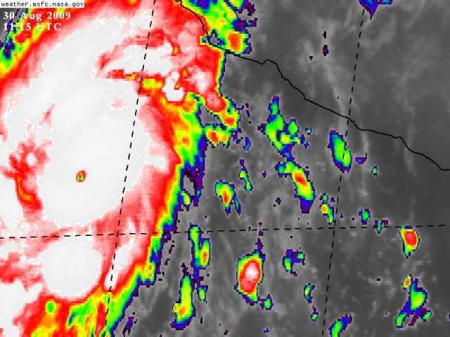
It was at 14:00 UTC that Hurricane Jimena looked the best with a clear pin-hole and I estimate it might have been at 115 knots and then quickly weakened to 85-90 knots again within a matter of hours. It seems like a lot of these cyclones that exhibit pin-hole eyes at the beginning of their maturity quickly lose the eye within hours and then continue where it left off before getting one. This is something I have always found strange about these types. It occurs frequently in the Epac especially.

Right now it's going into buzz saw mode just like what Hurricane Felix (2007) did after peaking that one Sunday evening. There is a warm spot on rainbow colour infrared imagery that can't be seen using the AVN. It seems to be getting larger and more symmetrical right now with the warm spot staying. They should send in recon right now...it's a possible threat to land you know! 8-) I also wonder if this will finally be the one to achieve category 5 status in the Epac after a very long wait.

I saw a poster post some visible images of Jimena yesterday near noon and some of them were around 14:00 UTC but just the AVN and the water vapor images were at 14:00 UTC. Has anyone saved the 14:00 UTC visible from the floater on the NHC's website? That one showed the most cleared out pinhole eye. It can't be an image from the NRL and such because it doesn't show up as well or it's not exactly 14:00 UTC, etc.
0 likes   

User avatar
wxmann_91
Category 5
Category 5
Posts: 8013
Age: 34
Joined: Fri Jul 15, 2005 2:49 pm
Location: Southern California
Contact:

Re: EPAC: HURRICANE JIMENA (13E)

#162 Postby wxmann_91 » Sun Aug 30, 2009 4:57 am

Cyclenall wrote:I saw a poster post some visible images of Jimena yesterday near noon and some of them were around 14:00 UTC but just the AVN and the water vapor images were at 14:00 UTC. Has anyone saved the 14:00 UTC visible from the floater on the NHC's website? That one showed the most cleared out pinhole eye. It can't be an image from the NRL and such because it doesn't show up as well or it's not exactly 14:00 UTC, etc.


14Z VIS

Image
0 likes   

User avatar
Cyclenall
Category 5
Category 5
Posts: 6666
Joined: Thu Jun 08, 2006 10:01 pm
Location: Ontario, Canada

Re: EPAC: HURRICANE JIMENA (13E)

#163 Postby Cyclenall » Sun Aug 30, 2009 5:51 am

wxmann_91 wrote:14Z VIS

Image

Thank you.

The pinhole is clearing out again. I would now estimate Hurricane Jimena's strength at 120 knots if not higher. If it clears out a bit more, then 135 knots. If it clears out fully, over 145 knots easy.

A raw T# was up to 6.8 a half hour ago before going back to 4.5. Using ADT estimates are completely useless currently.
0 likes   

User avatar
KWT
Category 5
Category 5
Posts: 31415
Joined: Tue Aug 17, 2004 11:02 am
Location: UK!!!

#164 Postby KWT » Sun Aug 30, 2009 5:54 am

Looking like this could be a big threat to Baja, could well be a pretty powerful hurricane at that point, maybe as strong as Lane.
0 likes   

User avatar
HURAKAN
Professional-Met
Professional-Met
Posts: 46086
Age: 38
Joined: Thu May 20, 2004 4:34 pm
Location: Key West, FL
Contact:

#165 Postby HURAKAN » Sun Aug 30, 2009 6:33 am

Image

You gotta love that eye!!!
0 likes   

User avatar
HURAKAN
Professional-Met
Professional-Met
Posts: 46086
Age: 38
Joined: Thu May 20, 2004 4:34 pm
Location: Key West, FL
Contact:

Re:

#166 Postby HURAKAN » Sun Aug 30, 2009 6:36 am

KWT wrote:Looking like this could be a big threat to Baja, could well be a pretty powerful hurricane at that point, maybe as strong as Lane.


Image

If it remains this small, it will be great because the damage will occur only in a small area
0 likes   

User avatar
Chacor
Category 5
Category 5
Posts: 10229
Joined: Mon Oct 02, 2006 10:43 pm
Location: Singapore

#167 Postby Chacor » Sun Aug 30, 2009 6:41 am

Don't forget that because it's so small, the moment it goes over Baja California Sur, the mountains will tear it up.
0 likes   

User avatar
HURAKAN
Professional-Met
Professional-Met
Posts: 46086
Age: 38
Joined: Thu May 20, 2004 4:34 pm
Location: Key West, FL
Contact:

#168 Postby HURAKAN » Sun Aug 30, 2009 7:07 am

Image

The eye looks to be getting bigger
0 likes   

User avatar
HURAKAN
Professional-Met
Professional-Met
Posts: 46086
Age: 38
Joined: Thu May 20, 2004 4:34 pm
Location: Key West, FL
Contact:

#169 Postby HURAKAN » Sun Aug 30, 2009 7:43 am

EP, 13, 2009083012, , BEST, 0, 160N, 1060W, 115, 948, HU

WOW, 115 knots!
0 likes   

User avatar
HURAKAN
Professional-Met
Professional-Met
Posts: 46086
Age: 38
Joined: Thu May 20, 2004 4:34 pm
Location: Key West, FL
Contact:

#170 Postby HURAKAN » Sun Aug 30, 2009 7:47 am

Image

I think it's called "rapid intensification!"
0 likes   

User avatar
HURAKAN
Professional-Met
Professional-Met
Posts: 46086
Age: 38
Joined: Thu May 20, 2004 4:34 pm
Location: Key West, FL
Contact:

#171 Postby HURAKAN » Sun Aug 30, 2009 7:58 am

237
WHXX01 KMIA 301234
CHGE77
TROPICAL CYCLONE GUIDANCE MESSAGE
NWS TPC/NATIONAL HURRICANE CENTER MIAMI FL
1234 UTC SUN AUG 30 2009

DISCLAIMER...NUMERICAL MODELS ARE SUBJECT TO LARGE ERRORS.
PLEASE REFER TO NHC OFFICIAL FORECASTS FOR TROPICAL CYCLONE
AND SUBTROPICAL CYCLONE INFORMATION.

EAST PACIFIC OBJECTIVE AIDS FOR

TROPICAL CYCLONE JIMENA (EP132009) 20090830 1200 UTC

...00 HRS... ...12 HRS... ...24 HRS. .. ...36 HRS...
090830 1200 090831 0000 090831 1200 090901 0000

LAT LON LAT LON LAT LON LAT LON
BAMS 16.0N 106.0W 16.9N 107.3W 17.8N 108.4W 19.0N 109.7W
BAMD 16.0N 106.0W 17.1N 106.9W 18.2N 107.8W 19.7N 108.7W
BAMM 16.0N 106.0W 16.9N 107.0W 17.9N 107.8W 19.4N 109.0W
LBAR 16.0N 106.0W 17.0N 107.2W 18.2N 108.8W 19.7N 110.6W
SHIP 115KTS 127KTS 128KTS 123KTS
DSHP 115KTS 127KTS 128KTS 123KTS

...48 HRS... ...72 HRS... ...96 HRS. .. ..120 HRS...
090901 1200 090902 1200 090903 1200 090904 1200

LAT LON LAT LON LAT LON LAT LON
BAMS 20.7N 111.0W 23.4N 113.2W 24.7N 115.6W 24.9N 116.7W
BAMD 21.6N 109.4W 25.3N 110.2W 26.9N 109.6W 26.5N 108.3W
BAMM 21.3N 110.0W 24.8N 111.7W 26.4N 113.2W 26.8N 113.6W
LBAR 21.7N 112.5W 26.5N 115.7W 30.9N 115.7W 31.9N 111.4W
SHIP 114KTS 92KTS 64KTS 36KTS
DSHP 114KTS 81KTS 52KTS 32KTS

...INITIAL CONDITIONS...
LATCUR = 16.0N LONCUR = 106.0W DIRCUR = 300DEG SPDCUR = 8KT
LATM12 = 15.4N LONM12 = 104.7W DIRM12 = 302DEG SPDM12 = 10KT
LATM24 = 14.2N LONM24 = 102.9W
WNDCUR = 115KT RMAXWD = 10NM WNDM12 = 90KT
CENPRS = 948MB OUTPRS = 1009MB OUTRAD = 150NM SDEPTH = D
RD34NE = 60NM RD34SE = 60NM RD34SW = 50NM RD34NW = 60NM

$$
NNNN


Image
0 likes   

User avatar
KWT
Category 5
Category 5
Posts: 31415
Joined: Tue Aug 17, 2004 11:02 am
Location: UK!!!

#172 Postby KWT » Sun Aug 30, 2009 7:58 am

Wow amazing strengthening but not at all surprising, I think this has a more then reasonable shot at becoming a category-5...
0 likes   

CrazyC83
Professional-Met
Professional-Met
Posts: 34002
Joined: Tue Mar 07, 2006 11:57 pm
Location: Deep South, for the first time!

#173 Postby CrazyC83 » Sun Aug 30, 2009 8:08 am

Even 115 seems really conservative. Looking at it, my guess is 130 kt right now.
0 likes   

User avatar
HURAKAN
Professional-Met
Professional-Met
Posts: 46086
Age: 38
Joined: Thu May 20, 2004 4:34 pm
Location: Key West, FL
Contact:

#174 Postby HURAKAN » Sun Aug 30, 2009 8:10 am

30/1200 UTC 16.0N 105.9W T6.0/6.0 JIMENA -- East Pacific

115 knots
0 likes   

CrazyC83
Professional-Met
Professional-Met
Posts: 34002
Joined: Tue Mar 07, 2006 11:57 pm
Location: Deep South, for the first time!

#175 Postby CrazyC83 » Sun Aug 30, 2009 8:13 am

Unfortunately, without Recon, we will never know the true intensity...
0 likes   

User avatar
Macrocane
Category 5
Category 5
Posts: 4218
Age: 36
Joined: Sun May 24, 2009 5:35 pm
Location: El Salvador

Re: EPAC: HURRICANE JIMENA (13E)

#176 Postby Macrocane » Sun Aug 30, 2009 8:38 am

I hope that the NHC this time won't be that conservative, my guess is 125 kt by the time of the next advisory. Mexico is under a big threat, they should be prepared especially Baja. No panic but be prepared.
0 likes   

User avatar
Macrocane
Category 5
Category 5
Posts: 4218
Age: 36
Joined: Sun May 24, 2009 5:35 pm
Location: El Salvador

Re: EPAC: HURRICANE JIMENA (13E)

#177 Postby Macrocane » Sun Aug 30, 2009 8:42 am

I wonder, if it will make landfall or pass very close to land will it be any recon?
0 likes   

User avatar
Chacor
Category 5
Category 5
Posts: 10229
Joined: Mon Oct 02, 2006 10:43 pm
Location: Singapore

Re: EPAC: HURRICANE JIMENA (13E)

#178 Postby Chacor » Sun Aug 30, 2009 8:43 am

mjs1103 wrote:Either way... it will be a CAT 4, and stronger than the NHC predicted


The NHC has been forecasting the storm to be able to reach Cat 4 strength for a while, so that statement is blurring the lines. It's only the timing of the forecast that's off here, and that is to be expected in such systems.
0 likes   

User avatar
Chacor
Category 5
Category 5
Posts: 10229
Joined: Mon Oct 02, 2006 10:43 pm
Location: Singapore

Re: EPAC: HURRICANE JIMENA (13E)

#179 Postby Chacor » Sun Aug 30, 2009 8:44 am

Macrocane wrote:I wonder, if it will make landfall or pass very close to land will it be any recon?


Recon will most likely fly, they've flown storms that threatened Mexico in the past. the TCPOD will be out soon.
0 likes   

User avatar
Chacor
Category 5
Category 5
Posts: 10229
Joined: Mon Oct 02, 2006 10:43 pm
Location: Singapore

Re: EPAC: HURRICANE JIMENA (13E)

#180 Postby Chacor » Sun Aug 30, 2009 8:45 am

Also, can we hold off on our own "guesses" (at least those without the disclaimer and some reasoning) and saying the NHC's too low? ATCF initialised Jimena at 90 kt, then later 95 kt at 06z, but NHC still went with 100 kt at its 09z warning. What's in the ATCF isn't necessarily the warning intensity.
0 likes   


Return to “2009”

Who is online

Users browsing this forum: No registered users and 1 guest