
HURAKAN wrote:
Houston, we have a problem!!!
wouldn't that be Miami, we have a problem?!?
Moderator: S2k Moderators


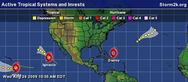
JPmia wrote:what was all this discussion about a Florida threat?? seems to me it is already on a WNW track and following quite nicely along the model tracks as of this morning.


Derek Ortt wrote:NHC is west of the consensus models and well west of the high res models.


otowntiger wrote:JPmia wrote:what was all this discussion about a Florida threat?? seems to me it is already on a WNW track and following quite nicely along the model tracks as of this morning.
I agree. No apparent Florida threat whatsoever.
KWT wrote:Derek Ortt wrote:NHC is west of the consensus models and well west of the high res models.
However those models are generally based off the GFS which is rather rapid in kicking out that ULL and lowering the pressure down the east coast, given we know GFS has a progressive issue more often then not thats something to keep in mind, esp given it may not be all that far away from the Carolinas.


Jevo wrote:otowntiger wrote:JPmia wrote:what was all this discussion about a Florida threat?? seems to me it is already on a WNW track and following quite nicely along the model tracks as of this morning.
I agree. No apparent Florida threat whatsoever.
Jeeeez Im going to have to add more crows to the pot... looks like there may be some extra helpings going around after all is said and done...... Im not saying you're going to need some... Just seem like a lot of people are making ABSOLUTE statments... This is an unorganized TC. The models don't even have a firm grasp yet....
I do miss the old days when posters (other than our resident mets and experts) would say.. "There is no threat to X and here is why I think that... (insert data here)"

Users browsing this forum: No registered users and 21 guests


