Derek Ortt wrote:magnusson_r wrote:Well, I think it was a very responsible item warning surfers about the high waves. Lots of rookie surfers will be out there trying to ride those big waves, and could get more than they bargained for.
The local media have become much more careful about warning the public since Juan 6 years ago.
As for track, the CBC weather forecast 1 hour ago still calls for this storm to remain offshore and not to make landfall until it reaches NFLD, at which point it'll be pretty much blown out.
I haven't seen any forecast that puts landfall near Halifax, which is the most densely pop. area.
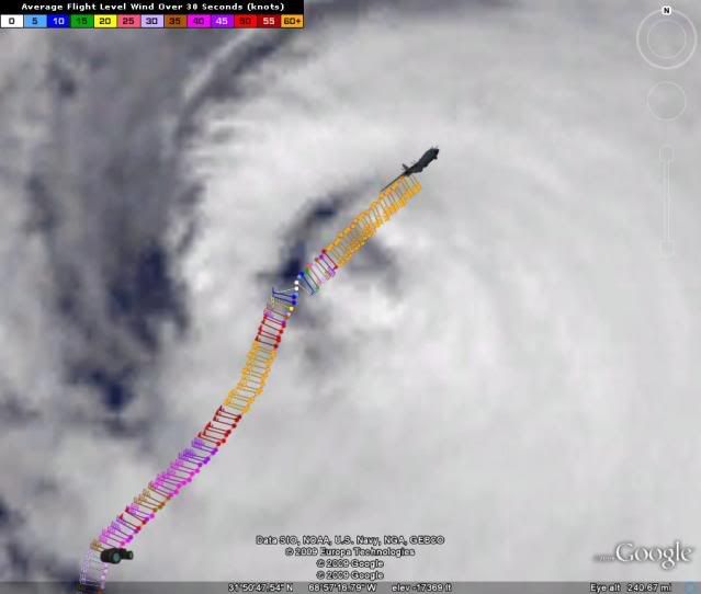
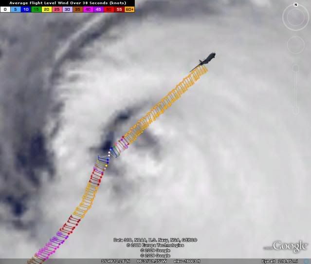
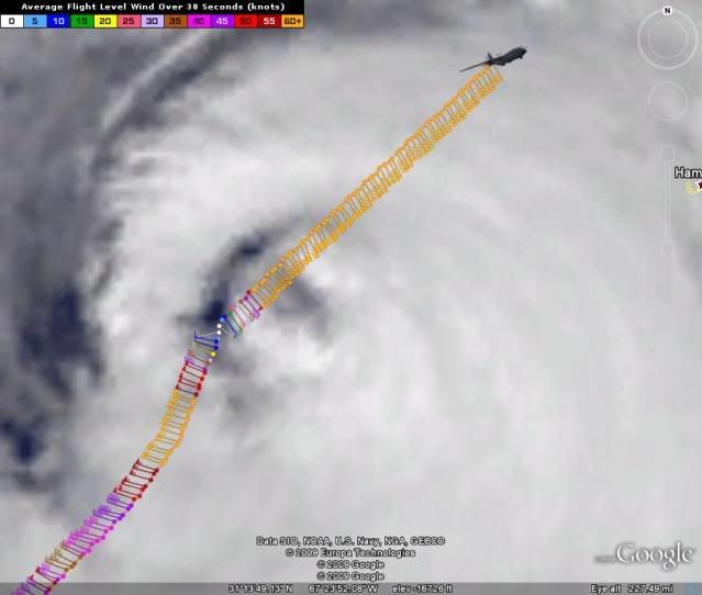
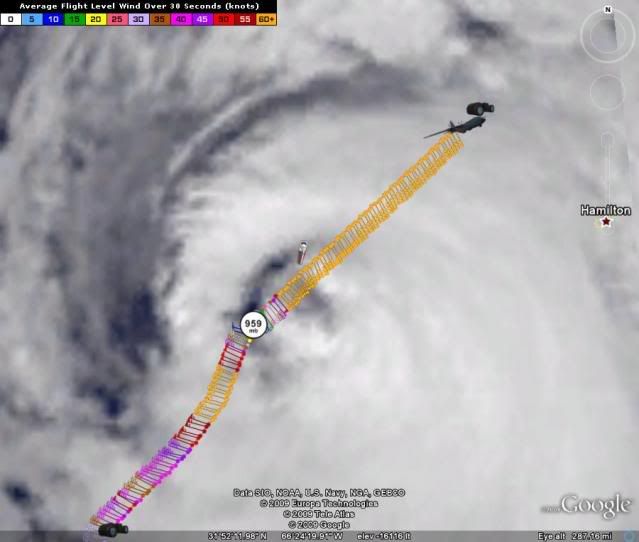
thats because the graphics are INCORRECTLY connecting forecast points with a straight line. How many times does this have to be repeated? A very simple cubic spline of the NHC track has this coming into eastern Nova Scotia. I ran models last night and 4 of them showed a significant threat to Halifax (these same models showed the EWRC today). I'll see what tomorrow brings before making any final conclusions where this makes landfall. However, to say Halifax is not at risk of a direct landfall is beyond absurd! You must not quite grasp the concept of forecast uncertainty (and it is not just you... many people have trouble getting this concept and I don't believe the cone explains the real uncertainty)
Derek, thanks for all your insight and professional wisdom! anyone who minimizes anothers potential threat is irresponsible. you do a great job of clarifying our amature thoughts and concerns with respect. keep on!