Lifesgud2 wrote:come on guys...Nothing really happening until mid to late september if anything at all...
Thats really something to say when you have the tropics heating up as we speak at this moment...
Moderator: S2k Moderators


Lifesgud2 wrote:come on guys...Nothing really happening until mid to late september if anything at all...


Tommedic wrote:Correct me, but aren't the models basing on TD or weak TS? So if this becomes a hurricane at near Islands, might we see a turn poleward? Just wondering....


Lifesgud2 wrote:come on guys...Nothing really happening until mid to late september if anything at all...

clfenwi wrote:SAB's classification remains unchanged, however, it does place the center further south than they've ever fixed it:
11/2345 UTC 14.0N 30.8W T1.5/2.0 02L -- Atlantic

clfenwi wrote:SAB's classification remains unchanged, however, it does place the center further south than they've ever fixed it:
11/2345 UTC 14.0N 30.8W T1.5/2.0 02L -- Atlantic
tgenius wrote:I'm sure if it keeps going more west that the news outlets are going to have a field day; It's been so quiet that they've actually been starting the wave train and with the new TD out there the scare factor is going up a bit.

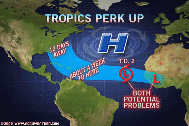
HURAKAN wrote:
Accuweather. Ok,
Users browsing this forum: No registered users and 112 guests