CPAC: TROPICAL DEPRESSION FELICIA (08E)

Moderator: S2k Moderators

Message
Author
Ed Mahmoud

Re: EPAC: HURRICANE FELICIA (08E)

#101 Postby Ed Mahmoud » Wed Aug 05, 2009 10:06 am

Image

If Felicia stays near the Southern edge of the error envelope, it might avoid the forecast weakening to a tropical storm in 5 days...

Image
0 likes   

User avatar
MGC
S2K Supporter
S2K Supporter
Posts: 5897
Joined: Sun Mar 23, 2003 9:05 pm
Location: Pass Christian MS, or what is left.

Re: EPAC: HURRICANE FELICIA (08E)

#102 Postby MGC » Wed Aug 05, 2009 10:33 am

Felicia has continued to slowly intensify as I expected. The hurricane is showing little if any effect from Enrique. Felicia's eye is quite pronounced in IR satellite image, which is to be expected for a major hurricane. I think Felicia is near its peak in intensity but could intensify a bit more before cooler waters cause a slow decrease in intensity. Looking more and more that Hawaii might be impacted by Felicia......MGC
0 likes   

RL3AO
Moderator-Pro Met
Moderator-Pro Met
Posts: 16308
Joined: Thu Jun 14, 2007 10:03 pm
Location: NC

#103 Postby RL3AO » Wed Aug 05, 2009 10:38 am

I'm thinking pojo and some of her colleagues might be getting a long (and probably uncomfortable) flight out to Hawaii here in a few days.
0 likes   

Derek Ortt

#104 Postby Derek Ortt » Wed Aug 05, 2009 10:38 am

what were the SSTs that Flossie traveled over? I know it was constantly predicted to weaken, but instead it reached cat 4 status before encountering shear near Hawaii

I think they were below 26C but I am not entirely sure
0 likes   

Derek Ortt

#105 Postby Derek Ortt » Wed Aug 05, 2009 11:13 am

also, what were Fernanda 1993 SST? This is likely to take a similar path to that storm and Fernanda intensified significantly once it cleared 145W
0 likes   

User avatar
Cookie
S2K Supporter
S2K Supporter
Posts: 477
Age: 37
Joined: Sun Dec 14, 2008 11:13 am
Location: Isle Of lewis scotland

#106 Postby Cookie » Wed Aug 05, 2009 11:18 am

according to weather underground its a cat 3
0 likes   

User avatar
brunota2003
S2K Supporter
S2K Supporter
Posts: 9476
Age: 34
Joined: Sat Jul 30, 2005 9:56 pm
Location: Stanton, KY...formerly Havelock, NC
Contact:

Re:

#107 Postby brunota2003 » Wed Aug 05, 2009 11:21 am

Cookie wrote:according to weather underground its a cat 3

According to the NHC, it is a cat 3 as well...115 mph
0 likes   

User avatar
HURAKAN
Professional-Met
Professional-Met
Posts: 46086
Age: 38
Joined: Thu May 20, 2004 4:34 pm
Location: Key West, FL
Contact:

#108 Postby HURAKAN » Wed Aug 05, 2009 11:25 am

Image

It appears Felicia continues to intensify
0 likes   

I-wall
Tropical Storm
Tropical Storm
Posts: 210
Joined: Wed Sep 10, 2008 5:24 pm

Re: Re:

#109 Postby I-wall » Wed Aug 05, 2009 11:26 am

wxmann_91 wrote:what the heck at the latest NHC intensity estimate. I know satellite estimates say whatever knots, but microwave data simply cannot be ignored.

I-wall wrote:
Derek Ortt wrote:The entire northern eyewall has been eroded based upon the latest TMI imagery. If anything, Felicia has weakened.

65KT at the most right now


No fair. You have special tools at your dispense. Kidding.....thanks for the info Derek. That's interesting to know. I thought for certain she was still picking up steam.

I-wall, TMI, SSMI, and other microwave data can be found on NRL. Available to the entire public.


Good to know. Thanks!
0 likes   

CrazyC83
Professional-Met
Professional-Met
Posts: 34002
Joined: Tue Mar 07, 2006 11:57 pm
Location: Deep South, for the first time!

Re: EPAC: HURRICANE FELICIA (08E)

#110 Postby CrazyC83 » Wed Aug 05, 2009 11:32 am

Sights set on Category 5???

UW - CIMSS
ADVANCED DVORAK TECHNIQUE
ADT-Version 7.2.3
Tropical Cyclone Intensity Algorithm

----- Current Analysis -----
Date : 05 AUG 2009 Time : 153000 UTC
Lat : 14:00:00 N Lon : 128:49:11 W


CI# /Pressure/ Vmax
5.1 / 971.1mb/ 92.4kt


Final T# Adj T# Raw T#
(3hr avg)
5.1 6.8 7.0

Latitude bias adjustment to MSLP : +3.1mb

Estimated radius of max. wind based on IR : 12 km

Center Temp : +1.9C Cloud Region Temp : -73.7C

Scene Type : EYE

Positioning Method : RING/SPIRAL COMBINATION

Ocean Basin : EAST PACIFIC
Dvorak CI > MSLP Conversion Used : ATLANTIC

Tno/CI Rules : Constraint Limits : 2.2T/6hr
Weakening Flag : OFF
Rapid Dissipation Flag : OFF
0 likes   

User avatar
HURAKAN
Professional-Met
Professional-Met
Posts: 46086
Age: 38
Joined: Thu May 20, 2004 4:34 pm
Location: Key West, FL
Contact:

#111 Postby HURAKAN » Wed Aug 05, 2009 11:38 am

Forget about the raw.
0 likes   

User avatar
HURAKAN
Professional-Met
Professional-Met
Posts: 46086
Age: 38
Joined: Thu May 20, 2004 4:34 pm
Location: Key West, FL
Contact:

Re: EPAC: HURRICANE FELICIA (08E)

#112 Postby HURAKAN » Wed Aug 05, 2009 11:39 am

Image

Image

Very well organized tropical cyclone
0 likes   

CrazyC83
Professional-Met
Professional-Met
Posts: 34002
Joined: Tue Mar 07, 2006 11:57 pm
Location: Deep South, for the first time!

Re:

#113 Postby CrazyC83 » Wed Aug 05, 2009 11:43 am

HURAKAN wrote:Forget about the raw.


For now at least, although I do find that it sets general trends on where it is headed.
0 likes   

I-wall
Tropical Storm
Tropical Storm
Posts: 210
Joined: Wed Sep 10, 2008 5:24 pm

Re:

#114 Postby I-wall » Wed Aug 05, 2009 11:50 am

Derek Ortt wrote:what were the SSTs that Flossie traveled over? I know it was constantly predicted to weaken, but instead it reached cat 4 status before encountering shear near Hawaii

I think they were below 26C but I am not entirely sure


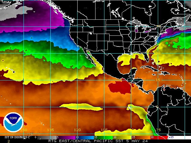
Derek, are you thinking we might have the same scenario with Felicia? It looks like SST are warmer as you get closer to Hawaii....any chance it would re-strenthen on its final approach to the islands?
0 likes   

User avatar
HURAKAN
Professional-Met
Professional-Met
Posts: 46086
Age: 38
Joined: Thu May 20, 2004 4:34 pm
Location: Key West, FL
Contact:

Re: Re:

#115 Postby HURAKAN » Wed Aug 05, 2009 11:50 am

CrazyC83 wrote:
HURAKAN wrote:Forget about the raw.


For now at least, although I do find that it sets general trends on where it is headed.


To me the raw just tells how organized a system is. Meaning, the higher the raw the better it looks but not how intense it is.
0 likes   

User avatar
brunota2003
S2K Supporter
S2K Supporter
Posts: 9476
Age: 34
Joined: Sat Jul 30, 2005 9:56 pm
Location: Stanton, KY...formerly Havelock, NC
Contact:

#116 Postby brunota2003 » Wed Aug 05, 2009 11:54 am

The POD for "tomorrow" has not been released yet (is usually released around 9 am...the last one out was yesterday, today's hasnt been issued yet...........and it is 1 pm). Someone keep an eye on that!
0 likes   

User avatar
Night Tide
Tropical Low
Tropical Low
Posts: 11
Age: 41
Joined: Thu Jul 16, 2009 2:57 am
Location: metairie, louisiana

#117 Postby Night Tide » Wed Aug 05, 2009 12:01 pm

This isn't looking good, as I have a sister who lives in Hawaii.

I thought I heard the news this morning say Hawaii will probably avoid a direct hit, but I don't know. It's worrying me.
0 likes   

I-wall
Tropical Storm
Tropical Storm
Posts: 210
Joined: Wed Sep 10, 2008 5:24 pm

Re:

#118 Postby I-wall » Wed Aug 05, 2009 12:02 pm

brunota2003 wrote:The POD for "tomorrow" has not been released yet (is usually released around 9 am...the last one out was yesterday, today's hasnt been issued yet...........and it is 1 pm). Someone keep an eye on that!

What is a POD?
0 likes   

User avatar
HURAKAN
Professional-Met
Professional-Met
Posts: 46086
Age: 38
Joined: Thu May 20, 2004 4:34 pm
Location: Key West, FL
Contact:

#119 Postby HURAKAN » Wed Aug 05, 2009 12:09 pm

Image

Looking great
0 likes   

Ed Mahmoud

Re:

#120 Postby Ed Mahmoud » Wed Aug 05, 2009 12:16 pm

brunota2003 wrote:The POD for "tomorrow" has not been released yet (is usually released around 9 am...the last one out was yesterday, today's hasnt been issued yet...........and it is 1 pm). Someone keep an eye on that!


NOUS42 KNHC 051615
WEATHER RECONNAISSANCE FLIGHTS
CARCAH, NATIONAL HURRICANE CENTER, MIAMI, FL.
1215 PM EDT WED 05 AUGUST 2009
SUBJECT: TROPICAL CYCLONE PLAN OF THE DAY (TCPOD)
VALID 06/1100Z TO 07/1100Z AUGUST 2009
TCPOD NUMBER.....09-069

I. ATLANTIC REQUIREMENTS
1. NEGATIVE RECONNAISSANCE REQUIREMENTS.
2. OUTLOOK FOR SUCCEEDING DAY.....NEGATIVE.

II. PACIFIC REQUIREMENTS
1. NEGATIVE RECONNAISSANCE REQUIREMENTS.
2. SUCCEEDING DAY OUTLOOK: A G-IV SYNOPTIC SURVEILLANCE
MISSION FOR 07/1200Z FROM KLGB TO PHNL ON HURRICANE
FELICIA.
3. ADDITIONAL DAY OUTLOOK: BEGIN 6-HRLY FIXES ON HURRICANE
FELICIA AT 08/1800Z NEAR 20N 141W.
JWP
0 likes   


Return to “2009”

Who is online

Users browsing this forum: No registered users and 1 guest