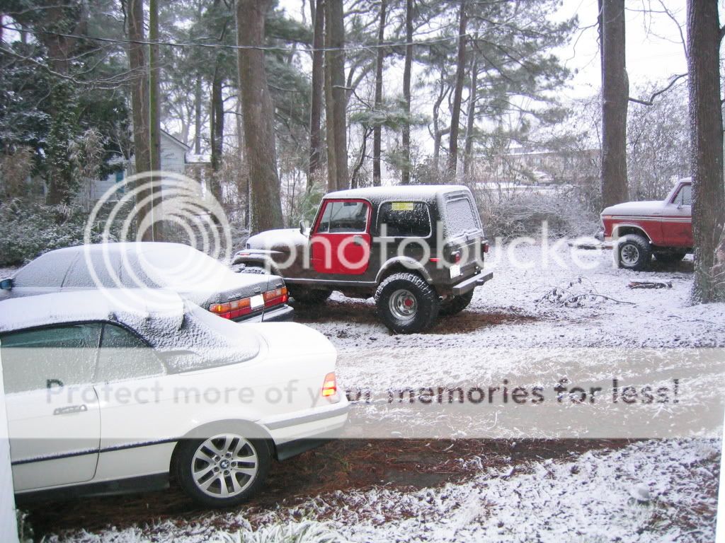
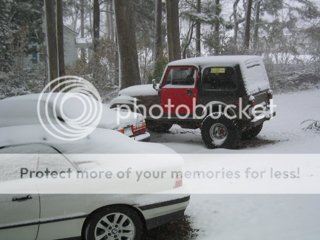
2 inches at RDU Temp 26 degrees
yes, I have pictures and video. . .
Deep South Winterwx Discussion 2015-2016
Moderator: S2k Moderators
Forum rules
 The posts in this forum are NOT official forecast and should not be used as such. They are just the opinion of the poster and may or may not be backed by sound meteorological data. They are NOT endorsed by any professional institution or STORM2K.

The posts in this forum are NOT official forecast and should not be used as such. They are just the opinion of the poster and may or may not be backed by sound meteorological data. They are NOT endorsed by any professional institution or STORM2K.
-
Extremeweatherguy

- Category 5

- Posts: 11095
- Joined: Mon Oct 10, 2005 8:13 pm
- Location: Florida
-
Weatherfreak14

- Category 5
- Posts: 1381
- Joined: Sat Sep 24, 2005 3:40 pm
- Location: Beaufort, SC
- Contact:
Re: Deep South Snow/Winterwx thread
We have a dusting on the ground all the way down here in Beaufort, SC as a heavy snow band went through.
0 likes
-
DESTRUCTION5

- Category 5
- Posts: 4430
- Age: 44
- Joined: Wed Sep 03, 2003 11:25 am
- Location: Stuart, FL
Re: Re:
lurker_from_nc wrote:Extremeweatherguy wrote:Just heard on the Weather Channel that Raleigh, NC currently has 4.75" on the ground.
just got back in . . . have pics and video .... mmmm yes I believe it is 4.75 inches
Why you dirty little.....
0 likes


-
Extremeweatherguy
- Category 5
- Posts: 11095
- Joined: Mon Oct 10, 2005 8:13 pm
- Location: Florida
I still remember living in Raleigh 9 years ago during the "Carolina Crusher". I will never forget waking up, looking out the window, and realizing that over two feet of powder coated the ground. I was shocked! Needless to say that was an amazing event for the Carolinas, and still ranks as my number one snow storm in terms of total accumulation (24" in my area in just ~12 hours).
0 likes
-
southerngale

- Retired Staff

- Posts: 27418
- Joined: Thu Oct 10, 2002 1:27 am
- Location: Southeast Texas (Beaumont area)
-
CYCLONE MIKE
- Category 5
- Posts: 2183
- Joined: Tue Aug 31, 2004 6:04 pm
- Location: Gonzales, LA
Re: Deep South Snow/Winterwx thread
Ha thats nothing, we still got more down here in mid december than you guys got today  Seriously though those are some nice pics. I was born in Durham years ago, have relatives in raleigh,wilmington, and statesville and remember some of those historic snowfalls. They make me jealous and WANT MORE of that white stuff. Forecast to be in the 70's by thursday
  Oh well maybe next month we might get a little something. Post some more pics when you get a chance.
0 likes
-
grentz7721
- Category 1

- Posts: 319
- Age: 40
- Joined: Sun Apr 06, 2003 12:24 pm
- Location: Massillon, OH, US
- Contact:
Re: Deep South Snow/Winterwx thread
Myrtle Beach did got snow eariler today, but the snow did not last very long to cover the ground.
0 likes
-
Extremeweatherguy
- Category 5
- Posts: 11095
- Joined: Mon Oct 10, 2005 8:13 pm
- Location: Florida

-
Brent
- S2K Supporter

- Posts: 38777
- Age: 37
- Joined: Sun May 16, 2004 10:30 pm
- Location: Tulsa Oklahoma
- Contact:
Re: Deep South Snow/Winterwx thread
Lucky lurkey. Great pictures.
So it's now snowed west and east of here this winter.
So it's now snowed west and east of here this winter.
0 likes
-
southerngale
- Retired Staff
- Posts: 27418
- Joined: Thu Oct 10, 2002 1:27 am
- Location: Southeast Texas (Beaumont area)
Re: Deep South Snow/Winterwx thread
Brent wrote:Lucky lurkey. Great pictures.
So it's now snowed west and east of here this winter.
Quit ticking off the snow angels and maybe they'll bring you some too.
0 likes
Re: Deep South Snow/Winterwx thread
southerngale wrote:Brent wrote:Lucky lurkey. Great pictures.
So it's now snowed west and east of here this winter.
Quit ticking off the snow angels and maybe they'll bring you some too.

*pays off the snow angels*
0 likes
-
NC George

- Category 2

- Posts: 635
- Age: 56
- Joined: Sun Sep 14, 2003 11:44 am
- Location: Washington, NC, USA
Re: Deep South Snow/Winterwx thread
Here's some pics of my yard from Ayden, NC from the snow on Tuesday:

I was at work for the last 1/2 of the storm, so we actually got about double the snow shown in the last 2 pics.
I was at work for the last 1/2 of the storm, so we actually got about double the snow shown in the last 2 pics.
0 likes

Re: Deep South Snow/Winterwx thread
Models seem to be hinting at some interesting weather for the Carolinas on Monday. Local mets starting to rumble about it. We shall see.......
0 likes
-
srainhoutx

- S2K Supporter
- Posts: 6919
- Age: 68
- Joined: Sun Jan 14, 2007 11:34 am
- Location: Haywood County, NC
- Contact:
Re: Deep South Snow/Winterwx thread
HPC is rather bullish on a Gulf Coast Storm forming this weekend/early next week. If this varifies, the Deep South to New England "may" have a Major System...
PRELIMINARY EXTENDED FORECAST DISCUSSION
NWS HYDROMETEOROLOGICAL PREDICTION CENTER CAMP SPRINGS MD
900 AM EST WED JAN 28 2009
VALID 12Z SUN FEB 01 2009 - 12Z WED FEB 04 2009
A MEAN UPPER LOW WILL DOMINATE NORTHERN ALASKA THIS PERIOD.
TELECONNECTIONS ON THIS FEATURE FAVOR A DOWNSTREAM TROF ALONG OR
OFF THE E COAST AND RIDGING ACROSS MUCH OF THE ROCKIES. A
PROGRESSIVE PATTERN...AS ADVERTISED BY THE GLOBAL GUIDANCE...IS
IMPLIED BY THE FAST WESTERLY FLOW ENTERING CANADA SOUTH OF THE
NORTHERN ALASKAN MEAN UPPER LOW.
JUST AFTER GROUNDHOG DAY...STANDARDIZED 500 HPA ANOMALIES ACROSS
THE SOUTHEAST SHOW THAT THE VIGOROUS 00Z/28 GFS COASTAL
CYCLOGNESIS LATE MON INTO WED IS POSSIBLE AND CANNOT BE RULED
OUT....THOUGH WE ARE NOT PRESENTLY BOMBING OUT THIS SYSTEM. A DEEP
UPPER CYCLONE COULD BRIEFLY CLOSE OFF AS FAR SOUTH AS TENNESSEE OR
NORTH CAROLINA BEFORE LIFTING NORTHWARD. ENSEMBLE SPAGHETTI PLOTS
GIVE DECENT SUPPORT FOR A MAJOR DEVELOPMENT NEAR OR A BIT INLAND
FROM THE SOUTH OR MID ATLANTIC COAST EARLY NEXT WEEK. A DEEPENING
SURFACE CYCLONE COULD MOVE NORTH TO NORTHEAST FROM THE GULF OF
MEXICO UP THE PIEDMONT...EASTERN SEABOARD...OR THROUGH THE WESTERN
ATLANTIC WITH THE USUAL WINTER WEATHER CONSEQUENCES. WE HAVE NOT
SEEN THIS TYPE OF CYCLONE TRACK TOO OFTEN THE PAST COUPLE WINTERS.
UPDATED PRELIM PROGS CONTINUED TO USE A BLEND OF THE 00Z ECMWF/00Z
GFS TO COME UP WITH THE PRESSURES...EXCEPT THAT WE ADJUSTED THE E
COAST STORM A BIT SOUTH FROM THE EARLY PRELIM TO BETTER FIT THE
POSITION OF THE SURFACE LOW TUE/WED DAYS 6-7 GIVEN BY THE GEFS AND
ECMWF ENSEMBLE MEANS. THIS TAKES INTO ACCOUNT THE FORECAST
UNCERTAINTY.
ROTH/FLOOD
0 likes
Who is online
Users browsing this forum: No registered users and 190 guests