12Z ECMWF
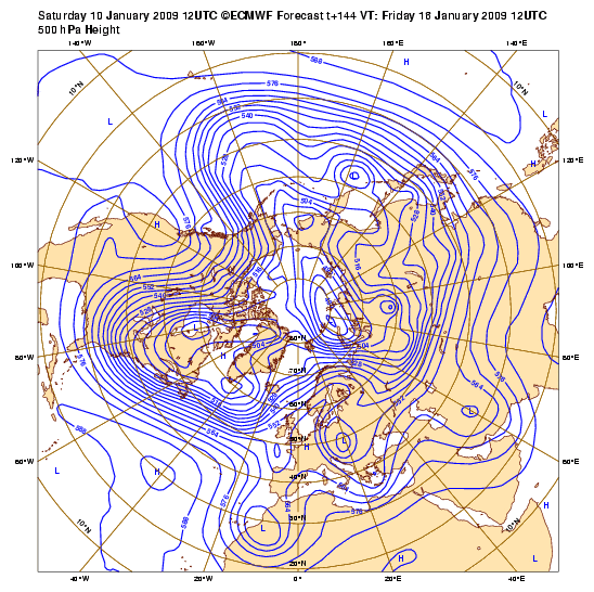
144 hours
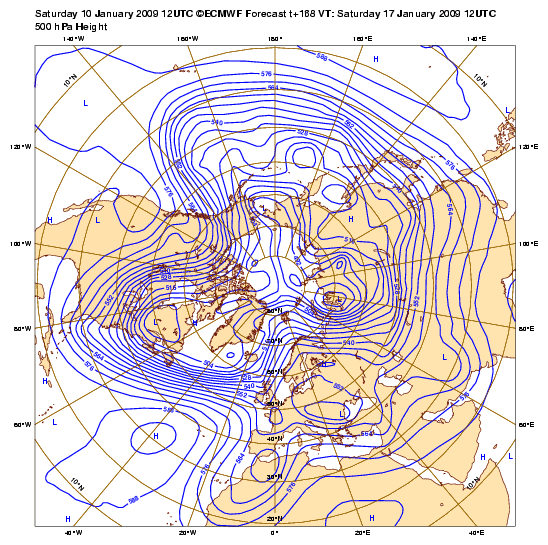
168 hours
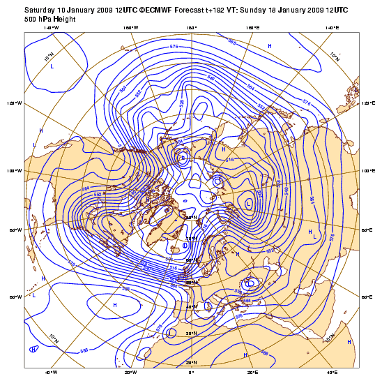
192 hours
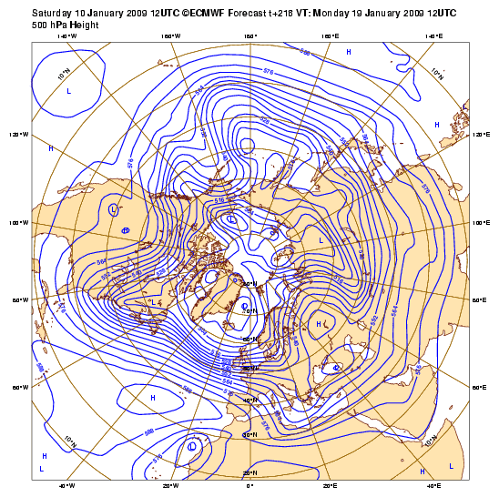
216 hours
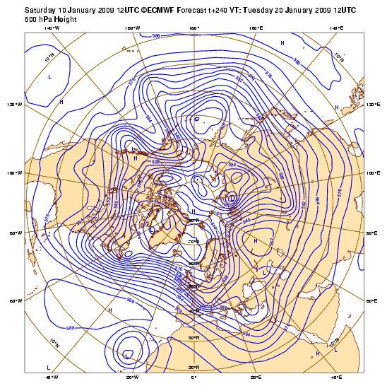
240 hours
HPC thoughts this afternoon...
EXTENDED FORECAST DISCUSSION
NWS HYDROMETEOROLOGICAL PREDICTION CENTER CAMP SPRINGS MD
230 PM EST SAT JAN 10 2009
VALID 12Z TUE JAN 13 2009 - 12Z SAT JAN 17 2009
FINAL GRAPHICS STAYED WITH THE BLEND USED IN THE UPDATED PRELIM
PROGS.
ALL NEW 12Z GUIDANCE SUPPORTS OUR EARLIER REASONING...WITH
THE EXCEPTION OF SHORTWAVE TIMING DIFFERENCES MAINLY DAYS 6-7. A
VERY HIGH AMPLITUDE W COAST OF NOAM RIDGE/ERN NOAM TROF ALONG 80W
WILL GOVERN THE PATTERN OVER THE LOWER 48 THIS NEXT WEEK. HIGHER THAN AVERAGE UNCERTAINTY IN THE DAY-TO-DAY SHORTWAVE
DETAILS ACCOMPANIES THIS PACKAGE DESPITE OOD DETERMINISTIC AND
ENSEMBLE SUPPORT FOR A HIGHLY AMPLIFIED W COAST RIDGE /ERN NOAM
TROF CONTINUING THROUGH THE MEDIUM RANGE PERIOD. RECENT GFS RUNS
APPEAR TO ALLOW SHORTWAVE TROUGHS TO BEGIN BREAKING THROUGH THE
MEAN WEST COAST UPPER RIDGE TOO QUICKLY BY DAY 6. THIS EROSION OF
THE UPPER RIDGE APPEARS UNREALISTIC GIVEN ITS STRENGTH IN THE 3-5
DAY PERIOD.
12Z MODELS: THE NEW 12Z GFS APPEARS TO FOLLOW ITS OWN CONTINUITY
REASONABLY WELL THRU DAY 5 BUT WE THINK THAT IT MAY STILL BE
ALLOWING TOO MUCH ENERGY TO COME THROUGH THE MEAN WRN CANADIAN
RIDGE POSITION AROUND FRI DAY 6. THE 12Z CANADIAN HOLDS ONTO
HIGHER HEIGHTS DAYS 5-6 OVER THE PACIFIC NW...IN FACT IT HAS A
CLOSED 588DM CONTOUR OVER WA/NRN FOR FRI DAY 6! THE UKMET ALSO
HOLDS ONTO MORE RIDGE OVER WRN CANADA THAN THE GFS THU DAY 5. THE
12Z/10 ECMWF HAS GOOD CONTINUITY WITH ITS PREVIOUS RUN THRU EARLY
DAY 6...BUT BEGINS TO SHOW SOME LOWER CONFIDENCE SHORTWAVE
ACTIVITY LATER DAY 6 AND DAY 7 IN THE FAST FLOW PATTERN ACROSS
NOAM.
...HIGHLIGHTS...
A HIGH AMPLITUDE COLD PATTERN WILL GRIP THE CENTRAL AND ERN
PORTIONS OF THE LOWER 48 STATESMUCH OF THIS MEDIUM RANGE PERIOD. CHUNKS OF ARCTIC HIGH PRES WILL
DROP SSE OUT OF CANADA INTO THE NRN PLAINS...THEN GRADUALLY
RECURVE ON A MORE ESE TRACK IN THE FAST CYCLONIC FLOW OF THE ERN
CONUS LONGWAVE TROF.
A CLIPPER SYS RACING CYCLONICALLY SEWD IN
THIS FAST FLOW LATE WED INTO EARLY THU WILL SEPARATE THE FIRST
ARCTIC OUTBREAK FROM A SECOND COLDER ONE THAT WILL BE PLUNGING
INTO THE N CENTRAL AND GREAT LAKES REGIONS THU. THIS SECOND SHOT
OF COLD AIR WILL LIKELY BE THE COLDEST OF THE WINTER SO FAR FOR
MANY LOCATIONS. MAXIMUM TEMP DEPARTURES FROM NORMAL OF -15 TO -25
WILL BE COMMON THU/FRI IN THE NE QUADRANT OF THE NATION. MINIMUM
TEMP DEPARTURES FROM NORMAL WILL NOT BE AS EXTREME. BY FRI AM
ALMOST THE ENTIRE AREA FROM THE OH VLY AND MID ATLANTIC REGIONS
NWD THRU THE GREAT LAKES AND NEW ENG WILL SEE THICKNESSES LOWER
THAN 500 DECAMETERS. 850MB TEMPS FROM THE 12Z/10 ECMWF FOR FRI AM
SHOWS MOST OF THE REGION NORTH OF LATITUDE 38N COLDER THAN
-18C...WITH INTERIOR NEW ENG COLDER THAN -24C.
FLOOD
 The posts in this forum are NOT official forecast and should not be used as such. They are just the opinion of the poster and may or may not be backed by sound meteorological data. They are NOT endorsed by any professional institution or


