zeusman wrote:Ed Mahmoud wrote:Water vapor loop
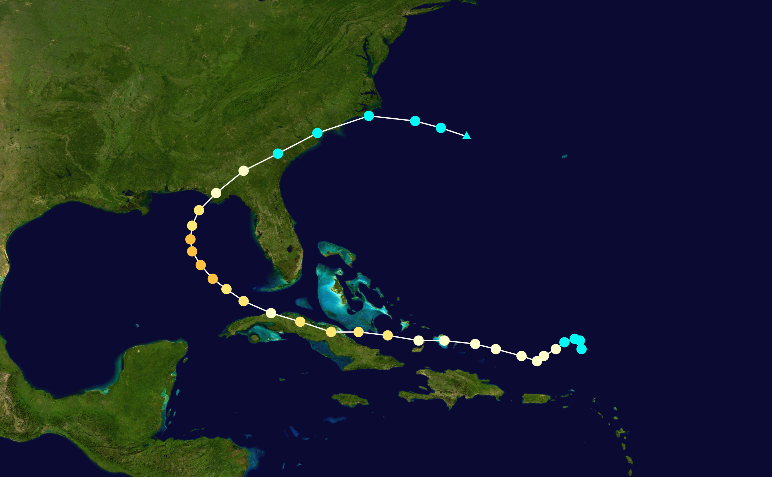
The trough to the Northeast and ridge on top seem to be following Ike. Note also the protective Wsterlies remain well established over all but extreme South Texas.
Protective westerlies?? Protecting where from what?
You can note from this WV loop that ridge axis is beginning a tilt from southwest to northeast orientation (not due north and south)
Hard to get anything to cross the entire Gulf to come to Texas when steering is blowing from the West.
European, subject to wild mood swings, does bring Ike to SW Louisiana on today's run, but had 2 days in a row of Carolinas to New York, and 500 mb operational and ensemble GFS have generally shown all/most of Texas with Westerlies.
Lake Charles is the same latitude (roughly) as HOU, and about 100 miles away. Westerlies from 700 mb up. I suppose a badly sheared storm could slide under that, but nothing bigger, and further, the UK Met's weakening of Ike is probably why it shifted from an Eastern outlier to a Western outlier.