Ed Mahmoud wrote:Double Post. Not sure if Shiner bet allows for fairly narrow 10 day error cone.
Disclaimer: Unofficial prognosis by a rank amateur to follow, at times so far out into the future, it is little more than speculation, and is not endorsed by Storm2K.
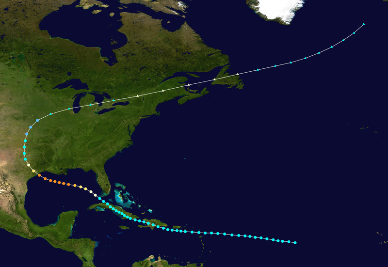
Based on GFS 500 mb (not surface position of too weak a system), Canadian, excellent agreement on 5 day tracks- I think the Euro is close, a path through Florida Straits, extreme Northern Greater Antilles or South Florida, generally West, and a turn Northwestward, toward somewhere between Lake Charles, LA and A'p'cola, Florida. Mid point- MSY to MOB. If Ike avoids too much of Cuba and/or Hispaniola, a major hurricane at landfall. If not, a Cat 1 or Cat 2. Major, but not a Cat 5 or higher end Cat 4, due to upwelled water in the Central and Eastern Gulf from Gustav.
At 10 days out, I reserve the right to revise, without reservation. Unless someone accepts error cone for 12 pack.
Ed, upwelling for Gus is not an issue now or even 10 days from now...... Got to remember Gus was not exacty an upwelling machine in its history over the LC....Watch this map for potential in the upcoming days.
http://wxmaps.org/pix/hurpot.html#ATLSecond, your basing your track on a 10 day GFS 500mb chart? 10 days away? 200+ hrs out? not wise my fellow Houstonian,,,,
HOWEVER, since I am a betting man, and I would like you to eat your "Texas Season over" thread you so put out in the second week of August, I AM willing to revisit this wager sometime in the next 5 days. Say around the weekend. Your cone basically encompasses the 3/4 of the GOM.....not much room for error....narrow it down some and And I will put out my cone in a few days.........
I got this gut feeling I will be drinking a 12pk of shiner next to my pool after this is all over......