ATL: IKE Discussion

Moderator: S2k Moderators

Message
Author
RL3AO
Moderator-Pro Met
Moderator-Pro Met
Posts: 16308
Joined: Thu Jun 14, 2007 10:03 pm
Location: NC

Re: ATL: Tropical Depression Nine in Central Atlantic

#241 Postby RL3AO » Mon Sep 01, 2008 2:23 pm

El Nino wrote:Still no update from the NHC ?


Advisory is out in 90 minutes.
0 likes   

User avatar
Weatherboy1
Category 5
Category 5
Posts: 1189
Age: 49
Joined: Mon Jul 05, 2004 1:50 pm
Location: Jupiter/Sarasota, FL

#242 Postby Weatherboy1 » Mon Sep 01, 2008 2:24 pm

http://www.hpc.ncep.noaa.gov/medr/day7nav_color.html -- pretty far out, of course, but the HPC's long-range (5-7 day) forecast charts show 9 moving almost due W through the Bahamas and then the FL Keys. This link is for day 7.
0 likes   

User avatar
Weatherboy1
Category 5
Category 5
Posts: 1189
Age: 49
Joined: Mon Jul 05, 2004 1:50 pm
Location: Jupiter/Sarasota, FL

#243 Postby Weatherboy1 » Mon Sep 01, 2008 2:27 pm

Also from the HPC's discussion of the coming week ...

THE NEXT ATLC TROPICAL SYSTEM... T.D. NINE... IS EXPECTED TO STRENGTHEN TO
HURRICANE STATUS BY THE LATTER HALF OF THE WEEK AND TRACK TOWARD
THE BAHAMAS AND JUST TO THE S OF FLORIDA AS PER TODAYS TPC/HPC
COORDINATION FOR DAYS 6-7.
0 likes   

bob rulz
Category 5
Category 5
Posts: 1704
Age: 35
Joined: Sat Jan 28, 2006 7:30 pm
Location: Salt Lake City, Utah

#244 Postby bob rulz » Mon Sep 01, 2008 2:28 pm

This ridge is unnaturally strong. A storm forming at 17N, 40W should NOT be on track to hit Florida.

There is still plenty of time for this thing to recurve, but still, I don't think I've ever seen a track like that.

This has been a really strange season so far.
0 likes   

Steve H.
Category 5
Category 5
Posts: 2146
Joined: Sat Oct 19, 2002 9:06 am
Location: Palm Bay, Florida

Re: ATL: Tropical Depression Nine in Central Atlantic

#245 Postby Steve H. » Mon Sep 01, 2008 2:47 pm

OH BTW, this will be Ike at 5 pm. This should stay south of Florida, but it will be close. :flag:
0 likes   

User avatar
Iune
Category 1
Category 1
Posts: 291
Joined: Mon Aug 04, 2008 12:23 pm
Location: New York City

Re:

#246 Postby Iune » Mon Sep 01, 2008 2:47 pm

fci wrote:judging on the speed that the NHC has Ike going you would think that Tina is chasing him!! :lol:

What do you mean Tina?
0 likes   

Sanibel
Category 5
Category 5
Posts: 10375
Joined: Mon Aug 30, 2004 11:06 pm
Location: Offshore SW Florida

Re: ATL: Tropical Depression Nine in Central Atlantic

#247 Postby Sanibel » Mon Sep 01, 2008 2:47 pm

This ridge is unnaturally strong. A storm forming at 17N, 40W should NOT be on track to hit Florida.

There is still plenty of time for this thing to recurve, but still, I don't think I've ever seen a track like that.

This has been a really strange season so far.


My thoughts upon seeing this exactly.

However I did say on the board earlier that a track similar to the great Okeechobee storm looked possible this year from the set up. (Yes, I do say that every year lol)

I will stick by my belief that if 99L runs up the back of this it will keep it from becoming a lone monster.
1 likes   

User avatar
wzrgirl1
S2K Supporter
S2K Supporter
Posts: 1325
Joined: Sat Sep 04, 2004 6:44 am
Location: Pembroke Pines, Florida

Re: Re:

#248 Postby wzrgirl1 » Mon Sep 01, 2008 3:23 pm

Phoenix's Song wrote:
fci wrote:judging on the speed that the NHC has Ike going you would think that Tina is chasing him!! :lol:

What do you mean Tina?


tina turner....hence ike turner
0 likes   

User avatar
KWT
Category 5
Category 5
Posts: 31415
Joined: Tue Aug 17, 2004 11:02 am
Location: UK!!!

#249 Postby KWT » Mon Sep 01, 2008 3:24 pm

Well Ike is looking decent still, I think 40kts is about right.

As others have said the models do prog a strong ridge, indeed the ECM shows a very powerful high ,enough to eventually have this in the Gulf of Mexico. Its a possiblity though the ECM was too far north with Hanna it seems.

For now its far too early to make any real forecast about Ike but needless to say I think a hurricane is very likely down the road indeed.
0 likes   

User avatar
johngaltfla
Category 5
Category 5
Posts: 2069
Joined: Sun Jul 10, 2005 9:17 pm
Location: Sarasota County, FL
Contact:

Re:

#250 Postby johngaltfla » Mon Sep 01, 2008 3:27 pm

Weatherboy1 wrote:Also from the HPC's discussion of the coming week ...

THE NEXT ATLC TROPICAL SYSTEM... T.D. NINE... IS EXPECTED TO STRENGTHEN TO
HURRICANE STATUS BY THE LATTER HALF OF THE WEEK AND TRACK TOWARD
THE BAHAMAS AND JUST TO THE S OF FLORIDA AS PER TODAYS TPC/HPC
COORDINATION FOR DAYS 6-7.


I think that might be optimistic. Latter half of Wednesday might be more realistic. :eek:
0 likes   

jlauderdal
S2K Supporter
S2K Supporter
Posts: 7182
Joined: Wed May 19, 2004 5:46 am
Location: NE Fort Lauderdale
Contact:

Re:

#251 Postby jlauderdal » Mon Sep 01, 2008 3:28 pm

bob rulz wrote:This ridge is unnaturally strong. A storm forming at 17N, 40W should NOT be on track to hit Florida.

There is still plenty of time for this thing to recurve, but still, I don't think I've ever seen a track like that.

This has been a really strange season so far.


its called a cape verde system and long runners do happen, im sure if you look you can find plenty of systems that made it all the way across.
The last few weeks have been active but what do you find so strange about it, we are approaching the statistical peak in mid september.
0 likes   

cpdaman
Category 5
Category 5
Posts: 3131
Joined: Sat Jun 10, 2006 11:44 am
Location: SPB county (gulf stream)

Re: ATL: Tropical Depression Nine in Central Atlantic

#252 Postby cpdaman » Mon Sep 01, 2008 3:30 pm

with the strength of the ridge progged i see this as a potential monster that scares florida to death i.e remember floyd before he turned .........hopefully this one turns
0 likes   

jlauderdal
S2K Supporter
S2K Supporter
Posts: 7182
Joined: Wed May 19, 2004 5:46 am
Location: NE Fort Lauderdale
Contact:

Re: Re:

#253 Postby jlauderdal » Mon Sep 01, 2008 3:30 pm

Phoenix's Song wrote:
fci wrote:judging on the speed that the NHC has Ike going you would think that Tina is chasing him!! :lol:

What do you mean Tina?

ike and tina turner, back on topic or board warnings will be issued :P
0 likes   

User avatar
KWT
Category 5
Category 5
Posts: 31415
Joined: Tue Aug 17, 2004 11:02 am
Location: UK!!!

#254 Postby KWT » Mon Sep 01, 2008 3:32 pm

Far far too early to make the call as to where Ike is going, I think this is almost certainly going to be a big player once it gets to around 60W, steady strengthening till then I'd have thought and then things go bang, it'll head into an area well able to support cat-4/5 hurricanes... :eek:
0 likes   

jlauderdal
S2K Supporter
S2K Supporter
Posts: 7182
Joined: Wed May 19, 2004 5:46 am
Location: NE Fort Lauderdale
Contact:

Re:

#255 Postby jlauderdal » Mon Sep 01, 2008 3:35 pm

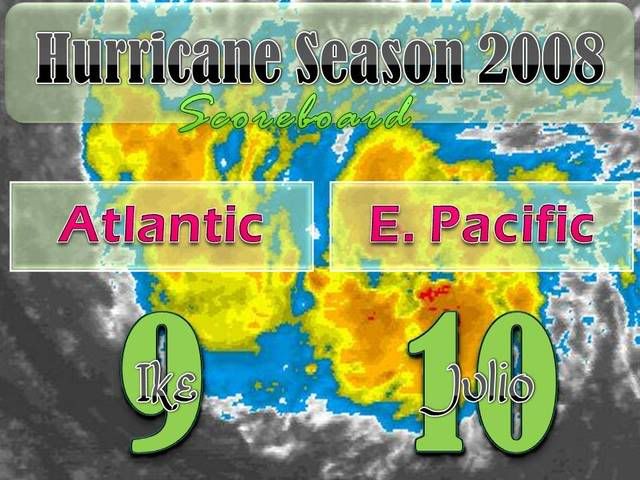
KWT wrote:Far far too early to make the call as to where Ike is going, I think this is almost certainly going to be a big player once it gets to around 60W, steady strengthening till then I'd have thought and then things go bang, it'll head into an area well able to support cat-4/5 hurricanes... :eek:


seems reasonable based on track and ridge setup, we need to get rid of hanna first, tune up the computers folks the next 10 days at least are going to be crazy
0 likes   

User avatar
MortisFL
Category 1
Category 1
Posts: 391
Age: 42
Joined: Mon Jul 21, 2003 9:01 am
Location: Sarasota, FL
Contact:

Re: ATL: Tropical Depression Nine in Central Atlantic

#256 Postby MortisFL » Mon Sep 01, 2008 3:35 pm

Steve H. wrote:OH BTW, this will be Ike at 5 pm. This should stay south of Florida, but it will be close. :flag:


Glad you know it should go south of FL...you cant fine tune a forecast this far out.
0 likes   

User avatar
WindRunner
Category 5
Category 5
Posts: 5806
Age: 34
Joined: Fri Jul 29, 2005 8:07 pm
Location: Warrenton, VA, but Albany, NY for school
Contact:

#257 Postby WindRunner » Mon Sep 01, 2008 3:43 pm

45kts at 5pm...

ESTIMATED MINIMUM CENTRAL PRESSURE 1000 MB
MAX SUSTAINED WINDS 45 KT WITH GUSTS TO 55 KT.
34 KT.......100NE 75SE 0SW 50NW.
12 FT SEAS..240NE 75SE 0SW 50NW.
WINDS AND SEAS VARY GREATLY IN EACH QUADRANT. RADII IN NAUTICAL
MILES ARE THE LARGEST RADII EXPECTED ANYWHERE IN THAT QUADRANT.
0 likes   

jlauderdal
S2K Supporter
S2K Supporter
Posts: 7182
Joined: Wed May 19, 2004 5:46 am
Location: NE Fort Lauderdale
Contact:

Re: ATL: Tropical Depression Nine in Central Atlantic

#258 Postby jlauderdal » Mon Sep 01, 2008 3:43 pm

MortisFL wrote:
Steve H. wrote:OH BTW, this will be Ike at 5 pm. This should stay south of Florida, but it will be close. :flag:


Glad you know it should go south of FL...you cant fine tune a forecast this far out.


steve needs to worry about hanna and not ike considering the setup
0 likes   

User avatar
HURAKAN
Professional-Met
Professional-Met
Posts: 46086
Age: 38
Joined: Thu May 20, 2004 4:34 pm
Location: Key West, FL
Contact:

#259 Postby HURAKAN » Mon Sep 01, 2008 3:46 pm

Image
0 likes   

Brent
S2K Supporter
S2K Supporter
Posts: 38088
Age: 36
Joined: Sun May 16, 2004 10:30 pm
Location: Tulsa Oklahoma
Contact:

Re: ATL: Tropical Storm Ike in Central Atlantic

#260 Postby Brent » Mon Sep 01, 2008 3:47 pm

Image
0 likes   


Return to “2008”

Who is online

Users browsing this forum: No registered users and 4 guests