Special advisory soon. Expect, maybe, a change in the track.
Moderator: S2k Moderators
\caneman wrote:I'm all for not creating panic but this is on our doorstep no excuse for Avilia not to have bumped up the winds higher.


HURAKAN wrote:
Special advisory soon. Expect, maybe, a change in the track.


gatorcane wrote:well if that is any eye its moving SW or maybe hints of SSW...to me.
http://www.ssd.noaa.gov/goes/flt/t2/loop-vis.html


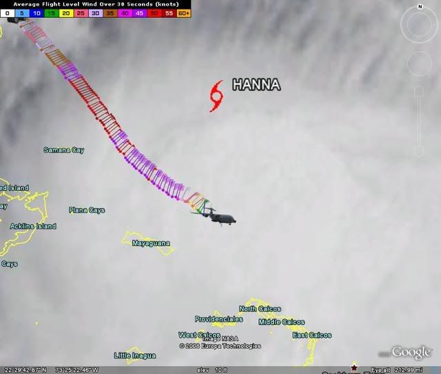
Grease Monkey wrote:So the center looks further north then we thought (based on the illustration above)?
Grease Monkey wrote:HURAKAN wrote:
Special advisory soon. Expect, maybe, a change in the track.
HURAKAN wrote:Grease Monkey wrote:So the center looks further north then we thought (based on the illustration above)?
Further south. The TS symbol is the 11 AM advisory, the plane is the real center.
caneman wrote:I'm all for not creating panic but this is on our doorstep no excuse for Avilia not to have bumped up the winds higher.

HURAKAN wrote:
Special advisory soon. Expect, maybe, a change in the track.


Evil Jeremy wrote:If the center is further south, I believe that means a more westward track. Please correct me if I am wrong.

Myersgirl wrote:Look at the last loop of the water vapor. Appears to show the center of circulation at about 22.5 and 71.3 to me.
Users browsing this forum: No registered users and 294 guests
