Smurfwicked wrote:
Just wondering...
Why does that very small amount of clouds in the upper left that image seem to be moving in a circular motion as if its rotating? (look about a inch below where it says 1mph)

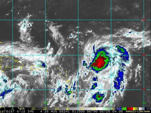
It's an upper level low.
Moderator: S2k Moderators

Smurfwicked wrote:
Just wondering...
Why does that very small amount of clouds in the upper left that image seem to be moving in a circular motion as if its rotating? (look about a inch below where it says 1mph)


KWT wrote:I think if this does develop you've got to favor it getting picked up by the trough like some of the models are expecting. I'd expect the system to steadily turn more to the NW over the next 48hrs.
JPmia wrote:I think we can all agree that the EURO's run today is rather unusual. Going north and the southwest and then northwest toward Florida. Though Jeanne did have an unusual track, there's plenty of reasons to be skeptical of that run. Let's see if they become a trend.


LAwxrgal wrote:Oh boy, something else to keep our eyes on. Hard Head Hanna....
Brent wrote:Smurfwicked wrote:
Just wondering...
Why does that very small amount of clouds in the upper left that image seem to be moving in a circular motion as if its rotating? (look about a inch below where it says 1mph)
It's an upper level low.

Patrick99 wrote:It looks like the ULL has gotten far enough away from 95L, so.....game on.
Users browsing this forum: No registered users and 37 guests