


ATL GUSTAV: Tropical Depression - Discussion
Moderator: S2k Moderators
-
cheezyWXguy

- Category 5

- Posts: 6281
- Joined: Mon Feb 13, 2006 12:29 am
- Location: Dallas, TX
Re: ATL: Invest 94L in East Atlantic
Brent wrote:TROPICAL WEATHER OUTLOOK
NWS TPC/NATIONAL HURRICANE CENTER MIAMI FL
800 PM EDT MON AUG 18 2008
FOR THE NORTH ATLANTIC...CARIBBEAN SEA AND THE GULF OF MEXICO...
THE NATIONAL HURRICANE CENTER IS ISSUING ADVISORIES ON TROPICAL
STORM FAY...CENTERED ABOUT 105 MILES SOUTH OF NAPLES FLORIDA.
SHOWERS AND THUNDERSTORMS ASSOCIATED WITH AN AREA OF LOW PRESSURE
LOCATED ABOUT 750 MILES WEST-SOUTHWEST OF THE CAPE VERDE ISLANDS
HAVE CHANGED LITTLE IN ORGANIZATION THIS EVENING. UPPER-LEVEL WINDS
ARE FORECAST TO BE MARGINALLY FAVORABLE FOR DEVELOPMENT OF THIS
SYSTEM OVER THE NEXT COUPLE OF DAYS AS IT MOVES WESTWARD OR
WEST-NORTHWESTWARD NEAR 15 MPH.
ELSEWHERE...TROPICAL CYCLONE FORMATION IS NOT EXPECTED DURING THE
NEXT 48 HOURS.
$$
FORECASTER RHOME
seems to be organizing to me...i still say td tomorrow
0 likes


-
cycloneye

- Admin

- Posts: 149276
- Age: 69
- Joined: Thu Oct 10, 2002 10:54 am
- Location: San Juan, Puerto Rico
Re: ATL: Invest 94L in East Atlantic
From 8 PM Discussion.Intersting last sentence about another low SE of 94L.
...TROPICAL WAVES...
A TROPICAL WAVE IS IN THE E TROPICAL ATLC ALONG 35W S OF 17N. A
1010 MB LOW IS ANALYZED ALONG THE WAVE AXIS NEAR 13N. SCATTERED
SHOWERS AND TSTMS ARE WITHIN 90 NM N SEMICIRCLE OF THE LOW
CENTER. SOME BANDING FEATURE IS NOTED ON SATELLITE IMAGERY. THIS
SYSTEM HAS CONTINUED TO BECOME BETTER ORGANIZED THIS EVENING AND
ADDITIONAL DEVELOPMENT INTO A POSSIBLE TROPICAL CYCLONE CAN BE
EXPECTED DURING THE NEXT 48 HOURS AS IT MOVES WESTWARD OR
WEST-NORTHWESTWARD AT ABOUT 15 MPH. ANOTHER AREA OF CLOUDINESS
WITH MODERATE CONVECTION IS WITHIN 530 NM SE OF THE ABOVE
MENTIONED SFC LOW. THE CLOUD PATTERN IS ALSO EXHIBITING CYCLONIC
CIRCULATION AS OBSERVED ON RECENT SATELLITE IMAGERY. WILL WAIT
FOR MORE SHIP...SCATTEROMETER AND SATELLITE DATA BEFORE PLACING
ANOTHER SFC LOW OUT THERE. CLUSTERS OF SCATTERED MODERATE
CONVECTION ARE FROM 11N-14.5N BETWEEN 31W-38W RELATED TO THE
TROPICAL WAVE/LOW.
http://www.storm2k.org/weather/hw3.php? ... hwvmetric=
...TROPICAL WAVES...
A TROPICAL WAVE IS IN THE E TROPICAL ATLC ALONG 35W S OF 17N. A
1010 MB LOW IS ANALYZED ALONG THE WAVE AXIS NEAR 13N. SCATTERED
SHOWERS AND TSTMS ARE WITHIN 90 NM N SEMICIRCLE OF THE LOW
CENTER. SOME BANDING FEATURE IS NOTED ON SATELLITE IMAGERY. THIS
SYSTEM HAS CONTINUED TO BECOME BETTER ORGANIZED THIS EVENING AND
ADDITIONAL DEVELOPMENT INTO A POSSIBLE TROPICAL CYCLONE CAN BE
EXPECTED DURING THE NEXT 48 HOURS AS IT MOVES WESTWARD OR
WEST-NORTHWESTWARD AT ABOUT 15 MPH.
WITH MODERATE CONVECTION IS WITHIN 530 NM SE OF THE ABOVE
MENTIONED SFC LOW. THE CLOUD PATTERN IS ALSO EXHIBITING CYCLONIC
CIRCULATION AS OBSERVED ON RECENT SATELLITE IMAGERY. WILL WAIT
FOR MORE SHIP...SCATTEROMETER AND SATELLITE DATA BEFORE PLACING
ANOTHER SFC LOW OUT THERE. CLUSTERS OF SCATTERED MODERATE
CONVECTION ARE FROM 11N-14.5N BETWEEN 31W-38W RELATED TO THE
TROPICAL WAVE/LOW.
http://www.storm2k.org/weather/hw3.php? ... hwvmetric=
0 likes


Re: ATL: Invest 94L in East Atlantic
Indeed. Also note how the TWD seems more bullish on development of 94L than the TWO.cycloneye wrote:From 8 PM Discussion.Interesting last sentence about another low SE of 94L.
...TROPICAL WAVES...
A TROPICAL WAVE IS IN THE E TROPICAL ATLC ALONG 35W S OF 17N. A
1010 MB LOW IS ANALYZED ALONG THE WAVE AXIS NEAR 13N. SCATTERED
SHOWERS AND TSTMS ARE WITHIN 90 NM N SEMICIRCLE OF THE LOW
CENTER. SOME BANDING FEATURE IS NOTED ON SATELLITE IMAGERY. THIS
SYSTEM HAS CONTINUED TO BECOME BETTER ORGANIZED THIS EVENING AND
ADDITIONAL DEVELOPMENT INTO A POSSIBLE TROPICAL CYCLONE CAN BE
EXPECTED DURING THE NEXT 48 HOURS AS IT MOVES WESTWARD OR
WEST-NORTHWESTWARD AT ABOUT 15 MPH.
WITH MODERATE CONVECTION IS WITHIN 530 NM SE OF THE ABOVE
MENTIONED SFC LOW. THE CLOUD PATTERN IS ALSO EXHIBITING CYCLONIC
CIRCULATION AS OBSERVED ON RECENT SATELLITE IMAGERY. WILL WAIT
FOR MORE SHIP...SCATTEROMETER AND SATELLITE DATA BEFORE PLACING
ANOTHER SFC LOW OUT THERE. CLUSTERS OF SCATTERED MODERATE
CONVECTION ARE FROM 11N-14.5N BETWEEN 31W-38W RELATED TO THE
TROPICAL WAVE/LOW.
0 likes
-
Gustywind

- Category 5
- Posts: 12334
- Joined: Mon Sep 03, 2007 7:29 am
- Location: Baie-Mahault, GUADELOUPE
Re: ATL: Invest 94L in East Atlantic
abajan wrote:Indeed. Also note how the TWD seems more bullish on development of 94L than the TWO.cycloneye wrote:From 8 PM Discussion.Intersting addition of discussion about another low SE of 94L.
...TROPICAL WAVES...
A TROPICAL WAVE IS IN THE E TROPICAL ATLC ALONG 35W S OF 17N. A
1010 MB LOW IS ANALYZED ALONG THE WAVE AXIS NEAR 13N. SCATTERED
SHOWERS AND TSTMS ARE WITHIN 90 NM N SEMICIRCLE OF THE LOW
CENTER. SOME BANDING FEATURE IS NOTED ON SATELLITE IMAGERY. THIS
SYSTEM HAS CONTINUED TO BECOME BETTER ORGANIZED THIS EVENING AND
ADDITIONAL DEVELOPMENT INTO A POSSIBLE TROPICAL CYCLONE CAN BE
EXPECTED DURING THE NEXT 48 HOURS AS IT MOVES WESTWARD OR
WEST-NORTHWESTWARD AT ABOUT 15 MPH.
WITH MODERATE CONVECTION IS WITHIN 530 NM SE OF THE ABOVE
MENTIONED SFC LOW. THE CLOUD PATTERN IS ALSO EXHIBITING CYCLONIC
CIRCULATION AS OBSERVED ON RECENT SATELLITE IMAGERY. WILL WAIT
FOR MORE SHIP...SCATTEROMETER AND SATELLITE DATA BEFORE PLACING
ANOTHER SFC LOW OUT THERE. CLUSTERS OF SCATTERED MODERATE
CONVECTION ARE FROM 11N-14.5N BETWEEN 31W-38W RELATED TO THE
TROPICAL WAVE/LOW.
Absolutely Abajan, agree with you
0 likes
-
cycloneye
- Admin
- Posts: 149276
- Age: 69
- Joined: Thu Oct 10, 2002 10:54 am
- Location: San Juan, Puerto Rico
Re: ATL: Invest 94L in East Atlantic
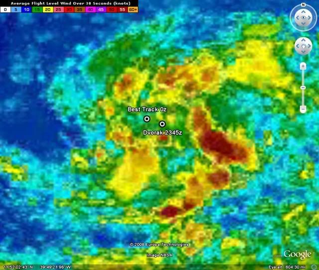
00:00 UTC Best Track for 94L:
AL, 94, 2008081900, , BEST, 0, 131N, 362W, 25, 1009, DB, 34, NEQ, 0, 0, 0, 0,
ftp://ftp.tpc.ncep.noaa.gov/atcf/tcweb/
AL, 94, 2008081900, , BEST, 0, 131N, 362W, 25, 1009, DB, 34, NEQ, 0, 0, 0, 0,
ftp://ftp.tpc.ncep.noaa.gov/atcf/tcweb/
0 likes
-
catastrophic

- Tropical Low

- Posts: 35
- Joined: Wed Jul 23, 2008 1:50 pm
- Location: palm bay FL

-
cycloneye
- Admin
- Posts: 149276
- Age: 69
- Joined: Thu Oct 10, 2002 10:54 am
- Location: San Juan, Puerto Rico
Re: ATL: Invest 94L in East Atlantic
0 likes

-
HurricaneHunter914
- Category 5
- Posts: 4439
- Age: 32
- Joined: Fri Mar 10, 2006 7:36 pm
- Location: College Station, TX
I've seen this soo many times. The system will have the circulation, but weak convection. Then it'll have the convection, but no circulation. I think that once this system burst w/ convection, it could possibly lose it's circulation. I do believe it could develop though.
The posts in this forum are NOT official forecast and should not be used as such. They are just the opinion of the poster and may or may not be backed by sound meteorological data. They are NOT endorsed by any professional institution or storm2k.org. For official information, please refer to the NHC and NWS products
The posts in this forum are NOT official forecast and should not be used as such. They are just the opinion of the poster and may or may not be backed by sound meteorological data. They are NOT endorsed by any professional institution or storm2k.org. For official information, please refer to the NHC and NWS products
0 likes
-
ConvergenceZone
.gif)
- Category 5
- Posts: 5241
- Joined: Fri Jul 29, 2005 1:40 am
- Location: Northern California
Re:
HurricaneHunter914 wrote:I've seen this soo many times. The system will have the circulation, but weak convection. Then it'll have the convection, but no circulation. I think that once this system burst w/ convection, it could possibly lose it's circulation. I do believe it could develop though.
The posts in this forum are NOT official forecast and should not be used as such. They are just the opinion of the poster and may or may not be backed by sound meteorological data. They are NOT endorsed by any professional institution or storm2k.org. For official information, please refer to the NHC and NWS products
I hear ya. This season seems to be a bit taxing on the nerves and patience...First Dolly, then Fay, of course we will have to see if this falls in the same ballpark. I don't blame you for being cautious and skeptical though. For some reason though, systems are just having a hard time getting their act together this season...I remember looking back on seasons in the past(not just 2005) and always remember a couple of buzzsaw storms spinning out in the Atlantic, most of the time away from land, but nonetheless they were there......Sometimes I just want to scream at the systems..."If you aren't gonna cook, get out of the kitchen"!!!
0 likes
-
cycloneye
- Admin
- Posts: 149276
- Age: 69
- Joined: Thu Oct 10, 2002 10:54 am
- Location: San Juan, Puerto Rico
Re: ATL: Invest 94L in East Atlantic
The last 94L was for what formed Dolly.All remember how that invest went thru many peaks and valleys for a week,then finnally it formed into a Cyclone after it passed the Yucatan.Lets see if this 94L doesnt repeat that or its another slow developer.
0 likes
-
alan1961

- Category 2

- Posts: 771
- Joined: Mon Mar 20, 2006 11:58 am
- Location: Derby, Derbyshire, England
- Contact:
Re: Re:
ConvergenceZone wrote:KWT wrote:Yep does look very good indeed, let see what it looks like 12hrs time but it seems like its a TD right now IMO.
Hey KWT, noticed you are in the UK....Not often we get someone that far away this interested in the tropics in this neck of the woods, kinda cool though...
I'm here too convergence..not too far from KWT too
0 likes

-
Ivanhater

- Storm2k Moderator

- Posts: 11221
- Age: 39
- Joined: Fri Jul 01, 2005 8:25 am
- Location: Pensacola
Re: ATL: Invest 94L in East Atlantic
I dont think this will develop for another few days, if at all
0 likes
Who is online
Users browsing this forum: No registered users and 92 guests