Other Areas To Watch!

This is the general tropical discussion area. Anyone can take their shot at predicting a storms path.

Moderator: S2k Moderators

Forum rules

The posts in this forum are NOT official forecasts and should not be used as such. They are just the opinion of the poster and may or may not be backed by sound meteorological data. They are NOT endorsed by any professional institution or STORM2K. For official information, please refer to products from the National Hurricane Center and National Weather Service.

Help Support Storm2K
Message
Author
chadtm80

Other Areas To Watch!

#1 Postby chadtm80 » Sun Jul 13, 2003 5:53 pm

Image

Image
Last edited by chadtm80 on Mon Jul 14, 2003 7:21 am, edited 1 time in total.
0 likes   

Rainband

#2 Postby Rainband » Sun Jul 13, 2003 6:31 pm

Great maps Chad!!!! :wink: Thanks BUD!!!
0 likes   

User avatar
Colin
Category 5
Category 5
Posts: 5086
Joined: Fri Apr 18, 2003 4:17 pm
Location: Catasauqua, PA
Contact:

#3 Postby Colin » Sun Jul 13, 2003 8:42 pm

Thanks for the maps, Chad... will be interesting to see what these do over the next few days. ;)
0 likes   

Steve H.
Category 5
Category 5
Posts: 2146
Joined: Sat Oct 19, 2002 9:06 am
Location: Palm Bay, Florida

Actually That's not the Area

#4 Postby Steve H. » Sun Jul 13, 2003 9:34 pm

The area they're talking about is closer to the central Atlantic that is not easily seen on IR imagery. This was a srong wave that came off Africa a few days ago. Notice they say 'between Africa and the Lesser Antilles'. However, the area you circled Chad is impressive in the 0Z 14 June shot, as it is showing some hint of a circulation as well. This has some potential for development some time during the week IMO. Cheers!!
0 likes   

Steve H.
Category 5
Category 5
Posts: 2146
Joined: Sat Oct 19, 2002 9:06 am
Location: Palm Bay, Florida

#5 Postby Steve H. » Mon Jul 14, 2003 6:50 am

Hey Chad, the wave you circled yesterday is looking good this morning and is developing some deep convection as it has pulled away from Africa....bears watching. The wave between the Lesser Antilles and Africa shows up well but still no deep convection. NHC still feels this area may develop over the next few days. Appears Claudette is moving NW again. Cheers!!
0 likes   

User avatar
cycloneye
Admin
Admin
Posts: 145308
Age: 68
Joined: Thu Oct 10, 2002 10:54 am
Location: San Juan, Puerto Rico

#6 Postby cycloneye » Mon Jul 14, 2003 7:01 am

Chad Put another circule on wave at 43w void of convection because it has a big circulation in the stratus clouds but TPC says it has a chance further west.
0 likes   
Visit the Caribbean-Central America Weather Thread where you can find at first post web cams,radars
and observations from Caribbean basin members Click Here

chadtm80

#7 Postby chadtm80 » Mon Jul 14, 2003 7:22 am

Updated
0 likes   

User avatar
Lindaloo
Category 5
Category 5
Posts: 22658
Joined: Sat Mar 29, 2003 10:06 am
Location: Pascagoula, MS

#8 Postby Lindaloo » Mon Jul 14, 2003 7:24 am

Thanks. That wave moving into the Carribean is not what I want to see. Does it have a chance? Or could it be another Claudette.
0 likes   

User avatar
wx247
S2K Supporter
S2K Supporter
Posts: 14279
Age: 41
Joined: Wed Feb 05, 2003 10:35 pm
Location: Monett, Missouri
Contact:

#9 Postby wx247 » Mon Jul 14, 2003 10:32 am

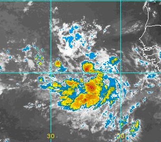
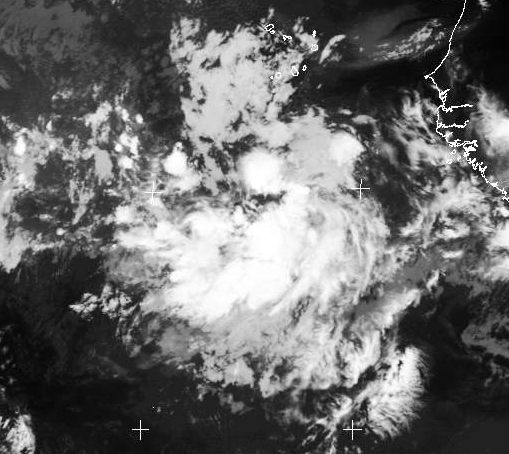
How long has the convection persisted southeast of Jamaica like that?
0 likes   
Personal Forecast Disclaimer:
The posts in this forum are NOT official forecast and should not be used as such. They are just the opinion of the poster and may or may not be backed by sound meteorological data. They are NOT endorsed by any professional institution or storm2k.org. For official information, please refer to the NHC and NWS products.

User avatar
cycloneye
Admin
Admin
Posts: 145308
Age: 68
Joined: Thu Oct 10, 2002 10:54 am
Location: San Juan, Puerto Rico

#10 Postby cycloneye » Mon Jul 14, 2003 10:41 am

That pic is not the recent one but convection has dimiuished there.

Hey Chad now the TPC cleared up that wave at 45w now as in the TWO at 11:30 says 1,100 miles eastnortheast of the leewards so that circule must be at the convection you see up there at that longitud sorry I made you change the circule.
0 likes   
Visit the Caribbean-Central America Weather Thread where you can find at first post web cams,radars
and observations from Caribbean basin members Click Here


Return to “Talkin' Tropics”

Who is online

Users browsing this forum: Google Adsense [Bot], ouragans, USTropics, wwizard, wxman57, Yellow Evan and 45 guests