ATL: Tropical Depression Fay
Moderator: S2k Moderators
- carolina_73
- Tropical Storm

- Posts: 148
- Joined: Wed Jul 23, 2008 1:30 am
Re: ATL: Invest 92L - Central Atlantic
The weather pattern right now sure is strange. HP to the northeast and a developing LP system in the deep south moving east. That is a wintertime setup. If it was January we would be getting either some snow or an ice storm. That is very strange this time of year. Well...it looks like Recon might be flying out today.
0 likes
- cycloneye
- Admin

- Posts: 149312
- Age: 69
- Joined: Thu Oct 10, 2002 10:54 am
- Location: San Juan, Puerto Rico
Re: ATL: Invest 92L - Central Atlantic
12:00 UTC Best Track position:
AL, 92, 2008081212, , BEST, 0, 155N, 508W, 25, 1007, DB, 0, , 0, 0, 0, 0,
AL, 92, 2008081212, , BEST, 0, 155N, 508W, 25, 1007, DB, 0, , 0, 0, 0, 0,
0 likes
- hurricanefloyd5
- Category 5

- Posts: 1659
- Age: 45
- Joined: Sun May 02, 2004 10:53 am
- Location: Spartanburg
- Contact:
Re: ATL: Invest 92L - Central Atlantic
cycloneye wrote:12:00 UTC Best Track position:
AL, 92, 2008081212, , BEST, 0, 155N, 508W, 25, 1007, DB, 0, , 0, 0, 0, 0,
dose this mean a TD is forming???????
0 likes
- deltadog03
- Professional-Met

- Posts: 3580
- Joined: Tue Jul 05, 2005 6:16 pm
- Location: Macon, GA
Re: ATL: Invest 92L - Central Atlantic
carolina_73 wrote:The weather pattern right now sure is strange. HP to the northeast and a developing LP system in the deep south moving east. That is a wintertime setup. If it was January we would be getting either some snow or an ice storm. That is very strange this time of year. Well...it looks like Recon might be flying out today.
I agree...We are going to have STRATIFORM rains in GA today.. Almost unheard of for august. I really think summer is about over for the SE...Ok, sorry for the OT there.
0 likes
-
caneman
Re: ATL: Invest 92L - Central Atlantic
I'm a little concerned about the pattern here in West Fl. Clearwater as well. It rained all of July. There are times it could be mistaken for Fall with cool breezes and lack of humidity from time to time.. The troughs keep dipping down much like the one that turned Charley. Hope nothing shakes loose in the Caribb or E.Gom at the wrong time.
0 likes
- bvigal
- S2K Supporter

- Posts: 2276
- Joined: Sun Jul 24, 2005 8:49 am
- Location: British Virgin Islands
- Contact:
Re: ATL: Invest 92L - Central Atlantic
This makes good sense from what I see on satellite. The 1007mb was correctly forecast on 6am surface map(below), but motion in this 12z model data: DIRCUR = 305DEG SPDCUR = 12KT is much more northward. (Hope it's correct, miss all the islands!)cycloneye wrote:12:00 UTC Best Track position:
AL, 92, 2008081212, , BEST, 0, 155N, 508W, 25, 1007, DB, 0, , 0, 0, 0, 0,

0 likes
- gatorcane
- S2K Supporter

- Posts: 23708
- Age: 48
- Joined: Sun Mar 13, 2005 3:54 pm
- Location: Boca Raton, FL
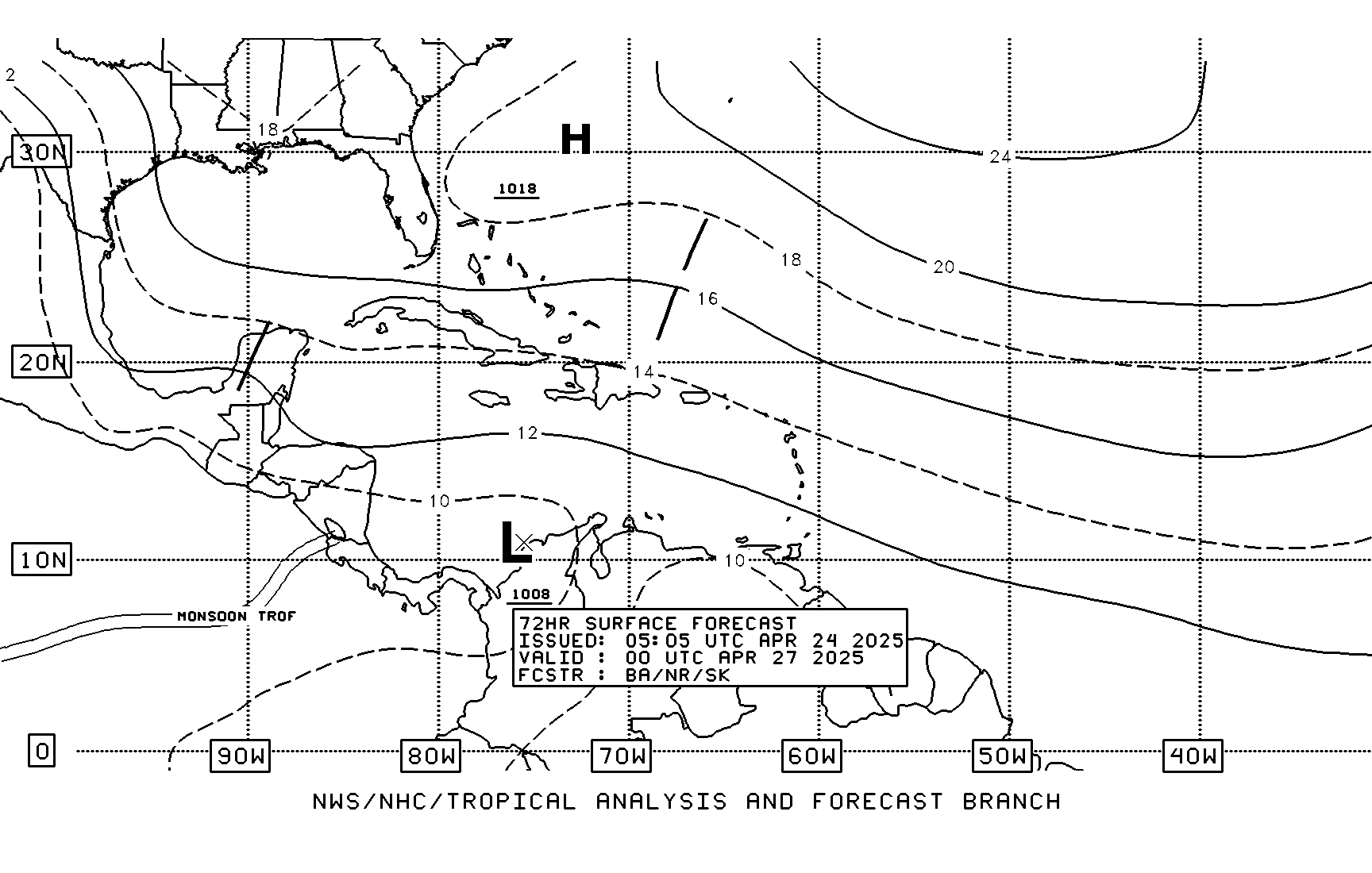
I know this was posted several pages back but I really hope this TAFB forecast changes as it is showing two possible tropical cyclones getting underneath the Bermuda High heading WNW 


Last edited by gatorcane on Tue Aug 12, 2008 8:40 am, edited 1 time in total.
0 likes
- BensonTCwatcher
- Category 5

- Posts: 1050
- Joined: Sat Aug 28, 2004 10:11 pm
- Location: Southport NC
We're going to have to consolidate a center before we see if this becomes likely to go into the Gulf or not. Once it crosses the axis of that ULL it may gain lattitude in earnest i.e. not from center relocation. This could easily consolidate and establish the center further south as well. That will make a significant difference on whether this goes carribean or not mid-term. It's why we are all here... 
0 likes
- Blown Away
- S2K Supporter

- Posts: 10253
- Joined: Wed May 26, 2004 6:17 am
Re: ATL: Invest 92L - Central Atlantic
I'm sniffing a "Special Disturbance Statement" if 92L continues to improve.
0 likes
-
tolakram
- Admin

- Posts: 20179
- Age: 62
- Joined: Sun Aug 27, 2006 8:23 pm
- Location: Florence, KY (name is Mark)
Re: ATL: Invest 92L - Central Atlantic
From 4AM ish, if I read that right. No closed low that I can see.


Last edited by tolakram on Tue Aug 12, 2008 9:06 am, edited 1 time in total.
0 likes
- gatorcane
- S2K Supporter

- Posts: 23708
- Age: 48
- Joined: Sun Mar 13, 2005 3:54 pm
- Location: Boca Raton, FL
Florida Keys AFD snippet on what I assume is the wave attached to 92L:
FRIDAY THROUGH MONDAY...LARGE SCALE PATTERN IS INDICATED TO CHANGE
WITH HEIGHT RISES OVER FLORIDA AND THE BAHAMAS. WILL HAVE TO WATCH A
TROPICAL WAVE AS IT APPROACHES THE KEYS LONGITUDE BY SUNDAY AND
SUNDAY NIGHT. ASIDE FROM ANY TROPICAL WAVES IMPACTING THE KEYS...A
LIGHT SURFACE TO 400 MB FLOW WILL FAVOR NORMAL MESOSCALE PROCESSES.
http://www.srh.noaa.gov/productview.php ... n=1&max=51
0 likes
- BensonTCwatcher
- Category 5

- Posts: 1050
- Joined: Sat Aug 28, 2004 10:11 pm
- Location: Southport NC
Re:
x-y-no wrote:I'm seeing a very elongated circulation, extending from under the big blob of convection SW to about 14N 53W. Actually not so sure it,a a circulation - could just be a very sharp wave axis.
I still think this will develop, but right now it's not much more organized than it was two days ago.
I agree, also there is still an anti-cyclone aloft and today I'd expect it to hold steady or strenghten due to relaxed shear. It will still have to battle past some likely 20kt shear before it clears the ULL to the NW of the center. After that I'd expect to see it develop fairly quickly i.e. 24-36 hrs or so. This is NOT a forecast. (See S2K disclaimer and refer to NHC for official information)
0 likes
- deltadog03
- Professional-Met

- Posts: 3580
- Joined: Tue Jul 05, 2005 6:16 pm
- Location: Macon, GA
-
tolakram
- Admin

- Posts: 20179
- Age: 62
- Joined: Sun Aug 27, 2006 8:23 pm
- Location: Florence, KY (name is Mark)
Re: ATL: Invest 92L - Central Atlantic
Jeff Masters agrees with the elongated low ...
http://www.wunderground.com/blog/JeffMa ... amp=200808
http://www.wunderground.com/blog/JeffMa ... amp=200808
0 likes
- CourierPR
- Category 5

- Posts: 1336
- Age: 72
- Joined: Tue Aug 31, 2004 7:53 pm
- Location: Pompano Beach, Florida
Re: ATL: Invest 92L - Central Atlantic
AccuWeather says that upper level winds are favorable.
0 likes
- gatorcane
- S2K Supporter

- Posts: 23708
- Age: 48
- Joined: Sun Mar 13, 2005 3:54 pm
- Location: Boca Raton, FL
the low is elongated so I don't expect it to become a depression until it becomes more consolidated.
The next 24-48 hours are going to be the toughest for this invest as it interacts with the ULL trough axis. But if it can pass the axis in tact, it is going to have very favorable UL winds and alot of real estate to work with more than likely.
The next 24-48 hours are going to be the toughest for this invest as it interacts with the ULL trough axis. But if it can pass the axis in tact, it is going to have very favorable UL winds and alot of real estate to work with more than likely.
0 likes
- BensonTCwatcher
- Category 5

- Posts: 1050
- Joined: Sat Aug 28, 2004 10:11 pm
- Location: Southport NC
Re: ATL: Invest 92L - Central Atlantic
One other thing. There is a decent amount of dry air about, so it may be a question of dry air capping the convection. As derek pointed out earlier not enough inflow and competing areas of uplift would keep it from consolidating. You can clearly see the ULL holding steady and the dry air http://www.ssd.noaa.gov/goes/flt/t1/loop-vis.html BUT I do think this will get past all of that since there is enough circ energy in the broad low. It will pop all too soon I think
0 likes
Re: ATL: Invest 92L - Central Atlantic
We had rain showers again this morning. West wind.
That elongated convection on the west side of 92L will pull in and form a feeder band of moisture like a reserve energy pack when and if 92L gets strong enough to pull it in. I think 92L will form so we are just adding bandwidth here until we see where the track resolves in terms of the Antilles tomorrow or the next day. We could be talking a different airmass and different support conditions north of the islands so I won't guess on intensity. What we have to watch for is a track north of Cuba and a hook turn up the west coast of Florida for us west coast worriers.
That elongated convection on the west side of 92L will pull in and form a feeder band of moisture like a reserve energy pack when and if 92L gets strong enough to pull it in. I think 92L will form so we are just adding bandwidth here until we see where the track resolves in terms of the Antilles tomorrow or the next day. We could be talking a different airmass and different support conditions north of the islands so I won't guess on intensity. What we have to watch for is a track north of Cuba and a hook turn up the west coast of Florida for us west coast worriers.
0 likes
Who is online
Users browsing this forum: No registered users and 30 guests
