Ex Invest 99L in Western Atlantic
Moderator: S2k Moderators

This ex-invest is reminding me of my lawnmower when the carberator is acting up...it starts running then dies off, then starts running again and repeat...
With the upper level low just to its southwest moving in tandem really makes it difficult for this thing to consistently maintain convection... however at the same time it is providing some upper level divergence on the northern portion of the llswirl. To the west it does look like it is trying to fire up A Little, which I hadn't seen to much of previously. All in all if surrounding features stay in motion in relation with the llswirl then not to much would happen. But yah never know exactly what will happen.
With the upper level low just to its southwest moving in tandem really makes it difficult for this thing to consistently maintain convection... however at the same time it is providing some upper level divergence on the northern portion of the llswirl. To the west it does look like it is trying to fire up A Little, which I hadn't seen to much of previously. All in all if surrounding features stay in motion in relation with the llswirl then not to much would happen. But yah never know exactly what will happen.
0 likes
-
alan1961

- Category 2

- Posts: 771
- Joined: Mon Mar 20, 2006 11:58 am
- Location: Derby, Derbyshire, England
- Contact:
Re: Ex Invest 99L in Western Atlantic
The blob down on the ITCZ has grown a stalk and is turning into a tomato, but it wont ripen into FAYE. 
0 likes


-
SouthFLTropics

- Category 5

- Posts: 4258
- Age: 50
- Joined: Thu Aug 14, 2003 8:04 am
- Location: Port St. Lucie, Florida
Re: Ex Invest 99L in Western Atlantic
Well based on current appearance I wouldn't give this thing a snowball's chance in...well you know. I have to admire some people on here though. They have stuck to their guns no matter what. At least we don't have a bunch of flip floppers. LOL...Hopefully this thing will just stay weak and give us some added rainfall over Big Lake "O".
SouthFLTropics
SouthFLTropics
0 likes
-
Emmett_Brown

- Category 5
- Posts: 1433
- Joined: Wed Aug 24, 2005 9:10 pm
- Location: Sarasota FL
Re: Ex Invest 99L in Western Atlantic
Yup, this is now nothing more than a very weak wave. Not counting it out completely, however. Who knows... tomorrow morning, we could see a big blowup of storms. Conditions are definitely more favorable, but there isnt much of a disturbance to work with. Its pretty much the next 12 hours or never for this wave.
0 likes
-
bvigal

- S2K Supporter

- Posts: 2276
- Joined: Sun Jul 24, 2005 8:49 am
- Location: British Virgin Islands
- Contact:
Re: Ex Invest 99L in Western Atlantic
extracted from 8pm 5th Aug 2008 Tropical Weather Discussion: (do we all know the link??? find it at National Hurricane Center main page!! http://www.nhc.noaa.gov/)
THE HIGH AMPLITUDE TROPICAL WAVE OVER THE E CARIBBEAN HAS
BROKEN. THE N PART IS MOVING NWD OVER THE W ATLC WHILE THE
REMAINDER OF THE WAVE IS ADJUSTED ALONG 65W BASED ON SFC
OBSERVATIONS...DOPPLER RADAR AND SATELLITE PICTURES. THE AXIS
CURRENTLY EXTENDS FROM THE VIRGIN ISLANDS TO NE VENEZUELA.
SCATTERED SHOWERS AND ISOLATED TSTMS ARE BEHIND THE WAVE AXIS
AFFECTING MAINLY THE WINDWARD ISLANDS AND NORTH-CENTRAL
VENEZUELA. THE SAN JUAN DOPPLER RADAR REVEALS SOME SHOWER
ACTIVITY OVER THE VIRGIN ISLANDS ASSOCIATED WITH THE NORTHERN
END OF THE WAVE AXIS. THE WAVE WILL MOVE ACROSS PUERTO RICO
TONIGHT THROUGH WED MORNING. AFTERWARD...THE WAVE WILL CROSS
HISPANIOLA INCREASING THE LIKELIHOOD OF RAIN.
It is a STEAM BATH here today!!! Got wrinkled clothes? Walk outside the air conditioning (if you are so lucky to have some!), the wrinkles will disappear. Why? Because your whole body will be instantly WET, and your body heat makes the steam!! I see the wave was 65W at 6z, 67W at 12z, 65W again at 18z. (which I could have told them this morning, and did on blog, looking at French radar of it raining from St. Lucia north through ALL the EC islands!)
0 likes
Re: Ex Invest 99L in Western Atlantic
well what is the opposite of boom?
latest ir 2
http://www.ssd.noaa.gov/goes/east/watl/loop-ir2.html
latest quikscat (only a couple hours old) at 2345Z
http://manati.orbit.nesdis.noaa.gov/dat ... MBds19.png
you can see no really LLC small area of moderate winds 25 or so, and anything to watch for would be around 23N
latest ir 2
http://www.ssd.noaa.gov/goes/east/watl/loop-ir2.html
latest quikscat (only a couple hours old) at 2345Z
http://manati.orbit.nesdis.noaa.gov/dat ... MBds19.png
you can see no really LLC small area of moderate winds 25 or so, and anything to watch for would be around 23N
0 likes
-
fasterdisaster
- Category 5
- Posts: 1868
- Joined: Mon Sep 19, 2005 4:41 pm
- Location: Miami, Florida
-
SapphireSea
- Category 1

- Posts: 430
- Joined: Wed Aug 24, 2005 12:13 pm
- Location: Miami, FL
Re: Ex Invest 99L in Western Atlantic
Nothing even remotely closed anymore, some lose convection, nothing to it. I had my doubts from the beginning when I saw the moderate amounts of shear it encountered in the E. Atlantic, and tendencies were not very good ahead of it, just look at what that TUTT did to this when it had what looked like a decent structure. Personally I don't think this has a prayer at becoming anything anymore, although I do hope that convection persists and gets into my yard.
0 likes


Re: Ex Invest 99L in Western Atlantic
Still bursting some convection. This thing is finally in a conducive environment. I would still give it till tomorrow morning to see what happens....

Appears to have decent Divergence.

Appears to have decent Divergence.
0 likes
-
StormTracker

- S2K Supporter
- Posts: 2909
- Age: 59
- Joined: Thu Jun 29, 2006 6:06 am
- Location: Quail Heights(Redlands), FL.
Re: Ex Invest 99L in Western Atlantic
StormTracker wrote:If the surface feature makes it into the Florida Keys or Bahamas, we might be looking at "Bahama-Buster" as they are called(when a system comes all the way from Africa, but can't develop until the last minute...i.e: Katrina/Rita). Not wishing anything on anybody!!! It's just a thought...ST
I'm sticking with my theory considering the way the season has started off!!! I just have a feeling about this one guyz & girlz!!!
0 likes
-
jaxfladude
- Category 5
- Posts: 1249
- Joined: Wed Aug 24, 2005 9:36 pm
- Location: Jacksonville, Fla
-
Honeyko
Re: Ex Invest 99L in Western Atlantic
Stubbornness has nothing to do with it. After initially promoting it, I called for 90L to puke once I observed a trailing system stealing its inflow; others in the thread argued for another half a day until there was nothing left. 99L, otoh, has consistently maintained a swirl and had a southeast moisture feed.SouthFLTropics wrote:I have to admire some people on here though. They have stuck to their guns no matter what.
0 likes

Re: Ex Invest 99L in Western Atlantic
11:14 pm 21.2 kts E ( 92 deg true ) 1-minute sustained wind
Almost directly over this buoy:
http://www.ndbc.noaa.gov/station_page.php?station=41046
Almost directly over this buoy:
http://www.ndbc.noaa.gov/station_page.php?station=41046
0 likes
-
SouthFloridawx

- S2K Supporter
- Posts: 8346
- Age: 47
- Joined: Tue Jul 26, 2005 1:16 am
- Location: Sarasota, FL
- Contact:

-
fasterdisaster
- Category 5
- Posts: 1868
- Joined: Mon Sep 19, 2005 4:41 pm
- Location: Miami, Florida
-
Honeyko
Re: Ex Invest 99L in Western Atlantic
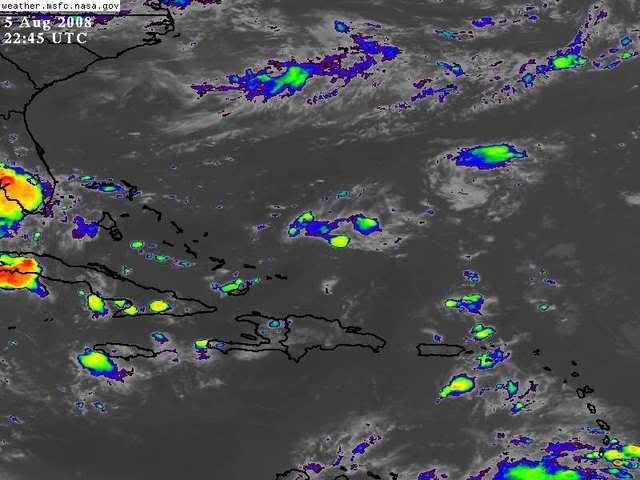
I can believe it. There's been a small but persistent patch of convection over the center or just north of it now for about eight hours. Banding lines are appearing nicely even on the less than clear ghcc.msfc.nasa IR. zooms.drezee wrote:11:14 pm 21.2 kts E ( 92 deg true ) 1-minute sustained wind
Almost directly over this buoy:
http://www.ndbc.noaa.gov/station_page.php?station=41046
This is developing now.
Unless it inexplicably dies (after not doing so over the last three days) -- yes. If I was in Key West, I'd start planning.Is this going into the Gulf?
Last edited by Honeyko on Wed Aug 06, 2008 12:50 am, edited 1 time in total.
0 likes
-
SouthFloridawx
- S2K Supporter
- Posts: 8346
- Age: 47
- Joined: Tue Jul 26, 2005 1:16 am
- Location: Sarasota, FL
- Contact:
Re:
fasterdisaster wrote:Is this going into the Gulf?
With the current motion being pretty quick off to the west, I'd say that the next stop is the gulf.
0 likes
Who is online
Users browsing this forum: No registered users and 62 guests