Ex Invest 99L in Western Atlantic
Moderator: S2k Moderators
-
Honeyko
Re: ATL: Invest 99L in Central Atlantic
My favorite WV: http://hadar.cira.colostate.edu/ramsdis ... _ls_0.html
0 likes


Re: ATL: Invest 99L in Central Atlantic
Shear tendencies do seem to be relaxing a bit.
0600 UTC

2100 UTC

It also needs to stay further south. It still needs to fight a little longer. Let see what happens....
0600 UTC
2100 UTC
It also needs to stay further south. It still needs to fight a little longer. Let see what happens....
Last edited by blp on Mon Aug 04, 2008 8:32 pm, edited 2 times in total.
0 likes
-
Blown Away

- S2K Supporter

- Posts: 10253
- Joined: Wed May 26, 2004 6:17 am
Re: ATL: Invest 99L in Central Atlantic
Honeyko, that is a nice look! Appears the TUTT is weakening and it appears 99L is moving past the dry air to the south, am I reading this correctly?
0 likes
-
stevetampa33614

Re: ATL: Invest 99L in Central Atlantic
Blown_away wrote:99L is back on a just N of due W track again.
Atlantic Ocean Basin: Imagery
DATE/TIME LAT LON CLASSIFICATION STORM
04/2345 UTC 21.7N 62.5W T1.0/1.0 99L
04/1745 UTC 28.2N 91.0W T3.0/3.0 EDOUARD
04/1745 UTC 21.6N 61.6W TOO WEAK 99L
04/1145 UTC 20.4N 59.0W TOO WEAK 99L
04/1145 UTC 28.3N 90.1W T2.5/2.5 EDOUARD
04/0545 UTC 19.8N 56.9W T1.0/1.0 99L
04/0545 UTC 28.2N 89.7W T2.0/2.0 EDOUARD
03/2345 UTC 28.1N 88.3W T2.0/2.0 EDOUARD
03/2345 UTC 19.4N 53.7W T1.0/1.0 99L
03/1745 UTC 28.4N 87.8W T1.5/1.5 91L
03/1745 UTC 19.4N 52.4W T1.0/1.0 99L
03/1145 UTC 28.2N 86.4W T1.5/1.5 91L
03/1145 UTC 18.7N 50.0W T1.0/1.0 99L
If that keeps up it might pass close enough to the below NOAA buoy. So far the pressure has been slightly dropping this afternoon.
http://www.ndbc.noaa.gov/station_page.php?station=41043
0 likes
-
Matt-hurricanewatcher
Re: ATL: Invest 99L in Central Atlantic
If things can get favorable over the next 24 hours, also if the system can move past 65 west below 22 north. I would start treating this with a little more respect being that it could become a threat to some where a long the east coast.
0 likes

Re: ATL: Invest 99L in Western Atlantic
This still has a little bite to it.Its moving WNW.
http://metofis.rsmas.miami.edu/~dortt/s ... 1_loop.gif
http://metofis.rsmas.miami.edu/~dortt/s ... 1_loop.gif
0 likes
-
Blown Away
- S2K Supporter
- Posts: 10253
- Joined: Wed May 26, 2004 6:17 am
Re: ATL: Invest 99L in Western Atlantic
TROPICAL WEATHER DISCUSSION
NWS TPC/NATIONAL HURRICANE CENTER MIAMI FL
805 PM EDT MON AUG 04 2008
A HIGH AMPLITUDE TROPICAL WAVE HAS ENTERED THE E CARIBBEAN. ITS
AXIS EXTENDS ALONG 61W/62W S OF 26N MOVING W NEAR 20 KT. A 1013
MB LOW IS ALONG THE WAVE AXIS NEAR 21N. SCATTERED MODERATE
CONVECTION ON THE NORTHERN END OF THE WAVE AND JUST N OF THE SFC
LOW FROM 22N-26N BETWEEN 60W-64W. THE WAVE IS ALSO GENERATING
SOME SHOWER ACTIVITY OVER THE WINDWARD ISLANDS AND NE VENEZUELA.
WHILE THE N PART OF THE WAVE IS FORECAST TO BREAK AWAY AND MOVE
NWD...THE REMAINDER OF THE WAVE WILL CONTINUE TO MOVE WWD ACROSS
THE E CARIBBEAN SPREADING ITS MOISTURE OVER THE UK/US VIRGIN
ISLANDS AND PUERTO RICO TOMORROW.
0 likes
-
jhamps10
Re: ATL: Invest 99L in Central Atlantic
Matt-hurricanewatcher wrote:If things can get favorable over the next 24 hours, also if the system can move past 65 west below 22 north. I would start treating this with a little more respect being that it could become a threat to some where a long the east coast.
yeah this needs to be watched, espically the east coast, but with the way it's been handling things, there very well also could be a SLIM and I do mean a very slim shot that a piece of this could make it into the gulf, an area that looks to remain favorable into the next week.
it's a less than 5% chance that happens, but i would not be suprised to see something form if it can get past 65-66w without crossing 22.5N. but I KNOW that after tomorrow we'll be watching this with all our eyes just in case.
0 likes


-
terrapintransit

- Category 1

- Posts: 275
- Age: 51
- Joined: Tue Sep 04, 2007 8:08 pm
- Location: Williamsport, Pa
Re: ATL: Invest 99L in Western Atlantic
Dr. Steve Lyons from the weather channel made absolutely no mention of this system on last hours update. I found that a bit interesting since there still is at least a potential for this thing to develope.
0 likes
-
Blown Away
- S2K Supporter
- Posts: 10253
- Joined: Wed May 26, 2004 6:17 am
Re: ATL: Invest 99L in Western Atlantic
terrapintransit wrote:Dr. Steve Lyons from the weather channel made absolutely no mention of this system on last hours update. I found that a bit interesting since there still is at least a potential for this thing to develope.
I like Dr. Lyons, I'm sure he has a certain time frame to give his update and all that time has to be given to Edouard at this point, IMO.
0 likes
-
Blown Away
- S2K Supporter
- Posts: 10253
- Joined: Wed May 26, 2004 6:17 am
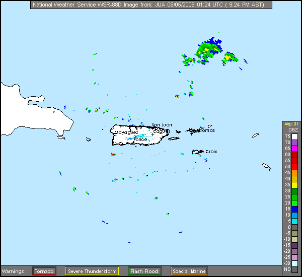
Re:
HURAKAN wrote:
Not only Ed is visible in radar!!!
Nice!! Looks like just north of due W movement. Can you get the lat/long's w/ the radar?
0 likes
-
jhamps10
Re: Re:
Blown_away wrote:HURAKAN wrote:
Not only Ed is visible in radar!!!
Nice!! Looks like just north of due W movement. Can you get the lat/long's w/ the radar?
well the area inbetween the 2 convection areas is located at 20.62N 64.9W now that is the middle of inbetween the convection, give me 25-30 minutes for some images to load on gr3 and I could possibly give ya a rotation area.
0 likes
-
Honeyko
Re: ATL: Invest 99L in Western Atlantic
http://www.nlmoc.navy.mil/cgi-bin/movie ... ic+hiresir
Assuming convection persists now, one of three things happens:
1) A mid-level circulation develops and is shoved north by shear. Result: Developing, recurving system.
2) The low center continues WNW and the upper-low retrogrades west quickly and remains strong: Result: 99L remains sheared....status quo.
3) The low center continues WNW and the upper-low retrogrades slowly or drops southwest. Result: 99L's surface center stacks with a 300mb upper trough. Explosive development as tropopause-overshooting CBs exhaust into excellent divergence.
0 likes
Re: ATL: Invest 99L in Western Atlantic
actually i heard steve mention this at 2pm . He said and this area here is not developing , and then moved on. I respect steve, but i would think this still has to be watched, especially since there is still a low, and he may have meant not developing any time today, tonite,etc.
the 8pm discussion mentions the wave goes up to 26 n and the northern part is supposed to break away, not sure if they include the low down at 21n , as getting turned north, but it would appear that is unlikely tonite.
the 8pm discussion mentions the wave goes up to 26 n and the northern part is supposed to break away, not sure if they include the low down at 21n , as getting turned north, but it would appear that is unlikely tonite.
0 likes
-
Blown Away
- S2K Supporter
- Posts: 10253
- Joined: Wed May 26, 2004 6:17 am
Re: ATL: Invest 99L in Western Atlantic
99L is building convection around the LLC again and is definitely moving just N of due W. Maybe the upper level conditions are improving a little. This area should at least be shaded after the next update.
http://www.ssd.noaa.gov/goes/flt/t1/loop-avn.html
http://www.ssd.noaa.gov/goes/flt/t1/loop-avn.html
0 likes
Who is online
Users browsing this forum: No registered users and 7 guests