
honeyko nice reference to the dung-beetle lol. also nice graphic showing the higher water temps.
honestly i think this thing looks better in the last two hours than in a while, seems at the hour of it's supposed death (10 am) their was a resesitation (sp?)
let me ask you this/ do you see increasing shear in it's near term path, i thought i did per shear maps/ models but the tighter cluster of convection popping is a good sign for life, we shall see how long it holds up to any SW shear , what do you think the next 24 will bring as far as favorable/unfavorable conditions go? or anyone for that matter
Ex Invest 99L in Western Atlantic
Moderator: S2k Moderators
-
kpost

- Tropical Storm

- Posts: 101
- Age: 48
- Joined: Sun Jul 06, 2008 10:52 am
- Location: Indialantic, Florida (Ohio 4now)
Re: ATL: Invest 99L in Central Atlantic
NOT a Forecast:
If (BIG if) it gets into the Bahamas as a closed Low. What would/could happen with the extremely high Sea temps?
This is 1 of the 4 hottest sea temps in the world right now.
EDIT: removed image, it is the first link below
If you view this full size. http://ghrsst-pp.metoffice.com/data/OSTIA/latest_full.png or this one http://www.ssec.wisc.edu/data/sst/latest_sst.gif you can see the color difference.
Last edited by kpost on Mon Aug 04, 2008 12:59 pm, edited 1 time in total.
0 likes
-
Honeyko
Re: ATL: Invest 99L in Central Atlantic
KWT, look at VIS zoom-loops; it looks better now than it has at any time in the last two days, and it's about to run over 29c water. LLC is evident. It's firing bursts in the daytime now. Water of 29c will support development despite screaming shear. cpdaman, the shear is as bad as it's going to get right now; the upper-level low is stretching out NE/SW and weakening.
http://www.nlmoc.navy.mil/cgi-bin/movie ... tlantic+wv
http://www.nlmoc.navy.mil/cgi-bin/movie ... c+hiresvis
http://www.nlmoc.navy.mil/cgi-bin/movie ... ic+hiresir
http://www.nlmoc.navy.mil/cgi-bin/movie ... tlantic+wv
http://www.nlmoc.navy.mil/cgi-bin/movie ... c+hiresvis
http://www.nlmoc.navy.mil/cgi-bin/movie ... ic+hiresir
0 likes
-
bvigal

- S2K Supporter

- Posts: 2276
- Joined: Sun Jul 24, 2005 8:49 am
- Location: British Virgin Islands
- Contact:
Re: ATL: Invest 99L in Central Atlantic
Thanks for great SST map!! But a question... do ya think it's a good idea to live-link a 7200-PIXEL-wide pic into the forum? That really hampers page load for those with slow connection, and just think of the bandwidth for every person who loads this page. Maybe just the link is enough.kpost wrote:NOT a Forecast:
If (BIG if) it gets into the Bahamas as a closed Low. What would/could happen with the extremely high Sea temps?
This is 1 of the 4 hottest sea temps in the world right now.
(giant photo)
If you view this full size. http://ghrsst-pp.metoffice.com/data/OSTIA/latest_full.png or this one http://www.ssec.wisc.edu/data/sst/latest_sst.gif you can see the color difference.
Last edited by bvigal on Mon Aug 04, 2008 12:58 pm, edited 1 time in total.
0 likes
-
alienstorm

- Category 1

- Posts: 496
- Joined: Tue Jul 31, 2007 1:29 pm
- Location: Miami Fla western suburb
Re: ATL: Invest 99L in Central Atlantic
No longer an invest and dropped from Tropical Weather Outlook as of 2PM...
0 likes
-
kpost
- Tropical Storm
- Posts: 101
- Age: 48
- Joined: Sun Jul 06, 2008 10:52 am
- Location: Indialantic, Florida (Ohio 4now)
Re: ATL: Invest 99L in Central Atlantic
If it gets invest again what will the # be , since it was 98 then 99 .....would it be 100? i am new at this so i do not understand the #ing
0 likes


Re: ATL: Invest 99L in Central Atlantic
kpost wrote:If it gets invest again what will the # be , since it was 98 then 99 .....would it be 100? i am new at this so i do not understand the #ing
they restart with 90 after we get 99. i think this one would be 92L if it gets renumbered again.
0 likes
-
Honeyko
http://www.nrlmry.navy.mil/tc-bin/tc_ho ... JavaScript
(Select only GOES 12s for your loop.)
They should not have dropped the invest on this.....
(Select only GOES 12s for your loop.)
They should not have dropped the invest on this.....
0 likes


-
Honeyko
Re: ATL: Invest 99L in Central Atlantic
KWT, look at the Navy loop link in my last post. The circulation is very evident.
0 likes
-
cycloneye

- Admin

- Posts: 148836
- Age: 69
- Joined: Thu Oct 10, 2002 10:54 am
- Location: San Juan, Puerto Rico
Re: ATL: Invest 99L in Central Atlantic
Well peeps,invest 99L is still alive per ATCF best track,but breathing on life support.
AL, 99, 2008080418, , BEST, 0, 215N, 615W, 25, 1012, DB, 34, NEQ, 0, 0, 0, 0, 1013, 150, 45, 0, 0, L, 0, , 0, 0, INVEST,
ftp://ftp.tpc.ncep.noaa.gov/atcf/tcweb/
AL, 99, 2008080418, , BEST, 0, 215N, 615W, 25, 1012, DB, 34, NEQ, 0, 0, 0, 0, 1013, 150, 45, 0, 0, L, 0, , 0, 0, INVEST,
ftp://ftp.tpc.ncep.noaa.gov/atcf/tcweb/
0 likes
-
SouthFloridawx

- S2K Supporter
- Posts: 8346
- Age: 47
- Joined: Tue Jul 26, 2005 1:16 am
- Location: Sarasota, FL
- Contact:
Re: ATL: Invest 99L in Central Atlantic
Yes but the circulation is moving swiftly off to the west. Maybe some decent rain and windy conditions for Florida later this week. That would be cool.
http://www.ssd.noaa.gov/goes/flt/t1/loop-rgb.html
http://www.ssd.noaa.gov/goes/flt/t1/loop-rgb.html
0 likes
-
Honeyko
Re:
"Angle"? What are you talking about? The Navy loops are "straight-down" Mercator projections; there aren't any curvature angles. It's VERY EASY to see the circulation. Set to rock-mode, speed fast.KWT wrote:Actually I really can't see much of a circulation there, if there is a circulation the angle from what we have to see it from is too hard to really see it.
0 likes
-
Honeyko
Re: ATL: Invest 99L in Central Atlantic
Select only the GOES12s of identical time-stamps for your loop.KWT wrote:Yeah but its way off to the left hand side of the image and blurs every 30 and 00 minutes which makes it harder to track.
"Closed off" is an static frame of reference which considers only surface winds, not a relative frame of reference which contemplates overall atmospheric parcel activity within its surrounding environment. If the relative frame of reference is an atmospheric body moving W or WNW at 15kts, then 99L is a clearly closed circulation entrained within it.There does appear to be rotation but I highly doubt its clsoed off.
==//==
It's juuust coming into the frame of the GHCC East-Conus loops -- and these are the most up-to-date of any civilian-accessible animation that I'm aware of (they're updated every 5-10 minutes during US-treatening tropical activity, which is also handy for watching other nearby systems):
http://www.ghcc.msfc.nasa.gov/GOES/goeseastconus.html
Last edited by Honeyko on Mon Aug 04, 2008 2:32 pm, edited 4 times in total.
0 likes
Re: ATL: Invest 99L in Central Atlantic
honeyko i will look at your prefered visible in a moment
however the nhc.noaa.gov one shows a CLEAR dissapearing trend of the low level clouds in the central and south part of the LLC from 1645 thru 1745, in only 3 frames the LLC appears to have opened up or weakend dramatically
however the nhc.noaa.gov one shows a CLEAR dissapearing trend of the low level clouds in the central and south part of the LLC from 1645 thru 1745, in only 3 frames the LLC appears to have opened up or weakend dramatically
0 likes
-
Honeyko
Re: ATL: Invest 99L in Central Atlantic
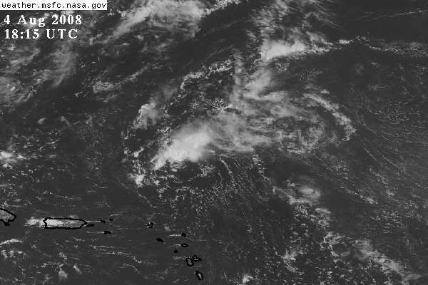
...and after 1815, CBs sprout up again.cpdaman wrote:however the nhc.noaa.gov one shows a CLEAR dissapearing trend of the low level clouds in the central and south part of the LLC from 1645 thru 1745, in only 3 frames the LLC appears to have opened up or weakend dramatically
(Peeve: I can't stand looking at "old" data. As I posted this, http://www.ghcc.msfc.nasa.gov/GOES/goeseastconus.html was up to 1925Z.)
0 likes
-
Blown Away

- S2K Supporter
- Posts: 10253
- Joined: Wed May 26, 2004 6:17 am
Re: ATL: Invest 99L in Central Atlantic
cycloneye wrote:Well peeps,invest 99L is still alive per ATCF best track,but breathing on life support.
AL, 99, 2008080418, , BEST, 0, 215N, 615W, 25, 1012, DB, 34, NEQ, 0, 0, 0, 0, 1013, 150, 45, 0, 0, L, 0, , 0, 0, INVEST,
ftp://ftp.tpc.ncep.noaa.gov/atcf/tcweb/
Well we all knew this would be the do or die day, so far 99L is clinging to life, once it gets past 65W conditions should improve. Still building convection, but the shear takes care of that pretty quick.
0 likes
Who is online
Users browsing this forum: No registered users and 34 guests