ATL: Invest 97L in Central Atlantic
Moderator: S2k Moderators


-
Hyperstorm

- Category 5

- Posts: 1500
- Joined: Sun Sep 07, 2003 3:48 am
- Location: Ocala, FL
Re: ATL: Invest 97L in East Atlantic
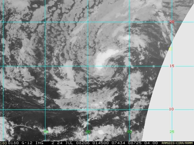
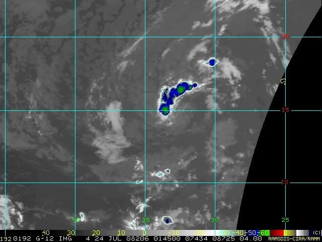
Even though 97L has been dropped, I think that it has a chance to be reactivated again during the weekend. The system is very well-defined with the curvature in the clouds that as soon as it hits the warmer waters, it's sure to fire off some heavy convection. As cool as the water is right now, we have some fair cloud tops showing up in the Color Enhanced IR. West of 40W the system will definitely have an opportunity with light easterly winds in the upper levels. Dry air may not be a big factor judging from what it's doing now in the midst of it.
0 likes

-
jhamps10
Re: ATL: Invest 97L in East Atlantic
Hyperstorm wrote:Even though 97L has been dropped, I think that it has a chance to be reactivated again during the weekend. The system is very well-defined with the curvature in the clouds that as soon as it hits the warmer waters, it's sure to fire off some heavy convection. As cool as the water is right now, we have some fair cloud tops showing up in the Color Enhanced IR. West of 40W the system will definitely have an opportunity with light easterly winds in the upper levels. Dry air may not be a big factor judging from what it's doing now in the midst of it.
i agree, we still need to watch this thing closely.
0 likes
-
cycloneye

- Admin

- Posts: 149843
- Age: 69
- Joined: Thu Oct 10, 2002 10:54 am
- Location: San Juan, Puerto Rico
Re: ATL: Invest 97L in East Atlantic
Someone asked earlier,if they reactivate it to invest,it would be again 97L.The answer is yes.
0 likes
-
cycloneye
- Admin
- Posts: 149843
- Age: 69
- Joined: Thu Oct 10, 2002 10:54 am
- Location: San Juan, Puerto Rico
Re: Ex 97L in East Atlantic
The thread was moved to Talking Tropics as 97L was deactivated.If it goes up again,then the thread will be moved back to active storms forum.
0 likes

Re: Ex 97L in East Atlantic
My guess is this one will be back.
http://cimss.ssec.wisc.edu/tropic/real- ... /main.html
http://cimss.ssec.wisc.edu/tropic/real- ... /main.html
0 likes

-
cycloneye
- Admin
- Posts: 149843
- Age: 69
- Joined: Thu Oct 10, 2002 10:54 am
- Location: San Juan, Puerto Rico
Re: Ex 97L in East Atlantic
It is still at NRL so I suspect it will be back soon as Sandy showed,it looks good.
http://www.nrlmry.navy.mil/tc-bin/tc_ho ... p&TYPE=geo
http://www.nrlmry.navy.mil/tc-bin/tc_ho ... p&TYPE=geo
0 likes
-
HurricaneQueen

- S2K Supporter

- Posts: 1011
- Age: 80
- Joined: Sat Oct 12, 2002 7:36 pm
- Location: No. Naples, Fl (Vanderbilt Beach area)
Re: Ex 97L in East Atlantic
Hurakan:
What are those two brown flashes at the end of the run-one from the tip of Florida and the other between 20-30N, 56-50W? Have never seen that before. BTW, very cool graphic! Thanks.
Lynn
What are those two brown flashes at the end of the run-one from the tip of Florida and the other between 20-30N, 56-50W? Have never seen that before. BTW, very cool graphic! Thanks.
Lynn
0 likes
-
GeneratorPower

- S2K Supporter
- Posts: 1648
- Age: 46
- Joined: Sun Dec 18, 2005 11:48 pm
- Location: Huntsville, AL
Re: Ex 97L in East Atlantic
HurricaneQueen wrote:Hurakan:
What are those two brown flashes at the end of the run-one from the tip of Florida and the other between 20-30N, 56-50W? Have never seen that before. BTW, very cool graphic! Thanks.
Lynn
Those are just places where evidently the satellite got some bad data or went out of range, so the didn't get a good pass.
0 likes
-
HurricaneQueen
- S2K Supporter
- Posts: 1011
- Age: 80
- Joined: Sat Oct 12, 2002 7:36 pm
- Location: No. Naples, Fl (Vanderbilt Beach area)
Re: Ex 97L in East Atlantic
GeneratorPower wrote:HurricaneQueen wrote:Hurakan:
What are those two brown flashes at the end of the run-one from the tip of Florida and the other between 20-30N, 56-50W? Have never seen that before. BTW, very cool graphic! Thanks.
Lynn
Those are just places where evidently the satellite got some bad data or went out of range, so the didn't get a good pass.
Thanks for the prompt answer GP!
Lynn
0 likes
-
gatorcane

- S2K Supporter
- Posts: 23708
- Age: 48
- Joined: Sun Mar 13, 2005 3:54 pm
- Location: Boca Raton, FL
Re: ATL: Invest 97L in East Atlantic
jhamps10 wrote:Hyperstorm wrote:Even though 97L has been dropped, I think that it has a chance to be reactivated again during the weekend. The system is very well-defined with the curvature in the clouds that as soon as it hits the warmer waters, it's sure to fire off some heavy convection. As cool as the water is right now, we have some fair cloud tops showing up in the Color Enhanced IR. West of 40W the system will definitely have an opportunity with light easterly winds in the upper levels. Dry air may not be a big factor judging from what it's doing now in the midst of it.
i agree, we still need to watch this thing closely.
The 40W that Hyperstorm mentions is where we would expect to see some development of ex-97L. Take a look at the SSTs and where ex-97L is located. It's located in some relatively cool SSTs currently, generally around 78F. I checked the SST anomalies also and they are running slightly below normal east of 40W. But once it moves to about 40W they become warm enough for development and increase to about 80F.
The Upper-level conditions appear favorable and there is no SAL to contend with so I agree with the consensus, we need to monitor this wave for gradual development AFTER a couple of days but slow development thereafter. General movement will be West through the next 3-5 days.

0 likes
-
Matt-hurricanewatcher
Re: Ex 97L in East Atlantic
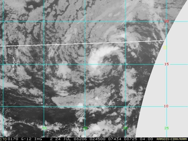
This has a nice cirulaiton on satellite with convection forming right over it. Wait intil it gets back into the warmer waters, I would expect it to develop.
0 likes

Re: Ex 97L in East Atlantic
Does anyone know where this system is centered (if it has one)?
The entire system seems to be moving steadily WSW, and if it continues, will be well below 15N.
The entire system seems to be moving steadily WSW, and if it continues, will be well below 15N.
0 likes


-
jhamps10
Who is online
Users browsing this forum: No registered users and 45 guests