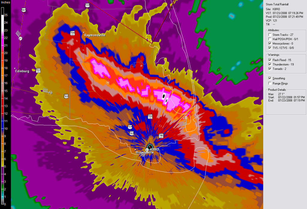
loro-rojo wrote:Does someone know why this hurricane has kept its structure so well over land. The last radar image I saw was when it made landfall, and I think it looks better now than it did before.
It happens more frequently than some people think (i.e. Katrina 2005, Claudette 2003, etc.)
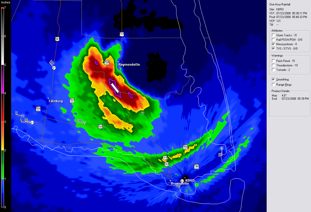
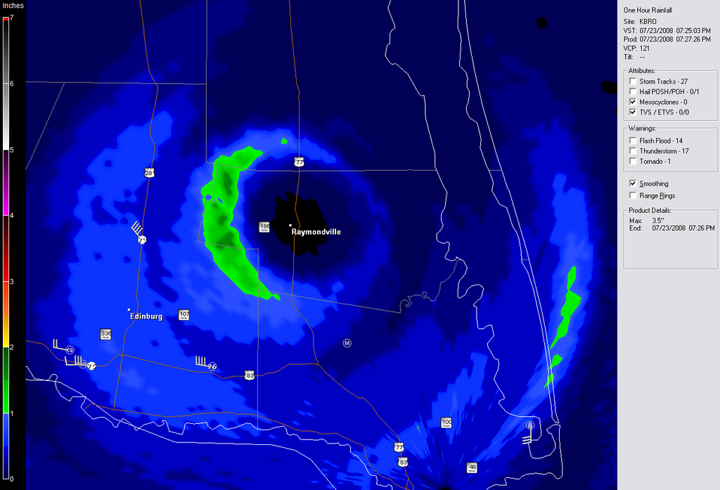
As Air Force Met mentioned, the upper-level outflow has a lot to do with it. The storm is being ventilated very well. With the daytime heating, the storm spreads out and "appears" to strengthen or maintains itself for a longer period. Another factor that helps is the strengthening up to near landfall, so the storm tends to remain intact for a while longer than usual. While the system is near the coast, its outer bands can feed from the ocean and wrap themselves around the core.
In addition, one theory that I have that may help systems "appear" to strengthen while overland is that the system is raining itself out over land to the point of the land almost becoming as humid and moist as the ocean for the hurricane. With good outflow in the upper-levels this process is visible.