

ATL: Tropical Depression Dolly
Moderator: S2k Moderators


-
Derek Ortt
for one... I don't see this developing into a cyclone until it is in the GOM
it is a very rare occurrance that a cyclone that develops in the GOM becomes a major hurricane. In the last 25 years we have Bret and Bret alone (as for previously, do not include Audrey... the cat 1 according to the Jarvinen study or 100KT at 850mb flight level cat 3 Alica).
2. HWRF is so inconsistent. Netx run it very well could keep this as an open wave. GFDL has some other issues regarding its intensity forecasts (not sure if they reduced the forcing or not... previously, its forcing was a bit too high)
0 likes

Re: ATL: INVEST 94L in Central Caribbean
I don't know if the model's changed, but remember the GFDL having Katrina correctly diving south from where it formed off Florida....but as a cat 5.
0 likes
-
Smurfwicked
- Tropical Storm

- Posts: 164
- Age: 41
- Joined: Mon Sep 03, 2007 7:47 pm
- Location: SETX
Re: ATL: INVEST 94L in Central Caribbean
Derek,
what do you think about the track? do you think this system will more likely go thru the channel rather than hitting the yucatan peninsula?
what do you think about the track? do you think this system will more likely go thru the channel rather than hitting the yucatan peninsula?
0 likes
-
Derek Ortt
-
HouTXmetro

- Category 5

- Posts: 3949
- Joined: Sun Jun 13, 2004 6:00 pm
- Location: District of Columbia, USA
Re: ATL: INVEST 94L in Central Caribbean
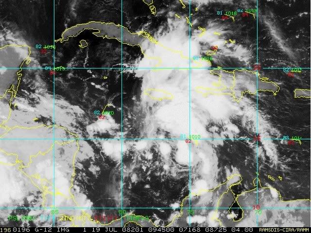
I'm far from a Pro, but based on this last frame I'm saying development into a TD has just occured. Looks like the Upper Low/Trough has aided in spinning up an LLC.

http://www.ssd.noaa.gov/goes/flt/t2/loop-avn.html Here is the Loop
Personal Forecast Disclaimer:
The posts in this forum are NOT official forecast and should not be used as such. They are just the opinion of the poster and may or may not be backed by sound meteorological data. They are NOT endorsed by any professional institution or storm2k.org. For official information, please refer to the NHC and NWS products.
0 likes
-
Cryomaniac
- Category 5
- Posts: 1289
- Joined: Tue Aug 15, 2006 2:26 pm
- Location: Newark, Nottinghamshire, UK
- Contact:
-
stevetampa33614
Re: ATL: INVEST 94L in Central Caribbean
Not sure whats going on with this system. I wonder if the Hurricane hunters have some kind of weather modification going on. Everytime a Recon goes out the LLC disappears 
Anyway, I see some kind of Spin 75, 15. The NHC is probably looking at the same thing with the ULL pulling all the convection off last night.
Ive read all 147 pages (jesus it took 4 hours) Time and again you guys are waaaay too quick too close the door on this. Every page is filled with comments like 'OPEN WAVE, SYSTEM IS TOAST, FICKLE' and then the Diurnal kicks in and everybodys bullish again. Lets just chill.
Infact reading through so much information gave me the idea S2k needs a Bettering system on its front page (no real currency of course) would make the site some what more entertaining while still being the great factual open resource it is.
Anyway, I see more than an open wave here, I see a system that is struggling to get it together, but will finally be classified today or early sunday.
Also, edit. Fl hurricane refugee here. 1st post
Last edited by stevetampa33614 on Sat Jul 19, 2008 6:39 am, edited 2 times in total.
0 likes

-
Frank P
- S2K Supporter

- Posts: 2779
- Joined: Fri Aug 29, 2003 10:52 am
- Location: Biloxi Beach, Ms
- Contact:
Re: ATL: INVEST 94L in Central Caribbean
The irritating on again off again saga of 94L continues again this morning as convection fires up this morning... I can't discern from looking at the IR that it is a depression (which I doubt it is) as I can't come close to figuring out if this has an LLC, which I think it does not atm... however IF the center of what ever rotation it does have is surrounded by the recent flare up of convection from the past couple of hours then I'd say it perhaps is getting a tad better organized, and that's a really big IF and STRETCH, but since I have been rather bullish on the system I'll keep that frame of mind...... another wait and see day with this aggrevating system....
0 likes
-
Derek Ortt
Re: ATL: INVEST 94L in Central Caribbean
stevetampa33614 wrote:Not sure whats going on with this system. I wonder if the Hurricane hunters have some kind of weather modification going on. Everytime a Recon goes out the LLC disappears
no trace of a LLC yesterday or today. The sin you see on satellite is almsot certainly mid level
0 likes
-
stevetampa33614
Re: ATL: INVEST 94L in Central Caribbean
Derek Ortt wrote:stevetampa33614 wrote:Not sure whats going on with this system. I wonder if the Hurricane hunters have some kind of weather modification going on. Everytime a Recon goes out the LLC disappears
no trace of a LLC yesterday or today. The sin you see on satellite is almsot certainly mid level
Perhaps i should refine that, Everytime Recon goes out the system bottoms out.
Anyway the word for today is RADAR. If anything happens, it will be picked up here
Lundberg summs up my feelings pretty well. He picked up on it
http://www.accuweather.com/mt-news-blog ... ing_si.asp
0 likes
-
cycloneye

- Admin

- Posts: 149342
- Age: 69
- Joined: Thu Oct 10, 2002 10:54 am
- Location: San Juan, Puerto Rico
Re: ATL: INVEST 94L in Central Caribbean
ABNT20 KNHC 191150
TWOAT
TROPICAL WEATHER OUTLOOK
NWS TPC/NATIONAL HURRICANE CENTER MIAMI FL
800 AM EDT SAT JUL 19 2008
FOR THE NORTH ATLANTIC...CARIBBEAN SEA AND THE GULF OF MEXICO...
THE NATIONAL HURRICANE CENTER IS ISSUING ADVISORIES ON HURRICANE
BERTHA LOCATED ABOUT 475 MILES SOUTHEAST OF CAPE RACE
NEWFOUNDLAND...AND ON TROPICAL DEPRESSION THREE CENTERED 65 MILES
SOUTHEAST OF CHARLESTON SOUTH CAROLINA.
SATELLITE IMAGES AND SURFACE OBSERVATIONS INDICATE THAT THE TROPICAL
WAVE IN THE WESTERN CARIBBEAN SEA HAS NOT BECOME ANY BETTER
ORGANIZED DURING THE PAST SEVERAL HOURS. HOWEVER...ENVIRONMENTAL
CONDITIONS ARE FAVORABLE FOR THIS SYSTEM TO BECOME A TROPICAL
DEPRESSION OVER THE NEXT DAY OR TWO AS IT MOVES WEST-NORTHWESTWARD
AT 15 MPH. INTERESTS IN THE NORTHWESTERN CARIBBEAN SEA AND THE
YUCATAN PENINSULA SHOULD CONTINUE TO MONITOR THE PROGRESS OF THIS
SYSTEM
0 likes
-
HouTXmetro
- Category 5
- Posts: 3949
- Joined: Sun Jun 13, 2004 6:00 pm
- Location: District of Columbia, USA
Re: ATL: INVEST 94L in Central Caribbean
cycloneye wrote:ABNT20 KNHC 191150
TWOAT
TROPICAL WEATHER OUTLOOK
NWS TPC/NATIONAL HURRICANE CENTER MIAMI FL
800 AM EDT SAT JUL 19 2008
FOR THE NORTH ATLANTIC...CARIBBEAN SEA AND THE GULF OF MEXICO...
THE NATIONAL HURRICANE CENTER IS ISSUING ADVISORIES ON HURRICANE
BERTHA LOCATED ABOUT 475 MILES SOUTHEAST OF CAPE RACE
NEWFOUNDLAND...AND ON TROPICAL DEPRESSION THREE CENTERED 65 MILES
SOUTHEAST OF CHARLESTON SOUTH CAROLINA.
SATELLITE IMAGES AND SURFACE OBSERVATIONS INDICATE THAT THE TROPICAL
WAVE IN THE WESTERN CARIBBEAN SEA HAS NOT BECOME ANY BETTER
ORGANIZED DURING THE PAST SEVERAL HOURS. HOWEVER...ENVIRONMENTAL
CONDITIONS ARE FAVORABLE FOR THIS SYSTEM TO BECOME A TROPICAL
DEPRESSION OVER THE NEXT DAY OR TWO AS IT MOVES WEST-NORTHWESTWARD
AT 15 MPH. INTERESTS IN THE NORTHWESTERN CARIBBEAN SEA AND THE
YUCATAN PENINSULA SHOULD CONTINUE TO MONITOR THE PROGRESS OF THIS
SYSTEM
OK, now I feel stupid... lol
0 likes
-
Portastorm

- Storm2k Moderator

- Posts: 9955
- Age: 63
- Joined: Fri Jul 11, 2003 9:16 am
- Location: Round Rock, TX
- Contact:
Re: ATL: INVEST 94L in Central Caribbean
FWIW, JB opines this morning in his blog that the ULL is weakening and will eventually serve to ventilate the system. Says he doesn't see the Yucatan doing much to mess up the development as it will not be a "major" at that point. Sees this being (worst case) a Cat-2 with landfall south of the Rio Grande.
0 likes

-
Smurfwicked
- Tropical Storm
- Posts: 164
- Age: 41
- Joined: Mon Sep 03, 2007 7:47 pm
- Location: SETX
Re: ATL: INVEST 94L in Central Caribbean
Portastorm wrote:FWIW, JB opines this morning in his blog that the ULL is weakening and will eventually serve to ventilate the system. Says he doesn't see the Yucatan doing much to mess up the development as it will not be a "major" at that point. Sees this being (worst case) a Cat-2 with landfall south of the Rio Grande.
I can't imagine a landfall anywhere close to being south of the Rio Grande. JMO
0 likes

Who is online
Users browsing this forum: No registered users and 17 guests