"Time will tell" is the most unbearable one liner...
What happened to the informative posts that permeated throughout the Bertha thread?
Thanks to wxman57 for bringing something to the plate!
ATL: Tropical Depression Dolly
Moderator: S2k Moderators
-
MiamiensisWx
-
ColdFusion

- S2K Supporter

- Posts: 452
- Joined: Wed Feb 13, 2008 3:46 pm
- Location: Addison, TX
Re:
MiamiensisWx wrote:"Time will tell" is the most unbearable one liner...
Personally, any post that has the word 'poof' in it makes me cringe.
0 likes


-
wzrgirl1

- S2K Supporter
- Posts: 1360
- Joined: Sat Sep 04, 2004 6:44 am
- Location: Pembroke Pines, Florida
Re: ATL: INVEST 94L East of the Windward Islands
does anyone have a current water vapor loop?
0 likes
-
jaxfladude
- Category 5

- Posts: 1249
- Joined: Wed Aug 24, 2005 9:36 pm
- Location: Jacksonville, Fla
Re:
Extremeweatherguy wrote:The battle of the pro mets is on!
Who will win? The bullish wxman57 or the bearish Derek Ortt? TIme will tell...

...There can be only one..........
0 likes
-
Brent
- S2K Supporter
- Posts: 38730
- Age: 37
- Joined: Sun May 16, 2004 10:30 pm
- Location: Tulsa Oklahoma
- Contact:
Re: ATL: INVEST 94L East of the Windward Islands
wxman57 wrote:My take is that it looks quite impressive this afternoon, as good as i expected it to look at this time and quite a bit more organized than most invests ever are. With a well-defined LLC present, I think it's only a matter of time before convection builds over the center (probably tonight) and the NHC upgrades it to TD 3. I think there's at least a 50% shot it'll be upgraded by 4am CDT tomorrow, and a 70-80% shot it'll be upgraded by 4pm tomorrow.
Now, about its future track. Early on, it looked like it might take the opportunity to turn NW as it approached the Caribbean. I don't think that'll be the case now. High pressure off the southeast U.S. coast may be too strong and extend too far east to allow for recurvature east of the Caribbean, and the upper trof to its north between 50-60W just may not extend far enough south. So a track into the east Caribbean north of Dominica looks probable, passing into the Caribbean overnight on Thursday with a heading of 280-290 deg. Beyond then, lots of uncertainties. The GFS tries to move the weakness in the ridge westward (north of the system). This could allow for more of a WNW movement toward the DR on Saturday, and it could cause a NW-N turn somewhere between PR and eastern Cuba late Saturday or on Sunday. That's a very low confidence forecast. If it misses the weakness in the ridge, then a strong ridge of high pressure over the central and eastern Gulf may just continue pushing it W-WNW toward Mexico. Really, really low confidence there.
Concerning intensity, once the convection builds near the center it should steadily strengthen. Quite possibly it could become a 75-80 mph hurricane prior to reaching the eastern Caribbean. But once in the Caribbean, the GFS indicates increasing low-level easterly winds (30-40 kt easterly winds at 850mb). This would lead to low-level divergence, a pattern that could tilt the storm and lead to weakening to a sheared TS. Of course, the GFS wind projections could be wrong, so my confidence in any weakening in the eastern Caribbean isn't high. I don't see conditions favorable for it to become a major hurricane, though.
So now we wait. I fully expect a call from the office at 3:45am tomorrow telling me we have TD 3 on our hands.
WOW, aggressive.
This should be interesting to see who's right.
0 likes
-
wxman57

- Moderator-Pro Met

- Posts: 23172
- Age: 68
- Joined: Sat Jun 21, 2003 8:06 pm
- Location: Houston, TX (southwest)
Re:
fci wrote:Not often that Wxman and Derek seem to be on two different pages on a system.
Wxman annointing 94L as a TD soon and to a Hurricane
Derek proclaiming most likely to die
Curious to see where this one ends up.
I'm usually the bearish one. Don't know what's come over me... Maybe we can hope for a draw? It becomes a TD then dies as it reaches the eastern Caribbean?
I do find it interesting that now that an LLC has spun up that the GFS can't find it. It could find it a week ago when it was a wave over Africa, but not now.
0 likes
-
MiamiensisWx
Re: Re:
MiamiensisWx wrote:
I'll offer some reasoning to support this post.
The lack of low level convergence has resulted in very scarce convection directly over the surface low. The convection to the south of 94L appears to be associated with a broad surface trough. Low level convergence is greater in that vicinity, which is more supportive of consistent and widespread thunderstorm development. This is "robbing" 94L of low level inflow, since cyclonic turning of the wind vectors is evident further south as well. Some subsidence could be greatly hindering 94L, too. This does not appear to change down the road as well. Overall, this may briefly become classified as a TD, and that is doubtful. It is quite probable that any formative LLC will dissipate, in my view.
It's still July.
The lack of low level convergence often kills July systems in a conducive thermodynamic/synoptic environment. I believe 94L also entrained some subsidence, based on surrounding stratocumulus to the north.
Many people were too aggressive for this July system partially because of Bertha, in my view.
The main threat will be precip for the E Caribbean islands.
Last edited by MiamiensisWx on Mon Jul 14, 2008 5:46 pm, edited 2 times in total.
0 likes
-
zaqxsw75050

- Tropical Storm

- Posts: 178
- Joined: Thu Mar 06, 2008 4:21 pm
- Location: Hong Kong

-
Gustywind

- Category 5
- Posts: 12334
- Joined: Mon Sep 03, 2007 7:29 am
- Location: Baie-Mahault, GUADELOUPE
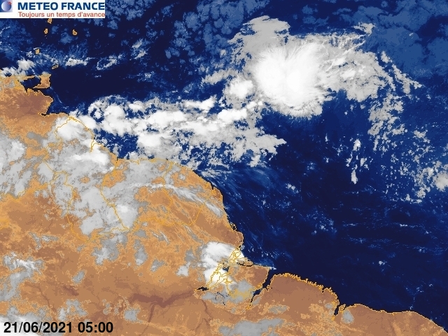
http://www.meteo.fr/temps/domtom/antill ... Tagant.jpg
http://www.meteo.fr/temps/domtom/antill ... Tagguy.jpg
System is always there and racing west near the Lesser Antilles and should be a threat Saturday or Sunday for Guadeloupe given the last weather forecast at 5 PM of our ProMet from Meteo-France. So i have heard in many replies "it's dead or it's dead Jim " dead or not, we have something getting more organized this afternoon and very suspicious, very low in lattitude and with a decent structure. It's another reason for all carib islanders to monitor carefully this area...

http://www.meteo.fr/temps/domtom/antill ... Tagguy.jpg
System is always there and racing west near the Lesser Antilles and should be a threat Saturday or Sunday for Guadeloupe given the last weather forecast at 5 PM of our ProMet from Meteo-France. So i have heard in many replies "it's dead or it's dead Jim "
dead or not, we have something getting more organized this afternoon and very suspicious, very low in lattitude and with a decent structure. It's another reason for all carib islanders to monitor carefully this area...
0 likes
-
Weatherfreak000
Are you guys really thinking this through?
A lack of Convergence WILL NOT kill this Invest. It's in an otherwise favorable environment. That means it has DAYS to make something happen and unless the environment changes it's BOUND to happen.
Wxman's logic seems clear to me, nothing is in this storm's path to develop so it most likely will UNLESS another factor presents itself.
0 likes
Well that would be cutting it down the middle wxman57 I suppose!
for what its worth Derek hasn't said its dead just chances down to 10-20% now.
Divergence has increased but the main core is to the east of the center now so its probably the same or maybe weven a touch less then it was earlier.
for what its worth Derek hasn't said its dead just chances down to 10-20% now.
Divergence has increased but the main core is to the east of the center now so its probably the same or maybe weven a touch less then it was earlier.
Last edited by KWT on Mon Jul 14, 2008 5:47 pm, edited 1 time in total.
0 likes
-
MGC

- S2K Supporter
- Posts: 5940
- Joined: Sun Mar 23, 2003 9:05 pm
- Location: Pass Christian MS, or what is left.
Re: ATL: INVEST 94L East of the Windward Islands
My amateur opinion has development at 75% probility prior to reaching the islands. There is a well established circulation, little shear and warm SST. Over the years I've witnessed systems gain convection then lose convection only to end up developing. I'd say the odds favor development. Throw out the model runs as several lost Bertha right before she made a run at Cat-3 so I have only modest confidence in the models ATT. I don't see an upgrade coming until tomorrow at the earliest as convection must start forming near the center......MGC
0 likes

Re: ATL: INVEST 94L East of the Windward Islands
IMO 94 looks as organized as ever. No it doesnt have deep convection yet but symetry has continued to improve. I expect convection to increase in the coming hours...
0 likes
-
MiamiensisWx
Re:
Weatherfreak000 wrote:Are you guys really thinking this through?
A lack of Convergence WILL NOT kill this Invest. It's in an otherwise favorable environment. That means it has DAYS to make something happen and unless the environment changes it's BOUND to happen.
Wxman's logic seems clear to me, nothing is in this storm's path to develop so it most likely will UNLESS another factor presents itself.
Have you analyzed the tropics for several years? This is just a question...
I have seen several historical July systems that never featured a long lived LLC because of scanty low level convergence during their early life spans.
I doubt development will occur beyond a TD classification.
Last edited by MiamiensisWx on Mon Jul 14, 2008 5:48 pm, edited 1 time in total.
0 likes
-
jlauderdal
- S2K Supporter
- Posts: 7240
- Joined: Wed May 19, 2004 5:46 am
- Location: NE Fort Lauderdale
- Contact:
Re:
Gustywind wrote:http://www.meteo.fr/temps/domtom/antilles/pack-public/TAG/Tagant.jpg
http://www.meteo.fr/temps/domtom/antill ... Tagguy.jpg
System is always there and racing west near the Lesser Antilles and should be a threat Saturday or Sunday for Guadeloupe given the last weather forecast at 5 PM of our ProMet from Meteo-France. So i have heard in many replies "it's dead or it's dead Jim "
we had to get the meteo-france post in there because its bastille day.
0 likes
Re:
Weatherfreak000 wrote:
A lack of Convergence WILL NOT kill this Invest. It's in an otherwise favorable environment. That means it has DAYS to make something happen and unless the environment changes it's BOUND to happen.
It won't kill it but it will make it much slower to get going and make its development harder then what it would otherwise be.
Indeed Vortex it doesn't look bad in terms of structure though IMO its stil noty stunning in that regards either but its really just the deep convection that is missing at this moment in time.
0 likes
Who is online
Users browsing this forum: No registered users and 21 guests