ATL: Tropical Depression Dolly
Moderator: S2k Moderators
-
wzrgirl1

- S2K Supporter

- Posts: 1360
- Joined: Sat Sep 04, 2004 6:44 am
- Location: Pembroke Pines, Florida
Re: ATL: INVEST 94L East of the Windward Islands
nice band trying to wrap around the north side....we shall see
0 likes

OFFSHORE WATERS FORECAST FOR THE SOUTHWEST AND TROPICAL NORTH
ATLANTIC AND CARIBBEAN SEA
NWS TPC/NATIONAL HURRICANE CENTER MIAMI FL
1130 AM EDT MON JUL 14 2008
A STRONG TROPICAL WAVE WITH AN
ACCOMPANYING 1008 MB LOW PRESSURE SYSTEM CAN BE FOUND ALONG 42W.
THE WAVE/LOW COMPLEX SHOULD REACH THE TROPICAL N ATLANTIC WATERS
THU AFTERNOON AND THE LESSER ANTILLES FRI MORNING PRODUCING AN
INCREASE IN WINDS...SEAS AND THUNDERSTORMS.
0 likes

-
PTrackerLA

- Category 5

- Posts: 5281
- Age: 42
- Joined: Thu Oct 10, 2002 8:40 pm
- Location: Lafayette, LA
Re: ATL: INVEST 94L East of the Windward Islands
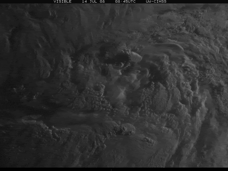
Nice circulation evident on visible. Look for an increase in convection later today. It seems that most thought this would be a Tropical storm by now given the slower pace of this thread!
http://www.ssd.noaa.gov/goes/east/catl/loop-vis.html
http://www.ssd.noaa.gov/goes/east/catl/loop-vis.html
0 likes
Re: ATL: INVEST 94L East of the Windward Islands
Yesterday the ITCZ was flaring south of 94L and jumped up into it. Today the ITCZ is deeply flaring to the south of 94L. We can only watch to see if it does it again.
0 likes
Well the thing is Ptracker there isn't enough deep convection over the center to really warrent an upgrade IMO. Some convection is developing to the north of it which will help but its not enough as of yet.
Also talking about the pace of this thread...if this gets to TD status at any point its already number 27 in the biggest Atlantic storm threads on this board!
I think if it does form then odds are very high for a top 10 finish if not top 5.
Also talking about the pace of this thread...if this gets to TD status at any point its already number 27 in the biggest Atlantic storm threads on this board!
I think if it does form then odds are very high for a top 10 finish if not top 5.
Last edited by KWT on Mon Jul 14, 2008 10:11 am, edited 1 time in total.
0 likes
-
Ivanhater

- Storm2k Moderator

- Posts: 11221
- Age: 39
- Joined: Fri Jul 01, 2005 8:25 am
- Location: Pensacola
Re: ATL: INVEST 94L East of the Windward Islands
I will be looking for a lone thunderstorm near the center to start growing throughout the day...
0 likes
-
Brent
- S2K Supporter
- Posts: 38730
- Age: 37
- Joined: Sun May 16, 2004 10:30 pm
- Location: Tulsa Oklahoma
- Contact:
Re: ATL: INVEST 94L East of the Windward Islands
Ivanhater wrote:I will be looking for a lone thunderstorm near the center to start growing throughout the day...
Yeah, same here. The structure does look a lot better today.
0 likes
-
Extremeweatherguy

- Category 5
- Posts: 11095
- Joined: Mon Oct 10, 2005 8:13 pm
- Location: Florida
Re: ATL: INVEST 94L East of the Windward Islands
PTrackerLA wrote:Nice circulation evident on visible. Look for an increase in convection later today. It seems that most thought this would be a Tropical storm by now given the slower pace of this thread!
http://www.ssd.noaa.gov/goes/east/catl/loop-vis.html
Once this is named a TD and we see the first 5-day cone, I expect this thread to explode once again.
Last edited by Extremeweatherguy on Mon Jul 14, 2008 10:10 am, edited 1 time in total.
0 likes
-
Ivanhater
- Storm2k Moderator
- Posts: 11221
- Age: 39
- Joined: Fri Jul 01, 2005 8:25 am
- Location: Pensacola
Re: ATL: INVEST 94L East of the Windward Islands
Brent wrote:Ivanhater wrote:I will be looking for a lone thunderstorm near the center to start growing throughout the day...

Yeah, same here. The structure does look a lot better today.
Lol Brent, glad I wasnt the only one..but yeah the structure is looking great
0 likes
-
PTrackerLA
- Category 5
- Posts: 5281
- Age: 42
- Joined: Thu Oct 10, 2002 8:40 pm
- Location: Lafayette, LA
Re: ATL: INVEST 94L East of the Windward Islands
I say TD tomorrow morning, we'll see how that pans out!
0 likes
-
cycloneye

- Admin

- Posts: 149307
- Age: 69
- Joined: Thu Oct 10, 2002 10:54 am
- Location: San Juan, Puerto Rico
Re: ATL: INVEST 94L East of the Windward Islands
Bouy 41041
Lets watch this data from the bouy located at 14.6n-46w far from the center but we can see how the winds are blowing as the system moves thru 46w.
Lets watch this data from the bouy located at 14.6n-46w far from the center but we can see how the winds are blowing as the system moves thru 46w.
0 likes

-
MGC

- S2K Supporter
- Posts: 5940
- Joined: Sun Mar 23, 2003 9:05 pm
- Location: Pass Christian MS, or what is left.
Re: ATL: INVEST 94L East of the Windward Islands
Just needs a bit of convection over the center and it should be upgraded.....MGC
0 likes
As expected cycloneye shows the region our invest is in and shows that development of this region is quite possible. I wonder how this invest will handle Dmin though?
Agreed MGC, its just a matter of when/if that convection decides to pop closer to the center.
Agreed MGC, its just a matter of when/if that convection decides to pop closer to the center.
Last edited by KWT on Mon Jul 14, 2008 10:54 am, edited 1 time in total.
0 likes
-
x-y-no

- Category 5
- Posts: 8359
- Age: 65
- Joined: Wed Aug 11, 2004 12:14 pm
- Location: Fort Lauderdale, FL
Re:
KWT wrote:Yep though if that northern convection stays where it is cycloneye the bouy may well get some of that convection who knows.
I think that's too far north to catch any of the convection, but we may see some indication of the system passing - more northerly component to the wind direction and slight drop in pressure.
0 likes
Who is online
Users browsing this forum: No registered users and 21 guests