ATL: Tropical Depression Dolly
Moderator: S2k Moderators

-
Jason_B
Re: ATL: INVEST 94L East of the Windward Islands
Why is everyone so focused on the track? It's well east of the islands and hasn't even got a name yet, I'm more interested in how strong it gets versus the track right now.
0 likes

Re:
gatorcane wrote:Thanks for the clarification, the immediate concern is the islands (Leewards and Puerto Rico)
94L seems to be wasting no time. I am shocked it is mid July and I am seeing such rapid organization in that area of the Atlantic.
You and me both, hard to believe today is only July 13th and conditions are so favorable for tropical development across the Atlantic.
0 likes

Re: Re:
DESTRUCTION5 wrote:gatorcane wrote:GFDL is bringing into South Florida as a CAT 3?
NO
At 126 hours GFDL has it near or Northeast of the Virgin Islands at 90 knots.
It is the last frame I see from the site I access it from.
http://moe.met.fsu.edu/cgi-bin/gfdltc2. ... =Animation
0 likes
-
Blown Away

- S2K Supporter

- Posts: 10253
- Joined: Wed May 26, 2004 6:17 am
Re: ATL: INVEST 94L East of the Windward Islands
MiamiensisWx wrote:Speculation is driving me nuts...
It's far too early to prognosticate beyond the islands, in my view.
If your getting frustrated now wait until there is a TD and the 5 day cone will be generally pointing through the NE Caribbean and towards SFL, then the over speculation will really get going. I know you don't want to hear it, but that's when this board is really entertaining.
0 likes
Re: ATL: INVEST 94L East of the Windward Islands
Looking good. At this time of the night, it *should* be looking good. See how it sustains itself tomorrow.
0 likes
Re: ATL: INVEST 94L East of the Windward Islands
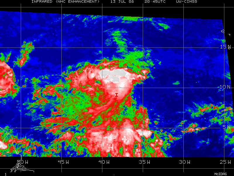
Vortex wrote:00:45 UTC imagery indicates a developing 94l that is or is just about to become a depression. Large envelope with this system with deeper convection spreading and developing closer to the LLC. Upgrade likely at 5am as organization continues overnight. I expect Cristobal by 11pm Monday night.
I am thinking TD more for 5PM tomorrow afternoon, Cristobal on Tuesday, IMO. It is just becoming detached from the ITCZ so it will be hard that a LLC has already formed, it is probably still broad.
Last edited by NDG on Sun Jul 13, 2008 8:34 pm, edited 1 time in total.
0 likes
-
93superstorm
- Tropical Depression

- Posts: 79
- Joined: Mon Jul 07, 2008 11:41 am
-
Jason_B
Re: ATL: INVEST 94L East of the Windward Islands
This one has a much bigger area of convection than Bertha did in her developing stages, when this one gets rolling it's going to be a pretty decent sized storm IMO.
0 likes
-
HURAKAN

- Professional-Met

- Posts: 46084
- Age: 39
- Joined: Thu May 20, 2004 4:34 pm
- Location: Key West, FL
- Contact:
Re: ATL: INVEST 94L East of the Windward Islands
Patrick99 wrote:Looking good. At this time of the night, it *should* be looking good. See how it sustains itself tomorrow.
Tomorrow morning it "should" be looking good. Remember how bad Bertha used to look at night when it was a wave, then it was rejuvenated in the morning.
0 likes

Re: ATL: INVEST 94L East of the Windward Islands
Seems to be a lot of squabling over the landfall location of a low on a tropical wave that is still East of 40 degrees longitude. Board seems fisty this year. I guess it is just all the bottled up energy to have something to watch.
Lets spend our energy on anaylizing the storms and trying to get our opinions (and that is all they are) out there and not squabling about the 10 day tracks of tropical waves.....
Lets spend our energy on anaylizing the storms and trying to get our opinions (and that is all they are) out there and not squabling about the 10 day tracks of tropical waves.....
0 likes
-
weatherguru18
Re: ATL: INVEST 94L East of the Windward Islands
Jason_B wrote:This one has a much bigger area of convection than Bertha did in her developing stages, when this one gets rolling it's going to be a pretty decent sized storm IMO.
You can't tell anything about size or strenght at this stage. Katrina was a small Cat 1...and blew up three times its origional size in the gulf. As we all now, Katrina was a HUGE hurricane.
0 likes
-
MiamiensisWx
Re:
93superstorm wrote:If ths this thing developes pretty faster, then expect a track just north of the Islands. Bertha may also cause this to be a bit more north then straight into the caribbean
Nope! Bolded portion is false!
As TS Bertha weakens and becomes more shallow, it will leave a weakness in the low level ridging over the next four to five days as it slowly moves NE and ENE from its current location. As I previously mentioned, the cutoff upper low to the east of Bertha at H5 (500 mb) will move SSE and amplify the H5 upper level ridging to the south and west. The key is 94L's intensity. It appears that 94L (as I suspected for a few days in my mind) will likely become deeper and more intense earlier than progged by the operational GFS, GFS ensembles, Euro, and other models in the short term. Additionally, based on the upcoming pattern and environment ahead of the system, a gradual and steady intensification trend is probable until 94L reaches the islands. I will not speculate on the intensity beyond that point. The trend implies that 94L (future Cristobal) will be more influenced by the mid to upper levels earlier in its life. 94L will likely become a TS over the next two to three days, and I believe it may approach the intensity of a strong TS as it arrives near the eastern Caribbean islands. The evidence strongly suggests that 94L will be deeper and influenced by the mid to upper levels. The weakness in the low levels will likely only result in a mild poleward movement of the LLC before it reaches the islands, followed by a WNW turn as the mid to upper level ridge develops over the Caribbean basin and eastern CONUS. Additionally, while it is initially weaker, it will move generally west because of the strong low level subtropical ridging to its north, which is producing easterly trades. When 94L reaches the eastern Caribbean, a faster movement toward the WNW is also probable, especially since the easterly trade speed max (strongest Caribbean trades) climatologically occur during July and August. We witnessed this factor with Dean and Felix in which case the strong easterly winds from the lower levels to upper levels resulted in a faster westward movement when they moved under the upper level ridge.
0 likes
-
MiamiensisWx
Re: ATL: INVEST 94L East of the Windward Islands
rjgator wrote:Seems to be a lot of squabling over the landfall location of a low on a tropical wave that is still East of 40 degrees longitude. Board seems fisty this year. I guess it is just all the bottled up energy to have something to watch.
Lets spend our energy on anaylizing the storms and trying to get our opinions (and that is all they are) out there and not squabling about the 10 day tracks of tropical waves.....
...and all of the FL speculation could be frivolous if it impacts Hispaniola.
0 likes
-
weatherguru18
Re: ATL: INVEST 94L East of the Windward Islands
MiamiensisWx wrote:rjgator wrote:Seems to be a lot of squabling over the landfall location of a low on a tropical wave that is still East of 40 degrees longitude. Board seems fisty this year. I guess it is just all the bottled up energy to have something to watch.
Lets spend our energy on anaylizing the storms and trying to get our opinions (and that is all they are) out there and not squabling about the 10 day tracks of tropical waves.....
...and all of the FL speculation could be frivolous if it impacts Hispaniola.
Yup..per the Euro. It loses it after it moves over the island.
0 likes

Re: Re:
MiamiensisWx wrote:93superstorm wrote:If ths this thing developes pretty faster, then expect a track just north of the Islands. Bertha may also cause this to be a bit more north then straight into the caribbean
Nope! Bolded portion is false!
As TS Bertha weakens and becomes more shallow, it will leave a weakness in the low level ridging over the next four to five days as it slowly moves NE and ENE from its current location. As I previously mentioned, the cutoff upper low to the east of Bertha at H5 (500 mb) will move SSE and amplify the H5 upper level ridging to the south and west. The key is 94L's intensity. It appears that 94L (as I suspected for a few days in my mind) will likely become deeper and more intense earlier than progged by the operational GFS, GFS ensembles, Euro, and other models in the short term. Additionally, based on the upcoming pattern and environment ahead of the system, a gradual and steady intensification trend is probable until 94L reaches the islands. I will not speculate on the intensity beyond that point. The trend implies that 94L (future Cristobal) will be more influenced by the mid to upper levels earlier in its life. 94L will likely become a TS over the next two to three days, and I believe it may approach the intensity of a strong TS as it arrives near the eastern Caribbean islands. The evidence strongly suggests that 94L will be deeper and influenced by the mid to upper levels. The weakness in the low levels will likely only result in a mild poleward movement of the LLC before it reaches the islands, followed by a WNW turn as the mid to upper level ridge develops over the Caribbean basin and eastern CONUS. Additionally, while it is initially weaker, it will move generally west because of the strong low level subtropical ridging to its north, which is producing easterly trades. When 94L reaches the eastern Caribbean, a faster movement toward the WNW is also probable, especially since the easterly trade speed max (strongest Caribbean trades) climatologically occur during July and August. We witnessed this factor with Dean and Felix in which case the strong easterly winds from the lower levels to upper levels resulted in a faster westward movement when they moved under the upper level ridge.
Good stuff as always. So since Bertha has weak convection, its weakness will be in the lower levels?
0 likes
-
vacanechaser

- Category 5

- Posts: 1461
- Joined: Wed Dec 03, 2003 9:34 pm
- Location: Portsmouth, Va
- Contact:
Re: ATL: INVEST 94L East of the Windward Islands
weatherguru18 wrote:Jason_B wrote:This one has a much bigger area of convection than Bertha did in her developing stages, when this one gets rolling it's going to be a pretty decent sized storm IMO.
You can't tell anything about size or strenght at this stage. Katrina was a small Cat 1...and blew up three times its origional size in the gulf. As we all now, Katrina was a HUGE hurricane.
well, you can tell as far as size... at this point, this cloud envelop is much bigger than berthas was... bertha was a small hurricane and that was evident as a wave early on... katrina was a larger area of cloudiness than bertha was... but katrina grew under a large, very large high.... this has a bigger circulation than bertha... now bertha is weaker and falling apart to some extent and the circulation is weakening now, so it is expanding to some extent.. the circulation is loosening up
Jesse V. Bass III
http://www.vastormphoto.com
Hurricane Intercept Research Team
0 likes
-
Extremeweatherguy

- Category 5
- Posts: 11095
- Joined: Mon Oct 10, 2005 8:13 pm
- Location: Florida
Re: ATL: INVEST 94L East of the Windward Islands
Keep in mind that Hurricane David (1979) hit Hispanola head on and then still managed to impact Florida a few days later as a Category 2 Hurricane...MiamiensisWx wrote:rjgator wrote:Seems to be a lot of squabling over the landfall location of a low on a tropical wave that is still East of 40 degrees longitude. Board seems fisty this year. I guess it is just all the bottled up energy to have something to watch.
Lets spend our energy on anaylizing the storms and trying to get our opinions (and that is all they are) out there and not squabling about the 10 day tracks of tropical waves.....
...and all of the FL speculation could be frivolous if it impacts Hispaniola.
http://en.wikipedia.org/wiki/Image:David_1979_track.png
Hurricane Jeanne in 2004 also hit Hispanola and it too was able to re-strengthen...
http://en.wikipedia.org/wiki/Image:Jean ... _track.png
As you can see, the idea that Hispanola instantly kills all storms is not always true.
Last edited by Extremeweatherguy on Sun Jul 13, 2008 8:49 pm, edited 1 time in total.
0 likes
Who is online
Users browsing this forum: No registered users and 80 guests