

TWD as of 2:05
CARIBBEAN...
THE REMNANTS OF TROPICAL SYSTEM ALMA IS IN THE GULF OF HONDURAS
AS A 1005 MB SURFACE LOW NEAR 17N87W MOVING NW AND WILL MOVE
INLAND OVER BELIZE AND THE YUCATAN OVER THE NEXT 12 HOURS. BROAD
UPPER RIDGE REMAINS OVER THE CARIBBEAN ANCHORED OVER THE GULF OF
HONDURAS COVERING THE AREA W OF 67W AND MAINTAINING DEEP
TROPICAL MOISTURE MAINLY W OF 80W. CLUSTERS OF SCATTERED
SHOWERS/ISOLATED THUNDERSTORMS ARE OVER THE W CARIBBEAN INTO THE
GULF OF MEXICO W OF 82W TO OVER CENTRAL AMERICA AND CUBA. UPPER
LEVEL MOISTURE WITH EMBEDDED SCATTERED SHOWERS COVERS THE
REMAINDER OF THE GREATER ANTILLES TO PUERTO RICO. MOSTLY CLEAR
SKIES COVER THE S CARIBBEAN S OF 14N E OF 82W. MODERATE/STRONG
EASTERLY TRADE WINDS REMAIN ACROSS THE ENTIRE BASIN.
Arthur's remnents near the BOC
Moderator: S2k Moderators

Re: INVEST 90L in Western Caribbean / Yucatan Penninsula
But 15-20 k pushing against the gulfstream? Instant 6-8 footers.
0 likes

Re:
Chacor,
I love this table. Can you give me a link? Thanks!
I love this table. Can you give me a link? Thanks!
Chacor wrote:SHIPS 00z run:Code: Select all
                    *   ATLANTIC SHIPS INTENSITY FORECAST       *
                    *        GOES/OHC INPUT INCLUDED            *
                    *      INVEST  AL902008  05/31/08  00 UTC   *

TIME (HR)          0     6    12    18    24    36    48    60    72    84    96   108   120
V (KT) NO LAND    30    35    39    43    49    56    64    72    76    78    79    76    76
V (KT) LAND       30    35    30    28    28    27    27    27    27    27    27    28    28
V (KT) LGE mod    30    32    31    29    28    27    27    27    27    27    27    31    35

SHEAR (KTS)        9    14    15    11     7    14     3     4     8     9    14    14    13
SHEAR DIR        337   342   358   357   315   326    28   356    91    87    79   112    92
SST (C)         28.4  28.7  28.8  29.0  29.1  29.5  29.6  29.5  29.4  29.4  29.4  29.5  29.5
POT. INT. (KT)   140   146   147   150   151   158   161   159   157   157   157   159   159
ADJ. POT. INT.   129   135   136   138   139   145   150   149   148   148   148   151   151
200 MB T (C)   -53.3 -53.7 -53.8 -53.2 -52.9 -53.6 -52.6 -53.3 -52.4 -53.0 -52.2 -52.9 -52.4
TH_E DEV (C)       8     7     6     9     9     7    10     8    10     8    10     9    11
700-500 MB RH     81    78    74    72    73    71    69    66    69    68    67    58    56
GFS VTEX (KT)     12    13    13    13    15    14    14    14    13    12    11     9     9
850 MB ENV VOR    64    62    61    71    74    77    95    98   114   103    98    70    84
200 MB DIV        81    56    51    59    73    50    56    23    47    30    41    46    34
LAND (KM)         75     5   -63  -127  -148   -78   -88   -96  -102   -98   -47    44   140
LAT (DEG N)     16.9  17.2  17.5  17.7  17.9  17.9  17.8  17.4  17.0  16.7  16.6  16.3  16.0
LONG(DEG W)     87.5  88.2  88.8  89.4  90.0  91.1  92.3  93.8  95.3  96.8  98.3  99.7 101.2
STM SPEED (KT)     5     7     6     6     6     5     7     7     7     7     7     7     7
HEAT CONTENT      58     0  9999  9999  9999  9999  9999  9999  9999  9999  9999     0  9999

  FORECAST TRACK FROM BAMM      INITIAL HEADING/SPEED (DEG/KT):270/  3      CX,CY:  -2/  0
  T-12 MAX WIND:  25            PRESSURE OF STEERING LEVEL (MB):  509  (MEAN=625)
  GOES IR BRIGHTNESS TEMP. STD DEV. 100-300 KM RAD:  16.5 (MEAN=20.0)
  % GOES IR PIXELS WITH T < -20 C    50-200 KM RAD:  92.0 (MEAN=68.6)

                        INDIVIDUAL CONTRIBUTIONS TO INTENSITY CHANGE
                         6   12   18   24   36   48   60   72   84   96  108  120
                        ----------------------------------------------------------
  SAMPLE MEAN CHANGE     1.   2.   3.   4.   6.   8.   9.  10.  11.  12.  12.  13.
  SST POTENTIAL          0.   1.   1.   2.   6.  11.  17.  22.  26.  30.  32.  34.
  VERTICAL SHEAR         1.   2.   3.   4.   5.   7.   8.   9.   9.   8.   7.   7.
  PERSISTENCE            1.   2.   2.   3.   3.   3.   2.   2.   2.   1.   1.   0.
  200/250 MB TEMP.       0.   0.   0.   0.   0.  -1.  -1.  -1.  -1.  -1.  -1.  -1.
  THETA_E EXCESS         0.  -1.  -1.  -1.  -2.  -2.  -3.  -3.  -4.  -5.  -5.  -5.
  700-500 MB RH          0.   0.   0.   0.   0.   0.   0.   0.   0.  -1.  -2.  -3.
  GFS VORTEX TENDENCY    0.   0.   0.   1.   1.   1.   1.   0.  -2.  -2.  -4.  -4.
  850 MB ENV VORTICITY   0.   1.   1.   1.   2.   3.   4.   5.   5.   6.   6.   6.
  200 MB DIVERGENCE      0.   1.   1.   2.   3.   4.   4.   5.   5.   5.   5.   5.
  ZONAL STORM MOTION     0.   0.   0.   0.   0.   0.  -1.  -1.  -1.  -2.  -2.  -2.
  STEERING LEVEL PRES    0.   1.   1.   1.   1.   2.   2.   3.   3.   2.   2.   2.
  DAYS FROM CLIM. PEAK   0.   0.   0.  -1.  -1.  -2.  -2.  -2.  -3.  -3.  -3.  -4.
                        ----------------------------------------------------------
  SUB-TOTAL CHANGE       4.   7.  11.  16.  23.  33.  41.  48.  52.  52.  49.  48.

  SATELLITE ADJUSTMENTS ----------------------------------------------------------
  MEAN ADJUSTMENT        0.   0.   0.   0.  -1.  -1.  -1.  -1.  -1.  -1.  -1.  -2.
  GOES IR STD DEV        1.   2.   2.   2.   2.   2.   1.   0.  -1.  -1.  -1.   0.
  GOES IR PIXEL COUNT    0.   1.   1.   1.   1.   1.   0.   0.  -1.  -1.  -1.   0.
  OCEAN HEAT CONTENT     0.   0.   0.   0.   0.   0.  -1.  -1.  -1.  -1.  -1.  -1.
                        ----------------------------------------------------------
  TOTAL ADJUSTMENT       1.   2.   3.   3.   2.   2.   0.  -2.  -3.  -3.  -3.  -3.
                        ----------------------------------------------------------
  TOTAL CHANGE (KT)      5.   9.  13.  19.  26.  34.  42.  46.  48.  49.  46.  46.

   ** 2008 ATLANTIC RI INDEX AL902008     INVEST 05/31/08  00 UTC **
           ( 25 KT OR MORE MAX WIND INCREASE IN NEXT 24 HR)

 12 HR PERSISTENCE (KT):   5.0 Range:-45.0 to  30.0 Scaled/Wgted Val:  0.7/  1.2
 850-200 MB SHEAR (KT) :  11.2 Range: 35.1 to   3.2 Scaled/Wgted Val:  0.8/  1.2
 D200 (10**7s-1)       :  64.0 Range:-20.0 to 149.0 Scaled/Wgted Val:  0.5/  0.7
 POT = MPI-VMAX (KT)   : 105.5 Range: 25.1 to 130.7 Scaled/Wgted Val:  0.8/  0.9
 850-700 MB REL HUM (%):  83.0 Range: 56.0 to  88.0 Scaled/Wgted Val:  0.8/  0.3
 % area w/pixels <-30 C:  85.0 Range: 17.0 to 100.0 Scaled/Wgted Val:  0.8/  0.2
 STD DEV OF IR BR TEMP :  12.5 Range: 35.1 to   3.2 Scaled/Wgted Val:  0.7/  0.9
 Heat content (KJ/cm2) :  29.0 Range:  0.0 to 132.0 Scaled/Wgted Val:  0.2/  0.0

 Prob of RI for 25 kt RI threshold=    44% is   3.6 times the sample mean(12.3%)
 Prob of RI for 30 kt RI threshold=    30% is   3.9 times the sample mean( 7.8%)
 Prob of RI for 35 kt RI threshold=    14% is   3.0 times the sample mean( 4.5%)
0 likes
-
Aric Dunn
- Category 5

- Posts: 21238
- Age: 43
- Joined: Sun Sep 19, 2004 9:58 pm
- Location: Ready for the Chase.
- Contact:
Re: INVEST 90L in Western Caribbean / Yucatan Penninsula
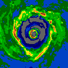
very interesting... it still has not moved from earlier i noticed the center fixed is farther east ...
here is something interesting tells me the center is still off shore
although winds are light the wnw direction is interesting
http://weather.noaa.gov/weather/current/MZBZ.html
the image below shows the location of the observation and where the low is..
the has moved very little since about 9pm and the convection has become quite intense as well as much more concentrated around the center.. it the center can stay where it is even longer i think by mid morning they will re asses possible weak td before coming in .. especially if the convection keep increasing..
0 likes
-
Chris_in_Tampa
- Category 5
- Posts: 5101
- Age: 42
- Joined: Thu Jun 21, 2007 11:06 pm
- Location: Tampa, Florida, USA
- Contact:
Re: INVEST 90L Models Thread
0 likes


-
Aric Dunn
- Category 5
- Posts: 21238
- Age: 43
- Joined: Sun Sep 19, 2004 9:58 pm
- Location: Ready for the Chase.
- Contact:
from the way things are progressing with the system i would not be surprised to see a TD by the 11am.. convection is firing right over the center and is deepening rapidly ... and wrapping around ..
http://www.ssd.noaa.gov/goes/flt/t1/loop-avn.html
as long as it continues to move slowly or not at all .. like it has been ..
http://www.ssd.noaa.gov/goes/flt/t1/loop-avn.html
as long as it continues to move slowly or not at all .. like it has been ..
0 likes

Very interesting to see the dvorak rating raising upto 1.5, that a big jump from last night. Still loads of convection bursting and it does seem depite what siome were saying that the broad center is still just off-shore. Good convection present and every bit further north it gets means a greater chance of developing in the BoC.
Still I don't think its going to have quite enough time to develop despite looking better and better but as Derek said if it gets into the BoC then it may have a real shot at something despite what the statistical models suggest which is it not reaching the BoC.
Still I don't think its going to have quite enough time to develop despite looking better and better but as Derek said if it gets into the BoC then it may have a real shot at something despite what the statistical models suggest which is it not reaching the BoC.
0 likes
-
ncupsscweather
- Category 1

- Posts: 321
- Age: 38
- Joined: Tue Jan 02, 2007 8:05 pm
- Location: Hickory,North Carolina
Re: INVEST 90L in Western Caribbean / Yucatan Penninsula
Think you guys are getting ya'll hopes up for nothing on this Invest, Looks as if the TW's are going to pull this thing inland and W, not NW, and is going to go Poof.
0 likes
Quite possible though the latest update suggests its heading NW however in truth with a fairly broad low center still its not easy to really be able to track it totally 100% accuratly, esp if little eddies form within.
IF it can head NW then it will certainly have a chance at becoming something in the BoC.
IF it can head NW then it will certainly have a chance at becoming something in the BoC.
Last edited by KWT on Sat May 31, 2008 3:50 am, edited 1 time in total.
0 likes
-
ncupsscweather
- Category 1
- Posts: 321
- Age: 38
- Joined: Tue Jan 02, 2007 8:05 pm
- Location: Hickory,North Carolina
Re: INVEST 90L in Western Caribbean / Yucatan Penninsula
Yes if it can make it into the GoH, then yes it will have a chance and becoming somthing. Latest GFDL model has it doing this, and becoming a Tropical Storm. But i still believe at this point it's going to move inland and the TW's are going to move it West. I guess we will have to wait and see. I had someone tell me earlier it was riding along the ITCZ, but looks to me that the ITCZ is ( South ) of the system. I may be wrong, but that's what it looks like to me.
0 likes
I think the 06z model runs will be interesting as they should give a better inidication of where the broad circulation is going to go, of course the issue is if the center does concentrate down we could well find the estimates are out a little on its position which would have a bearing on the track.
0 likes

Re: INVEST 90L in Western Caribbean / Yucatan Penninsula
000
WONT41 KNHC 310904
DSAAT
SPECIAL TROPICAL DISTURBANCE STATEMENT
NWS TPC/NATIONAL HURRICANE CENTER MIAMI FL
500 AM EDT SAT MAY 31 2008
AN AREA OF LOW PRESSURE...ASSOCIATED WITH THE REMNANTS OF FORMER
EASTERN PACIFIC TROPICAL STORM ALMA...IS CENTERED OVER THE GULF OF
HONDURAS NEAR THE COAST OF NORTHERN BELIZE. THE LOW IS MOVING
SLOWLY WESTWARD...AND THE CENTER IS EXPECTED TO MOVE INLAND OVER
THE YUCATAN PENINSULA DURING THE NEXT FEW HOURS. HOWEVER...
SATELLITE IMAGERY AND SURFACE OBSERVATIONS INDICATE THIS SYSTEM IS
BECOMING BETTER ORGANIZED...AND A TROPICAL DEPRESSION COULD FORM IF
THE CENTER REMAINS OFFSHORE THIS MORNING. EVEN IF NO DEVELOPMENT
OCCURS...LOCALIZED HEAVY RAINS AND FLOODS ARE POSSIBLE DURING THE
NEXT COUPLE OF DAYS OVER PORTIONS OF HONDURAS...EL SALVADOR...
GUATELAMALA...BELIZE...AND SOUTHEASTERN MEXICO. FUTURE TROPICAL
DISTURBANCE STATEMENTS WILL BE ISSUED ON THIS SYSTEM AS NECESSARY.
FOR INFORMATION SPECIFIC TO YOUR AREA...PLEASE CONSULT STATEMENTS
FROM YOUR LOCAL WEATHER OFFICE.
$$
FORECASTER BEVEN
0 likes
Thanks thunder44, so as has been said by others this morning its looking better organised but whether it gets upgraded is all down to whether the center can stay offshore or not, probably looking at it odds are that it will just move inland before it can get upgraded but who knows. As Beven said upgrade or not there will be strong convection moving through which is bound to give some heavy rain.
0 likes
Re: INVEST 90L in Western Caribbean / Yucatan Penninsula
It looks like it's coming ashore now. Belize Airport reported a
SW wind at 9mph, with a pressure at 1006mb at 5am:
http://weather.noaa.gov/weather/current/MZBZ.html
SW wind at 9mph, with a pressure at 1006mb at 5am:
http://weather.noaa.gov/weather/current/MZBZ.html
0 likes
-
Matt-hurricanewatcher
Re: INVEST 90L in Western Caribbean / Yucatan Penninsula
It is moving very very slowly and is still where it was, or very close to it was 5-6 hours ago. I think we have a "depression" now based on those southwest winds. But this will run out of time as it moves over land. Once it moves over the Yuctan it will then remain over land for 24+ hours,,,This will pretty much destroy the inner core of the system, so once into the BOC it will take a lot of time to reorganize.
0 likes
Re: INVEST 90L in Western Caribbean / Yucatan Penninsula
This system is probably going to look better over land, than it did over water, for while today.
0 likes
-
ncupsscweather
- Category 1
- Posts: 321
- Age: 38
- Joined: Tue Jan 02, 2007 8:05 pm
- Location: Hickory,North Carolina
-
ncupsscweather
- Category 1
- Posts: 321
- Age: 38
- Joined: Tue Jan 02, 2007 8:05 pm
- Location: Hickory,North Carolina
Re: INVEST 90L in Western Caribbean / Yucatan Penninsula
 Just watching the Weather Channel and they just said that 90L has been setting there for about 5 to 6 day's now
0 likes
Who is online
Users browsing this forum: No registered users and 27 guests