Don't know what it means, but actual 0Z Fort Worth sounding is a touch more unstable and a little less inhibition that 0Z WRF model at tau zero

versus

Looking at the actual sounding at CRP, from the general direction Houston's 800 to 900 mb winds are coming from, pronounced CAP, although the actual sounding is very slightly more unstable and slightly less CINH than the WRF forecast sounding.

I like to check model soundings/forecasts vs actual at time zero, and during the NYC non-snow about a week back, the WRF was 2 to 3º Celcius to cool with surface temps, leading me to suspect Bastardi would be right in predicting the NYC area WSW would bust.
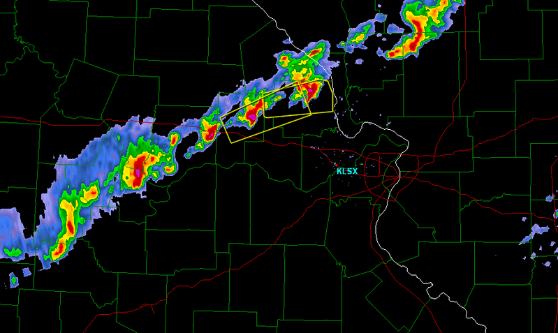
New WRF suggests Houston remains capped.Hard to argue too much, although the model has a touch too much inhibition, the warm layer does look pretty steep. Based on forecast precip, best action looks like Arkansas, SE Missouri, Tennessee, Northern Mississippi and Southwest Kentucky.
Most Unstable CAPE in excess of 750 J/Kg, some places in excess of 1000 J/Kg, 50 to 70 knots deep layer shear, strong directional shear between the surface and 700 mb, looks interesting.

Looking at forecast skew-Ts, Northeast Arkansas looks to have the best combination of instability and shear, with just a hint of a cap to keep everything in check until conditions are prime.