

57F at my house this morning.
Nice and cool start to the day.
Hope it holds......................
Florida Weather
Moderator: S2k Moderators
Forum rules

The posts in this forum are NOT official forecast and should not be used as such. They are just the opinion of the poster and may or may not be backed by sound meteorological data. They are NOT endorsed by any professional institution or STORM2K.
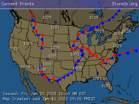
Re: Florida Cool Front Thread-
0 likes
-
JonathanBelles
- Professional-Met

- Posts: 11430
- Age: 35
- Joined: Sat Dec 24, 2005 9:00 pm
- Location: School: Florida State University (Tallahassee, FL) Home: St. Petersburg, Florida
- Contact:
-
chadtm80
Re: Florida Cool Front Thread-
Simply Beutifull out here.. I would take this year long..
Front has stalled out now..
Front has stalled out now..
0 likes
-
Opal storm
Re: Florida Cool Front Thread-
Stayed in the 50's all day with overcast and drizzle, right now the sun is finally starting to pop out.
0 likes
-
JonathanBelles
- Professional-Met
- Posts: 11430
- Age: 35
- Joined: Sat Dec 24, 2005 9:00 pm
- Location: School: Florida State University (Tallahassee, FL) Home: St. Petersburg, Florida
- Contact:
-
JonathanBelles
- Professional-Met
- Posts: 11430
- Age: 35
- Joined: Sat Dec 24, 2005 9:00 pm
- Location: School: Florida State University (Tallahassee, FL) Home: St. Petersburg, Florida
- Contact:
Re: Florida Weather Thread- Tropical Halloween?
For St. Pete, FL,
This Afternoon: A 40 percent chance of showers and thunderstorms. Mostly cloudy, with a high near 83. Northeast wind around 14 mph, with gusts as high as 18 mph. New rainfall amounts of less than a tenth of an inch, except higher amounts possible in thunderstorms. (I have 22mph winds right now)
Tonight: A chance of showers and thunderstorms before 8pm, then a slight chance of showers. Mostly cloudy, with a low around 70. Northeast wind between 14 and 18 mph. Chance of precipitation is 40%. New rainfall amounts between a tenth and quarter of an inch, except higher amounts possible in thunderstorms.
Tuesday: A slight chance of showers, then a chance of showers and thunderstorms after 8am. Mostly cloudy, with a high near 84. Northeast wind between 14 and 20 mph, with gusts as high as 31 mph. Chance of precipitation is 40%. New rainfall amounts between a tenth and quarter of an inch, except higher amounts possible in thunderstorms.
Tuesday Night: A chance of showers and thunderstorms. Mostly cloudy, with a low around 72. Northeast wind between 15 and 21 mph, with gusts as high as 33 mph. Chance of precipitation is 40%. New rainfall amounts between a tenth and quarter of an inch, except higher amounts possible in thunderstorms.
Wednesday: A chance of showers, with thunderstorms also possible after 2pm. Mostly cloudy, with a high near 84. Northeast wind between 16 and 18 mph. Chance of precipitation is 40%. New rainfall amounts between a tenth and quarter of an inch, except higher amounts possible in thunderstorms.
Wednesday Night: A chance of showers and thunderstorms before 8pm, then a slight chance of showers. Partly cloudy, with a low around 72. Northeast wind between 15 and 17 mph. Chance of precipitation is 40%. New rainfall amounts between a tenth and quarter of an inch, except higher amounts possible in thunderstorms.
______________________________________________________________________________
The wind forecast for all days has been increased since yesterday, and the rain chance for Halloween has been bumped up from 20% yesterday.
0 likes
-
Cookiely

- S2K Supporter

- Posts: 3211
- Age: 75
- Joined: Fri Aug 13, 2004 7:31 am
- Location: Tampa, Florida
Re: Florida Weather Thread- Tropical Halloween?
NWS Tampa
Gale Force Winds - I agree and I love the wind.
AREA FORECAST DISCUSSION
NATIONAL WEATHER SERVICE TAMPA BAY RUSKIN FL
854 PM EDT TUE OCT 30 2007
SHORTWAVE TROF SLOWLY MOVING THRU THE MISS RV VALLEY TONIGHT WITH
SW FLOW ALOFT KEEPING UPPER MOISTURE STREAMING OFF THE GULF. WHILE
SFC-MID LEVEL RIDGE HOLDING FIRM OVER THE MID ATLANTIC STATES AND
TROPICAL STORM NOEL IS MOVING SLOWLY OVER CUBA BEFORE NORTHWARD
TURN. STRONG GRADIENT BETWEEN THESE TWO FEATURES PRODUCING VERY
GUSTY WINDS AT LOWER LEVELS. 00Z SOUNDING SHOWING WINDS OF 40-46KTS
FROM 2-3K FT AND 1 SFC OB FROM NEAR THE MOUTH OF THE BAY GUSTING
TO NEAR GALE FORCE. WEAK DECAYING BOUNDARY REMAINS OVER THE FL
PENINSULA WITH SLIGHTLY DRIER AIRMASS OVER THE NATURE COAST WITH
DEW POINTS IN THE LOWER 60S WHILE MORE MOIST AIRMASS IN PLACE FROM
AROUND THE BAY AREA SOUTHWARD WITH DEW POINTS NEAR 70. RADAR
SHOWING WEAK OVERRUNNING ASSOCIATED WITH THE BOUNDARY AS WELL FROM
THE ATLANTIC BUT COVERAGE LESSENING THIS EVENING SO SLIGHT CHANCE
POPS REST OF THE NIGHT STILL IN LINE. MIN TEMPS AGAIN AROUND 10
DEGREES ABOVE NORMAL. FORECAST AND GRIDS ON TRACK NO UPDATES
EXPECTED
0 likes
-
Cookiely
- S2K Supporter
- Posts: 3211
- Age: 75
- Joined: Fri Aug 13, 2004 7:31 am
- Location: Tampa, Florida
Re: Florida Weather Thread- Tropical Halloween?
Apparently one of the long time forecasters is leaving. Thanks and good luck in your new job.
Area Forecast Discussion
Issued by NWS Tampa Bay Area, FL
Current Version | Previous Version | Text Only | Print | Product List | Glossary Off
Versions: 1 2 3 4 5 6 7 8 9 10 11 12 13 14 15 16 17 18 19 20 21 22 23 24 25 26 27 28
--------------------------------------------------------------------------------
000
FXUS62 KTBW 010118
AFDTBW
AREA FORECAST DISCUSSION
NATIONAL WEATHER SERVICE TAMPA BAY RUSKIN FL
918 PM EDT WED OCT 31 2007
.SYNOPSIS...BREEZY CONDITIONS WITH VARYING AMOUNTS OF CLOUDS IS
THE RULE THIS EVENING...WITH TEMPERATURES SLOWLY FALLING THROUGH
THE 70S. ONLY ITEM OF INTEREST IS A SINGULAR BAND OF SHOWERS
STRETCHING ACROSS LAKE OKEECHOBEE AND INTO HENDRY COUNTY...BUT
THEY TEND TO FADE QUICKLY AS THEY APPROACH SOUTHWEST FLORIDA. KTBW
SOUNDING FAIRLY STABLE BUT IS CARRYING BRISK NORTHEAST FLOW AS
WINDS JUMP OVER 30 KNOTS AT 2000 FEET OFF THE SURFACE.
&&
.DISCUSSION...CURRENT FORECAST IS ON TRACK AS AFTERNOON/EVENING
BREEZY CONDITIONS BEARING OUT UNDER A PARTLY CLOUDY SKY. WILL
CONTINUE TO MENTION ISOLATED SHOWERS FROM THE CENTRAL PENINSULA
SOUTHWARD TO THE FORT MYERS AREA...AS SOME OF THE CONVERGENT BANDS
PROPAGATING INLAND FROM THE ATLANTIC COAST WILL HAVE JUST ENOUGH
LEFT TO DROP SOME MEASURABLE RAINS IN A FEW SPOTS.
OTHERWISE...WITH DEW POINTS STILL FLIRTING WITH 70 AND EAST-
NORTHEAST LOW LEVEL FLOW EXPECTED FOR ONE MORE NIGHT...EXPECT
BROKEN TO OVERCAST CONDITIONS TO RETURN OVERNIGHT AND CONTINUE
INTO THE EARLY MORNING ON THURSDAY BEFORE SUNSHINE RETURNS.
ZONE UPDATES AVAILABLE BY 930 PM.
FINALLY...I`D PERSONALLY LIKE TO THANK EVERYONE FOR THEIR SUPPORT
DURING THE PAST NINE YEARS THAT I HAVE BEEN A FORECASTER HERE IN WEST
CENTRAL FLORIDA. IT HAS BEEN A GREAT RIDE AND A PLEASURE SERVING
ALL OF YOU!
&&
.MARINE...WINDS WILL EBB AND FLOW DURING THE NEXT 24-30 HOURS BUT
SHOULD AVERAGE NEAR OR JUST ABOVE ADVISORY CONDITIONS (20 KNOTS OR
SO). EARLIER...THE ADVISORY FOR THE 20-60NM LEG WAS EXTENDED IN
TIME TO 10 PM THURSDAY BASED ON GRIDDED DATA...AND PENDING THE
EVENTUAL DEVELOPMENT/EXTRATROPICAL TRANSITION OF NOEL AS IT SLIDES
EAST OF THE FLORIDA ATLANTIC COAST WE`LL HAVE TO MAKE A DECISION
ON THE NEARSHORE WATERS...EITHER EASING BACK TO CAUTION BY THIS
TIME THURSDAY OR EXTENDING THE ADVISORY. WILL DEFER DECISION TO
NEXT SHIFT.
OTHERWISE...CURRENT FORECAST COVERS THE HIGHLIGHTS AND PLAN NO CHANGES.
&&
.CLIMATE...THE SUMMER OF 2007`S "FIFTH MONTH" COMES TO A CLOSE
TODAY AND IT LOOKS LIKE JUST MAYBE WE`LL FINALLY SEE SOME REAL
NICE EARLY NOVEMBER WEATHER FOR MOST OF THE WEEKEND WITH LOWER
TEMPERATURES AND COMFORTABLE HUMIDITY.
IN THE MEANTIME...UNTIL FINAL STATISTICS ARE GENERATED ON
THURSDAY...PRELIMINARY DATA SHOW THE FOLLOWING:
TAMPA...2ND HIGHEST MEAN TEMPERATURE (79.8 OR 79.9) SINCE RECORDS
BEGAN IN 1890 (HIGHEST: 80.4 IN 1919)
SARASOTA/BRADENTON: HIGHEST MEAN TEMPERATURE (AROUND 80.4) SINCE
RECORDS BEGAN IN 1948
FORT MYERS: 2ND HIGHEST MEAN TEMPERATURE (81.2 OR SLIGHTLY LOWER)
SINCE OFFICIAL RECORDS BEGAN IN 1931.
IN SUMMARY: IF YOU THOUGHT OCTOBER WAS UNUSUALLY WARM...IT WAS.
MORE INFORMATION WILL BE PROVIDED OVER THE NEXT FEW DAYS...LOOK
FOR MORE INFORMATION ON OUR WEBSITE AT HTTP://WEATHER.GOV/TAMPABAY.
&&
.TBW WATCHES/WARNINGS/ADVISORIES...
GULF WATERS...SMALL CRAFT ADVISORY UNTIL 10 PM EDT THURSDAY FOR
BONITA BEACH TO SUWANNEE RIVER OUT 20 TO 60 NM.
SMALL CRAFT ADVISORY UNTIL 4 PM EDT THURSDAY FOR BONITA BEACH TO
SUWANNEE RIVER OUT 20 NM...INCLUDING TAMPA BAY.
&&
$$
SHORT TERM UPDATE...88/BSG
0 likes
-
JonathanBelles
- Professional-Met
- Posts: 11430
- Age: 35
- Joined: Sat Dec 24, 2005 9:00 pm
- Location: School: Florida State University (Tallahassee, FL) Home: St. Petersburg, Florida
- Contact:
-
JonathanBelles
- Professional-Met
- Posts: 11430
- Age: 35
- Joined: Sat Dec 24, 2005 9:00 pm
- Location: School: Florida State University (Tallahassee, FL) Home: St. Petersburg, Florida
- Contact:
This Afternoon: A slight chance of sprinkles. Mostly cloudy, with a high near 84. North northeast wind around 14 mph, with gusts as high as 21 mph.
Tonight: A slight chance of sprinkles before 8pm. Mostly cloudy, with a low around 70. North northeast wind between 14 and 17 mph, with gusts as high as 24 mph.
Friday: Mostly sunny, with a high near 82. North northwest wind between 11 and 14 mph, with gusts as high as 21 mph.
Friday Night: Partly cloudy, with a low around 64. North northwest wind between 10 and 14 mph, with gusts as high as 20 mph.
Saturday: Mostly sunny, with a high near 78. North wind between 9 and 13 mph.
Saturday Night: Mostly clear, with a low around 59. North northwest wind between 7 and 9 mph.
Sunday: Sunny, with a high near 76. North northeast wind between 7 and 11 mph.
Sunday Night: Mostly clear, with a low around 59. Northeast wind around 9 mph.
Monday: Sunny, with a high near 79. East northeast wind between 7 and 10 mph.
Monday Night: Partly cloudy, with a low around 62.
Tuesday: Mostly sunny, with a high near 80.
Tuesday Night: Partly cloudy, with a low around 61.
Wednesday: Mostly sunny, with a high near 74.
_____________________________________________--
50's!!!!!!!!!!!!!!
0 likes
-
JonathanBelles
- Professional-Met
- Posts: 11430
- Age: 35
- Joined: Sat Dec 24, 2005 9:00 pm
- Location: School: Florida State University (Tallahassee, FL) Home: St. Petersburg, Florida
- Contact:
Re: Florida Weather Thread- Cold Shot Coming
I went out at 7:20 and the stat said 52°! Local NWS reading said 62, so that 52 reading might be right as I am usually cooler than that reading and have been known to be as much as 15° cooler.
0 likes

Re: Florida Weather Thread- Cold Shot Coming
It was definitely chilly this morning. 47 at my house. 
Seems like we went straight from hot to cold! I'm with OTown - 60's are nice for the mornings!
Seems like we went straight from hot to cold! I'm with OTown - 60's are nice for the mornings!
0 likes

Re: Florida Weather Thread- Cold Shot Coming
Cold here too, have started to blanket the horses at night already.
Gonna be a rough winter for hay it looks like. I expect to spend about $1000+ just in hay alone just to feed my horses through the winter this year, if we can find hay. That is in addition to the $400 per month in regular feed and supplements. Last year it was a real challange to get any towards the end of winter and the price was through the roof for garbage quality hay, and the drought didn't let the supply recover very well.
Gonna be a rough winter for hay it looks like. I expect to spend about $1000+ just in hay alone just to feed my horses through the winter this year, if we can find hay. That is in addition to the $400 per month in regular feed and supplements. Last year it was a real challange to get any towards the end of winter and the price was through the roof for garbage quality hay, and the drought didn't let the supply recover very well.
0 likes

-
JonathanBelles
- Professional-Met
- Posts: 11430
- Age: 35
- Joined: Sat Dec 24, 2005 9:00 pm
- Location: School: Florida State University (Tallahassee, FL) Home: St. Petersburg, Florida
- Contact:
-
Cookiely
- S2K Supporter
- Posts: 3211
- Age: 75
- Joined: Fri Aug 13, 2004 7:31 am
- Location: Tampa, Florida
Re:
fact789 wrote:I'm in the 40's here. The low is at least 49° here.
My mama is freezing this morning. Flannel pajamas, huge robe and turned the heat up big time. If we get a frost warning, I'm going to wrap her in a heated blanket and turn up the thermostat on it. I love the cold but my poor bones and ligaments are protesting vehemently.
0 likes

-
JonathanBelles
- Professional-Met
- Posts: 11430
- Age: 35
- Joined: Sat Dec 24, 2005 9:00 pm
- Location: School: Florida State University (Tallahassee, FL) Home: St. Petersburg, Florida
- Contact:
-
Scorpion