
Everyone's playing it cautious. Fortunately we haven't seen that much rain here in the city, but that's expectd to change as some of the next squalls begin moving over our area. Walking to the CBD from the parking garage in the French Quarter, I noticed a lot of businesses already had sandbags out to prevent water filling up the streets from getting inside their businesses for the 3rd week in a row. There was a steady but light drizzle, and winds were 12-15 gusting to around 20 (nothing to flip the umbrella inside out, but enough that you had to hold onto it tight).
I don't see us getting the kind of rain they've seen over in Jackson County (10-15"), MS, but it could be heavy enough to fill up the streets. I'm guessing we'll get between 4-6" today. As the storm lifts north, I'd expect the Mississippi Gulf Coast to end up on the shortest end of the stick. Portions of the MS GC could easily pick up another 6-10" today. The soil is pretty sandy and well drained over there, but there will be plenty of localized flooding.
John C. is out of town so he can't reset CFHC, so I'm not sure how I can link any photos in case I can get any good photo shoots. I almost wore cotton pants today so I could go to the FQ at lunchtime in case things get bad. But this suit could use a drycleaning anyway, so I might go for it if I get the chance.
http://www.srh.noaa.gov/radar/loop/DS.8 ... klix.shtml
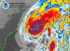
There's the rainfall amounts since last night at 6pm. Notice Jackson Co., MS (extreme SE MS). They got caught under a nasty feeder band. There's always the danger with a weak storm that someone to the east of the ciculation center by up to 400 miles can be in for a rude awakening. Take care out there.
Steve
Early report from New Orleans CBD...
Moderator: S2k Moderators
Forum rules

The posts in this forum are NOT official forecasts and should not be used as such. They are just the opinion of the poster and may or may not be backed by sound meteorological data. They are NOT endorsed by any professional institution or STORM2K. For official information, please refer to products from the National Hurricane Center and National Weather Service.
-
mf_dolphin

- Category 5

- Posts: 17758
- Age: 69
- Joined: Tue Oct 08, 2002 2:05 pm
- Location: St Petersburg, FL
- Contact:
-
wx247

- S2K Supporter

- Posts: 14279
- Age: 42
- Joined: Wed Feb 05, 2003 10:35 pm
- Location: Monett, Missouri
- Contact:
Thanks for the update. Keep us posted on how The Big Easy is doing!
0 likes
Personal Forecast Disclaimer:
The posts in this forum are NOT official forecast and should not be used as such. They are just the opinion of the poster and may or may not be backed by sound meteorological data. They are NOT endorsed by any professional institution or storm2k.org. For official information, please refer to the NHC and NWS products.
The posts in this forum are NOT official forecast and should not be used as such. They are just the opinion of the poster and may or may not be backed by sound meteorological data. They are NOT endorsed by any professional institution or storm2k.org. For official information, please refer to the NHC and NWS products.

I am in Jackson County (extreme SE MS) and I must say you are right on Steve about the rainfall here. I had to back flush my pool this morning to get some of the water out, then I closed it off with the hurricane shutter I had installed this past winter. Some areas of HWY 90 are closed because of the Escatawpa (es-Ka-taw-puh) River. Even when the rains go North of the coast it will get the run-off and continue above flood stage.
0 likes
-
Toni - 574

- Category 1

- Posts: 493
- Joined: Wed May 28, 2003 9:20 pm
- Location: W. Central Florida
Re: Early report from New Orleans CBD...
Steve wrote:Everyone's playing it cautious. Fortunately we haven't seen that much rain here in the city, but that's expectd to change as some of the next squalls begin moving over our area. Walking to the CBD from the parking garage in the French Quarter, I noticed a lot of businesses already had sandbags out to prevent water filling up the streets from getting inside their businesses for the 3rd week in a row. There was a steady but light drizzle, and winds were 12-15 gusting to around 20 (nothing to flip the umbrella inside out, but enough that you had to hold onto it tight).
I don't see us getting the kind of rain they've seen over in Jackson County (10-15"), MS, but it could be heavy enough to fill up the streets. I'm guessing we'll get between 4-6" today. As the storm lifts north, I'd expect the Mississippi Gulf Coast to end up on the shortest end of the stick. Portions of the MS GC could easily pick up another 6-10" today. The soil is pretty sandy and well drained over there, but there will be plenty of localized flooding.
John C. is out of town so he can't reset CFHC, so I'm not sure how I can link any photos in case I can get any good photo shoots. I almost wore cotton pants today so I could go to the FQ at lunchtime in case things get bad. But this suit could use a drycleaning anyway, so I might go for it if I get the chance.
http://www.srh.noaa.gov/radar/loop/DS.8 ... klix.shtml
There's the rainfall amounts since last night at 6pm. Notice Jackson Co., MS (extreme SE MS). They got caught under a nasty feeder band. There's always the danger with a weak storm that someone to the east of the ciculation center by up to 400 miles can be in for a rude awakening. Take care out there.
Steve
Thanks for the info. Steve. I was wondering what was going on at CFHC. I enjoy your pictures, but hopefully you will not have to take to many pictures of flooded streets.Stay high and dry,keep us informed!
0 likes
Our push up to 2-3" is now occuring. A feeder band is wrapping in over the city:
http://www.srh.noaa.gov/radar/loop/DS.p ... klix.shtml
I'd call the rainfall "moderate", and the winds are gusting up to about 30mph. It's not raining hard enough to flood, but many of the drains around my building are already topping out. What kills us is if there are more than 2" in the first hour. When that happens, the pumps can't catch up for a while.
Steve
0 likes
-
vbhoutex

- Storm2k Executive

- Posts: 29150
- Age: 74
- Joined: Wed Oct 09, 2002 11:31 pm
- Location: Cypress, TX
- Contact:
Looks like a ton more rain on the way for you Steve as Bill is making landfall. The turn to the NE appears to have already begun and it looks like Bill will track NNE between NO and BR, closer to NO, meaning you will be getting "pounded" for several hours. I guess that is why you are under a Flash Flood Warning. 
 Recon has recorded a wind of 58mph at 28.8, 89.8 to your S near Grand Ilse.
Be safe and keep reporting in as you can.
Be safe and keep reporting in as you can.
0 likes
Skywarn, C.E.R.T.
Please click below to donate to STORM2K to help with the expenses of keeping the site going:

Please click below to donate to STORM2K to help with the expenses of keeping the site going:

We got let go at 12:00 after the bosses heard City Hall was closing down. Getting to the parking lot on Iberville St. in the French Quarter was an adventure. The streets were flooding (as per all recent pictures) and I had a suit on today. My boss loaned me a pancho which didn't help when someone sped through downtown soaking me. I gave them the thumbs up (possibly the wrong finger?) when I knew it was inevitable. Bah. Anyway, I took Airline Dr. home and there were numerous streets under water in New Orleans. As noted above, our 2-3" push was coming. It came to the tune of 3.5" in an hour in the FQ (right next to the CBD where I work). By the end of the day, we'll shatter our June rainfall record set in 2001 (Allison).
Anyway, now that I'm home, it's time to crack open some of these cold Abita Purple Hazes I have in the refrigerator for this very occasion . If there's one thing you gotta love about tropical weather, it's those free days off - assuming you don't work in emergency mangaement or medical
  .
.
Peace,
Steve
Anyway, now that I'm home, it's time to crack open some of these cold Abita Purple Hazes I have in the refrigerator for this very occasion
Peace,
Steve
0 likes
-
Toni - 574
- Category 1
- Posts: 493
- Joined: Wed May 28, 2003 9:20 pm
- Location: W. Central Florida
I work in medical-NO FREE DAYS OFF! Unless you just happen to be out of town, if you know what I mean We have to also help with any shelter opening and help make decisions regarding evacuees, such as if they are ok to stay in a reg. shelter or do they need a special care shelter or hospital. My name is down on the list to be called so I keep my fingers crossed that I don't get called when we have a tropical system approaching.Never the less I have to always be in the stand by mode if our local emergency management comes calling.
STAY SAFE!
STAY SAFE!
0 likes
-
flightpath
- Tropical Low

- Posts: 35
- Joined: Sun May 11, 2003 10:27 pm
- Location: metairie,LA
hello everyone, new here- It's really coming down now here just west of the city (New Orleans). winds steady at 15, gusting in squalls to about 25. rain guage now at 3 in. and rising. Drainage canals are about already full. Saw tree down in CBD on way out around noon at corner of Julia and I want to say O'keefe but no matter, most of you folks won't know it anyway. Great board! stay safe everyone...flightpath
0 likes
-
flightpath
- Tropical Low
- Posts: 35
- Joined: Sun May 11, 2003 10:27 pm
- Location: metairie,LA


-
Steve Cosby

- S2K Supporter
- Posts: 525
- Joined: Sat Jun 14, 2003 6:49 pm
- Location: Northwest Arkansas
-
wx247
- S2K Supporter
- Posts: 14279
- Age: 42
- Joined: Wed Feb 05, 2003 10:35 pm
- Location: Monett, Missouri
- Contact:
Thanks for sharing! And... if that person isn't going to take care of that Mustang I think I should take it off their hands!
0 likes
Personal Forecast Disclaimer:
The posts in this forum are NOT official forecast and should not be used as such. They are just the opinion of the poster and may or may not be backed by sound meteorological data. They are NOT endorsed by any professional institution or storm2k.org. For official information, please refer to the NHC and NWS products.
The posts in this forum are NOT official forecast and should not be used as such. They are just the opinion of the poster and may or may not be backed by sound meteorological data. They are NOT endorsed by any professional institution or storm2k.org. For official information, please refer to the NHC and NWS products.
-
PTrackerLA

- Category 5
- Posts: 5281
- Age: 42
- Joined: Thu Oct 10, 2002 8:40 pm
- Location: Lafayette, LA
-
southerngale

- Retired Staff

- Posts: 27418
- Joined: Thu Oct 10, 2002 1:27 am
- Location: Southeast Texas (Beaumont area)
 my Cowboys
 Who is online
Users browsing this forum: No registered users and 153 guests