INVEST 90L: Gulf of Mexico : Gone from NRL

Moderator: S2k Moderators

Message
Author
User avatar
Extremeweatherguy
Category 5
Category 5
Posts: 11095
Joined: Mon Oct 10, 2005 8:13 pm
Location: Florida

Re: INVEST 90L: Near South Florida: Discussions & Images

#301 Postby Extremeweatherguy » Tue Oct 02, 2007 2:45 pm

mvtrucking wrote:Image


If I am looking at this shear map correctly,isn't shear in the 10 knot range over this Invest?
Yes, in the 10-15 knot range. It is certainly not enough to stop this from developing.

The biggest negative right now is the dry air: http://www.ssd.noaa.gov/goes/east/gmex/wv-l.jpg

However, it has been fighting it pretty well this afternoon.
0 likes   

Stormcenter
S2K Supporter
S2K Supporter
Posts: 6684
Joined: Wed Sep 03, 2003 11:27 am
Location: Houston, TX

Re: INVEST 90L: Near South Florida: Discussions & Images

#302 Postby Stormcenter » Tue Oct 02, 2007 2:49 pm

Extremeweatherguy wrote:
mvtrucking wrote:Image


If I am looking at this shear map correctly,isn't shear in the 10 knot range over this Invest?
Yes, in the 10-15 knot range. It is certainly not enough to stop this from developing.

The biggest negative right now is the dry air: http://www.ssd.noaa.gov/goes/east/gmex/wv-l.jpg

However, it has been fighting it pretty well this afternoon.


Yes but like with TD10 the dry air is not going anywhere fast if at all.
0 likes   

americanrebel

#303 Postby americanrebel » Tue Oct 02, 2007 2:51 pm

Dry air is moving West at a pretty good clip.

Looking at the Visible and IR3, looks like the LLC is West of the ULL. Am I seeing this correctly?
0 likes   

americanrebel

#304 Postby americanrebel » Tue Oct 02, 2007 2:55 pm

Since people are trying to compare this to TD 10, can we expect this system to go further East of the projected paths?
0 likes   

User avatar
Extremeweatherguy
Category 5
Category 5
Posts: 11095
Joined: Mon Oct 10, 2005 8:13 pm
Location: Florida

Re:

#305 Postby Extremeweatherguy » Tue Oct 02, 2007 3:01 pm

americanrebel wrote:Since people are trying to compare this to TD 10, can we expect this system to go further East of the projected paths?
Unlikely. By the time TD10 was in the GOM, the models had already all shifted toward NOLA eastward and we no longer expected the storm to make it west of central LA. This time, however, the opposite has happened. The models that were pointed east are starting to shift west and with a ridge in place and the storm already far enough south, I think it is becoming more and more likely that this will end up hitting somewhere from NOLA westward...likely in TX or SW LA.
0 likes   

User avatar
Extremeweatherguy
Category 5
Category 5
Posts: 11095
Joined: Mon Oct 10, 2005 8:13 pm
Location: Florida

#306 Postby Extremeweatherguy » Tue Oct 02, 2007 3:09 pm

Image
0 likes   

dwg71
Category 5
Category 5
Posts: 2349
Joined: Wed Jun 08, 2005 4:34 pm

#307 Postby dwg71 » Tue Oct 02, 2007 3:10 pm

It would appear that it will struggle to get to any strength beyond mild TS and Southern LA seems to be a probable area to be affected. No biggie IMO. Odds on getting a name 30%.
0 likes   

User avatar
hurricanetrack
HurricaneTrack.com
HurricaneTrack.com
Posts: 1781
Joined: Tue Dec 02, 2003 10:46 pm
Location: Wilmington, NC
Contact:

#308 Postby hurricanetrack » Tue Oct 02, 2007 3:12 pm

Name would be Noel.

It is a male name, so it would be pronounced Nole and not No-El like Xmas.

Next up is Olga. That sounds lovely.
0 likes   

dwg71
Category 5
Category 5
Posts: 2349
Joined: Wed Jun 08, 2005 4:34 pm

#309 Postby dwg71 » Tue Oct 02, 2007 3:16 pm

^ i do believe its (Nole) and not (No L)
0 likes   

User avatar
cycloneye
Admin
Admin
Posts: 145308
Age: 68
Joined: Thu Oct 10, 2002 10:54 am
Location: San Juan, Puerto Rico

Re: INVEST 90L : Gulf of Mexico : Discussions & Images

#310 Postby cycloneye » Tue Oct 02, 2007 3:21 pm

In spanish is No-el.
0 likes   

User avatar
BigA
Professional-Met
Professional-Met
Posts: 1317
Joined: Sun Jul 24, 2005 10:56 pm

Re: INVEST 90L : Gulf of Mexico : Discussions & Images

#311 Postby BigA » Tue Oct 02, 2007 3:22 pm

The NOGAPS and GFS degrade the shear in the western gulf in the next three days. It appears to me that this system will be hampered more by its inherent disorganization than by unfavorable upper level winds.

Interesting that the map shows a closed, though broad low now.
0 likes   

User avatar
jasons2k
Storm2k Executive
Storm2k Executive
Posts: 8245
Age: 51
Joined: Wed Jul 06, 2005 12:32 pm
Location: The Woodlands, TX

#312 Postby jasons2k » Tue Oct 02, 2007 3:32 pm

I didn't think this would close-off completely until tomorrow; also there is a lot of convection on the west side of this that could wrap over time. This does not look like your typical highly-sheared system with all the convection well-removed to the east. IMO I think some are writing this off too quickly. As I've been saying since Sunday we won't know what will really happen with this probably until tomorrow (Wednesday). The parameters that could affect intensity (such as shear, etc.) can't be reliably forecasted 4 and 5 days in advance...and just since yesterday there have already been big changes to the local forcast with regards to the front and the trough out west. This will impact what happens to 90L.
0 likes   

Ed Mahmoud

Re: INVEST 90L : Gulf of Mexico : Discussions & Images

#313 Postby Ed Mahmoud » Tue Oct 02, 2007 3:41 pm

After staring closely at this visible loop, I think there may be an area of spin, closer to the surface than the ULL, that may not be a completely closed circulation, just East of the storms. If this is what will be the center, (and I don't know) it is already moving more North than West, and while the Beta Advection models may be cosnidered unsophisticated, their forecast of a Panhandle or Alabama landfall of whatever feature is there could be correct.
0 likes   

User avatar
HURAKAN
Professional-Met
Professional-Met
Posts: 46086
Age: 38
Joined: Thu May 20, 2004 4:34 pm
Location: Key West, FL
Contact:

#314 Postby HURAKAN » Tue Oct 02, 2007 3:43 pm

Noel

No·el [ nō él ] (plural No·els) or No·ël [ nō él ] (plural No·ëls)

noun

Definition:

Christmas: Christmas, especially in carols or greetings

[12th century. < French< Latin (dies) natalis "birth (day)" < nasci "be born"]

From encarta: http://encarta.msn.com/dictionary_1861683540/Noel.html
0 likes   

User avatar
Steve
S2K Supporter
S2K Supporter
Posts: 9621
Joined: Sat Apr 05, 2003 11:41 pm
Location: Not a state-caster

#315 Postby Steve » Tue Oct 02, 2007 3:44 pm

>>After staring closely at this visible loop, I think there may be an area of spin, closer to the surface than the ULL, that may not be a completely closed circulation, just East of the storms. If this is what will be the center, (and I don't know) it is already moving more North than West...

It was also apparent on the WV loop. Whether it's a primary low or just a rotating one (which would be moving north based on its overall position to a broader low) remains to be seen. If there is any similarity in organizing from subtropical with a broad area of low pressure to a primary center, we'll probably see a few more of those along the way. But based on what TD #10 did, I wouldn't discount the possibility of a farther-than-anticipated east landfall.

Steve
0 likes   

User avatar
srainhoutx
S2K Supporter
S2K Supporter
Posts: 6919
Age: 67
Joined: Sun Jan 14, 2007 11:34 am
Location: Haywood County, NC
Contact:

Re: INVEST 90L : Gulf of Mexico : Discussions & Images

#316 Postby srainhoutx » Tue Oct 02, 2007 3:46 pm

Snipet from HGX AFD this afternoon...


FXUS64 KHGX 022043
AFDHGX

AREA FORECAST DISCUSSION
NATIONAL WEATHER SERVICE HOUSTON/GALVESTON TX
343 PM CDT TUE OCT 2 2007

.DISCUSSION...
CU OVER THE AREA MAINLY SW TO NE ACROSS THE NORTHERN REGIONS OF THE
CWA THIS AFTERNOON. DRY AIR OVER THE AREA NOW WITH GPS IPWV
SHOWING 1 SOUTH TO 1.5" NORTHWEST COUNTIES. DRY AIR CONTINUES TO
SPREAD OVER THE AREA FROM THE EAST AND THIS SHOULD CONTINUE INTO
WEDNESDAY SO WILL BE KEEPING THE DRY FORECAST THROUGH WEDNESDAY
NIGHT WITH ABOVE NORMAL TEMPERATURES DURING THE DAY AND DECENT
RADIATIONAL COOLING AT NIGHT. MAY SEE SOME AREAS OF GROUND FOG BUT
NOT EXPECTING VISBY TO CRATER.

THE AREA OF LOW PRESSURE IN THE EASTERN GULF CONTINUES TO DEEPEN
PRESSURES AS OF 19Z WERE DOWN TO 1005 MB THAT IS DOWN 7 MB FROM
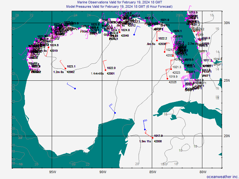
YESTERDAY AT THIS TIME. WINDS AT BUOY 42003 AND 42036 HAVE BEEN
SHOWING SUSTAINED WINDS OF 15-25 KNOTS WITH GUSTS OF 24-37 KNOTS
MOST OF THE DAY. 42003 HAS HAD PERSISTENT THUNDERSTORMS NEAR IT ON
THE WEST SIDE OF THE CIRCULATION ALL AFTERNO0N. THE WRF/GFS/ECMWF
ALL TAKE IT WEST WEDNESDAY AND EARLY THURSDAY THEN TURN IT NW
(EXCEPTION BEING THE ECMWF WHICH IS STILL WNW) BRINGING A LARGE
CIRCULATION INTO THE NORTHWEST GULF THURSDAY NIGHT AND FRIDAY. A
COUPLE OF THINGS WILL BE WORKING AGAINST RAPID
INTENSIFICATION...WIND SHEAR AND THE COLD CORE TO START WITH AND
THE FACT THAT A GOOD DEAL OF MID AND UPPER LEVEL DRY AIR HAS
WRAPPED AROUND THE SYSTEM PER WATER VAPOR. AS THE SYSTEM MOVES
WEST THE SHEAR SHOULD RELAX AS THE CORE WARMS ESPECIALLY ON
THURSDAY THE UPPER WINDS RELAX...AND THE DEEPEST MOISTURE WILL
LIKELY STILL BE TO THE EAST OR WELL TO THE EAST OF THE SYSTEM. THE
TIGHTEST GRADIENT SHOULD BE ON THE EAST SIDE AND NORTHEAST SIDE OF
THE STORMS SO AM NOT EXPECTING ANY PARTICULARLY STRONG WINDS HERE.
GIVEN THE CURRENT SUITE OF MODELS AM FAVORING A TRACK TOWARDS
SABINE MOUTH FRIDAY. IF IT TRANSITIONS TO A TROPICAL SYSTEM RATHER
THAN A SUB-TROPICAL THURSDAY SEEMS LIKE THE DAY FOR IT. WITH THIS
IN MIND HAVE GONE WITH HIGHER POPS SOUTHEAST THURSDAY-FRIDAY AND
INCREASING CLOUDS. WILL HOLD OFF ON ANY MENTION OF LOCALLY HEAVY
RAINFALL AS IT IS STILL FAR FROM ANY CERTAINTY ON THE TRACK.
STAY TUNED.

ANOTHER ISSUE IS THAT OF THE STRONG PACIFIC FRONT ARRIVING
SUNDAY...MODELS PARTICULARLY THE 00Z RUNS BACKED OFF ENTIRELY. THE
NEW 12Z ECMWF HAS IT BACK JUST DELAYED 12-18 HOURS. FOR THE TIME
BEING HAVE HELD OFF ON IT BUT WOULD NOT BE AT ALL SURPRISED TO SEE
IT BACK IN THE 00Z GFS TONIGHT.

NOTE...
WE WILL NOW BE CARRYING NEW GRAPHICS ON THE WEBSITE UPDATED AT
LEAST ONCE A DAY WITH WEATHER OF INTEREST TO THE REGION. SEE...
HTTP://WWW.SRH.NOAA.GOV/HGX/GRAPH_HAZ/G ... STHGX2.PHP


&&
.MARINE...
PRESSURE GRADIENT HAS LOOSENED UP QUITE A BIT AS ADVERTISED BY
MODELS THE LAST 2 DAYS. WAVE HEIGHTS EXPECTED TO LOWER TONIGHT TO
AROUND 4 FEET 20-60 NM REGION. PRESSURE GRADIENT SHOULD START TO
TIGHTEN LATE WEDNESDAY NIGHT IN RESPONSE TO FALLING PRESSURES IN THE GULF
DUE TO UPPER LOW AND ASSOCIATED SURFACE FEATURE. WE SHALL STAY CLOSER
TO GFS SOLUTION FOR NOW BUT OUR WAVE HEIGHTS AND WINDS WILL BE
SOMEWHAT HIGHER THAN GFS IN ANTICIPATION OF EXPECTED DEVELOPMENT.
GOOD NEWS IS THAT 12Z ECMWF RUN NOW BACK WITH FRONT PUSHING THROUGH
MONDAY (NEXT WEEK).


http://www.srh.noaa.gov/productview.php?pil=HGXAFDHGX
Last edited by srainhoutx on Tue Oct 02, 2007 3:58 pm, edited 2 times in total.
0 likes   

User avatar
eaglegirl
S2K Supporter
S2K Supporter
Posts: 60
Joined: Sun Sep 09, 2007 10:14 am
Location: Tallahassee, FL
Contact:

#317 Postby eaglegirl » Tue Oct 02, 2007 3:50 pm

Can anyone tell me what the comma shaped area SW of Tampa is?

[img]Image[/img]
0 likes   

Stormcenter
S2K Supporter
S2K Supporter
Posts: 6684
Joined: Wed Sep 03, 2003 11:27 am
Location: Houston, TX

Re: INVEST 90L : Gulf of Mexico : Discussions & Images

#318 Postby Stormcenter » Tue Oct 02, 2007 3:55 pm


This is the morning discussion. The afternoon one is not out yet.
0 likes   

User avatar
srainhoutx
S2K Supporter
S2K Supporter
Posts: 6919
Age: 67
Joined: Sun Jan 14, 2007 11:34 am
Location: Haywood County, NC
Contact:

Re: INVEST 90L : Gulf of Mexico : Discussions & Images

#319 Postby srainhoutx » Tue Oct 02, 2007 3:59 pm

Stormcenter wrote:


This is the morning discussion. The afternoon one is not out yet.


Sorry about that. Meant to post HGX anyway. :oops:
0 likes   

User avatar
fci
S2K Supporter
S2K Supporter
Posts: 3324
Joined: Tue Sep 14, 2004 10:29 am
Location: Lake Worth, FL

Re:

#320 Postby fci » Tue Oct 02, 2007 4:00 pm

HURAKAN wrote:Noel

No·el [ nō él ] (plural No·els) or No·ël [ nō él ] (plural No·ëls)

noun

Definition:

Christmas: Christmas, especially in carols or greetings

[12th century. < French< Latin (dies) natalis "birth (day)" < nasci "be born"]

From encarta: http://encarta.msn.com/dictionary_1861683540/Noel.html


Noel REALLY needs to be a Christmas Storm and not an October storm.
:sled:
Last edited by fci on Tue Oct 02, 2007 4:01 pm, edited 1 time in total.
0 likes   


Return to “2007”

Who is online

Users browsing this forum: No registered users and 1 guest